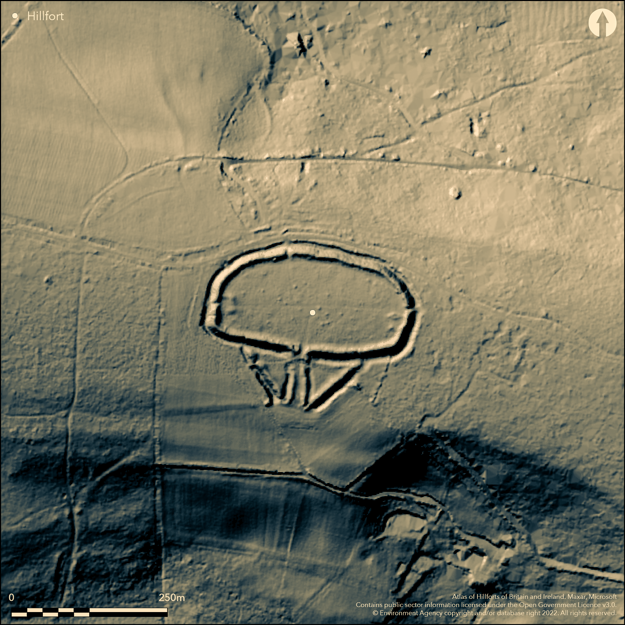
LiDAR 1m DTM Hillshade
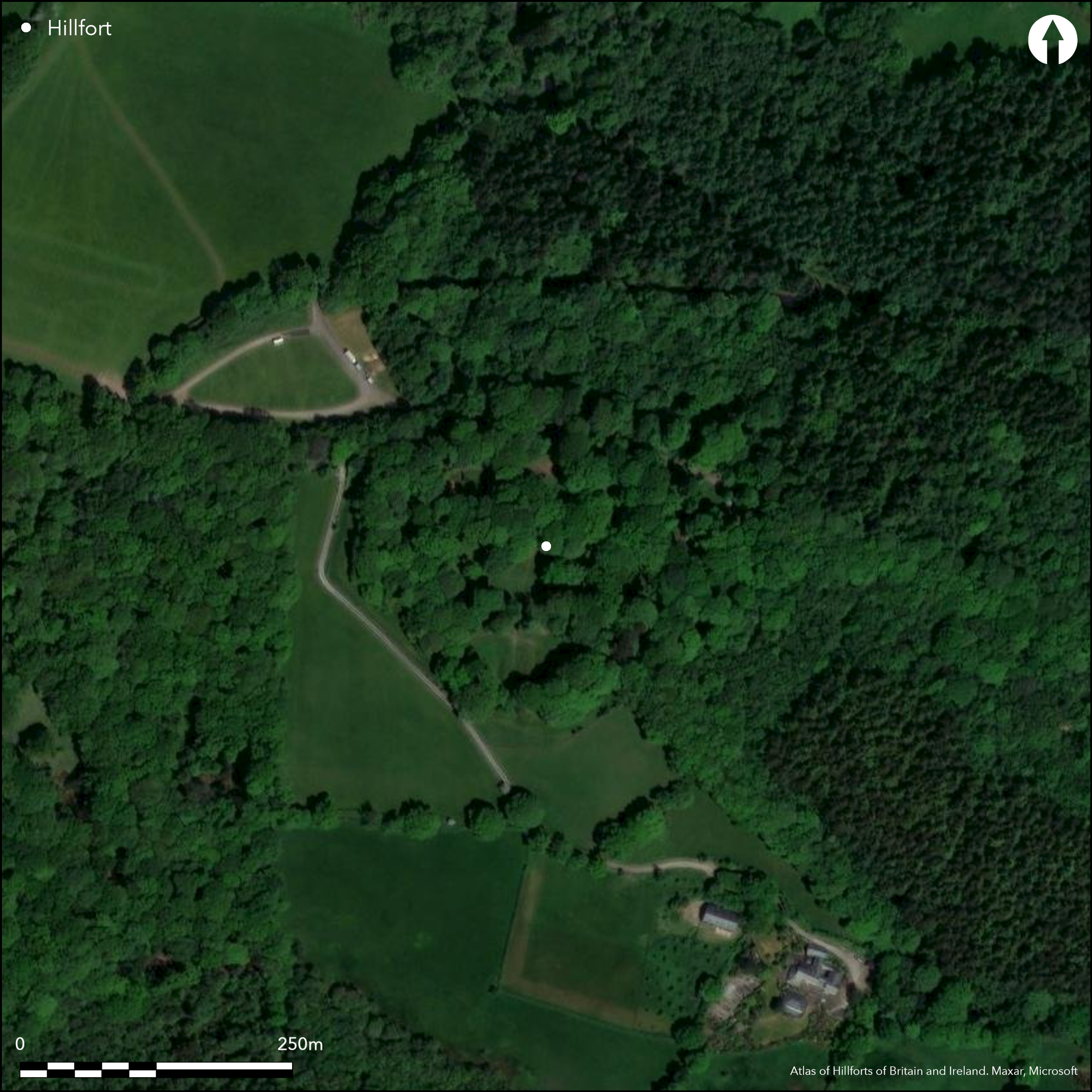
Satellite Imagery
LiDAR 1m DTM Hillshade
Satellite Imagery
Scroll left/right to view further images.
HER: Devon MDV10840 (None)
NMR: SY 19 SE 14 (449304)
SM: 1013425
NGR: SY18749238
X: 318745 Y: 92384 (OSGB36)
Large univallate contour hillfort straddling E-W spur leading from Broad Down plateau and overlooking valleys of tributaries of River Coly, a tributary of River Axe. Steep to very steep slopes to N and S, moderate to E and W. Oval area encloses c. 1.3ha. Defined by bank and outer ditch c. 1.8m high internally and 4.8m high externally. Ditch to 1.1m deep. Traces of quarry ditch. Interesting S entrance with barbican, possibly secondary to main enclosure. Three modern entrances, each with causeway. Excavation by P.O. Hutchinson 1869 and under auspices of Devon Exploration Society by A. Young and K. Richardson 1952-54. Latter found hut site, trenches, cooking pit and clay oven base. Also early and middle Iron Age pottery (largest published ceramic assemblage from a Devon hillfort), iron slag, over 1000 slingstones, four whetstones, two spindle whorls, bronze fragments and worked flints. Two rectangular building platforms against the inner face of rampart possibly medieval or post medieval buildings. Rough grass interior with large scattered trees and some scrub. Well-preserved site. On 1st Ed. OS map (1889).
Citizen Science: ✗
Reliability of Data: Confirmed
Reliability of Interpretation: Confirmed
X: -350944 Y: 6572847 (EPSG: 3857)
Longitude: -3.1525872971492706 Latitude: 50.725310794141734 (EPSG:4326)
Country: England
Current County or Unitary Authority: Devon
Historic County: Devon
Current Parish/Community/Council/Townland: Southleigh
Well-preserved Historic England site. 19th century removal of calcined flint. Part of W rampart flattened and filled along entrance and humps and hollows in interior probably result of removal of material.
| Extant | ✓ |
| Cropmark | ✗ |
| Likely Destroyed | ✗ |
Rough grass interior with large scattered trees and some scrub. Rectangular building platforms.
| Woodland | ✓ |
| Commercial Forestry Plantation | ✗ |
| Parkland | ✗ |
| Pasture (Grazing) | ✓ |
| Arable | ✗ |
| Scrub/Bracken | ✓ |
| Bare Outcrop | ✗ |
| Heather/Moorland | ✗ |
| Heath | ✗ |
| Built-up | ✗ |
| Coastal Grassland | ✗ |
| Other | ✓ |
Large univallate hillfort stradding E-W spur leading from Broad Down plateau and overlooking valleys of tributaries of River Coly, a tribuatary of River Axe. Steep to very steep slopes to N and S, moderate to E and W.
| Contour Fort | ✓ |
| Partial Contour Fort | ✗ |
| Promontory Fort | ✗ |
| Hillslope Fort | ✗ |
| Level Terrain Fort | ✗ |
| Marsh Fort | ✗ |
| Multiple Enclosure Fort | ✗ |
| Hilltop | ✓ |
| Coastal Promontory | ✗ |
| Inland Promontory | ✗ |
| Valley Bottom | ✗ |
| Knoll/Hillock/Outcrop | ✗ |
| Ridge | ✗ |
| Cliff/Plateau-edge/Scarp | ✗ |
| Hillslope | ✗ |
| Lowland | ✗ |
| Spur | ✗ |
Dominant Topographic Feature: Hill top
| North | ✗ |
| Northeast | ✗ |
| East | ✗ |
| Southeast | ✗ |
| South | ✗ |
| Southwest | ✗ |
| West | ✗ |
| Northwest | ✗ |
| Level | ✓ |
Altitude: 185.0m
N/A
Early Iron Age pottery, middle Iron Age SWD ware and piece of late Iron Age plain ware.
Reliability: B - Medium
| Pre 1200BC | ✗ |
| 1200BC - 800BC | ✗ |
| 800BC - 400BC | ✓ |
| 400BC - AD50 | ✓ |
| AD50 - AD400 | ✗ |
| AD400 - AD 800 | ✗ |
| Post AD800 | ✗ |
| Unknown | ✗ |
| Pre Hillfort: | None |
| Post Hillfort: | None |
| Artefactual: | Early Iron Age pottery, middle Iron Age SWD ware and piece of late Iron Age plain ware. |
On 1st Ed. OS map (1889). Excavation directed by P.O. Hutchinson 1869. Excavation under auspices of Devon Exploration Society A. Young and K. Richardson 1952-54.
| 1st Identified Written Reference (1842): | Shortt W.T.P reference.Shortt W.T.P. Collectanea Curiosa Antiqua Dumnonia, |
| Excavation (1869): | P.O. Hutchinson. |
| 1st Identified Map Depiction (1889): | OS map. |
| Other (1972): | Visited by Hillfort Study Group |
| Other (2013): | Visited by Hillfort Study Group |
| Excavation (None): | Under auspices of Devon Exploration Society A. Young and K. Richardson. |
Hut site and associated palisade, trenches, cooking pit and clay oven base. Irregular scatter of postholes. Iron Age pottery, iron slag, over 1000 slingstones, four whetstones, two spindle whorls, bronze fragments and worked flints.
None
| None | ✓ |
| Spring | ✗ |
| Stream | ✗ |
| Pool | ✗ |
| Flush | ✗ |
| Well | ✗ |
| Other | ✗ |
Traces of quarry ditch.
| No Known Features | ✗ |
| Round Stone Structures | ✗ |
| Rectangular Stone Structures | ✗ |
| Curvilinear Platforms | ✗ |
| Other Roundhouse Evidence | ✗ |
| Pits | ✗ |
| Quarry Hollows | ✓ |
| Other | ✗ |
Hut site and associated palisade, trenches, cooking pit and clay oven base. Irregular scatter of postholes.
| No Known Excavation | ✗ |
| Pits | ✗ |
| Postholes | ✗ |
| Roundhouses | ✗ |
| Rectangular Structures | ✗ |
| Roads/Tracks | ✗ |
| Quarry Hollows | ✗ |
| Other | ✓ |
| Nothing Found | ✗ |
None
| No Known Geophysics | ✓ |
| Pits | ✗ |
| Roundhouses | ✗ |
| Rectangular Structures | ✗ |
| Roads/Tracks | ✗ |
| Quarry Hollows | ✗ |
| Other | ✗ |
| Nothing Found | ✗ |
Much Iron Age pottery, iron slag, over 1000 slingstones, four whetstones, two spindle whorls, bronze fragments and worked flints.
| No Known Finds | ✗ |
| Pottery | ✓ |
| Metal | ✓ |
| Metalworking | ✓ |
| Human Bones | ✗ |
| Animal Bones | ✗ |
| Lithics | ✓ |
| Environmental | ✗ |
| Other | ✗ |
None
| APs Not Checked | ✓ |
| None | ✗ |
| Roundhouses | ✗ |
| Rectangular Structures | ✗ |
| Pits | ✗ |
| Postholes | ✗ |
| Roads/Tracks | ✗ |
| Other | ✗ |
Interesting S entrance with barbican, with three modern entrances, each with causeway. Two substantial postholes possibly gate support evidence. Excavation suggests barbican secondary to main enclosure.
| 4: | Three modern entrances, each with causeway. |
| 2: | None |
Guard Chambers: ✗
Chevaux de Frise: ✗
| 1. Barbican (South): | Substantial. |
Defined by bank and outer ditch c. 1.8m high internally and 4.8m high externally. Ditch to 1.1m deep. Rampart top capped by dump of local chert.
| Area 1: | 1.3ha. |
| Total: | 1.3ha. |
Total Footprint Area: Noneha.
None
| ✗ | None |
| ✓ | None |
| NE Quadrant: | 1 |
| SE Quadrant: | 1 |
| SW Quadrant: | 1 |
| NW Quadrant: | 1 |
| Total: | 1 |
| Partial Univallate | ✗ |
| Univallate | ✓ |
| Partial Bivallate | ✗ |
| Bivallate | ✗ |
| Partial Multivallate | ✗ |
| Multivallate | ✗ |
| Unknown | ✗ |
| Partial Univallate | ✗ |
| Univallate | ✗ |
| Partial Bivallate | ✗ |
| Bivallate | ✗ |
| Partial Multivallate | ✗ |
| Multivallate | ✗ |
Possible traces of counterscarp near barbican ditch on SE. Quarry ditch.
| None | ✗ |
| Earthen Bank | ✓ |
| Stone Wall | ✗ |
| Rubble | ✗ |
| Wall-walk | ✗ |
| Evidence of Timber | ✗ |
| Vitrification | ✗ |
| Other Burning | ✗ |
| Palisade | ✗ |
| Counter Scarp Bank | ✓ |
| Berm | ✗ |
| Unfinished | ✗ |
| Other | ✓ |
Rampart top capped by dump of local chert. Possible evidence of revetment to terminal found E side of entrance, continuing as palisade trench.
| None | ✗ |
| Earthen Bank | ✓ |
| Stone Wall | ✗ |
| Murus Duplex | ✗ |
| Timber-framed | ✗ |
| Timber-laced | ✗ |
| Vitrification | ✗ |
| Other Burning | ✗ |
| Palisade | ✓ |
| Counter Scarp Bank | ✗ |
| Berm | ✗ |
| Unfinished | ✗ |
| No Known Excavation | ✗ |
| Other | ✓ |
| ✗ | None |
| ✓ | Good outer ditch. |
Number of Ditches: 1
| ✗ | None |
Allcroft, A.H. 1908. Earthworks of England, London: Macmillan.
Griffith, F.M. and Wilkes, E.M. 2011. In the footsteps of pioneering women: some recent work on Devon hillforts, In Pearce, S. (ed), Recent archaeological work in South-Western Britain, BAR British Series 548.
Shortt, W.T.P 1842. Collectanea Curiosa Antiqua Dumnonia, Exeter: Featherstone.
Young, A., and Richardson, K.M. 1954-55. Report on the Excavations at Blackbury Castle, Proc Devon Archaeol Ex Soc, 5, (1958), 43-67.
Atlas of Hillforts:
Wikidata:
This work is licensed under CC BY-SA 4.0

 and should be cited as:
Lock, Gary and Ralston, Ian. 2024. Atlas of Hillforts of Britain and Ireland. Available at: https://hillforts.arch.ox.ac.uk
Document Version 1.1