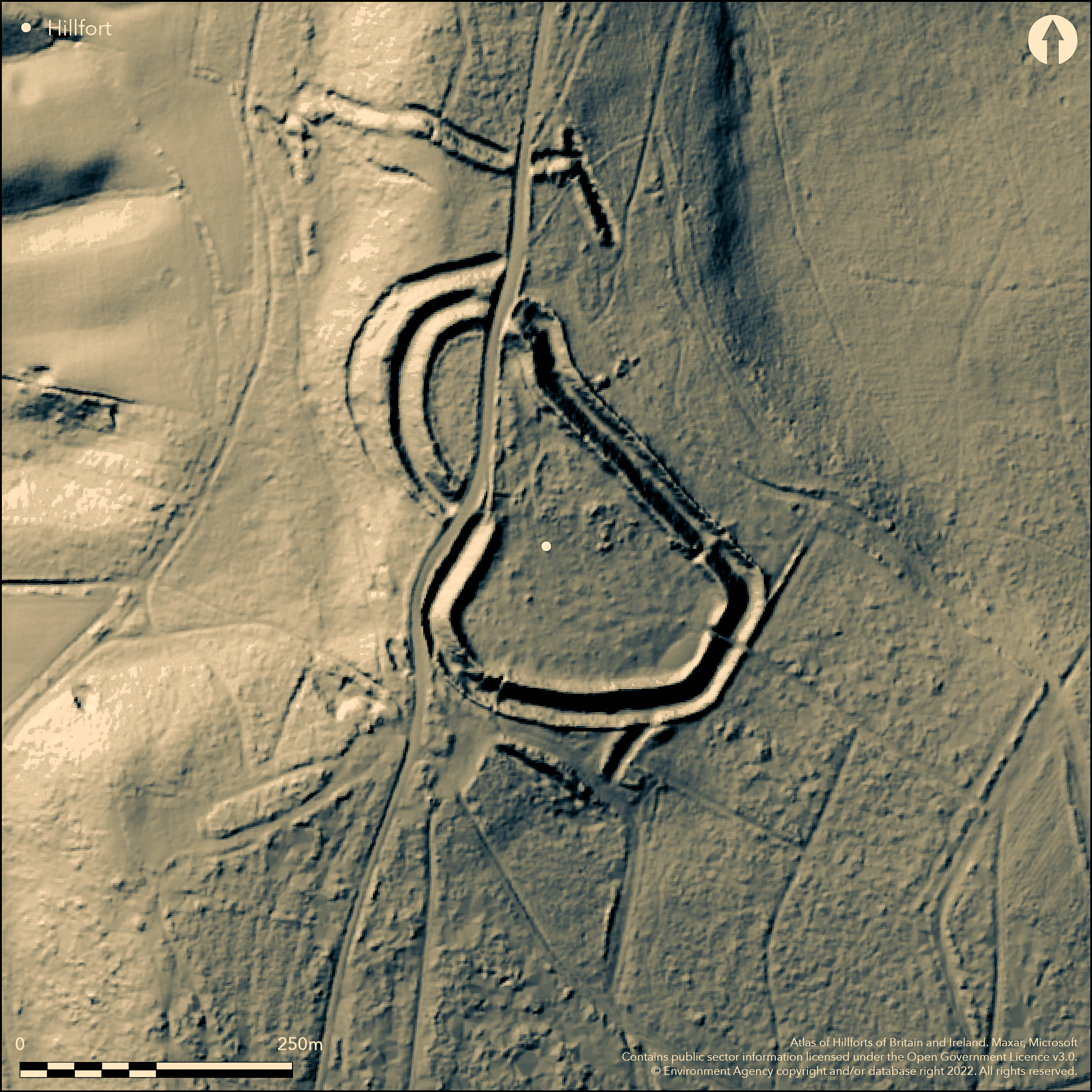
LiDAR 1m DTM Hillshade
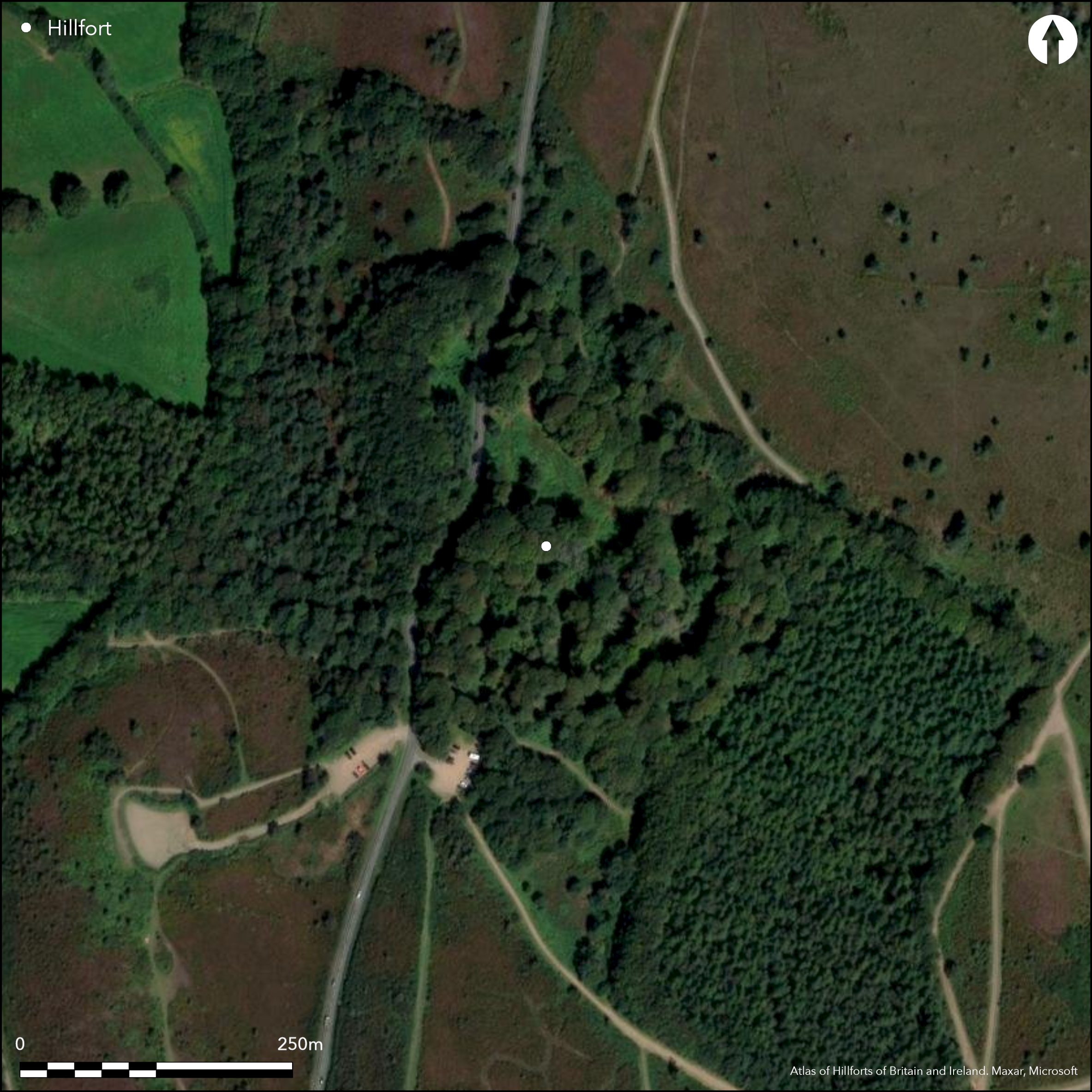
Satellite Imagery
LiDAR 1m DTM Hillshade
Satellite Imagery
Scroll left/right to view further images.
HER: Devon MDV10500 (None)
NMR: SY 08 NW 7 (448559)
SM: 1003862
NGR: SY032873
X: 303289 Y: 87358 (OSGB36)
Complex contour hillfort located on highest point of Woodbury Common. Extensive views to N across Dolbury to Raddon Hills, to W across River Exe estuary to Haldon and Dartmoor, to sea to S and to E across River Otter valley. Steep slopes to E and W, less to S and along ridge to N. Damage to ramparts W of S entrance and at N entrance and outer earthworks and along all 400m of road through hillfort 1968 and 1971 without adequate investigation. Site has main enclosure of c. 2ha, bivallate on W, with discontinuous outer earthworks to N, S, and W. Impressive ramparts despite B3180 passing through main enclosure entrances to N and W. Inner rampart has substantial outer ditch, as has the second rampart, with counterscarp, at its N end on W. Counterscarp bank also on E side where bank not taken by road. Excavations at entrances by H. Miles in 1971 as result of roadworks found postholes and evidence of revetting in timber and then chert block at N entrance. Postholes beneath rampart suggested earlier palisaded enclosure. Outer earthworks 50m to N of main enclosure of bank and ditch possible cross-ridge dyke running SE-NW, with bank turning sharply S on E and on W, where discontinuous and incorporates spring known as 'Soldier's Well'. Excavation showed possible timber structure incorporated in rampart. Simple gap through bank. Outworks to S intermittent, with excavation showing ditch c. 2.2m deep, with out-turned entrance. Mature woodland predominates with large trees and scrub. Cottage and garden formerly located in interior. On 1st Ed. OS map (1889-90).
Citizen Science: ✗
Reliability of Data: Confirmed
Reliability of Interpretation: Confirmed
X: -375167 Y: 6564489 (EPSG: 3857)
Longitude: -3.3701851232566824 Latitude: 50.6777557007724 (EPSG:4326)
Country: England
Current County or Unitary Authority: Devon
Historic County: Devon
Current Parish/Community/Council/Townland: Woodbury
Impressive ramparts despite B3180 passing through site through N and S entrances. Damage to ramparts W of S entrance and at N entrance and outer earthworks and along all 400m of road through hillfort 1968 and 1971 without adequate investigation. Cottage and garden formerly located in interior. WWII bunker dug into rampart. On Heritage at Risk Register (2015).
| Extant | ✓ |
| Cropmark | ✗ |
| Likely Destroyed | ✓ |
Mature woodland predominates with large trees and scrub. Main road through site. Cottage and garden formerly located in interior. WWII bunker dug into rampart.
| Woodland | ✓ |
| Commercial Forestry Plantation | ✗ |
| Parkland | ✗ |
| Pasture (Grazing) | ✗ |
| Arable | ✗ |
| Scrub/Bracken | ✓ |
| Bare Outcrop | ✗ |
| Heather/Moorland | ✗ |
| Heath | ✗ |
| Built-up | ✗ |
| Coastal Grassland | ✗ |
| Other | ✓ |
Complex contour hillfort located on highest point of Woodbury Common. Extensive views to N across Dolbury to Raddon Hills, to W across River Exe estuary to Haldon and Dartmoor, to sea to S and to E across River Otter valley. Steep slopes to E and W, less to S and along ridge to N.
| Contour Fort | ✓ |
| Partial Contour Fort | ✗ |
| Promontory Fort | ✗ |
| Hillslope Fort | ✗ |
| Level Terrain Fort | ✗ |
| Marsh Fort | ✗ |
| Multiple Enclosure Fort | ✗ |
| Hilltop | ✓ |
| Coastal Promontory | ✗ |
| Inland Promontory | ✗ |
| Valley Bottom | ✗ |
| Knoll/Hillock/Outcrop | ✗ |
| Ridge | ✗ |
| Cliff/Plateau-edge/Scarp | ✗ |
| Hillslope | ✗ |
| Lowland | ✗ |
| Spur | ✗ |
Dominant Topographic Feature: Hill top
| North | ✗ |
| Northeast | ✗ |
| East | ✗ |
| Southeast | ✗ |
| South | ✗ |
| Southwest | ✗ |
| West | ✗ |
| Northwest | ✗ |
| Level | ✓ |
Altitude: 175.0m
N/A
Charcoal from oven beneath rampart C14 date of HAR S235 1930+/- 200BP. Some early Iron Age pottery.
Reliability: B - Medium
| Pre 1200BC | ✗ |
| 1200BC - 800BC | ✗ |
| 800BC - 400BC | ✓ |
| 400BC - AD50 | ✗ |
| AD50 - AD400 | ✗ |
| AD400 - AD 800 | ✗ |
| Post AD800 | ✗ |
| Unknown | ✗ |
| Pre Hillfort: | None |
| Post Hillfort: | None |
| Artefactual: | Early Iron Age pottery. |
| C14: | HAR S235 1930+/- 200BP. |
On 1st Ed. OS map (1889-90). A map of County of Devon with City and Counnty of Exeter by B. Donn 1765. Tithe map and apportionment - Devon Record Office 1839. Shortt W.T. Collectanea Curiosa Antiqua Dumnonia 1842. Excavation by H. Miles 1971. Palynological examination of soils beneath rampart (Dimbleby and Miles 1975; in Miles 1975). Survey by RCHME 1999. 2009 geophysical survey (ADS Grey Lit. Library, OASIS report no: geoflo1-107071). LiDAR survey Citizen Science information 2015.
| 1st Identified Map Depiction (1765): | A map of County of Devon with City and Counnty of Exeter by B. Donn 1765 |
| Other (1839): | Tithe map and apportionment - Devon Record Office. |
| 1st Identified Written Reference (1842): | Shortt W.T. Collectanea Curiosa Antiqua Dumnonia, |
| Excavation (1971): | H. Miles. |
| Other (1972): | Visited by Hillfort Study Group |
| Other (1975): | Palynological examination of soils beneath rampart (Dimbleby and Miles 1975). |
| Earthwork Survey (1999): | M. Fletcher RCHME |
| Geophysical Survey (2009): | Geoflo |
| Other (2013): | Visited by Hillfort Study Group |
| LiDAR Survey (2015): | Citizen Science information. |
| 1st Identified Map Depiction (None): | OS map. |
Line of postholes had preceded rampart W of S entrance. Postholes found in interior. Possible oven with charcoal. Some early Iron Age pottery. Sparse lithics finds.
N outworks incorporates spring known as 'Soldier's Well' in ditch.
| None | ✗ |
| Spring | ✓ |
| Stream | ✗ |
| Pool | ✗ |
| Flush | ✗ |
| Well | ✗ |
| Other | ✗ |
None
| No Known Features | ✓ |
| Round Stone Structures | ✗ |
| Rectangular Stone Structures | ✗ |
| Curvilinear Platforms | ✗ |
| Other Roundhouse Evidence | ✗ |
| Pits | ✗ |
| Quarry Hollows | ✗ |
| Other | ✗ |
Line of postholes had preceded rampart W of S entrance. Postholes found in interior.
| No Known Excavation | ✗ |
| Pits | ✗ |
| Postholes | ✓ |
| Roundhouses | ✗ |
| Rectangular Structures | ✗ |
| Roads/Tracks | ✗ |
| Quarry Hollows | ✗ |
| Other | ✗ |
| Nothing Found | ✗ |
None
| No Known Geophysics | ✓ |
| Pits | ✗ |
| Roundhouses | ✗ |
| Rectangular Structures | ✗ |
| Roads/Tracks | ✗ |
| Quarry Hollows | ✗ |
| Other | ✗ |
| Nothing Found | ✗ |
Possible oven with charcoal. Some early Iron Age pottery. Sparse lithics finds.
| No Known Finds | ✗ |
| Pottery | ✓ |
| Metal | ✗ |
| Metalworking | ✗ |
| Human Bones | ✗ |
| Animal Bones | ✗ |
| Lithics | ✓ |
| Environmental | ✓ |
| Other | ✗ |
None
| APs Not Checked | ✓ |
| None | ✗ |
| Roundhouses | ✗ |
| Rectangular Structures | ✗ |
| Pits | ✗ |
| Postholes | ✗ |
| Roads/Tracks | ✗ |
| Other | ✗ |
Entrances badly damaged with B3180 passing through main enclosure entrances to N and W. Evidence of revetting at N entrance. Modern gaps to main enclosure to SE, SW. Entrances through both N and S outworks.
| 6: | Two modern gaps to main enclosure to SE, SW. |
| 2: | None |
Guard Chambers: ✗
Chevaux de Frise: ✗
| 1. Simple Gap (North): | Main enclosure - road runs through entrance. |
| 2. Simple Gap (West): | Main enclosure - road runs through entrance. |
| 3. Simple Gap (North): | Entrance through N outwork - uncertain. |
| 3. Outworks (North): | None |
| 4. Out-turned (South): | Entrance through S outworks. |
| 4. Outworks (South): | None |
Ramparts around circuit of main enclosure, bivallate on W. Inner rampart has substantial outer ditch, as has the second rampart, with counterscarp, at its N end on W. Counterscarp bank also on E side where bank not taken by road. Postholes beneath rampart suggested earlier palisaded enclosure. Evidence of revetting at N entrance. Excavation showed possible timber structure incorporated in rampart.
| Area 1: | 2.0ha. |
| Total: | 2.0ha. |
Total Footprint Area: Noneha.
None
| ✓ | Area of main enclosure 2ha.Two phases of build. |
| ✓ | Quadrants of main enclosure defined. |
| NE Quadrant: | 1 |
| SE Quadrant: | 1 |
| SW Quadrant: | 2 |
| NW Quadrant: | 2 |
| Total: | 2 |
| Partial Univallate | ✓ |
| Univallate | ✗ |
| Partial Bivallate | ✓ |
| Bivallate | ✗ |
| Partial Multivallate | ✗ |
| Multivallate | ✗ |
| Unknown | ✗ |
| Partial Univallate | ✗ |
| Univallate | ✓ |
| Partial Bivallate | ✗ |
| Bivallate | ✗ |
| Partial Multivallate | ✗ |
| Multivallate | ✗ |
Counterscarp in places.
| None | ✗ |
| Earthen Bank | ✓ |
| Stone Wall | ✗ |
| Rubble | ✗ |
| Wall-walk | ✗ |
| Evidence of Timber | ✗ |
| Vitrification | ✗ |
| Other Burning | ✗ |
| Palisade | ✗ |
| Counter Scarp Bank | ✓ |
| Berm | ✗ |
| Unfinished | ✗ |
| Other | ✗ |
Postholes beneath rampart suggested earlier palisaded enclosure. Evidence of revetting at N entrance. Excavation showed possible timber structure incorporated in rampart.
| None | ✗ |
| Earthen Bank | ✓ |
| Stone Wall | ✓ |
| Murus Duplex | ✗ |
| Timber-framed | ✓ |
| Timber-laced | ✗ |
| Vitrification | ✗ |
| Other Burning | ✗ |
| Palisade | ✓ |
| Counter Scarp Bank | ✗ |
| Berm | ✗ |
| Unfinished | ✗ |
| No Known Excavation | ✗ |
| Other | ✗ |
| ✗ | None |
| ✓ | Two ditches to main enclosure where bivallate. Outworks also ditched. |
Number of Ditches: 2
| ✗ | None |
Fletcher, M 1998. Woodbury Castle: An earthwork survey by RCHME, Proc Devon Archaeol Soc, 56, 165-171.
Griffith, F.M. and Wilkes, E.M. 2011. In the footsteps of pioneering women: some recent work on Devon hillforts, In Pearce, S (ed). Recent archaeological work in South-Western Britain, BAR British Series 548.
Miles, H. 1975. Excavations at Woodbury Castle, East Devon, Proc Devon Archaeol Soc, 33, 183-207.
Shortt W.T.P 1842. Collectanea Curiosa Antiqua Dumnonia, Exeter: Featherstone.
Atlas of Hillforts:
Wikidata:
This work is licensed under CC BY-SA 4.0

 and should be cited as:
Lock, Gary and Ralston, Ian. 2024. Atlas of Hillforts of Britain and Ireland. Available at: https://hillforts.arch.ox.ac.uk
Document Version 1.1