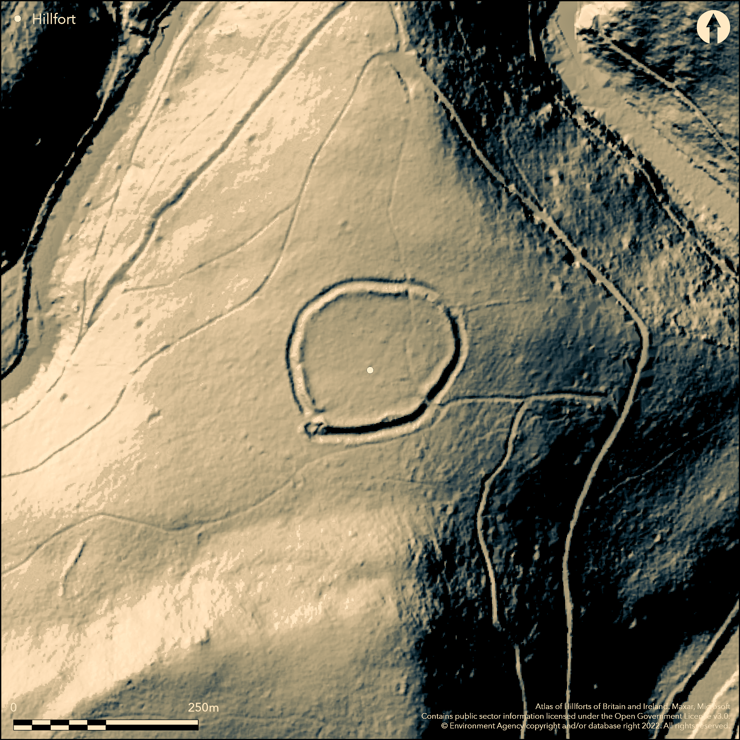
LiDAR 1m DTM Hillshade
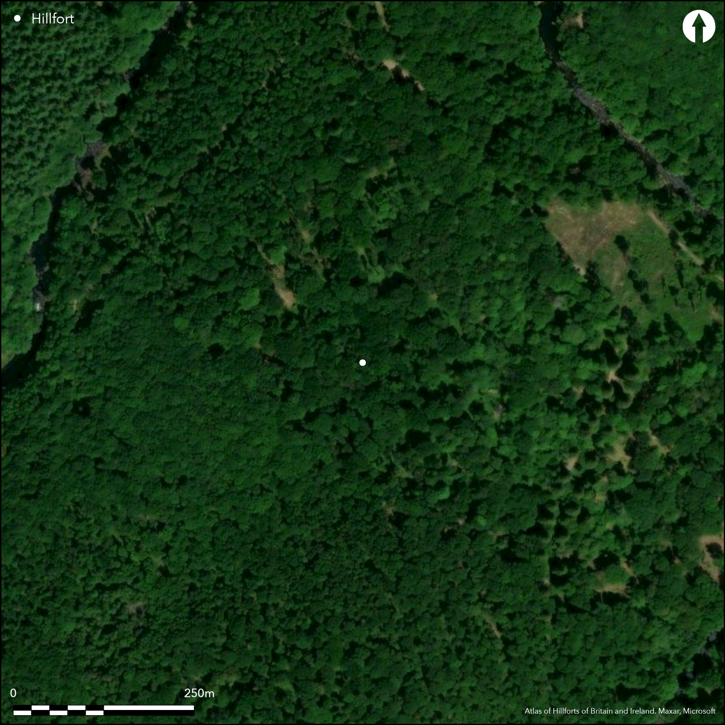
Satellite Imagery
LiDAR 1m DTM Hillshade
Satellite Imagery
Scroll left/right to view further images.
HER: Devon MDV7996 (None)
NMR: SX 77 SW 14 (71900)
SM: 1003842
NGR: SX72447190
X: 272440 Y: 71906 (OSGB36)
Small univallate contour hillfort located on pronounced N-facing inland promontory of Carboniferous, slates, limestones and grits above bend on the River Dart at the SE edge of Dartmoor. Lies within Dartmoor National Park. Very steep surrounding slopes to N, S and W moderate along promontory on S. Oval shaped with area enclosed c. 1ha. Defined by rampart and outer ditch with counterscarp around SW entrance and to W. Rampart extant for c. three-quarters of circuit and absent in part of NW sector, where possibly removed by quarrying. Bank massive to S near entrances and slightly offset from rest of circuit. Average width of bank c. 15m, and 20m on S, where 4m high and ditch to 4m deep. Riley (1995, 93) suggests hollows in ditch bottom and raised portions on rampart top result of gang working. Three breaches to rampart. That on NE apex modern track, those on SE and SW original. SE has simple passage 5m wide through rampart, with SW terminal turning inward. Erosion from track cause two slight scarps flanking passage in interior. Similar 5m passage entrance on SW, but disturbed by quarrying. Simple terminal to ditch on NW, but very stony rampart has sharp inturn; terminal and ditch on S much disturbed and counterscarp modified as a result. Stone heaps and disturbance in interior probably result of later mineral extraction activity. Possible unrecorded antiquarian digging, 12 currency bars found in 1870. Dense mixed broad-leaved woodland, with some conifers. Rhododendron management. Well-preserved, although part of NW sector where bank absent probably removed by quarrying and SW entrance also disturbed by quarrying. Stone heaps and disturbance in interior probably result of later mineral extraction activity. On 1st Ed. OS map (1886). Minimal investigations, undated.
Citizen Science: ✗
Reliability of Data: Confirmed
Reliability of Interpretation: Confirmed
X: -423158 Y: 6539084 (EPSG: 3857)
Longitude: -3.801291994641134 Latitude: 50.53291557706109 (EPSG:4326)
Country: England; None
Current County or Unitary Authority: Devon
Historic County: Devon
Current Parish/Community/Council/Townland: Holne; Buckland in the Moor
Well-preserved, although part of NW sector where bank absent probably removed by quarrying and SW entrance also disturbed by quarrying. Stone heaps and disturbance in interior probably result of later mineral extraction activity. Lies within Chase Wood, SSSI within Dartmoor National Park .On Heritage at Risk Register (2015).
| Extant | ✓ |
| Cropmark | ✗ |
| Likely Destroyed | ✗ |
Dense mixed broad-leaved woodland, with some conifers. Rhododendron management. SSSI. Quarrying and spoil.
| Woodland | ✓ |
| Commercial Forestry Plantation | ✗ |
| Parkland | ✗ |
| Pasture (Grazing) | ✗ |
| Arable | ✗ |
| Scrub/Bracken | ✗ |
| Bare Outcrop | ✗ |
| Heather/Moorland | ✗ |
| Heath | ✗ |
| Built-up | ✗ |
| Coastal Grassland | ✗ |
| Other | ✓ |
Small univallate contour hillfort located on pronounced N-facing promontory above bend on the River Dart at the SE edge of Dartmoor. Steep surrounding slopes to N, E and W, moderate along promontory on S.
| Contour Fort | ✓ |
| Partial Contour Fort | ✗ |
| Promontory Fort | ✗ |
| Hillslope Fort | ✗ |
| Level Terrain Fort | ✗ |
| Marsh Fort | ✗ |
| Multiple Enclosure Fort | ✗ |
| Hilltop | ✗ |
| Coastal Promontory | ✗ |
| Inland Promontory | ✓ |
| Valley Bottom | ✗ |
| Knoll/Hillock/Outcrop | ✗ |
| Ridge | ✗ |
| Cliff/Plateau-edge/Scarp | ✗ |
| Hillslope | ✗ |
| Lowland | ✗ |
| Spur | ✗ |
Dominant Topographic Feature: Promontory.
| North | ✗ |
| Northeast | ✗ |
| East | ✗ |
| Southeast | ✗ |
| South | ✗ |
| Southwest | ✗ |
| West | ✗ |
| Northwest | ✗ |
| Level | ✓ |
Altitude: 150.0m
Boundary Type: Parish/Townland
None.
Reliability: D - None
| Pre 1200BC | ✗ |
| 1200BC - 800BC | ✗ |
| 800BC - 400BC | ✗ |
| 400BC - AD50 | ✗ |
| AD50 - AD400 | ✗ |
| AD400 - AD 800 | ✗ |
| Post AD800 | ✗ |
| Unknown | ✓ |
| Pre Hillfort: | None |
| Post Hillfort: | None |
Possible unrecorded antiquarian digging. First depicted with plan and described by Amery (1873). On 1st Ed. OS map (1886). Survey plan by . A.H. Allcroft 1908. Measured survey RCHME 1996, ref. no. 1066696; earthwork plan, vegetation map and digital terrain model.
| 1st Identified Map Depiction (1765): | B. Donn map of the County of Devon. |
| 1st Identified Written Reference (1873): | P.F.S. Amery description and plan. |
| Other (1886): | OS map. |
| Other (1908): | Survey plan by . A.H. Allcroft. |
| Earthwork Survey (1996): | Measured survey RCHME. |
Disturbance interior probably later mineral activity. 12 flat iron bars found by gamekeeper 1870, just adjacent to hillfort. Later identified as currency bars by P.F.S. Amery (1906). Amery noted several iron bars 1873 suggested as unfinished weapons, and base of jar.
None
| None | ✓ |
| Spring | ✗ |
| Stream | ✗ |
| Pool | ✗ |
| Flush | ✗ |
| Well | ✗ |
| Other | ✗ |
Disturbance interior probably later mineral activity.
| No Known Features | ✓ |
| Round Stone Structures | ✗ |
| Rectangular Stone Structures | ✗ |
| Curvilinear Platforms | ✗ |
| Other Roundhouse Evidence | ✗ |
| Pits | ✗ |
| Quarry Hollows | ✗ |
| Other | ✗ |
None
| No Known Excavation | ✓ |
| Pits | ✗ |
| Postholes | ✗ |
| Roundhouses | ✗ |
| Rectangular Structures | ✗ |
| Roads/Tracks | ✗ |
| Quarry Hollows | ✗ |
| Other | ✗ |
| Nothing Found | ✗ |
None
| No Known Geophysics | ✓ |
| Pits | ✗ |
| Roundhouses | ✗ |
| Rectangular Structures | ✗ |
| Roads/Tracks | ✗ |
| Quarry Hollows | ✗ |
| Other | ✗ |
| Nothing Found | ✗ |
12 flat iron bars found by gamekeeper 1870, just adjacent to hillfort. Later identified as currency bars by P.F.S. Amery (1906). Amery noted several iron bars 1873 suggested as unfinished weapons, and base of jar.
| No Known Finds | ✗ |
| Pottery | ✓ |
| Metal | ✓ |
| Metalworking | ✗ |
| Human Bones | ✗ |
| Animal Bones | ✗ |
| Lithics | ✗ |
| Environmental | ✗ |
| Other | ✗ |
None
| APs Not Checked | ✓ |
| None | ✗ |
| Roundhouses | ✗ |
| Rectangular Structures | ✗ |
| Pits | ✗ |
| Postholes | ✗ |
| Roads/Tracks | ✗ |
| Other | ✗ |
Three breaches to rampart. That on NE apex modern track, those on SE and SW original. SE has simple passage 5m wide through defences, with SW terminal turning inward. Erosion from track cause two slight scarps flanking passage in interior. Similar 5m passage entrance on SW, but disturbed by quarrying. Simple terminal to ditch on NW, but very stony rampart has sharp inturn; terminal and ditch on S much disturbed and counterscarp modified as a result.
| 3: | That on NE apex modern track, those on SE and SW original. |
| 2: | None |
Guard Chambers: ✗
Chevaux de Frise: ✗
| 1. In-turned (South east): | Part-inturned passage. |
| 1. Passage-way/Corridor (South east): | None |
| 2. In-turned (South west): | Part-inturned passage. |
| 2. Passage-way/Corridor (South west): | None |
Defined by rampart and outer ditch with counterscarp around SW entrance and to W. Rampart extant for c. three-quarters of circuit and absent in part of NW sector, where possibly removed by quarrying. Bank massive to S near entrances and slightly offset from rest of circuit. Average with of bank c. 15m, and 20m on S, where 4m high and ditch to 4m deep. Riley (1995, 93) suggests hollows in ditch bottom and raised portions on rampart top result of gang working. Rampart very stony at SW entrance suggests earth and stone bank.
| Area 1: | 1.0ha. |
| Total: | 1.0ha. |
Total Footprint Area: Noneha.
None
| ✗ | None |
| ✗ | Rampart on NW probably lost to quarrying. |
| NE Quadrant: | 1 |
| SE Quadrant: | 1 |
| SW Quadrant: | 1 |
| NW Quadrant: | 0 |
| Total: | 1 |
| Partial Univallate | ✓ |
| Univallate | ✗ |
| Partial Bivallate | ✗ |
| Bivallate | ✗ |
| Partial Multivallate | ✗ |
| Multivallate | ✗ |
| Unknown | ✗ |
| Partial Univallate | ✗ |
| Univallate | ✗ |
| Partial Bivallate | ✗ |
| Bivallate | ✗ |
| Partial Multivallate | ✗ |
| Multivallate | ✗ |
Rampart very stony at SW entrance suggests earth and stone bank. Counterscarp around SW entrance and to W.
| None | ✗ |
| Earthen Bank | ✓ |
| Stone Wall | ✗ |
| Rubble | ✓ |
| Wall-walk | ✗ |
| Evidence of Timber | ✗ |
| Vitrification | ✗ |
| Other Burning | ✗ |
| Palisade | ✗ |
| Counter Scarp Bank | ✓ |
| Berm | ✗ |
| Unfinished | ✗ |
| Other | ✗ |
None
| None | ✗ |
| Earthen Bank | ✗ |
| Stone Wall | ✗ |
| Murus Duplex | ✗ |
| Timber-framed | ✗ |
| Timber-laced | ✗ |
| Vitrification | ✗ |
| Other Burning | ✗ |
| Palisade | ✗ |
| Counter Scarp Bank | ✗ |
| Berm | ✗ |
| Unfinished | ✗ |
| No Known Excavation | ✓ |
| Other | ✗ |
| ✓ | Riley (1995, 93) suggests hollows in ditch bottom and raised portions on rampart top result of gang working. |
| ✓ | Deepest to 4m on S near entrances. |
Number of Ditches: 1
| ✗ | None |
Allcroft, A.H. 1908. Earthworks of England, London: Macmillan.
Amery, P.F.S. 1873-74. Trans. Devon Ass. vol. 6, 1873-4, pp.261-65.
Amery, P.F.S. 1905. Fragment of pottery found at Holne Chase Castle, Rep. Trans. Devonshire Ass., 37, 81.
Amery, P.F.S. 1906. Supposed currency bars found near Holne cHase camp, Rep. Trans. Devonshire Ass., 38, 370-76.
Donn, B. 1765. A map of the County of Devon.
Riley, H. 1995. Holne Chase Castle, Holne, Devon: a new survey by the Royal Commission on the Historical Monuments of England, Proc. Devon. Archaeol. Soc, 53, 91-95.
Hazel Riley 31-MAR-1996 RCHME: Holne Chase Survey
Atlas of Hillforts:
Wikidata:
This work is licensed under CC BY-SA 4.0

 and should be cited as:
Lock, Gary and Ralston, Ian. 2024. Atlas of Hillforts of Britain and Ireland. Available at: https://hillforts.arch.ox.ac.uk
Document Version 1.1