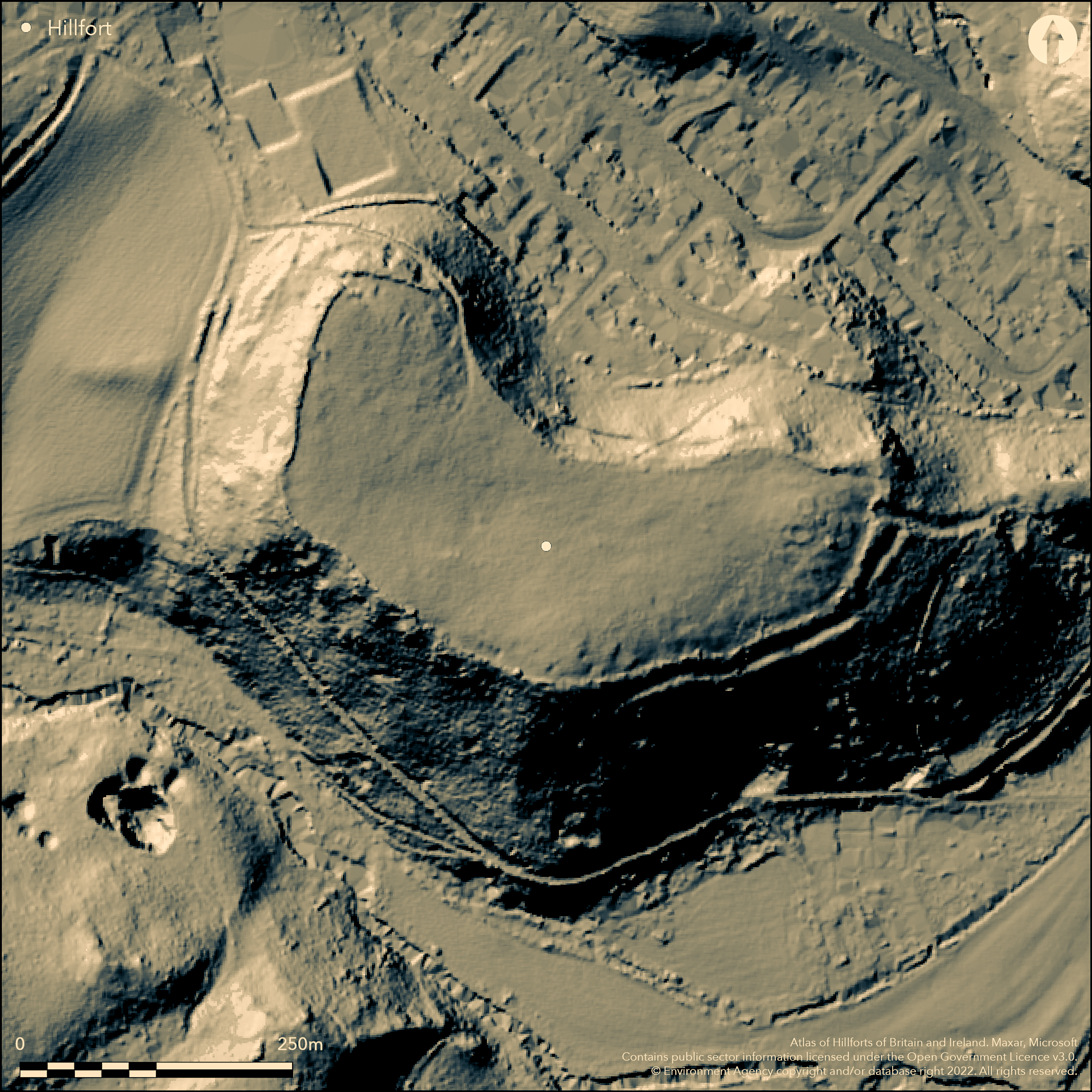
LiDAR 1m DTM Hillshade
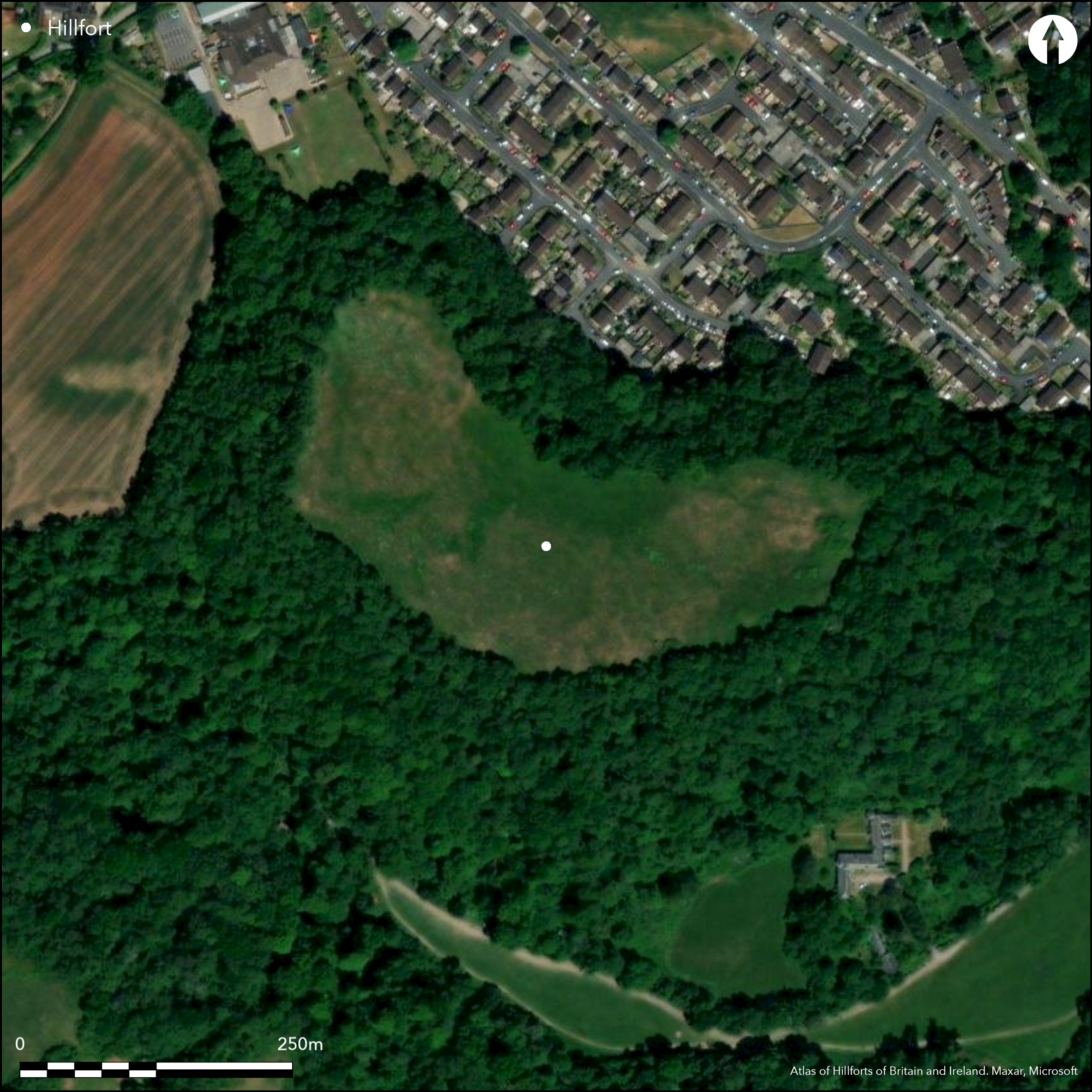
Satellite Imagery
LiDAR 1m DTM Hillshade
Satellite Imagery
Scroll left/right to view further images.
HER: Devon MDV9145 (None)
NMR: SX 87 SW 9 (636732)
SM: None
NGR: SX846710
X: 284668 Y: 71052 (OSGB36)
Partial contour hillfort located on plateau, sloping to E, at E and lower end of E-W limestone ridge above River Lemon. Surrounded by steep wooded escarpment except at NW end where slope less. Kidney-shaped measuring 340m E-W by 130m, with internal area c. 4.5ha. Modern broad dry-stone wall encloses summit and no evidence of bank, although base of an earlier bank or wall underlies this, but whether this is remnant of original circuit not determined. Site thus defined by four lengths of ditch, with counterscarp in places on circumference. This shallow ditch, where visible to c. 0.2m-1.2m deep, or terrace in places, is 3m-6m wide and created by scarping rock face above it to height of 3m-5m. Two entrances. To E, approached by broad hollow way 0.5m-1.5m deep, extending for short way into interior. Second entrance at NW apex, also approached by hollow way to 0.9m deep, with S side cut through or uses natural outcropping rock break. Possible that this may be later, but uncertain. Three other approaches into site modern. Three embanked roundhouse sites identified in E interior, ranging from 8m-10m diameter. One has two possible annexes and all have E entrances. Near W entrance two other possible hut sites or quarry scoops. Small excavation of all of most N roundhouse in 1962 under auspices of Devon Archaeological Exploration Society, finding at least two successive buildings on site. Finds of late Iron Age pottery, imported glass bead of third century BC to part first century AD, spindle whorls rotary and saddle querns and iron objects. Bones of fox, cattle, pig, sheep and horse and evidence of metal working. Under improved pasture with wooded surrounds. Newton Abbot development encroaches from NE and material from construction of housing estate dumped on lower part of site on plateau.
Citizen Science: ✗
Reliability of Data: Confirmed
Reliability of Interpretation: Confirmed
X: -403930 Y: 6538185 (EPSG: 3857)
Longitude: -3.6285648319225574 Latitude: 50.527779365137306 (EPSG:4326)
Country: England; None
Current County or Unitary Authority: Devon
Historic County: Devon
Current Parish/Community/Council/Townland: Highweek; Ogwell
Newton Abbot development encroaches from NE and material from construction of housing estate dumped on lower part of site on plateau.
| Extant | ✓ |
| Cropmark | ✗ |
| Likely Destroyed | ✗ |
Improved pasture interior, wooded surrounds.
| Woodland | ✗ |
| Commercial Forestry Plantation | ✗ |
| Parkland | ✗ |
| Pasture (Grazing) | ✓ |
| Arable | ✗ |
| Scrub/Bracken | ✗ |
| Bare Outcrop | ✗ |
| Heather/Moorland | ✗ |
| Heath | ✗ |
| Built-up | ✗ |
| Coastal Grassland | ✗ |
| Other | ✗ |
Partial contour hillfort located on plateau, sloping to E, at E and lower end of E-W limestone ridge above River Lemon. Surrounded by steep wooded escarpment except at NW end where slope less.
| Contour Fort | ✗ |
| Partial Contour Fort | ✓ |
| Promontory Fort | ✗ |
| Hillslope Fort | ✗ |
| Level Terrain Fort | ✗ |
| Marsh Fort | ✗ |
| Multiple Enclosure Fort | ✗ |
| Hilltop | ✗ |
| Coastal Promontory | ✗ |
| Inland Promontory | ✗ |
| Valley Bottom | ✗ |
| Knoll/Hillock/Outcrop | ✗ |
| Ridge | ✓ |
| Cliff/Plateau-edge/Scarp | ✓ |
| Hillslope | ✗ |
| Lowland | ✗ |
| Spur | ✗ |
Dominant Topographic Feature: Plateau on limestone ridge
| North | ✗ |
| Northeast | ✗ |
| East | ✗ |
| Southeast | ✗ |
| South | ✗ |
| Southwest | ✗ |
| West | ✓ |
| Northwest | ✗ |
| Level | ✗ |
Altitude: 68.0m
Boundary Type: Parish/Townland
Late Iron Age pottery and mported glass bead of third century BC to part first century AD.
Reliability: B - Medium
| Pre 1200BC | ✗ |
| 1200BC - 800BC | ✗ |
| 800BC - 400BC | ✗ |
| 400BC - AD50 | ✓ |
| AD50 - AD400 | ✗ |
| AD400 - AD 800 | ✗ |
| Post AD800 | ✗ |
| Unknown | ✗ |
| Pre Hillfort: | None |
| Post Hillfort: | None |
| Artefactual: | Pottery and bead. |
Excavation of roundhouse by L. Gallant and R.J. Silvester 1962.
| Excavation (1962): | L. Gallant and R.J. Silvester 1962 under auspices of Devon Archaeological Exploration Society. |
Three embanked roundhouse sites identified in E interior, ranging from 8m-10m diameter. One has two possible annexes and all have E entrances. Near W entrance two other possible hut sites or quarry scoops. Small excavation of all of most N roundhouse in 1962 under auspices of Devon Archaeological Exploration Society, finding at least two successive buildings on site. Postholes for doorway. Internal diameter 7.5m. Possible sandstone slab floor. Finds of late Iron Age pottery, imported glass bead of third century BC to part first century AD, spindle whorls rotary and saddle querns and iron objects. Bones of fox, cattle, pig, sheep and horse and evidence of metal working.
None
| None | ✓ |
| Spring | ✗ |
| Stream | ✗ |
| Pool | ✗ |
| Flush | ✗ |
| Well | ✗ |
| Other | ✗ |
Three embanked roundhouse sites identified in E interior, ranging from 8m-10m diameter. One has two possible annexes and all have E entrances. Near W entrance two other possible hut sites or quarry scoops.
| No Known Features | ✗ |
| Round Stone Structures | ✗ |
| Rectangular Stone Structures | ✗ |
| Curvilinear Platforms | ✓ |
| Other Roundhouse Evidence | ✓ |
| Pits | ✗ |
| Quarry Hollows | ✓ |
| Other | ✗ |
Small excavation of all of most N roundhouse in 1962 under auspices of Devon Archaeological Exploration Society, finding at least two successive buildings on site. Postholes for doorway. Internal diameter 7.5m. Possible sandstone slab floor.
| No Known Excavation | ✗ |
| Pits | ✗ |
| Postholes | ✓ |
| Roundhouses | ✓ |
| Rectangular Structures | ✗ |
| Roads/Tracks | ✗ |
| Quarry Hollows | ✗ |
| Other | ✓ |
| Nothing Found | ✗ |
None
| No Known Geophysics | ✓ |
| Pits | ✗ |
| Roundhouses | ✗ |
| Rectangular Structures | ✗ |
| Roads/Tracks | ✗ |
| Quarry Hollows | ✗ |
| Other | ✗ |
| Nothing Found | ✗ |
Finds of late Iron Age pottery, imported glass bead of third century BC to part first century AD, spindle whorls rotary and saddle querns and iron objects. Bones of fox, cattle, pig, sheep and horse and evidence of metal working.
| No Known Finds | ✗ |
| Pottery | ✓ |
| Metal | ✗ |
| Metalworking | ✓ |
| Human Bones | ✗ |
| Animal Bones | ✓ |
| Lithics | ✓ |
| Environmental | ✗ |
| Other | ✗ |
None
| APs Not Checked | ✓ |
| None | ✗ |
| Roundhouses | ✗ |
| Rectangular Structures | ✗ |
| Pits | ✗ |
| Postholes | ✗ |
| Roads/Tracks | ✗ |
| Other | ✗ |
Two entrances. To E, approached by broad hollow way 0.5m-1.5m deep, extending for short way into interior. Second entrance at NW apex, also approached by hollow way to 0.9m deep, with S side cut through or uses natural outcropping rock break. Possible that this may be later, but uncertain. Three other approaches into site modern.
| 5: | Three definite modern gaps. |
| 2: | The date of entrance at NW apex uncertain. |
Guard Chambers: ✗
Chevaux de Frise: ✗
| 1. Hollow Way (East): | Broad hollow way. |
| 2. Hollow Way (North west): | Possibly later, but uncertain. |
Modern broad dry-stone wall encloses summit and no evidence of bank, although base of an earlier bank or wall underlies this, but whether this is remnant of original circuit not determined. Site thus defined by four lengths of ditch, with counterscarp in places on circumference. This shallow ditch, where visible to c. 0.2m-1.2m deep, or terrace in places, is 3m-6m wide and created by scarping rock face above it to height of 3m-5m.
| Area 1: | 4.5ha. |
| Total: | 4.5ha. |
Total Footprint Area: Noneha.
None
| ✗ | None |
| ✓ | No bank visible, but completed circuit in prehistory as quadrants. |
| NE Quadrant: | 1 |
| SE Quadrant: | 1 |
| SW Quadrant: | 1 |
| NW Quadrant: | 1 |
| Total: | 1 |
| Partial Univallate | ✗ |
| Univallate | ✓ |
| Partial Bivallate | ✗ |
| Bivallate | ✗ |
| Partial Multivallate | ✗ |
| Multivallate | ✗ |
| Unknown | ✗ |
| Partial Univallate | ✗ |
| Univallate | ✗ |
| Partial Bivallate | ✗ |
| Bivallate | ✗ |
| Partial Multivallate | ✗ |
| Multivallate | ✗ |
Counterscarp in places.
| None | ✗ |
| Earthen Bank | ✓ |
| Stone Wall | ✗ |
| Rubble | ✗ |
| Wall-walk | ✗ |
| Evidence of Timber | ✗ |
| Vitrification | ✗ |
| Other Burning | ✗ |
| Palisade | ✗ |
| Counter Scarp Bank | ✓ |
| Berm | ✗ |
| Unfinished | ✗ |
| Other | ✗ |
Bank and ditch not excavated.
| None | ✗ |
| Earthen Bank | ✗ |
| Stone Wall | ✗ |
| Murus Duplex | ✗ |
| Timber-framed | ✗ |
| Timber-laced | ✗ |
| Vitrification | ✗ |
| Other Burning | ✗ |
| Palisade | ✗ |
| Counter Scarp Bank | ✗ |
| Berm | ✗ |
| Unfinished | ✗ |
| No Known Excavation | ✓ |
| Other | ✗ |
| ✗ | None |
| ✓ | Site defined by four lengths of ditch, with counterscarp in places on circumference. This shallow ditch, where visible to c. 0.2m-1.2m deep, or terrace in places, is 3m-6m wide and created by scarping rock face above it to height of 3m-5m. |
Number of Ditches: 1
| ✗ | None |
Gallant, L. and Silvester, R.J. 1985. An excavation on the Iron Age hillfort at Berry Down, Newton Abbot, Proc. Devon Archaeol. Soc, 43, 39-49.
Atlas of Hillforts:
Wikidata:
This work is licensed under CC BY-SA 4.0

 and should be cited as:
Lock, Gary and Ralston, Ian. 2024. Atlas of Hillforts of Britain and Ireland. Available at: https://hillforts.arch.ox.ac.uk
Document Version 1.1