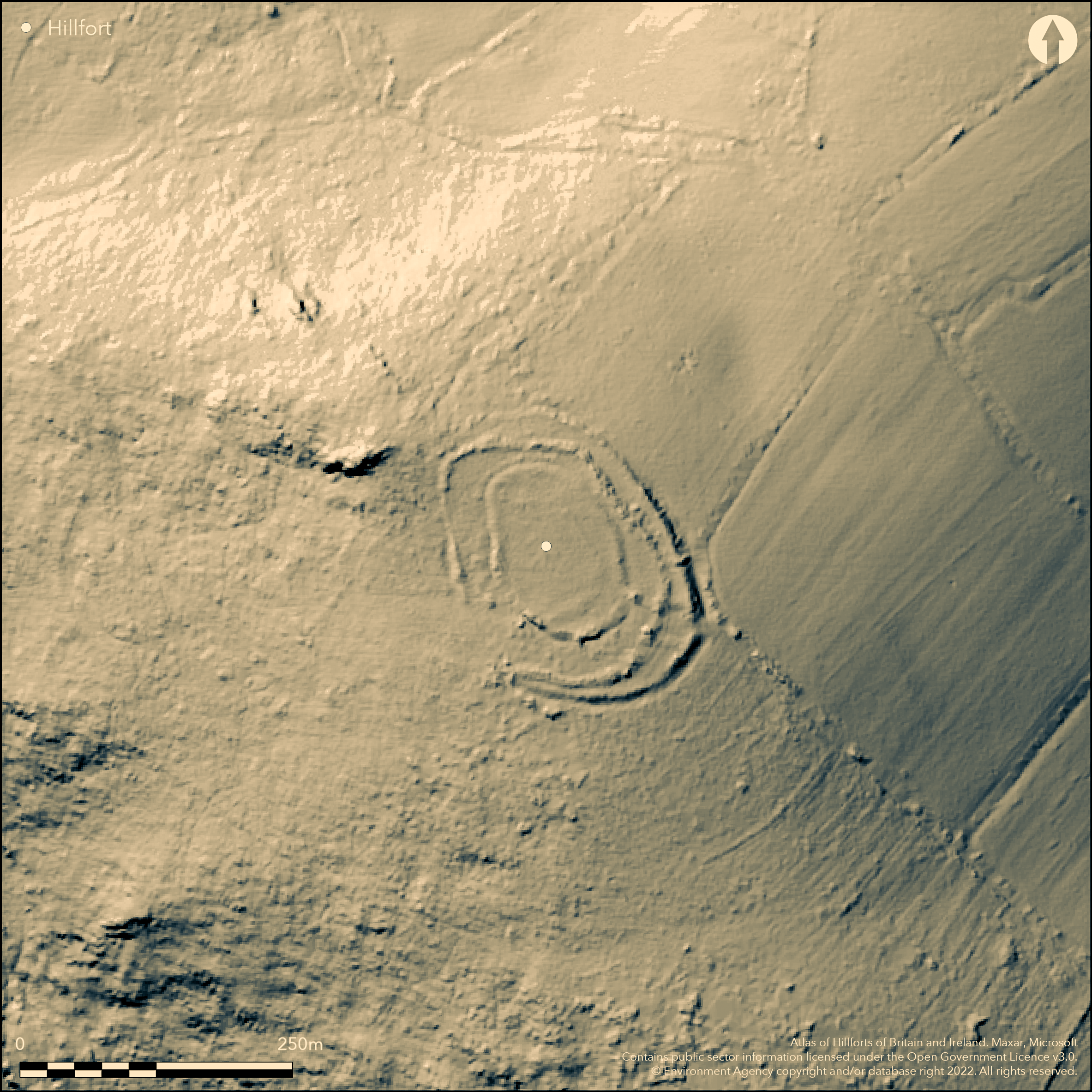
LiDAR 1m DTM Hillshade
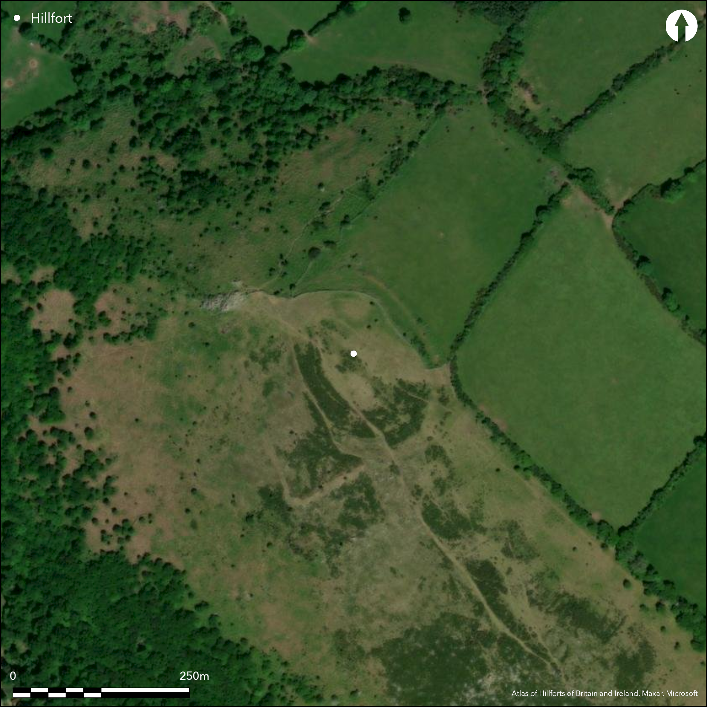
Satellite Imagery
LiDAR 1m DTM Hillshade
Satellite Imagery
Scroll left/right to view further images.
HER: Devon MDV8824 (None)
NMR: SX 78 SE 2 (445589)
SM: 1003827
NGR: SX761824
X: 276151 Y: 82427 (OSGB36)
Complex, possibly unfinished, multiple enclosure fort located at NW end of ridge above River Bovey and Wray Brook tributary to S and W. Steep surrounding slopes to NE and E, moderate along ridge then steep to SE and very steep to W quadrants, Extensive views to N and W. Morphological evidence suggests hillfort superimposed on earlier field system of c. 12ha covering top and sides of ridge between 290m and 320m contours. Hillfort defined by three enclosures. Inner circuit encloses c. 0.6ha, has low bank with ditch on S side, continuing W as scarp, more prominent to N, mainly from scooping of material then dumped in front of resulting ditch as intermittent piles and then low bank. Ditch hardly visible. Scarp alone also visible on E side towards entrance on SE. Concentric with inner, outer circuit similar in construction. Defences most massive near SE entrance to 2.4m from ditch bottom to rampart top. Here builders appear to have used a pre-existing lynchet as marker bank. MIddle bank more confusing. On S side consists of platform of stones with large upright revetment slabs lining inner face. At NW corner similar with few upstanding orthostats. No evidence of continuation on W and elsewhere platform used as foundation for modern field wall. It is possible that the inturned entrance was partially blocked during construction. Two phases of construction suggested by Silvester and Quinnell (1993, 21). Initially two concentric circuits planned to provide a multiple enclosure system, but the inner circuit is certainly unfinished. More of outer circuit finished. Stone wall of later construction and abandoned unfinished, although robbing for field wall confuses matters. Entrance to interior through all three circuits on SE. Simple causewayed passage through outer, then middle banks inturned sharply to form 25m passageway and so though inner circuit and into interior of fort, forming one long entrance. Rough upland moorland grazing. Fair condition. Much of NE side fields cleared for pasture. On 1st Ed. OS map (1886). Minimal investigations, undated.
Citizen Science: ✗
Reliability of Data: Confirmed
Reliability of Interpretation: Confirmed
X: -417722 Y: 6555803 (EPSG: 3857)
Longitude: -3.752462121621938 Latitude: 50.62828556904952 (EPSG:4326)
Country: England
Current County or Unitary Authority: Devon
Historic County: Devon
Current Parish/Community/Council/Townland: Lustleigh
Fair condition. Much of NE side fields cleared for pasture.
| Extant | ✓ |
| Cropmark | ✗ |
| Likely Destroyed | ✗ |
Rough upland moorland grazing.
| Woodland | ✗ |
| Commercial Forestry Plantation | ✗ |
| Parkland | ✗ |
| Pasture (Grazing) | ✓ |
| Arable | ✗ |
| Scrub/Bracken | ✓ |
| Bare Outcrop | ✗ |
| Heather/Moorland | ✓ |
| Heath | ✗ |
| Built-up | ✗ |
| Coastal Grassland | ✗ |
| Other | ✗ |
Complex, possibly unfinished, multiple enclosure fort located at NW end of ridge above River Bovey and Wray Brook tributary to S and W. Steep surrounding slopes to NE and E, moderate along ridge then steep to SE and very steep to W quadrants. Extensive views to N and W.
| Contour Fort | ✗ |
| Partial Contour Fort | ✗ |
| Promontory Fort | ✗ |
| Hillslope Fort | ✗ |
| Level Terrain Fort | ✗ |
| Marsh Fort | ✗ |
| Multiple Enclosure Fort | ✓ |
| Hilltop | ✓ |
| Coastal Promontory | ✗ |
| Inland Promontory | ✗ |
| Valley Bottom | ✗ |
| Knoll/Hillock/Outcrop | ✗ |
| Ridge | ✓ |
| Cliff/Plateau-edge/Scarp | ✗ |
| Hillslope | ✗ |
| Lowland | ✗ |
| Spur | ✗ |
Dominant Topographic Feature: Hill top ridge
| North | ✗ |
| Northeast | ✗ |
| East | ✗ |
| Southeast | ✗ |
| South | ✗ |
| Southwest | ✗ |
| West | ✗ |
| Northwest | ✓ |
| Level | ✗ |
Altitude: 320.0m
N/A
None
Reliability: D - None
| Pre 1200BC | ✗ |
| 1200BC - 800BC | ✗ |
| 800BC - 400BC | ✗ |
| 400BC - AD50 | ✗ |
| AD50 - AD400 | ✗ |
| AD400 - AD 800 | ✗ |
| Post AD800 | ✗ |
| Unknown | ✓ |
| Pre Hillfort: | None |
| Post Hillfort: | None |
On 1st Ed. OS map (1886). EH survey.
| 1st Identified Map Depiction (1886): | OS map. |
| Earthwork Survey (None): | Newman |
None
None
| None | ✓ |
| Spring | ✗ |
| Stream | ✗ |
| Pool | ✗ |
| Flush | ✗ |
| Well | ✗ |
| Other | ✗ |
None
| No Known Features | ✓ |
| Round Stone Structures | ✗ |
| Rectangular Stone Structures | ✗ |
| Curvilinear Platforms | ✗ |
| Other Roundhouse Evidence | ✗ |
| Pits | ✗ |
| Quarry Hollows | ✗ |
| Other | ✗ |
None
| No Known Excavation | ✓ |
| Pits | ✗ |
| Postholes | ✗ |
| Roundhouses | ✗ |
| Rectangular Structures | ✗ |
| Roads/Tracks | ✗ |
| Quarry Hollows | ✗ |
| Other | ✗ |
| Nothing Found | ✗ |
None
| No Known Geophysics | ✓ |
| Pits | ✗ |
| Roundhouses | ✗ |
| Rectangular Structures | ✗ |
| Roads/Tracks | ✗ |
| Quarry Hollows | ✗ |
| Other | ✗ |
| Nothing Found | ✗ |
None
| No Known Finds | ✓ |
| Pottery | ✗ |
| Metal | ✗ |
| Metalworking | ✗ |
| Human Bones | ✗ |
| Animal Bones | ✗ |
| Lithics | ✗ |
| Environmental | ✗ |
| Other | ✗ |
None
| APs Not Checked | ✓ |
| None | ✗ |
| Roundhouses | ✗ |
| Rectangular Structures | ✗ |
| Pits | ✗ |
| Postholes | ✗ |
| Roads/Tracks | ✗ |
| Other | ✗ |
Entrance to interior through all three circuits on SE. Simple causewayed passage through outer, then middle banks inturned sharply to form 25m passageway and so though inner circuit and into interior of fort, forming one long entrance.
| 1: | None |
| 2: | Long entrance through all three circuits. |
Guard Chambers: ✗
Chevaux de Frise: ✗
| 1. Simple Gap (South east): | Entrance to interior through all three circuits. Causewayed through outer. |
| 1. Passage-way/Corridor (South east): | Long passage. |
| 1. In-turned (South east): | Middle banks sharply inturned. |
Inner circuit has low bank with ditch on S side, continuing W as scarp, more prominent to N, mainly from scooping of material then dumped in front of resulting ditch as intermittent piles and then low bank. Ditch hardly visible. Scarp alone also visible on E side towards entrance on SE. Concentric with inner, outer circuit similar in construction. Defences most massive near SE entrance to 2.4m from ditch bottom to rampart top. Here builders appear to have used a pre-existing lynchet as marker bank. Middle circuit bank more confusing. On S side consists of platform of stones with large upright revetment slabs lining inner face. At NW corner similar with few upstanding orthostats. No evidence of continuation on W and elsewhere platform used as foundation for modern field wall.
| Area 1: | 0.6ha. |
| Total: | 0.6ha. |
Total Footprint Area: Noneha.
None
| ✓ | Two phases of construction suggested by Silvester and Quinnell (1993, 21). Initially two concentric circuits planned to provide a multiple enclosure system similar, but the inner circuit is certainly unfinished. More of outer circuit finished. Stone wall of later construction and abandoned unfinished, although robbing for field wall confuses matters. |
| ✓ | None |
| NE Quadrant: | 3 |
| SE Quadrant: | 3 |
| SW Quadrant: | 2 |
| NW Quadrant: | 2 |
| Total: | 3 |
| Partial Univallate | ✗ |
| Univallate | ✗ |
| Partial Bivallate | ✓ |
| Bivallate | ✗ |
| Partial Multivallate | ✓ |
| Multivallate | ✗ |
| Unknown | ✗ |
| Partial Univallate | ✗ |
| Univallate | ✗ |
| Partial Bivallate | ✗ |
| Bivallate | ✓ |
| Partial Multivallate | ✗ |
| Multivallate | ✗ |
None
| None | ✗ |
| Earthen Bank | ✓ |
| Stone Wall | ✓ |
| Rubble | ✓ |
| Wall-walk | ✗ |
| Evidence of Timber | ✗ |
| Vitrification | ✗ |
| Other Burning | ✗ |
| Palisade | ✗ |
| Counter Scarp Bank | ✗ |
| Berm | ✗ |
| Unfinished | ✓ |
| Other | ✗ |
None
| None | ✗ |
| Earthen Bank | ✗ |
| Stone Wall | ✗ |
| Murus Duplex | ✗ |
| Timber-framed | ✗ |
| Timber-laced | ✗ |
| Vitrification | ✗ |
| Other Burning | ✗ |
| Palisade | ✗ |
| Counter Scarp Bank | ✗ |
| Berm | ✗ |
| Unfinished | ✗ |
| No Known Excavation | ✓ |
| Other | ✗ |
| ✗ | None |
| ✓ | Ditches intermittent. |
Number of Ditches: 3
| ✗ | None |
Silvester, R.J. and Quinnell, N.V. 1993. Unfinished hillforts on the Devon moors, Proc. Devon Archaeol. Soc, 51, 17-31.
Atlas of Hillforts:
Wikidata:
This work is licensed under CC BY-SA 4.0

 and should be cited as:
Lock, Gary and Ralston, Ian. 2024. Atlas of Hillforts of Britain and Ireland. Available at: https://hillforts.arch.ox.ac.uk
Document Version 1.1