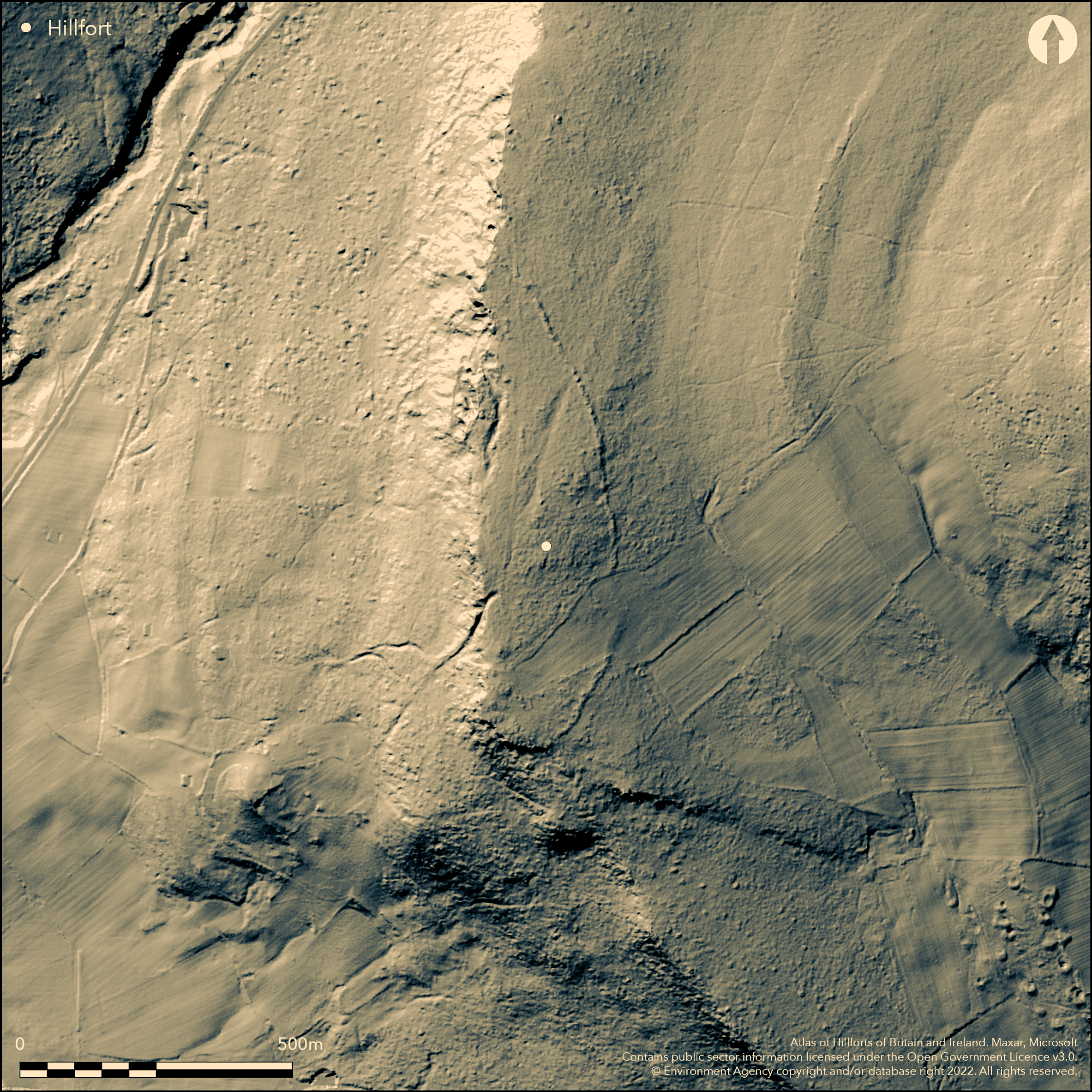
LiDAR 1m DTM Hillshade
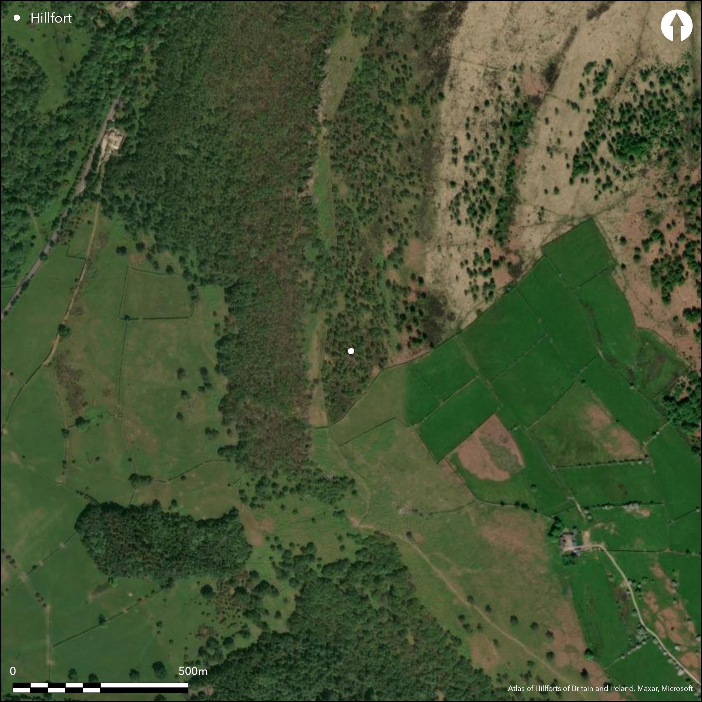
Satellite Imagery
LiDAR 1m DTM Hillshade
Satellite Imagery
Scroll left/right to view further images.
HER: Derbyshire 1386 (None)
NMR: SK 27 SE 37 (1004216)
SM: None
NGR: SK 2720 7290
X: 427200 Y: 372900 (OSGB36)
Lying on the crest of the Gritstone escarpment of Gardom's Edge, partially within the Chatsworth Estate, an enclosure variously interpreted as Neolithic or early Bronze Age, or an Iron Age hillfort or stock enclosure (Hart 1985) and now confirmed by radiocarbon dating as having an Iron Age date. The location offers extensive views in all directions except in the E where it is overlooked by Birchen Edge. The site was first noted in 1942 by the Sheffield Clarion Ramblers, and recorded as `Meg Walls' a `British defence wall' (Ward 1942; 1943). It comprises discontinuous lengths of curved stone wall forming a semi-circle totalling 610m in length, 6-9m wide and 0.3-1.5m high, enclosing approximately 6ha. The walls terminate at the cliff edge with the western extent defined by the scarp. The wall is constructed from large gritstone boulders of a type found locally on the surface, and smaller stones, and was possibly once faced with slabs. Occasional large slabs set vertically, lie towards the outer side of the bank. Excavation has determined three phases of construction with the wall preceded by a line of timber posts, although these are considered to be too shallow to represent a palisade (Barnatt et al. 2000). The wall had an outer kerb and was widened after its original construction to double the width. A charcoal layer overlay the postholes with the stone wall placed on top. Reddening on some of the stones suggests burning took place. A variation in construction methods was observed around the circuit interpreted as evidence for possible gang working (Ainsworth and Barnatt 1998). Six breaks, 2m wide and approximately 40-60m apart have been recorded around the circuit some have been framed with large stones and large earthfast slabs. Four of the entrances are considered original (ibid. 10) and two were later blocked, one with a clearance cairn. A large number of boulders and a large burial cairn lie within the enclosure. It lies within an extensive prehistoric landscape and the enclosure underwent a detailed RCHME topographical survey in 1987 (Cocroft and Jecock 1987) and included in a survey of monuments on Gardom's Edge by RCHME in 1990-1 (Ainsworth and Barnatt, 1998). Further investigations including excavation was carried out between 1995-2000 (Barnatt et al. interim reports). An arc of postholes directly outside the enclosure wall was interpreted as a building, possibly a shrine. It was associated with cobbling and later prehistoric pottery and flintwork was recovered from the features. A small pit containing a human cremation and charcoal deposits was found inside. The site is not recorded on OS mapping.
Citizen Science: ✗
Reliability of Data: Confirmed
Reliability of Interpretation: Confirmed
X: -177419 Y: 7029823 (EPSG: 3857)
Longitude: -1.5937845828766486 Latitude: 53.25240555901337 (EPSG:4326)
Country: England
Current County or Unitary Authority: Derbyshire
Historic County: Derbyshire
Current Parish/Community/Council/Townland: Baslow and Bubnel
Differential robbing for stone ranging from removal of the walls to quarry pits
| Extant | ✓ |
| Cropmark | ✗ |
| Likely Destroyed | ✗ |
Moorland and deciduous woodland (birch scrub)
| Woodland | ✓ |
| Commercial Forestry Plantation | ✗ |
| Parkland | ✗ |
| Pasture (Grazing) | ✗ |
| Arable | ✗ |
| Scrub/Bracken | ✗ |
| Bare Outcrop | ✗ |
| Heather/Moorland | ✓ |
| Heath | ✗ |
| Built-up | ✗ |
| Coastal Grassland | ✗ |
| Other | ✗ |
A partial contour fort sited on a westerly sloping scarp edge at between 266-278m OD
| Contour Fort | ✗ |
| Partial Contour Fort | ✓ |
| Promontory Fort | ✗ |
| Hillslope Fort | ✗ |
| Level Terrain Fort | ✗ |
| Marsh Fort | ✗ |
| Multiple Enclosure Fort | ✗ |
| Hilltop | ✓ |
| Coastal Promontory | ✗ |
| Inland Promontory | ✗ |
| Valley Bottom | ✗ |
| Knoll/Hillock/Outcrop | ✗ |
| Ridge | ✗ |
| Cliff/Plateau-edge/Scarp | ✓ |
| Hillslope | ✗ |
| Lowland | ✗ |
| Spur | ✗ |
Dominant Topographic Feature: Scarp Edge
| North | ✗ |
| Northeast | ✗ |
| East | ✗ |
| Southeast | ✗ |
| South | ✗ |
| Southwest | ✗ |
| West | ✓ |
| Northwest | ✗ |
| Level | ✗ |
Altitude: 270.0m
N/A
Charcoal from the bank has been radiocarbon dated to the Iron Age (G. Guilbert pers. comm.). The report is not yet published and the dates given here represent an estimated period from the late Bronze Age and Iron Age. Burial cairn within.
Reliability: B - Medium
| Pre 1200BC | ✗ |
| 1200BC - 800BC | ✓ |
| 800BC - 400BC | ✓ |
| 400BC - AD50 | ✓ |
| AD50 - AD400 | ✗ |
| AD400 - AD 800 | ✗ |
| Post AD800 | ✗ |
| Unknown | ✗ |
| Pre Hillfort: | None |
| Post Hillfort: | None |
| C14: | None |
First discovered in the 1940's and surveyed between the 1940's and 1960's but published posthumously in 1983 (Beswick and Merrills, 1983, 28). The southern extent underwent a detailed RCHME topographical survey in 1987 and was included in a survey of monuments on Gardom's Edge by RCHME in 1990-1. Excavation between 1995-2000
| 1st Identified Written Reference (1951): | None |
| Other (1996): | Shovel pit survey |
| Other (1999): | Visited by Hillfort Study Group |
| Earthwork Survey (None): | None |
| Excavation (None): | None |
Strewn with boulders. A large burial cairn lies within the interior. Pottery and lithics.
None
| None | ✓ |
| Spring | ✗ |
| Stream | ✗ |
| Pool | ✗ |
| Flush | ✗ |
| Well | ✗ |
| Other | ✗ |
None
| No Known Features | ✓ |
| Round Stone Structures | ✗ |
| Rectangular Stone Structures | ✗ |
| Curvilinear Platforms | ✗ |
| Other Roundhouse Evidence | ✗ |
| Pits | ✗ |
| Quarry Hollows | ✗ |
| Other | ✗ |
None
| No Known Excavation | ✗ |
| Pits | ✗ |
| Postholes | ✗ |
| Roundhouses | ✗ |
| Rectangular Structures | ✗ |
| Roads/Tracks | ✗ |
| Quarry Hollows | ✗ |
| Other | ✗ |
| Nothing Found | ✓ |
Magnetic susceptibility used across small building appended to the outside of the enclosure wall
| No Known Geophysics | ✓ |
| Pits | ✗ |
| Roundhouses | ✗ |
| Rectangular Structures | ✗ |
| Roads/Tracks | ✗ |
| Quarry Hollows | ✗ |
| Other | ✗ |
| Nothing Found | ✗ |
None
| No Known Finds | ✗ |
| Pottery | ✓ |
| Metal | ✗ |
| Metalworking | ✗ |
| Human Bones | ✗ |
| Animal Bones | ✗ |
| Lithics | ✓ |
| Environmental | ✗ |
| Other | ✗ |
None
| APs Not Checked | ✓ |
| None | ✗ |
| Roundhouses | ✗ |
| Rectangular Structures | ✗ |
| Pits | ✗ |
| Postholes | ✗ |
| Roads/Tracks | ✗ |
| Other | ✗ |
Six breaks, 2m wide and approximately 40-60m apart have been recorded around the circuit, some have been framed with large stones and large earthfast slabs. Four of the entrances are considered original (Ainsworth and Barnatt 1998, 10) and two were later blocked.
| 6: | None |
| 2: | None |
Guard Chambers: ✗
Chevaux de Frise: ✗
| 1. Simple Gap (East): | None |
| 2. Simple Gap (East): | None |
| 3. Simple Gap (East): | None |
| 4. Simple Gap (East): | None |
Excavation has shown three phases of construction. It comprises discontinuous lengths of curved stone wall totalling 610m in length, 6-9m wide and 0.3-1.5m high, enclosing approximately 6ha and forming a semi-circle. The walls terminate at the cliff edge with the western extent defined by the scarp. The wall is constructed from large gritstone boulders of a type found locally on the surface, and smaller stones, and was possibly once faced with slabs. Occasional large slabs set vertically lie towards the outer side of the bank. Excavation has determined three phases of construction with the wall preceded by a line of timber posts. The wall had an outer kerb and was widened after its original construction to double the width. Evidence survives for fires inside the wall with the stones placed on top.
| Area 1: | 6.0ha. |
| Total: | 6.0ha. |
Total Footprint Area: Noneha.
None
| ✓ | Excavation has shown three-phases of construction for the ramparts |
| ✗ | None |
| NE Quadrant: | 1 |
| SE Quadrant: | 1 |
| SW Quadrant: | None |
| NW Quadrant: | None |
| Total: | 1 |
| Partial Univallate | ✓ |
| Univallate | ✗ |
| Partial Bivallate | ✗ |
| Bivallate | ✗ |
| Partial Multivallate | ✗ |
| Multivallate | ✗ |
| Unknown | ✗ |
| Partial Univallate | ✗ |
| Univallate | ✗ |
| Partial Bivallate | ✗ |
| Bivallate | ✗ |
| Partial Multivallate | ✗ |
| Multivallate | ✗ |
None
| None | ✗ |
| Earthen Bank | ✗ |
| Stone Wall | ✓ |
| Rubble | ✓ |
| Wall-walk | ✗ |
| Evidence of Timber | ✗ |
| Vitrification | ✗ |
| Other Burning | ✗ |
| Palisade | ✗ |
| Counter Scarp Bank | ✗ |
| Berm | ✗ |
| Unfinished | ✗ |
| Other | ✗ |
Line of timber posts too shallow to represent a palisade (Barnatt et al. 1998)
| None | ✗ |
| Earthen Bank | ✗ |
| Stone Wall | ✓ |
| Murus Duplex | ✗ |
| Timber-framed | ✗ |
| Timber-laced | ✗ |
| Vitrification | ✗ |
| Other Burning | ✓ |
| Palisade | ✗ |
| Counter Scarp Bank | ✗ |
| Berm | ✗ |
| Unfinished | ✗ |
| No Known Excavation | ✗ |
| Other | ✓ |
| ✓ | Ainsworth and Barnatt (1998, 15) suggest the height and bulk of the some of the sections of bank might indicated gang working |
| ✗ | None |
Number of Ditches: None
| ✗ | None |
Ainsworth, S and Barnatt, J. 1998. A Scarp-Edge Enclosure at Gardom's Edge, Baslow, Derbyshire. Derbyshire Archaeol J 118, 1998, 5-23
Barnatt, J., Bevan, B. and Edmonds, M. 2002. Gardom's Edge: a landscape through time. Antiquity, 76, 50-56
Barnatt and Bannister 2009, The Archaeology of a Great Estate: Chatsworth and Beyond. Windgatherer Press. 33-35
Barnatt, J., Bevan, W. and Edmonds, M. 1995. A prehistoric landscape at Gardom's Edge, Baslow, Derbyshire: Excavations 1995. 1st interim report. https://www.academia.edu/962719/Gardoms-Edge-interim-report-1995. Accessed Sept 2015
Barnatt, J., Bevan, W. and Edmonds, M. 1996. A prehistoric landscape at Gardom's Edge, Baslow, Derbyshire: Excavations 1996. 2nd interim report. https://www.academia.edu/962725/Gardoms-Edge-interim-report-1996. Accessed Sep 2015
Barnatt, J., Bevan, W. and Edmonds, M. 1990 and 2000. A prehistoric landscape at Gardom's Edge, Baslow, Derbyshire: Excavations 1997. 5th interim report. https://www.academia.edu/962780/Gardoms-Edge-interim-report-1999. Accessed Sep 2015
Beswick, P and Merrills, D. 1983. LH Butcher's survey of early settlements and fields in the southern Pennines. Trans Hunter Archaeol Soc 12, 1983, 16-50
Cocroft, W. and Jecock, M. 1987. RCHME: Peak District Bronze Age Settlements and Field Systems. Unpublished
Hart, C. R. 1985. Gardom's Edge, Derbyshire: settlements, cairnfield and hillfort. In D. Spratt and C.Burgess (eds)
Upland Settlement in Britain, 71-76. Oxford: British Archaeological Reports, British Series 143. Oxford
Ward, G. H. B. 1942. Ancient British defence works discovered near Baslow. Sheffield Clarion Ramblers Handbook 1941-2, 76-81
Ward, G. H. B. 1943. Ancient British defence works discovered near Baslow. Sheffield Clarion Ramblers Handbook 1942-3, 144-45
Atlas of Hillforts:
Wikidata:
This work is licensed under CC BY-SA 4.0

 and should be cited as:
Lock, Gary and Ralston, Ian. 2024. Atlas of Hillforts of Britain and Ireland. Available at: https://hillforts.arch.ox.ac.uk
Document Version 1.1