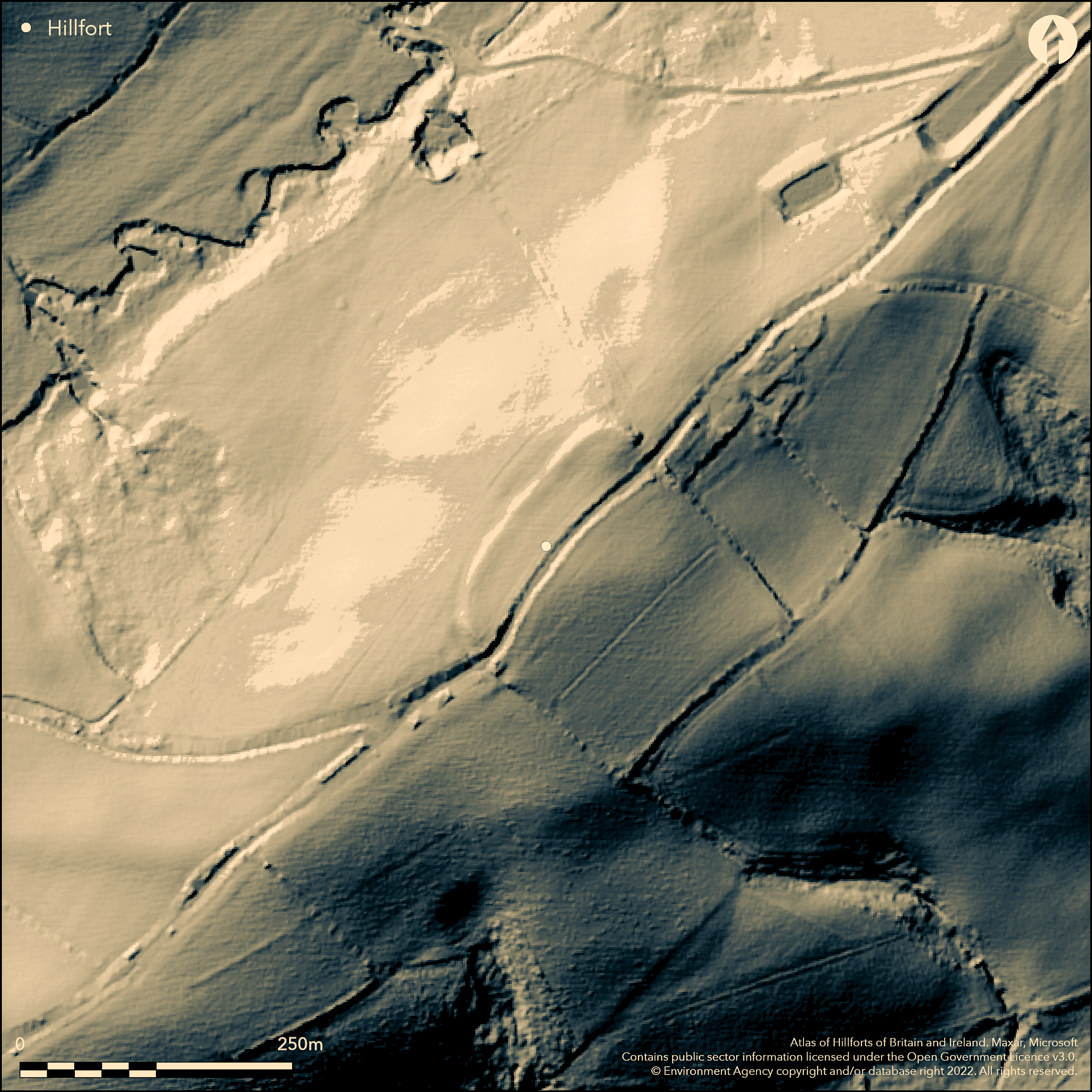
LiDAR 1m DTM Hillshade
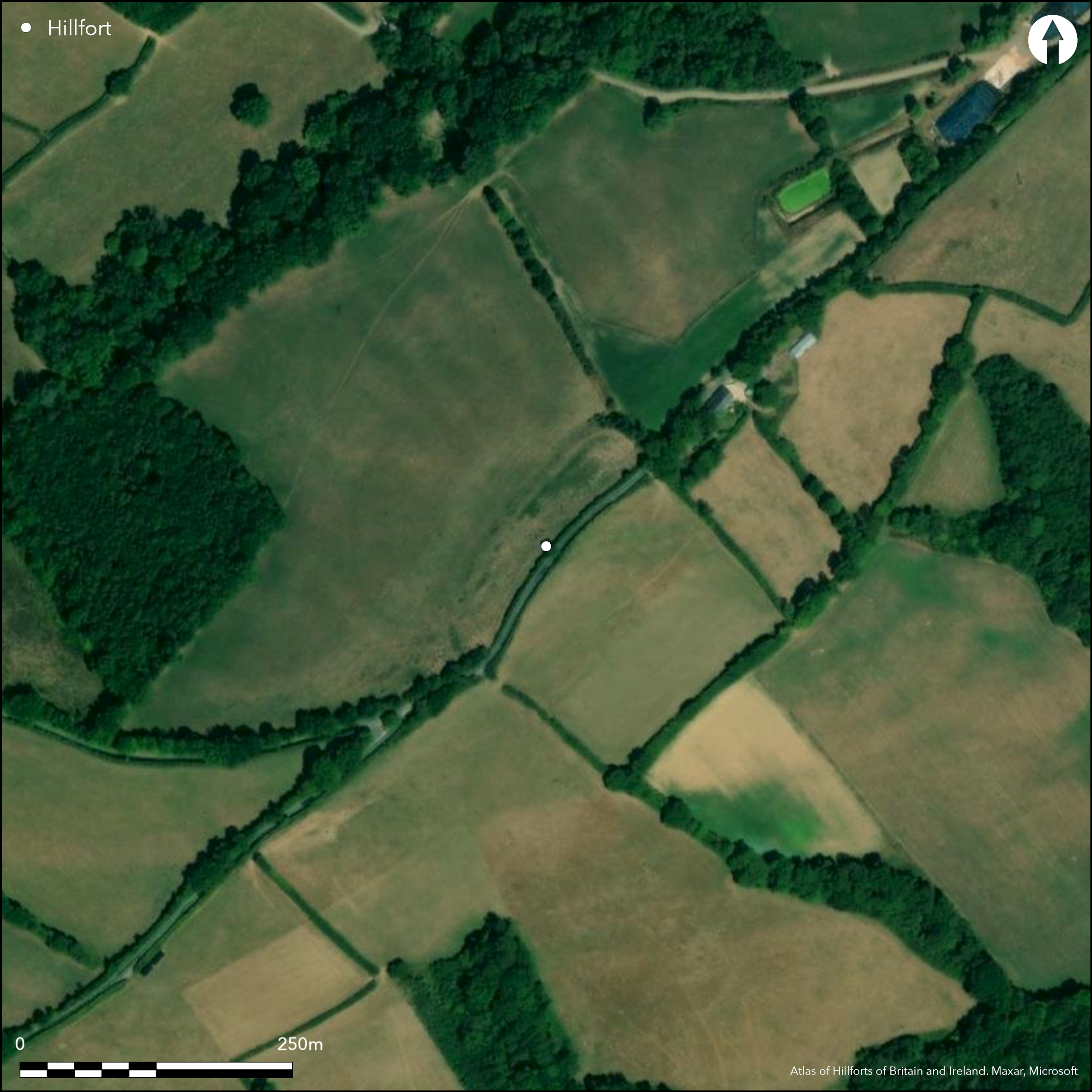
Satellite Imagery
LiDAR 1m DTM Hillshade
Satellite Imagery
Scroll left/right to view further images.
HER: Devon MDV13753 (None)
NMR: SX 79 NE 5 (445714)
SM: None
NGR: SX76199748
X: 276190 Y: 97482 (OSGB36)
Cropmark of contour hillfort located on point of NE-SW ridge above River Yeo to SE and River Troney to NW. SE of Great Cleeve Copse. Commands extensive views to E and NW. Visible on aerial photographs, but barely visible as sub-rectangular enclosure c. 1.2ha on ground. One side can be traced and parts of two others. Road passes through site NE-SW. To SE of this road former earthworks barely visible and possible that survives in hedge pattern. To NW of road artificial scarp c. 3m high, turning sharply to SW end where fragment of bank 0.6m high with outer ditch 0.4m deep. At NE end very spread bank 0.8m. high possibly site of inturned entrance. Ridgeway road may have utilised it, but now seems to rest on accompanying inturn. Significant excavation and geophysical survey in advance of laying of new water pipeline, and one of few Devon hillforts with firm dates Manning and Quinnell 2009). Curvilinear ditches of at least nine roundhouses, postholes and pits found by excavation. Very dense occupation suggested. Track detected by geophysics running from presumed entrance, but no internal features. Glass bead of Garrow Tor type with pale turquoise body with three sets of stratified eyes of brown, white and blue, characteristic of middle Iron Age (c. 300BC to 200BC). Three C14 dates from wood charcoal indicated site occupied between in middle Iron Age 400BC to 200 BC.
Citizen Science: ✗
Reliability of Data: Confirmed
Reliability of Interpretation: Confirmed
X: -418223 Y: 6579587 (EPSG: 3857)
Longitude: -3.7569607983265265 Latitude: 50.7636183462 (EPSG:4326)
Country: England; None
Current County or Unitary Authority: Devon
Historic County: Devon
Current Parish/Community/Council/Townland: Crediton Hamlets; Bow
Mostly cropmark. Road passes through site NE-SW. Some traces of bank and ditch survive.
| Extant | ✓ |
| Cropmark | ✓ |
| Likely Destroyed | ✗ |
Improved pasture. Road.
| Woodland | ✗ |
| Commercial Forestry Plantation | ✗ |
| Parkland | ✗ |
| Pasture (Grazing) | ✓ |
| Arable | ✗ |
| Scrub/Bracken | ✗ |
| Bare Outcrop | ✗ |
| Heather/Moorland | ✗ |
| Heath | ✗ |
| Built-up | ✗ |
| Coastal Grassland | ✗ |
| Other | ✓ |
Cropmark of contour hillfort located on point of NE-SW ridge above River Yeo to SE and River Troney to NW. SE of Great Cleeve Copse. Commands extensive views to E and NW.
| Contour Fort | ✓ |
| Partial Contour Fort | ✗ |
| Promontory Fort | ✗ |
| Hillslope Fort | ✗ |
| Level Terrain Fort | ✗ |
| Marsh Fort | ✗ |
| Multiple Enclosure Fort | ✗ |
| Hilltop | ✓ |
| Coastal Promontory | ✗ |
| Inland Promontory | ✗ |
| Valley Bottom | ✗ |
| Knoll/Hillock/Outcrop | ✗ |
| Ridge | ✗ |
| Cliff/Plateau-edge/Scarp | ✗ |
| Hillslope | ✗ |
| Lowland | ✗ |
| Spur | ✗ |
Dominant Topographic Feature: Hill top
| North | ✗ |
| Northeast | ✗ |
| East | ✗ |
| Southeast | ✗ |
| South | ✗ |
| Southwest | ✗ |
| West | ✗ |
| Northwest | ✗ |
| Level | ✓ |
Altitude: 150.0m
Boundary Type: Parish/Townland
Glass bead of Garrow Tor type with pale turquoise body with three sets of stratified eyes of brown, white and blue, characteristic of middle Iron Age (c. 300BC to 200BC). Three C14 dates from wood charcoal indicated site occupied between in middle Iron Age 400BC to 200 BC.
Reliability: B - Medium
| Pre 1200BC | ✗ |
| 1200BC - 800BC | ✗ |
| 800BC - 400BC | ✗ |
| 400BC - AD50 | ✓ |
| AD50 - AD400 | ✗ |
| AD400 - AD 800 | ✗ |
| Post AD800 | ✗ |
| Unknown | ✗ |
| Pre Hillfort: | None |
| Post Hillfort: | None |
| Artefactual: | Middle Iron Age glass bead. |
| C14: | Middle Iron Age dates. |
Described by Davidson under the name of Lethen Castle 1861. 1993-96 RCHME aerial photograph primary recording project. Excavation Exeter Archaeology 1998. Geophysical survey GBS Prospecting Ltd 2007.
| 1st Identified Written Reference (1861): | Described by Davidson under the name of Lethen Castle. |
| Excavation (1998): | Exeter Archaeology. |
| Geophysical Survey (2007): | GBS Prospecting Ltd. |
| Other (None): | RCHME aerial photograph primary recording project. |
Curvilinear ditches of at least nine roundhouses, postholes and pits found by excavation. Track detected by geophysics running from presumed entrance, but no internal features. Glass bead from pit of Garrow Tor type with pale turquoise body with three sets of stratified eyes of brown, white and blue. Wood charcoal.
None
| None | ✓ |
| Spring | ✗ |
| Stream | ✗ |
| Pool | ✗ |
| Flush | ✓ |
| Well | ✗ |
| Other | ✗ |
None
| No Known Features | ✓ |
| Round Stone Structures | ✗ |
| Rectangular Stone Structures | ✗ |
| Curvilinear Platforms | ✗ |
| Other Roundhouse Evidence | ✗ |
| Pits | ✗ |
| Quarry Hollows | ✗ |
| Other | ✗ |
Curvilinear ditches of at least nine roundhouses, postholes and pits.
| No Known Excavation | ✗ |
| Pits | ✓ |
| Postholes | ✓ |
| Roundhouses | ✓ |
| Rectangular Structures | ✗ |
| Roads/Tracks | ✗ |
| Quarry Hollows | ✗ |
| Other | ✗ |
| Nothing Found | ✗ |
Track detected running from presumed entrance, but no internal features.
| No Known Geophysics | ✓ |
| Pits | ✗ |
| Roundhouses | ✗ |
| Rectangular Structures | ✗ |
| Roads/Tracks | ✗ |
| Quarry Hollows | ✗ |
| Other | ✗ |
| Nothing Found | ✗ |
Glass bead from pit of Garrow Tor type with pale turquoise body with three sets of stratified eyes of brown, white and blue. Wood charcoal.
| No Known Finds | ✗ |
| Pottery | ✗ |
| Metal | ✗ |
| Metalworking | ✗ |
| Human Bones | ✗ |
| Animal Bones | ✗ |
| Lithics | ✗ |
| Environmental | ✓ |
| Other | ✓ |
None
| APs Not Checked | ✓ |
| None | ✗ |
| Roundhouses | ✗ |
| Rectangular Structures | ✗ |
| Pits | ✗ |
| Postholes | ✗ |
| Roads/Tracks | ✗ |
| Other | ✗ |
At NE end very spread bank 0.8m. high possibly site of inturned entrance. Ridgeway road may have utilised it, but now seems to rest on accompanying inturn.
| None: | Not defined - mostly cropmark. |
| 2: | None |
Guard Chambers: ✗
Chevaux de Frise: ✗
| 1. In-turned (North east): | Spread bank possible entrance site. |
Road passes through site NE-SW. To SE of this road former earthworks barely visible and possible that survives in hedge pattern. To NW of road artificial scarp c. 3m high, turning sharply to SW end where fragment of bank 0.6m high with outer ditch 0.4m deep.
| Area 1: | 1.2ha. |
| Total: | 1.2ha. |
Total Footprint Area: Noneha.
None
| ✓ | Two phases identified from excavation. |
| ✗ | Mostly cropmark - original circuit estimated. |
| NE Quadrant: | 1 |
| SE Quadrant: | 1 |
| SW Quadrant: | 1 |
| NW Quadrant: | 1 |
| Total: | 1 |
| Partial Univallate | ✗ |
| Univallate | ✓ |
| Partial Bivallate | ✗ |
| Bivallate | ✗ |
| Partial Multivallate | ✗ |
| Multivallate | ✗ |
| Unknown | ✗ |
| Partial Univallate | ✗ |
| Univallate | ✗ |
| Partial Bivallate | ✗ |
| Bivallate | ✗ |
| Partial Multivallate | ✗ |
| Multivallate | ✗ |
None
| None | ✗ |
| Earthen Bank | ✓ |
| Stone Wall | ✗ |
| Rubble | ✗ |
| Wall-walk | ✗ |
| Evidence of Timber | ✗ |
| Vitrification | ✗ |
| Other Burning | ✗ |
| Palisade | ✗ |
| Counter Scarp Bank | ✗ |
| Berm | ✗ |
| Unfinished | ✗ |
| Other | ✗ |
None
| None | ✓ |
| Earthen Bank | ✗ |
| Stone Wall | ✗ |
| Murus Duplex | ✗ |
| Timber-framed | ✗ |
| Timber-laced | ✗ |
| Vitrification | ✗ |
| Other Burning | ✗ |
| Palisade | ✗ |
| Counter Scarp Bank | ✗ |
| Berm | ✗ |
| Unfinished | ✗ |
| No Known Excavation | ✗ |
| Other | ✗ |
| ✗ | None |
| ✓ | Traces survive. |
Number of Ditches: 1
| ✗ | None |
Davidson, J. 1861. Notes on Antiquities of Devon, 26.
Griffith, F.M. and Wilkes, E.M. 2011. In the footsteps of pioneering women: some recent work on Devon hillforts, In Pearce, S (ed). Recent archaeological work in South-Western Britain, BAR British Series 548.
Manning, P. and Quinnell, H. 2009. Excavation and field survey at the Iron Age hillfort of Berry Ball, Crediton Hamlets, Proc. Devon Archaeol. Soc, 67, 99-132.
Stephens C. 2007. Geophysical Survey Report. Berry Ball Hillfort, near Crediton, GSB Prospection Ltd Survey report.
Atlas of Hillforts:
Wikidata:
This work is licensed under CC BY-SA 4.0

 and should be cited as:
Lock, Gary and Ralston, Ian. 2024. Atlas of Hillforts of Britain and Ireland. Available at: https://hillforts.arch.ox.ac.uk
Document Version 1.1