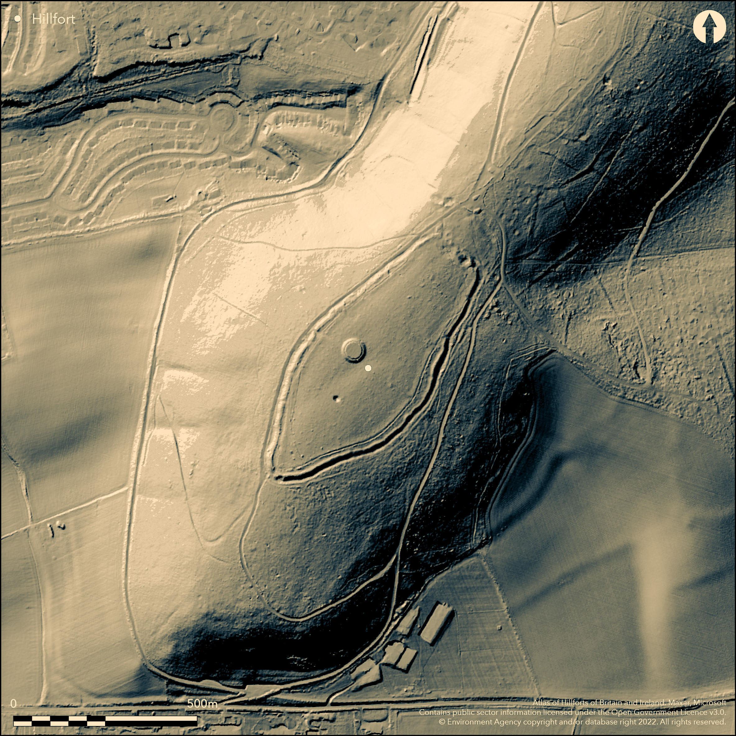
LiDAR 1m DTM Hillshade
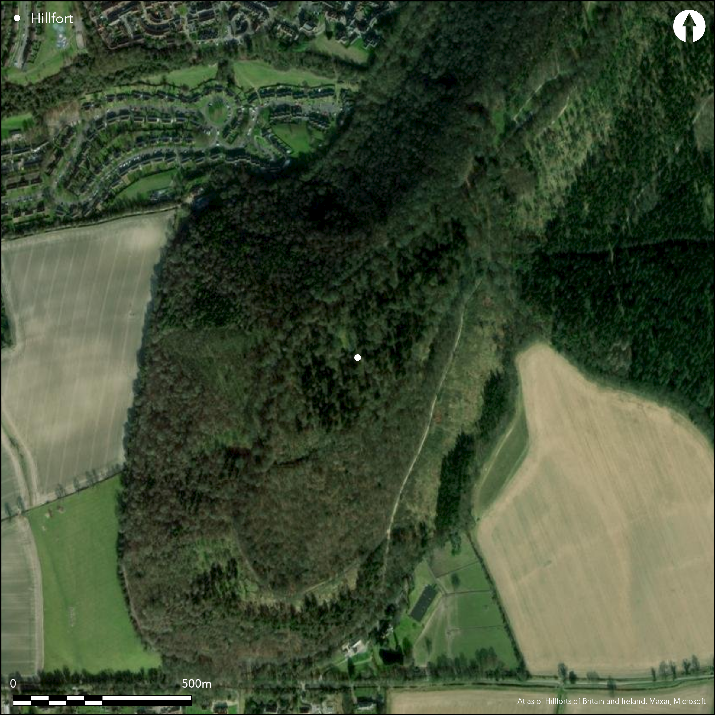
Satellite Imagery
LiDAR 1m DTM Hillshade
Satellite Imagery
Scroll left/right to view further images.
HER: Buckinghamshire 164500000 (None)
NMR: SP 80 NE 2 (344134)
SM: 1011304
NGR: SP 8822 0798
X: 488220 Y: 207980 (OSGB36)
Lying on the eastern fringes of Wendover, on Boddington Hill, a univallate hillfort of approximately 6ha. The site occupies the summit of a steep sided, wooded chalk spur at 251m OD. It measures 500m NE-SW by 220 transversely and is oval in plan, following the 240m contour beneath the flattened summit. It comprises a single rampart with external flat-bottomed ditch, strongest in the S and E where the rampart stands 3.4m above the bottom of the ditch and 1.7m high internally. The ditch is up to 1.6m deep. Traces of a counterscarp 5m wide and 0.4m high has been recorded in the SE, following the line of the ditch. Quarrying has damaged the defences in the NE, and the construction of farm buildings and their subsequent demolition in the 1950's has destroyed those in the northern corner. A terraced forestry track overlies the outer ditch on the NW side with the rampart surviving as a scarp averaging 2.6m high. A modern break lies 300m to the S of this. The location of the original entrance is unknown but it possibly lay in the area now destroyed. A geophysical survey across a short length of earthworks thought to be original at the northern end in 1996 showed it was relatively recent, probably associated with the demolition of Calloway Farm in the 1950's. A feature interpreted as the hillfort ditch was identified by the survey (Thorn and Gething 1996). A section cut through the bank and ditch in 1964 recovered 1st-2nd century BC pottery immediately beneath the rampart and a bronze knife or dagger was found on the surface in 1967 (notes from Buckinghamshire County Museum). Iron Age pottery and animal bone were recovered from a tree throw following the collapse of a large beech on the southern ramparts, with further finds made in 1982. The finds were interpreted as coming from the bank or immediately beneath it (Farley 1982, 172). The site is recorded on 1877-78 1:2,500 OS mapping. Scheduled
Citizen Science: ✓
Reliability of Data: Confirmed
Reliability of Interpretation: Confirmed
X: -80492 Y: 6757478 (EPSG: 3857)
Longitude: -0.7230697870283701 Latitude: 51.76351534703663 (EPSG:4326)
Country: England; None
Current County or Unitary Authority: Buckinghamshire
Historic County: Buckinghamshire
Current Parish/Community/Council/Townland: Halton; Wendover
Destroyed in the northern corner. Since 2010 volunteers from the Chilterns Society, who form the Wendover Woods Conservation Group, have been removing vegetation from the banks and ditch
| Extant | ✓ |
| Cropmark | ✗ |
| Likely Destroyed | ✓ |
Forestry Commission coniferous and deciduous woodland
| Woodland | ✓ |
| Commercial Forestry Plantation | ✗ |
| Parkland | ✗ |
| Pasture (Grazing) | ✗ |
| Arable | ✗ |
| Scrub/Bracken | ✗ |
| Bare Outcrop | ✗ |
| Heather/Moorland | ✗ |
| Heath | ✗ |
| Built-up | ✗ |
| Coastal Grassland | ✗ |
| Other | ✗ |
Contour fort of approximately 6ha. The site occupies the summit of a steep-sided, wooded chalk spur at 251m OD.
| Contour Fort | ✓ |
| Partial Contour Fort | ✗ |
| Promontory Fort | ✗ |
| Hillslope Fort | ✗ |
| Level Terrain Fort | ✗ |
| Marsh Fort | ✗ |
| Multiple Enclosure Fort | ✗ |
| Hilltop | ✓ |
| Coastal Promontory | ✗ |
| Inland Promontory | ✗ |
| Valley Bottom | ✗ |
| Knoll/Hillock/Outcrop | ✗ |
| Ridge | ✗ |
| Cliff/Plateau-edge/Scarp | ✗ |
| Hillslope | ✗ |
| Lowland | ✗ |
| Spur | ✓ |
Dominant Topographic Feature: Spur
| North | ✗ |
| Northeast | ✗ |
| East | ✗ |
| Southeast | ✗ |
| South | ✗ |
| Southwest | ✗ |
| West | ✗ |
| Northwest | ✗ |
| Level | ✓ |
Altitude: 251.0m
The parish boundary between Halton and Wendover runs around the W, S and E of the hill
Boundary Type: Parish/Townland
Dated by pottery to the 1st-2nd century BC
Reliability: B - Medium
| Pre 1200BC | ✗ |
| 1200BC - 800BC | ✗ |
| 800BC - 400BC | ✗ |
| 400BC - AD50 | ✓ |
| AD50 - AD400 | ✗ |
| AD400 - AD 800 | ✗ |
| Post AD800 | ✗ |
| Unknown | ✗ |
| Pre Hillfort: | None |
| Post Hillfort: | None |
| Artefactual: | None |
Recorded in RCHM Bucks 1912. Field investigation 1974. Geophysical survey in 1996 commissioned as part of Buckinghamshire County Council Chilterns Project and Forest Enterprise. Survey 1996. Work since 2010 by the Chiltern Society Conservation Volunteers who keep the ditches clear of vegetation. Recorded on 1877-78 1;2,500 OS mapping. Scheduled
| 1st Identified Written Reference (1912): | None |
| Other (1963): | Scheduled |
| Excavation (1964): | None |
| Other (1974): | Field investigation |
| Geophysical Survey (1996): | None |
| Earthwork Survey (1996): | None |
| Other (2010): | Volunteer scrub clearance, ongoing |
| 1st Identified Map Depiction (None): | None |
No features contemporary with the use of the hillfort are recorded. Iron Age pottery fragments, ingot, part of a bronze dagger, flint scraper, spindle whorl
None
| None | ✓ |
| Spring | ✗ |
| Stream | ✗ |
| Pool | ✗ |
| Flush | ✗ |
| Well | ✗ |
| Other | ✗ |
None
| No Known Features | ✓ |
| Round Stone Structures | ✗ |
| Rectangular Stone Structures | ✗ |
| Curvilinear Platforms | ✗ |
| Other Roundhouse Evidence | ✗ |
| Pits | ✗ |
| Quarry Hollows | ✗ |
| Other | ✗ |
Only the ramparts investigated
| No Known Excavation | ✓ |
| Pits | ✗ |
| Postholes | ✗ |
| Roundhouses | ✗ |
| Rectangular Structures | ✗ |
| Roads/Tracks | ✗ |
| Quarry Hollows | ✗ |
| Other | ✗ |
| Nothing Found | ✗ |
Ramparts only investigated
| No Known Geophysics | ✓ |
| Pits | ✗ |
| Roundhouses | ✗ |
| Rectangular Structures | ✗ |
| Roads/Tracks | ✗ |
| Quarry Hollows | ✗ |
| Other | ✗ |
| Nothing Found | ✗ |
Spindle whorl
| No Known Finds | ✗ |
| Pottery | ✓ |
| Metal | ✓ |
| Metalworking | ✗ |
| Human Bones | ✗ |
| Animal Bones | ✗ |
| Lithics | ✓ |
| Environmental | ✗ |
| Other | ✓ |
Woodland
| APs Not Checked | ✓ |
| None | ✗ |
| Roundhouses | ✗ |
| Rectangular Structures | ✗ |
| Pits | ✗ |
| Postholes | ✗ |
| Roads/Tracks | ✗ |
| Other | ✗ |
The location of the original entrance is unknown but possibly lay in the NE where the ramparts are now destroyed.
| 2: | Modern breaks |
| 2: | None |
Guard Chambers: ✗
Chevaux de Frise: ✗
Univallate hillfort of approximately 7ha. It measures 500m NE-SW by 220 transversely and is oval in plan, following the 240m contour beneath the flattened summit. It comprises a single rampart with external flat-bottomed ditch, strongest in the S and E where the rampart stands 3.4m above the bottom of the ditch and 1.7m high internally. The ditch is up to 1.6m deep. Traces of a counterscarp 5m wide and 0.4m high has been recorded in the SE, following the line of the ditch. Quarrying has damaged the defences in the NE, and the construction of farm buildings and their subsequent demolition in the 1950's has destroyed those in the northern corner. A terraced forestry track overlies the outer ditch on the NW side with the rampart surviving as a scarp averaging 2.6m high.
| Area 1: | 7.0ha. |
| Total: | 7.0ha. |
Total Footprint Area: Noneha.
None
| ✗ | None |
| ✓ | Now destroyed in places |
| NE Quadrant: | 1 |
| SE Quadrant: | 1 |
| SW Quadrant: | 1 |
| NW Quadrant: | 1 |
| Total: | 1 |
| Partial Univallate | ✗ |
| Univallate | ✓ |
| Partial Bivallate | ✗ |
| Bivallate | ✗ |
| Partial Multivallate | ✗ |
| Multivallate | ✗ |
| Unknown | ✗ |
| Partial Univallate | ✗ |
| Univallate | ✗ |
| Partial Bivallate | ✗ |
| Bivallate | ✗ |
| Partial Multivallate | ✗ |
| Multivallate | ✗ |
None
| None | ✗ |
| Earthen Bank | ✓ |
| Stone Wall | ✗ |
| Rubble | ✗ |
| Wall-walk | ✗ |
| Evidence of Timber | ✗ |
| Vitrification | ✗ |
| Other Burning | ✗ |
| Palisade | ✗ |
| Counter Scarp Bank | ✓ |
| Berm | ✗ |
| Unfinished | ✗ |
| Other | ✗ |
Not recorded
| None | ✗ |
| Earthen Bank | ✓ |
| Stone Wall | ✗ |
| Murus Duplex | ✗ |
| Timber-framed | ✗ |
| Timber-laced | ✗ |
| Vitrification | ✗ |
| Other Burning | ✗ |
| Palisade | ✗ |
| Counter Scarp Bank | ✗ |
| Berm | ✗ |
| Unfinished | ✗ |
| No Known Excavation | ✗ |
| Other | ✗ |
| ✗ | None |
| ✓ | None |
Number of Ditches: 1
| ✗ | None |
Anon. 1961-65. Archaeological Notes from the Buckinghamshire County Museum. Rec Buckinghamshire 17, (1964), 301
Bartlett-Clark Consultancy. 1996. Archaeogeophysical survey of the Hillfort at Boddington Banks, Wendover. Unpublished.
Farley, M. 1982. Archaeological Notes from the Buckinghamshire County Museum. Rec Buckinghamshire 24, 172
Royal Commision on Historic Monuments England. 1912. Buckinghamshire, 1, 184.
Thorn, B. and Gething, I. 1996. A report on an Archaeological Survey of the Hillfort at Boddington Bank, Wendover, Buckinghamshire. Bartlett Clark Consultancy. Unpublished.
Atlas of Hillforts:
Wikidata:
This work is licensed under CC BY-SA 4.0

 and should be cited as:
Lock, Gary and Ralston, Ian. 2024. Atlas of Hillforts of Britain and Ireland. Available at: https://hillforts.arch.ox.ac.uk
Document Version 1.1