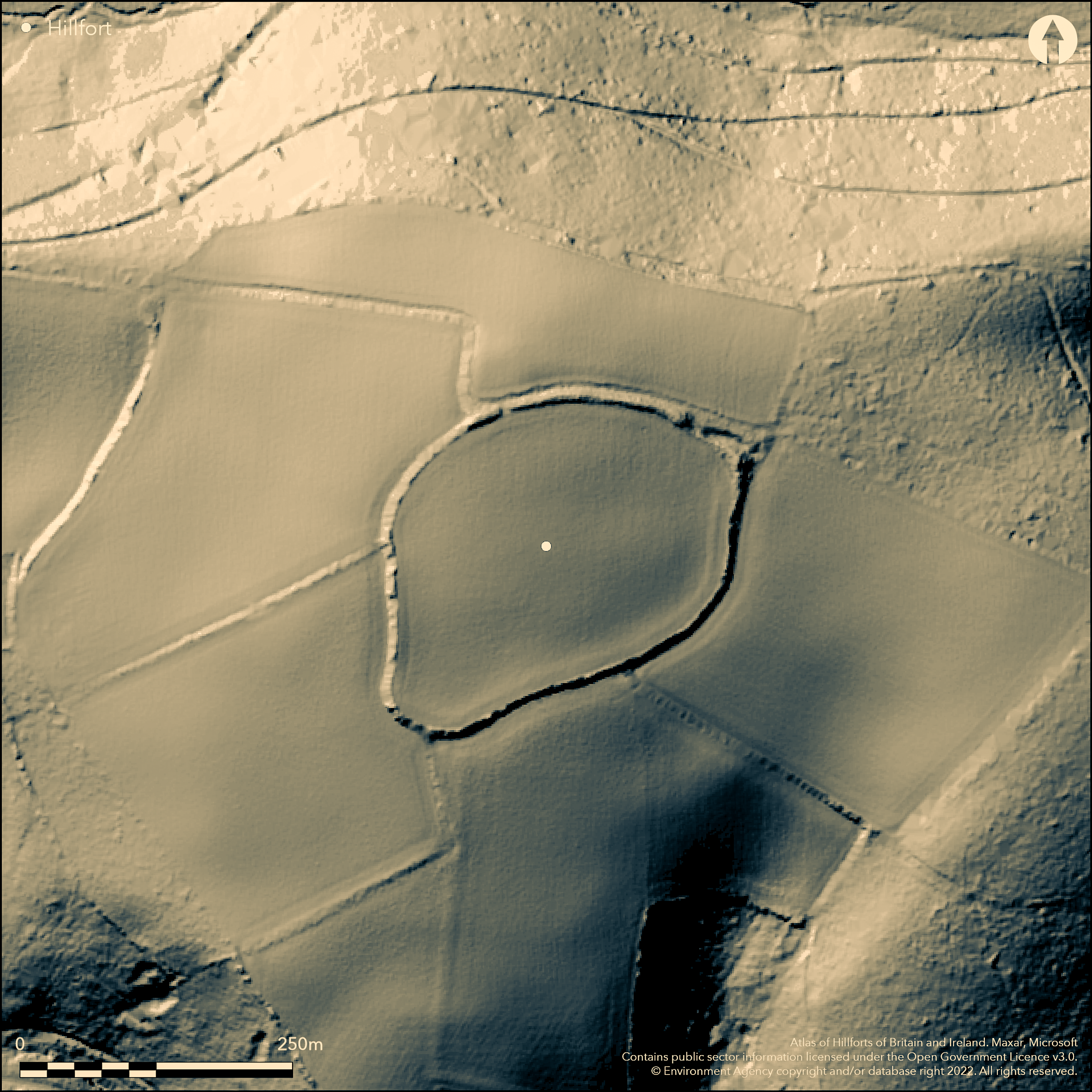
LiDAR 1m DTM Hillshade
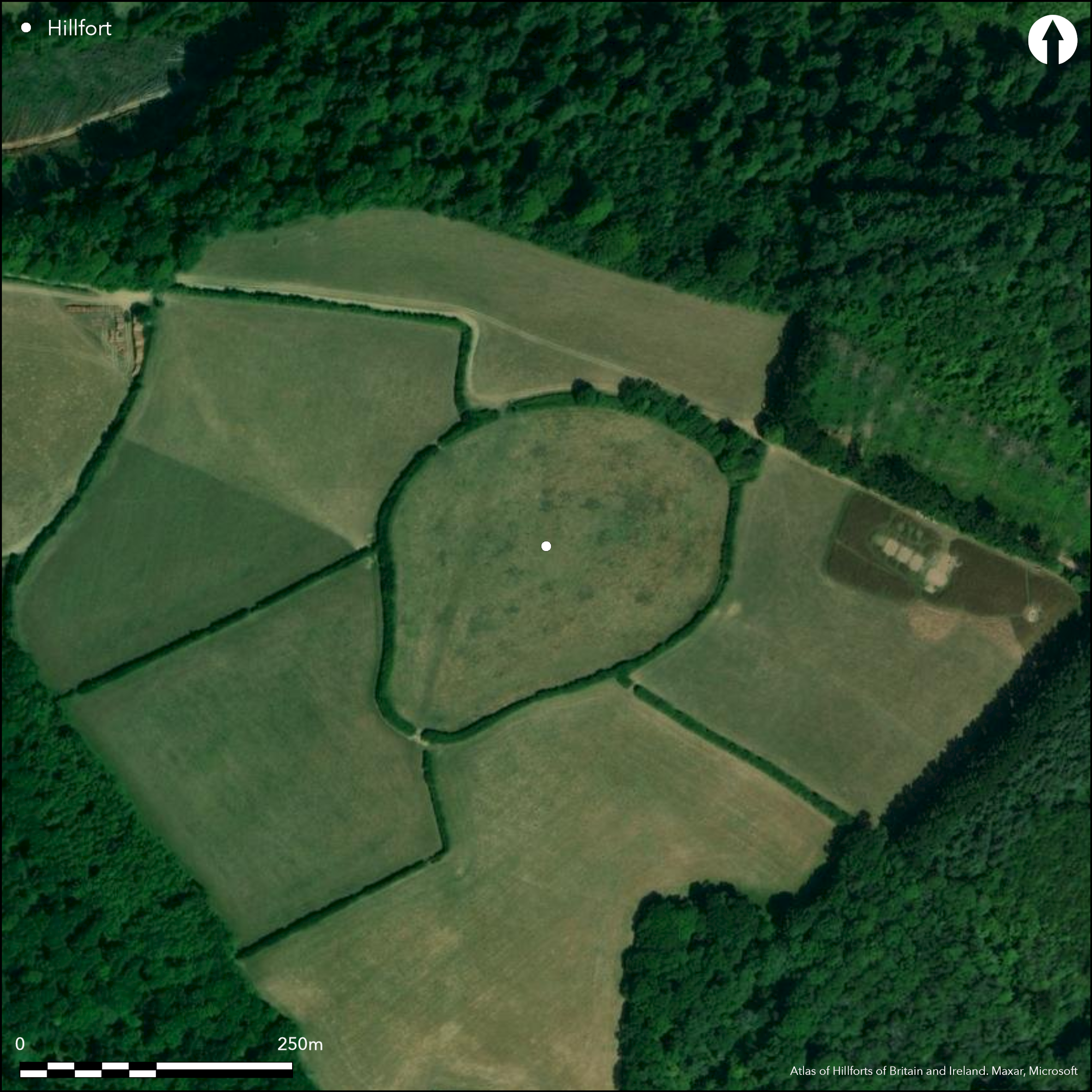
Satellite Imagery
LiDAR 1m DTM Hillshade
Satellite Imagery
Scroll left/right to view further images.
HER: Devon MDV3155 (None)
NMR: SX 65 SW 3 (441335)
SM: 1019782
NGR: SX62385049
X: 262381 Y: 50510 (OSGB36)
Univallate partial contour hillfort located on crest and gentle slope on SSW side of Caste Park Hill. Prominent location with good views down Erme estuary to S. Steep, then very steep, to NW through to SE (towards Yarninknowle Wood on N becoming precipitous) and SW, steep to S and W. Measures 280m long by 220m wide across outer limits, enclosing c. 3.4ha. Straddles the 80m and 90m contours, with highest point of 96m on N side. Odd shape with bulge to rampart in SW corner. Single rampart, outer ditch and counterscarp. Bank best on N, 0.8m internally at W end and 2.3m to E and up to 10m to 12m wide by 2.6m high at NE apex. E, S and W rampart, although fossilised into later hedgebanks, scarps c. 5m wide, falling to outer ditch 0.4m on N and1.6m on S. Ditch mostly filled-in averaging 15m wide and 0.2m deep on E, S and W.the south. Modern track follows and damages ditch to N. Counterscarp bank here c. 8m wide and 0.4m high. Ploughed elsewhere. Four entrances; that to NE original, those to NW and W uncertain and considered modern by Wilkes (2007, 126). Definite modern gap on S. That on NE causeway crosses ditch through staggered banks, that on W 8m in front of other. NW entrance has curving semi-circular hornwork c. 41m wide some 30m from rampart to 0.6m high, with outer ditch on E. W entrance blocked with traces of hornwork across ditch and hollow way down hill. Two outworks in later field boundaries to N and W of site. Improved pasture. Well-preserved despite plough damage. Undated.
Citizen Science: ✓
Reliability of Data: Confirmed
Reliability of Interpretation: Confirmed
X: -438074 Y: 6505075 (EPSG: 3857)
Longitude: -3.935284934185753 Latitude: 50.33832371894865 (EPSG:4326)
Country: England
Current County or Unitary Authority: Devon
Historic County: Devon
Current Parish/Community/Council/Townland: Holbeton
Well-preserved despite some plough damage.
| Extant | ✓ |
| Cropmark | ✗ |
| Likely Destroyed | ✗ |
Improved pasture.
| Woodland | ✗ |
| Commercial Forestry Plantation | ✗ |
| Parkland | ✗ |
| Pasture (Grazing) | ✓ |
| Arable | ✗ |
| Scrub/Bracken | ✗ |
| Bare Outcrop | ✗ |
| Heather/Moorland | ✗ |
| Heath | ✗ |
| Built-up | ✗ |
| Coastal Grassland | ✗ |
| Other | ✗ |
Univallate partial contour hillfort located on crest and gentle slope on SSW side of Caste Park Hill. Prominent location with commanding views down Erme estuary to S. Steep, then very steep, to NW through to SE (towards Yarninknowle Wood on N becoming precipitous) and SW, steep to S and W. Straddles 80m and 90m contours.
| Contour Fort | ✗ |
| Partial Contour Fort | ✓ |
| Promontory Fort | ✗ |
| Hillslope Fort | ✗ |
| Level Terrain Fort | ✗ |
| Marsh Fort | ✗ |
| Multiple Enclosure Fort | ✗ |
| Hilltop | ✓ |
| Coastal Promontory | ✗ |
| Inland Promontory | ✗ |
| Valley Bottom | ✗ |
| Knoll/Hillock/Outcrop | ✗ |
| Ridge | ✗ |
| Cliff/Plateau-edge/Scarp | ✗ |
| Hillslope | ✗ |
| Lowland | ✗ |
| Spur | ✗ |
Dominant Topographic Feature: Hill top
| North | ✗ |
| Northeast | ✗ |
| East | ✗ |
| Southeast | ✗ |
| South | ✗ |
| Southwest | ✗ |
| West | ✗ |
| Northwest | ✗ |
| Level | ✓ |
Altitude: 96.0m
N/A
None.
Reliability: D - None
| Pre 1200BC | ✗ |
| 1200BC - 800BC | ✗ |
| 800BC - 400BC | ✗ |
| 400BC - AD50 | ✗ |
| AD50 - AD400 | ✗ |
| AD400 - AD 800 | ✗ |
| Post AD800 | ✗ |
| Unknown | ✓ |
| Pre Hillfort: | None |
| Post Hillfort: | None |
Recorded by J. Davidson in 1861. MPP fieldwork R. Waterhouse 2000. Geophysics (Wilkes 2007)
| 1st Identified Written Reference (1861): | Recorded by J. Davidson in Notes on the Antiquities of Devon before the Norman Conquest. |
| Other (2000): | MPP fieldwork R. Waterhouse. |
| Geophysical Survey (2007): | None |
Geophysics suggest internal features despite heavy ploughing. Fall in ground suggests SW part may have been divided from rest of fort by bank, since ploughed down.
None
| None | ✓ |
| Spring | ✗ |
| Stream | ✗ |
| Pool | ✗ |
| Flush | ✗ |
| Well | ✗ |
| Other | ✗ |
Fall in ground suggests SW part may have been divided from rest of fort by bank, since ploughed down.
| No Known Features | ✗ |
| Round Stone Structures | ✗ |
| Rectangular Stone Structures | ✗ |
| Curvilinear Platforms | ✗ |
| Other Roundhouse Evidence | ✗ |
| Pits | ✗ |
| Quarry Hollows | ✗ |
| Other | ✓ |
None
| No Known Excavation | ✓ |
| Pits | ✗ |
| Postholes | ✗ |
| Roundhouses | ✗ |
| Rectangular Structures | ✗ |
| Roads/Tracks | ✗ |
| Quarry Hollows | ✗ |
| Other | ✗ |
| Nothing Found | ✗ |
Geophysics suggest internal features despite heavy ploughing.
| No Known Geophysics | ✗ |
| Pits | ✗ |
| Roundhouses | ✗ |
| Rectangular Structures | ✗ |
| Roads/Tracks | ✗ |
| Quarry Hollows | ✗ |
| Other | ✓ |
| Nothing Found | ✗ |
None
| No Known Finds | ✓ |
| Pottery | ✗ |
| Metal | ✗ |
| Metalworking | ✗ |
| Human Bones | ✗ |
| Animal Bones | ✗ |
| Lithics | ✗ |
| Environmental | ✗ |
| Other | ✗ |
None
| APs Not Checked | ✓ |
| None | ✗ |
| Roundhouses | ✗ |
| Rectangular Structures | ✗ |
| Pits | ✗ |
| Postholes | ✗ |
| Roads/Tracks | ✗ |
| Other | ✗ |
Four entrances, original to NE, but those to NW and third, now blocked, on W, problematical, considered modern by Wilkes (2007, 126). Modern gap on S. On NE causeway crosses ditch through staggered banks, that on W 8m in front of other. NW entrance has curving semicircular hornwork c. 41m wide some 30m from rampart to 0.6m high, with outer ditch on E. W entrance blocked with traces of hornwork across ditch and hollow way down hill.
| 4: | Modern gap on S. |
| 2: | Entrance on NW and W considered modern by Wilkes (2007, 126). |
Guard Chambers: ✗
Chevaux de Frise: ✗
| 1. Over-lapping (North east): | Causeway crosses ditch through staggered banks, that on W 8m in front of other. |
| 2. Hornwork (North west): | Curving semi-circular hornwork. |
| 3. Blocked (West): | Traces of hornwork across ditch and hollow way down hill. Uncertain. |
| 3. Hornwork (West): | Traces of hornwork across ditch and hollow way down hill. |
| 3. Hollow Way (West): | Traces of hornwork across ditch and hollow way down hill. |
Single rampart, outer ditch and counterscarp. Bank best on N, 0.8m internally at W end and 2.3m to E and up to 10m to 12m wide by 2.6m high at NE apex. E, S and W rampart, although fossilised into later hedgebanks, scarps c. 5m wide, falling to outer ditch 0.4m on N and1.6m on S. Ditch mostly filled-in averaging 15m wide and 0.2m deep on E, S and W.the south. Modern track follows and damages ditch to N. Counterscarp bank here c. 8m wide and 0.4m high. Ploughed elsewhere.
| Area 1: | 3.4ha. |
| Total: | 3.4ha. |
Total Footprint Area: Noneha.
None
| ✗ | None |
| ✓ | None |
| NE Quadrant: | 1 |
| SE Quadrant: | 1 |
| SW Quadrant: | 1 |
| NW Quadrant: | 1 |
| Total: | 1 |
| Partial Univallate | ✗ |
| Univallate | ✓ |
| Partial Bivallate | ✗ |
| Bivallate | ✗ |
| Partial Multivallate | ✗ |
| Multivallate | ✗ |
| Unknown | ✗ |
| Partial Univallate | ✗ |
| Univallate | ✗ |
| Partial Bivallate | ✗ |
| Bivallate | ✗ |
| Partial Multivallate | ✗ |
| Multivallate | ✗ |
None
| None | ✗ |
| Earthen Bank | ✓ |
| Stone Wall | ✗ |
| Rubble | ✗ |
| Wall-walk | ✗ |
| Evidence of Timber | ✗ |
| Vitrification | ✗ |
| Other Burning | ✗ |
| Palisade | ✗ |
| Counter Scarp Bank | ✓ |
| Berm | ✗ |
| Unfinished | ✗ |
| Other | ✗ |
None
| None | ✗ |
| Earthen Bank | ✗ |
| Stone Wall | ✗ |
| Murus Duplex | ✗ |
| Timber-framed | ✗ |
| Timber-laced | ✗ |
| Vitrification | ✗ |
| Other Burning | ✗ |
| Palisade | ✗ |
| Counter Scarp Bank | ✗ |
| Berm | ✗ |
| Unfinished | ✗ |
| No Known Excavation | ✓ |
| Other | ✗ |
| ✗ | None |
| ✓ | Ditch mostly in-filled. |
Number of Ditches: 1
| ✗ | None |
Davidson, J. 1861. Antiquities of Devon before the Norman Conquest, 50.
Fox, A. 1955. Archaeology and early history, 22nd report, Rep. Trans. Devonshire Assoc, 87, 319-26.
Griffith, F.M. and Wilkes, E.M. 2011. In the footsteps of pioneering women: some recent work on Devon hillforts, In Pearce, S (ed). Recent archaeological work in South-Western Britain, BAR British Series 548.
Wilkes, E.M. 2007. Report on geophysical survey and targeted excavation at Holbury Camp, south Devon, Unpublished client report (SHDC), available at Devon HER.
Atlas of Hillforts:
Wikidata:
This work is licensed under CC BY-SA 4.0

 and should be cited as:
Lock, Gary and Ralston, Ian. 2024. Atlas of Hillforts of Britain and Ireland. Available at: https://hillforts.arch.ox.ac.uk
Document Version 1.1