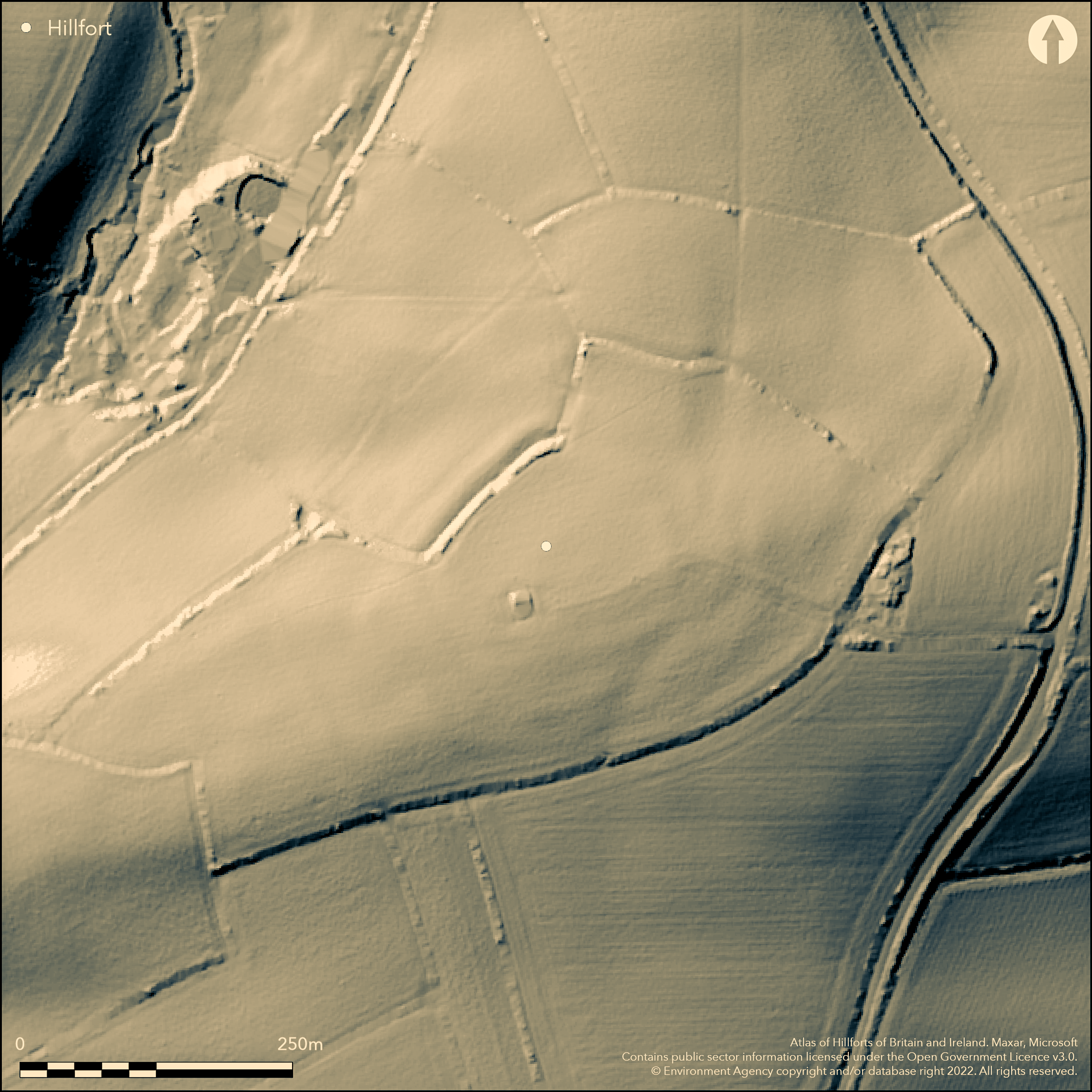
LiDAR 1m DTM Hillshade
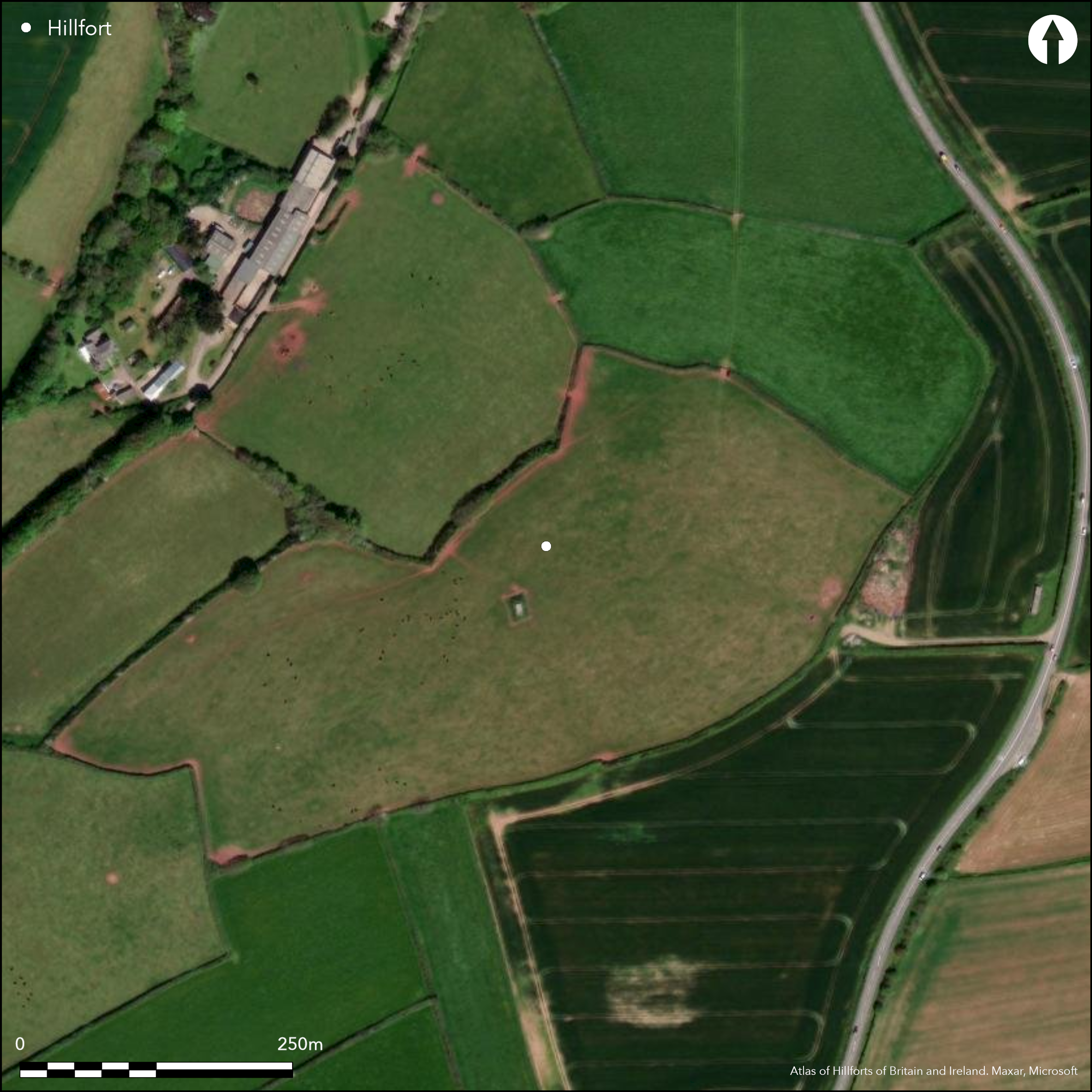
Satellite Imagery
LiDAR 1m DTM Hillshade
Satellite Imagery
Scroll left/right to view further images.
HER: Devon MDV7224 (None)
NMR: SX 74 SW 16 (444528)
SM: 1019313
NGR: SX70804060
X: 270791 Y: 40604 (OSGB36)
Part-destroyed, probably bivallate, multiple enclosure fort sited on prominent hill just below crest, overlooking saddle to the N and valley to W. Kingsbridge Estuary to E, sea to S and W and in good prominent position. To S hilltop obscures distant views. NW hillside steep, NE moderate , S and W nearly level. Oval in shape, inner enclosure of c. 3ha. Formerly three semi-concentric enclosures, the two outer now fossilised in hedgebanks or ploughed, the inner E and S defences deliberately destroyed 1950, NW only surviving, but still the best preserved part of fort. Formerly surrounded by strong bank with wide ditch from E to S, absent on lower level to N. On NW, bank c. 5m wide rising to 3.5m above outer ditch to 0.7m deep but now mostly terrace, with wide glacis counterscarp to 1m high. On NE ramparts eroded by agriculture over a long period. Outer banks in hedge banks mostly to 1.5m internally, but outer and also ploughed circuit to 0.5m high with outer ditch to 0.4m deep. Middle ramparts to S only to 0.4m high at best and with ditch really only visible from air. Generally entrance through banks follows line uphill. Victoria County History (1906) shows inner bank to 4.2m high on SE and overlapping entrance at SW corner, but aerial photographs show continuous bank here despite being most probable location. Original main gate possibly at extreme E apex of outer rampart, inturned slightly, with faint hollow. Entrance at NW corner of site has traces of hornwork below, projecting from outer rampart and curving round to E, followed in part by later hedge bank. Another entrance, 110m to NW, of later date, with hollow way followed by modern footpath climbs up through from N, but no obvious break. Improved pasture. Within inner circuit brick bunker of World War II radar station, now embanked reservoir. Traces of service road along the inside of former S rampart to E. On 1st Ed. OS map (1885-86). Undated.
Citizen Science: ✗
Reliability of Data: Confirmed
Reliability of Interpretation: Confirmed
X: -424548 Y: 6489891 (EPSG: 3857)
Longitude: -3.8137776599104916 Latitude: 50.25118506611623 (EPSG:4326)
Country: England; None
Current County or Unitary Authority: Devon
Historic County: Devon
Current Parish/Community/Council/Townland: South Huish; West Alving
E and S inner defences deliberately destroyed 1950, now NW survives. Outer circuits in hedgebanks or ploughed, but substantial lengths survive.
| Extant | ✓ |
| Cropmark | ✗ |
| Likely Destroyed | ✓ |
Improved pasture. Within inner circuit brick bunker of World War II radar station, now enbanked reservoir.Traces of service road along the inside of former S rampart to E.
| Woodland | ✗ |
| Commercial Forestry Plantation | ✗ |
| Parkland | ✗ |
| Pasture (Grazing) | ✓ |
| Arable | ✗ |
| Scrub/Bracken | ✗ |
| Bare Outcrop | ✗ |
| Heather/Moorland | ✗ |
| Heath | ✗ |
| Built-up | ✗ |
| Coastal Grassland | ✗ |
| Other | ✓ |
Part destroyed, probably bivallate, multiple enclosure fort sited on prominent hill just below crest overlooking saddle to the N and valley to W. Kingsbridge Estuary to E, sea to S and W. To S hilltop obscures distant views. NW hillside steep, NE moderate , S and W nearly level.
| Contour Fort | ✗ |
| Partial Contour Fort | ✗ |
| Promontory Fort | ✗ |
| Hillslope Fort | ✗ |
| Level Terrain Fort | ✗ |
| Marsh Fort | ✗ |
| Multiple Enclosure Fort | ✓ |
| Hilltop | ✗ |
| Coastal Promontory | ✗ |
| Inland Promontory | ✗ |
| Valley Bottom | ✗ |
| Knoll/Hillock/Outcrop | ✗ |
| Ridge | ✗ |
| Cliff/Plateau-edge/Scarp | ✗ |
| Hillslope | ✓ |
| Lowland | ✗ |
| Spur | ✗ |
Dominant Topographic Feature: Hillslope
| North | ✓ |
| Northeast | ✗ |
| East | ✗ |
| Southeast | ✗ |
| South | ✗ |
| Southwest | ✗ |
| West | ✓ |
| Northwest | ✗ |
| Level | ✗ |
Altitude: 91.0m
Boundary Type: Parish/Townland
None.
Reliability: D - None
| Pre 1200BC | ✗ |
| 1200BC - 800BC | ✗ |
| 800BC - 400BC | ✗ |
| 400BC - AD50 | ✗ |
| AD50 - AD400 | ✗ |
| AD400 - AD 800 | ✗ |
| Post AD800 | ✗ |
| Unknown | ✓ |
| Pre Hillfort: | Possibly. Round barrow immediately E of site (Wilkes, 2006). |
| Post Hillfort: | None |
On 1st Ed. OS map (1885-86). Mention by Hawkins, A. 1819. On South Huish Tithe Map and Award 1840. MPP fieldwork M. Waterhouse 1999.
| 1st Identified Written Reference (1819): | A. Hawkins. |
| 1st Identified Map Depiction (1840): | South Huish Tithe Map and Award. |
| Other (1999): | MPP fieldwork M. Waterhouse. |
| Other (None): | OS map. |
Geophysical survey showed interior features and divisiions within the enclosed areas.
None
| None | ✓ |
| Spring | ✗ |
| Stream | ✗ |
| Pool | ✗ |
| Flush | ✗ |
| Well | ✗ |
| Other | ✗ |
None
| No Known Features | ✓ |
| Round Stone Structures | ✗ |
| Rectangular Stone Structures | ✗ |
| Curvilinear Platforms | ✗ |
| Other Roundhouse Evidence | ✗ |
| Pits | ✗ |
| Quarry Hollows | ✗ |
| Other | ✗ |
None
| No Known Excavation | ✓ |
| Pits | ✗ |
| Postholes | ✗ |
| Roundhouses | ✗ |
| Rectangular Structures | ✗ |
| Roads/Tracks | ✗ |
| Quarry Hollows | ✗ |
| Other | ✗ |
| Nothing Found | ✗ |
Geophysical survey showed interior features and divisiions within the enclosed areas.
| No Known Geophysics | ✗ |
| Pits | ✗ |
| Roundhouses | ✗ |
| Rectangular Structures | ✗ |
| Roads/Tracks | ✗ |
| Quarry Hollows | ✗ |
| Other | ✓ |
| Nothing Found | ✗ |
None
| No Known Finds | ✓ |
| Pottery | ✗ |
| Metal | ✗ |
| Metalworking | ✗ |
| Human Bones | ✗ |
| Animal Bones | ✗ |
| Lithics | ✗ |
| Environmental | ✗ |
| Other | ✗ |
None
| APs Not Checked | ✓ |
| None | ✗ |
| Roundhouses | ✗ |
| Rectangular Structures | ✗ |
| Pits | ✗ |
| Postholes | ✗ |
| Roads/Tracks | ✗ |
| Other | ✗ |
Generally entrance through banks follows line uphill. Victoria County History shows overlapping entrance at SW corner, but aerial photographs show continuous bank here despite being most probable location. Original main gate possibly at extreme E apex of outer rampart, inturned slightly, with faint hollow. Entrance at NW corner of site has traces of hornwork below, projecting from outer rampart and curving round to E, followed in part by later hedgebank. Another entrance, 110m to NW of later date, with hollow way followed by modern footpath climbs up through from N, but no obvious break. followed in part by later hedgebank. Improved
| 4: | Another entrance, 110m to NW, of later date, with hollow way followed by modern footpath climbs up through from N, but no obvious break. |
| 2: | None |
Guard Chambers: ✗
Chevaux de Frise: ✗
| 1. Over-lapping (South west): | Possible entrance to inner enclosure. Uncertain. |
| 2. In-turned (East): | Outer rampart main gate. Slightly inturned with faint hollow way. |
| 2. Hollow Way (East): | Faint hollow way. |
| 3. Hornwork (North west): | Traces of hornwork below. |
E and S defences deliberately destroyed 1950, NW only surviving. Formerly surrounded by strong bank with wide ditch from E to S, absent on lower level to N. On NW bank to 3.5m above outer ditch, now terrace. On NE defences eroded by agriculture over a long period.
| Area 1: | 3.0ha. |
| Total: | 3.0ha. |
Total Footprint Area: Noneha.
None
| ✗ | None |
| ✓ | Banks formerly completed circuit; now part destroyed or reduced. |
| NE Quadrant: | 1 |
| SE Quadrant: | 1 |
| SW Quadrant: | 1 |
| NW Quadrant: | 1 |
| Total: | 1 |
| Partial Univallate | ✗ |
| Univallate | ✓ |
| Partial Bivallate | ✗ |
| Bivallate | ✗ |
| Partial Multivallate | ✗ |
| Multivallate | ✗ |
| Unknown | ✗ |
| Partial Univallate | ✗ |
| Univallate | ✗ |
| Partial Bivallate | ✗ |
| Bivallate | ✗ |
| Partial Multivallate | ✗ |
| Multivallate | ✗ |
Wide glacis counterscarp on NW.
| None | ✗ |
| Earthen Bank | ✓ |
| Stone Wall | ✗ |
| Rubble | ✗ |
| Wall-walk | ✗ |
| Evidence of Timber | ✗ |
| Vitrification | ✗ |
| Other Burning | ✗ |
| Palisade | ✗ |
| Counter Scarp Bank | ✓ |
| Berm | ✗ |
| Unfinished | ✗ |
| Other | ✗ |
None
| None | ✗ |
| Earthen Bank | ✗ |
| Stone Wall | ✗ |
| Murus Duplex | ✗ |
| Timber-framed | ✗ |
| Timber-laced | ✗ |
| Vitrification | ✗ |
| Other Burning | ✗ |
| Palisade | ✗ |
| Counter Scarp Bank | ✗ |
| Berm | ✗ |
| Unfinished | ✗ |
| No Known Excavation | ✓ |
| Other | ✗ |
| ✗ | None |
| ✓ | Ditches show in part, but mostly levelled or shallow. |
Number of Ditches: 3
| ✗ | None |
Elliot, E.A.S. 1901. X, Trans. Devonshire Assoc, 33, 475-83.
Fox, A. 1951. Twentieth report on ancient monuments, Trans. Devonshire Assoc., 83, 34-5.
Griffith, F.M. and Wilkes, E.M. 2011. In the footsteps of pioneering women: some recent work on Devon hillforts, In Pearce, S (ed). Recent archaeological work in South-Western Britain, BAR British Series 548.
Hawkins, A. 1819. Devon and Cornwall notes and queries Kingsbridge and Salcombe, 109.
Wall, J.C. 1906. Ancient Earthworks, In W. Page (ed), The Victoria County History of the County of Devon, Vol I, London: James Street, Haymarket, 609-10.
Wilkes, E.M. 2006. Report on geophysical survey and targeted excavation at Burleigh Dolts, south Devon, Unpublished client report (SHDC), available at Devon HER.
Atlas of Hillforts:
Wikidata:
This work is licensed under CC BY-SA 4.0

 and should be cited as:
Lock, Gary and Ralston, Ian. 2024. Atlas of Hillforts of Britain and Ireland. Available at: https://hillforts.arch.ox.ac.uk
Document Version 1.1