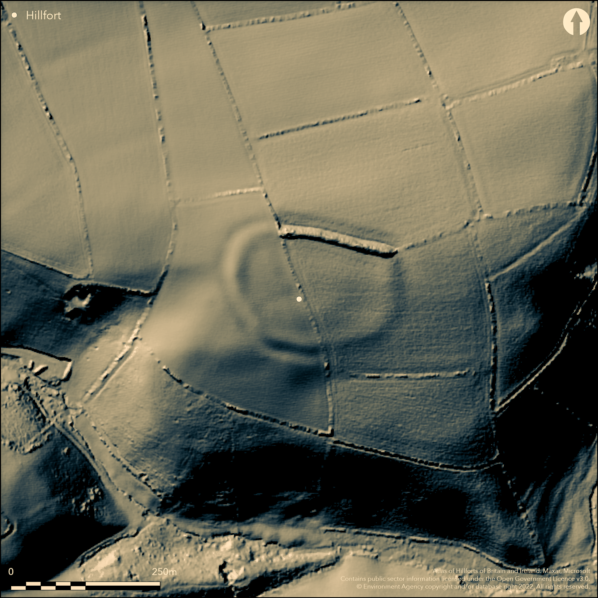
LiDAR 1m DTM Hillshade
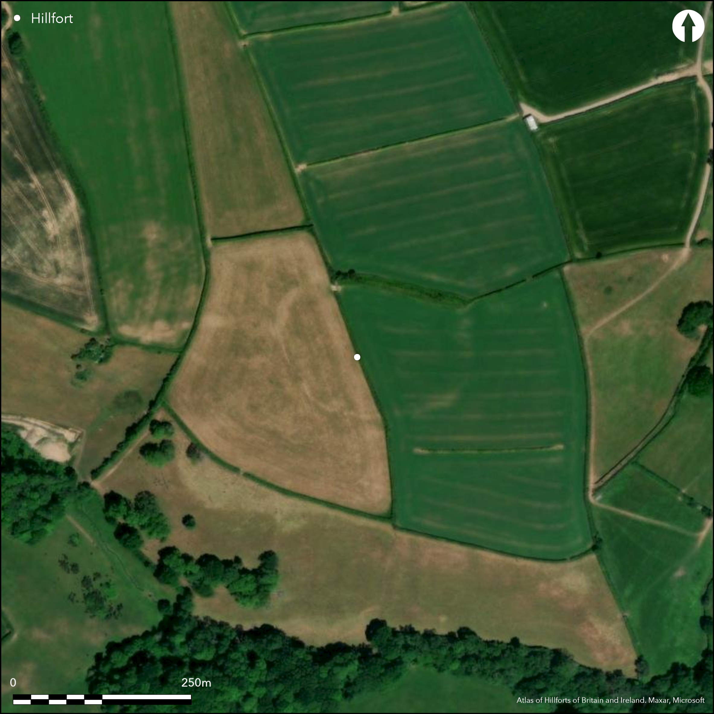
Satellite Imagery
LiDAR 1m DTM Hillshade
Satellite Imagery
Scroll left/right to view further images.
HER: Devon MDV8504 (None)
NMR: SX 85 SW 8 (446086)
SM: 1019783
NGR: SX84255105
X: 284255 Y: 51048 (OSGB36)
Slight univallate partial contour hillfort sited on crest and SSE-facing slope of promontory of Devonian slates above streams to E and S, W of Dartmouth. Moderate, then steep slopes on quadrants from E to W, moderate on N quadrants. Commanding views. D-shaped enclosure, straight side running along crest of hill on N and arc encloses c.1.5 hectares on moderate slope to S. Site split into three fields. Defined by a rampart aligned E-W with narrow and flat top, best on N, rising to 3.5m above ditch bottom, and used as long-standing field boundary, as other sides plough mutilated and reduced, barely visible except on SE quadrant and cropmarks or soilmarks. Outer ditch mostly in-filled and a terrace, but to 0.7m deep in places. Two faint terraces visible on W side of interior. Spring in natural hollow on E. Possible entrance on SE where reduction in rampart height coincides with a faint hornwork projecting from the rampart to E. Reduction in height on the SW possible later entrance. Pasture and arable use. On 1st Ed. OS map (1888). Minimal investigations, undated.
Citizen Science: ✗
Reliability of Data: Confirmed
Reliability of Interpretation: Confirmed
X: -403890 Y: 6506740 (EPSG: 3857)
Longitude: -3.6282071335562165 Latitude: 50.347868847817246 (EPSG:4326)
Country: England
Current County or Unitary Authority: Devon
Historic County: Devon
Current Parish/Community/Council/Townland: Stoke Fleming
About two-thirds of site ploughed-down and now cropmarks or soilmarks. Trig point on site till 1945. Site divided into three fields. On Heritage at Risk Register (2015).
| Extant | ✓ |
| Cropmark | ✓ |
| Likely Destroyed | ✗ |
Pasture and arable.
| Woodland | ✗ |
| Commercial Forestry Plantation | ✗ |
| Parkland | ✗ |
| Pasture (Grazing) | ✓ |
| Arable | ✓ |
| Scrub/Bracken | ✗ |
| Bare Outcrop | ✗ |
| Heather/Moorland | ✗ |
| Heath | ✗ |
| Built-up | ✗ |
| Coastal Grassland | ✗ |
| Other | ✗ |
Slight univallate partial contour hillfort sites on crest and SSE-facing slope of promontory above streams to E and S, W of Dartmouth. Commanding views.Steep, then very steep slopes on quadrants from E to W, moderate on N quadrants.
| Contour Fort | ✗ |
| Partial Contour Fort | ✓ |
| Promontory Fort | ✗ |
| Hillslope Fort | ✗ |
| Level Terrain Fort | ✗ |
| Marsh Fort | ✗ |
| Multiple Enclosure Fort | ✗ |
| Hilltop | ✓ |
| Coastal Promontory | ✗ |
| Inland Promontory | ✓ |
| Valley Bottom | ✗ |
| Knoll/Hillock/Outcrop | ✗ |
| Ridge | ✗ |
| Cliff/Plateau-edge/Scarp | ✗ |
| Hillslope | ✗ |
| Lowland | ✗ |
| Spur | ✗ |
Dominant Topographic Feature: Promontory.
| North | ✗ |
| Northeast | ✗ |
| East | ✗ |
| Southeast | ✓ |
| South | ✗ |
| Southwest | ✗ |
| West | ✗ |
| Northwest | ✗ |
| Level | ✗ |
Altitude: 150.0m
N/A
None.
Reliability: D - None
| Pre 1200BC | ✗ |
| 1200BC - 800BC | ✗ |
| 800BC - 400BC | ✗ |
| 400BC - AD50 | ✗ |
| AD50 - AD400 | ✗ |
| AD400 - AD 800 | ✗ |
| Post AD800 | ✗ |
| Unknown | ✓ |
| Pre Hillfort: | None |
| Post Hillfort: | None |
On 1st Ed. OS map (1888). Early undated survey poorly shown on OS 25 inch map 1904. On Stoke Fleming Tithe Map - Devon Record Office 1841. RCHME Aerial Photograph Primary Recording Project 1995.
| 1st Identified Map Depiction (1841): | Stoke Fleming Tithe Map - Devon Record Office |
| Other (1888): | OS map. |
| Other (1995): | RCHME Aerial Photograph Primary Recording Project. |
| Other (None): | Early undated survey poorly shown on OS 25 inch map 1904. |
None.
Spring in natural hollow on E.
| None | ✗ |
| Spring | ✓ |
| Stream | ✗ |
| Pool | ✗ |
| Flush | ✗ |
| Well | ✗ |
| Other | ✗ |
None
| No Known Features | ✓ |
| Round Stone Structures | ✗ |
| Rectangular Stone Structures | ✗ |
| Curvilinear Platforms | ✗ |
| Other Roundhouse Evidence | ✗ |
| Pits | ✗ |
| Quarry Hollows | ✗ |
| Other | ✗ |
None
| No Known Excavation | ✓ |
| Pits | ✗ |
| Postholes | ✗ |
| Roundhouses | ✗ |
| Rectangular Structures | ✗ |
| Roads/Tracks | ✗ |
| Quarry Hollows | ✗ |
| Other | ✗ |
| Nothing Found | ✗ |
None
| No Known Geophysics | ✓ |
| Pits | ✗ |
| Roundhouses | ✗ |
| Rectangular Structures | ✗ |
| Roads/Tracks | ✗ |
| Quarry Hollows | ✗ |
| Other | ✗ |
| Nothing Found | ✗ |
None
| No Known Finds | ✓ |
| Pottery | ✗ |
| Metal | ✗ |
| Metalworking | ✗ |
| Human Bones | ✗ |
| Animal Bones | ✗ |
| Lithics | ✗ |
| Environmental | ✗ |
| Other | ✗ |
None
| APs Not Checked | ✓ |
| None | ✗ |
| Roundhouses | ✗ |
| Rectangular Structures | ✗ |
| Pits | ✗ |
| Postholes | ✗ |
| Roads/Tracks | ✗ |
| Other | ✗ |
Possible entrance on SE corner where reduction in rampart height coincides with a faint hornwork projecting from the rampart to E. Reduction in height of bank on SW possible later entrance. Gap on NW modern.
| 3: | Reduction in height of bank on SW possible later entrance. Gap on NW modern. |
| 2: | None |
Guard Chambers: ✗
Chevaux de Frise: ✗
| 1. Hornwork (South east): | Faint hornwork. |
Defined by a rampart aligned E-W with narrow and flat top, best on N, rising to 3.5m above ditch bottom, and used as long-standing field boundary, as other sides mutilated and reduced, but visible except on SE quadrant. Outer ditch mostly in-filled and a terrace, but to 0.7m deep in places. Possibly stony bank. Possible ploughed-down counterscarp.
| Area 1: | 1.5ha. |
| Total: | 1.5ha. |
Total Footprint Area: Noneha.
None
| ✗ | None |
| ✗ | Bank on N best; other sides mutilated and reduced, but visible except on SE quadrant |
| NE Quadrant: | 1 |
| SE Quadrant: | 0 |
| SW Quadrant: | 1 |
| NW Quadrant: | 1 |
| Total: | 1 |
| Partial Univallate | ✓ |
| Univallate | ✗ |
| Partial Bivallate | ✗ |
| Bivallate | ✗ |
| Partial Multivallate | ✗ |
| Multivallate | ✗ |
| Unknown | ✗ |
| Partial Univallate | ✗ |
| Univallate | ✗ |
| Partial Bivallate | ✗ |
| Bivallate | ✗ |
| Partial Multivallate | ✗ |
| Multivallate | ✗ |
Possibly stony bank. Possible ploughed-down counterscarp.
| None | ✗ |
| Earthen Bank | ✓ |
| Stone Wall | ✗ |
| Rubble | ✓ |
| Wall-walk | ✗ |
| Evidence of Timber | ✗ |
| Vitrification | ✗ |
| Other Burning | ✗ |
| Palisade | ✗ |
| Counter Scarp Bank | ✓ |
| Berm | ✗ |
| Unfinished | ✗ |
| Other | ✗ |
None
| None | ✗ |
| Earthen Bank | ✗ |
| Stone Wall | ✗ |
| Murus Duplex | ✗ |
| Timber-framed | ✗ |
| Timber-laced | ✗ |
| Vitrification | ✗ |
| Other Burning | ✗ |
| Palisade | ✗ |
| Counter Scarp Bank | ✗ |
| Berm | ✗ |
| Unfinished | ✗ |
| No Known Excavation | ✓ |
| Other | ✗ |
| ✗ | None |
| ✓ | Ditch mostly infilled by plough, but to 0.7m deep in places. |
Number of Ditches: 1
| ✗ | None |
Griffith, F.M. and Wilkes, E.M. 2011. In the footsteps of pioneering women: some recent work on Devon hillforts, In Pearce, S (ed). Recent archaeological work in South-Western Britain, BAR British Series 548.
Atlas of Hillforts:
Wikidata:
This work is licensed under CC BY-SA 4.0

 and should be cited as:
Lock, Gary and Ralston, Ian. 2024. Atlas of Hillforts of Britain and Ireland. Available at: https://hillforts.arch.ox.ac.uk
Document Version 1.1