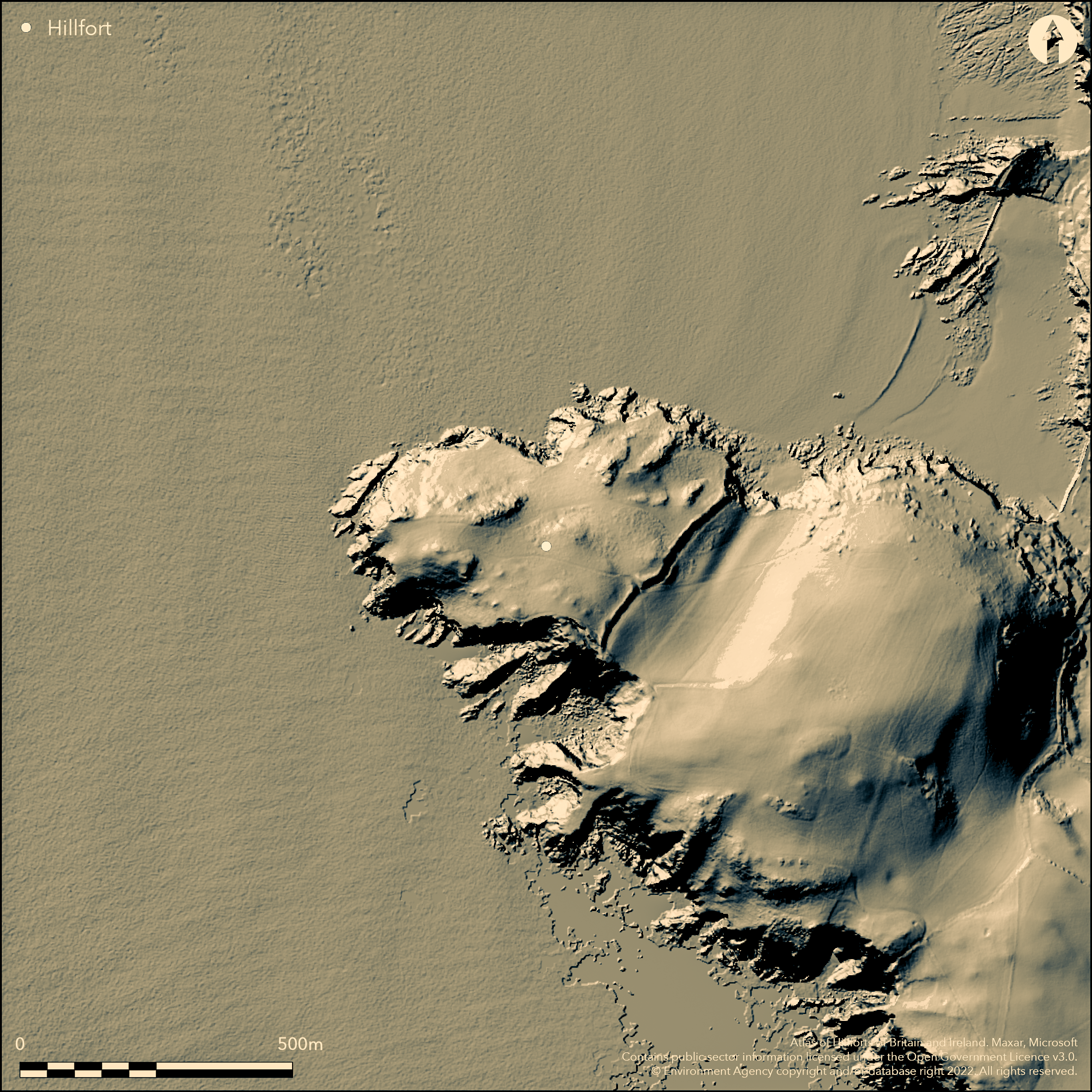
LiDAR 1m DTM Hillshade
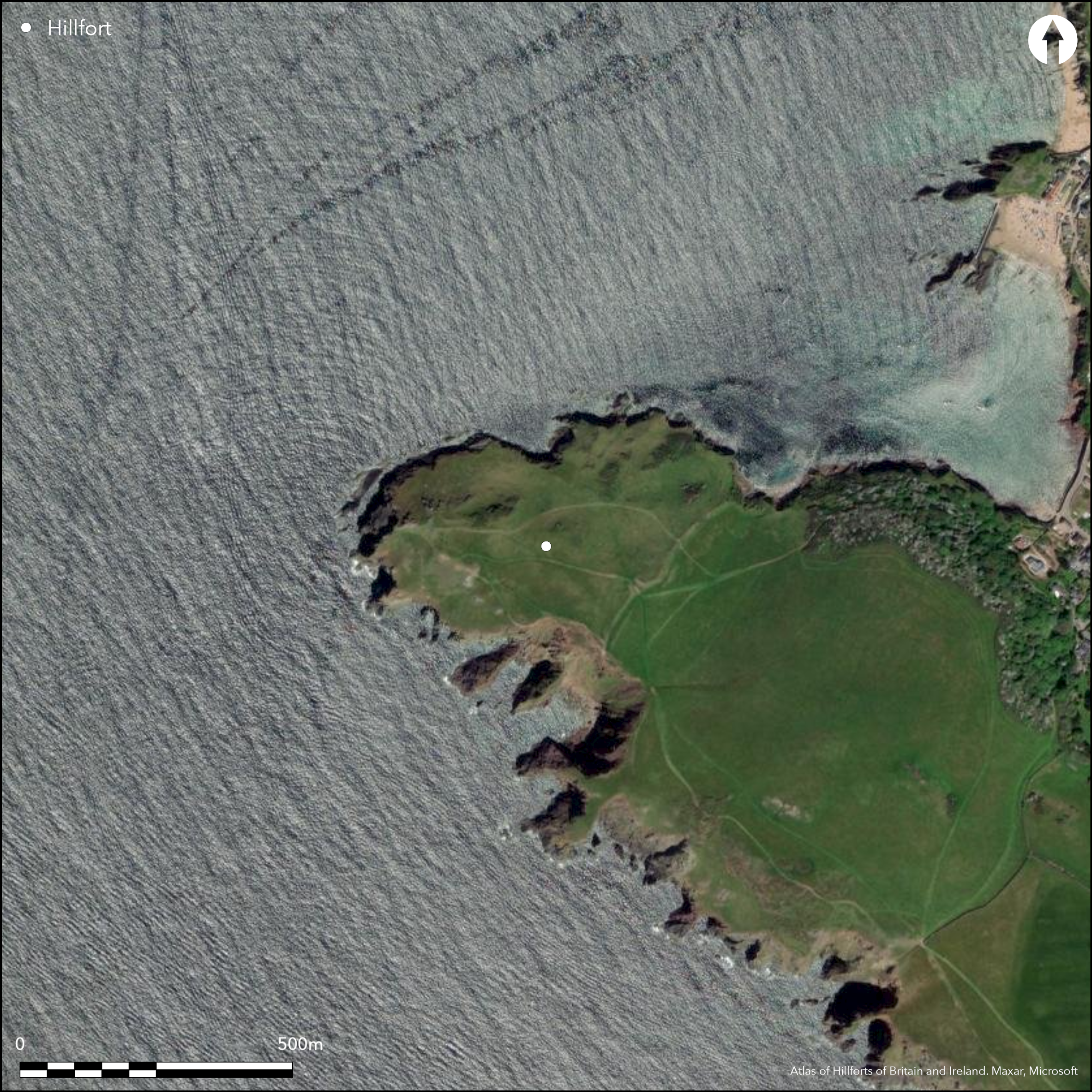
Satellite Imagery
LiDAR 1m DTM Hillshade
Satellite Imagery
Scroll left/right to view further images.
HER: Devon MDV4842 (None)
NMR: SX 63 NE 1 (440918)
SM: 1019323
NGR: SX66883965
X: 266911 Y: 39658 (OSGB36)
Large and prominent coastal promontory fort located on rocky schist headland of NW-facing Bolt Tail and dominating Hope Cove and coast to N to Bigbury Bay and S to Redrot Cove and SE coast. Precipitous sea cliffs to N, S and W, rising between 23m-82m O.D., with broad moderate to strong slope inland to SE. Internal area c. 6ha. Headland, highest on S, cut off NE-SW by prominent rampart c. 274m long with stone-facing wall and revetted earthen bank visible on outer E side. The bank was constructed by cutting away the natural slope to enhanced height of the outer slope. This resulted in a significant height difference between inner and outer scarps. The inner scarp of the rampart is 0.7m high whilst outer is to 5.0m. Two 2.0m long and 0.4m high coursed walls are visible on the rampart and at least half length of outer face partially revetted up to 1.8m. It is possible that this outer walling is result of c. 19th century cultivation of the promontory. Broad outer ditch to 5m wide and inner quarry ditch visible. Outer ditch ploughed and silted and now mostly only 0.4m deep, but midway along its length ditch crosses rounded outcrop of resistant rock and here rock-cut ditch 2.0m wide and 0.7m deep, with E side revetted. Well-marked inturned entrance through rampart to S of mid point and formerly approached by hollow-way now ploughed out. Twin arms composed of mostly smallish stones, and open onto a natural level terrace. Rocky coastal grassland and scrub. Bank well-preserved though ditch ploughed and sited, with visitor footpath erosion especially at N end. Natural coastal erosion and slumping in evidence. On 1st Ed. OS map (1887). Undated.
Citizen Science: ✗
Reliability of Data: Confirmed
Reliability of Interpretation: Confirmed
X: -430566 Y: 6488261 (EPSG: 3857)
Longitude: -3.867839399297868 Latitude: 50.24181975927771 (EPSG:4326)
Country: England
Current County or Unitary Authority: Devon
Historic County: Devon
Current Parish/Community/Council/Townland: South Huish
Bank well-preserved, but visitor footpath erosion especially at N end. Natural coastal erosion and slumping in evidence. South West Coast Path passes through entrance. Outer ditch ploughed and silted.
| Extant | ✓ |
| Cropmark | ✗ |
| Likely Destroyed | ✗ |
Rough rocky coastal grassland and scrub. WWII slit trenches.
| Woodland | ✗ |
| Commercial Forestry Plantation | ✗ |
| Parkland | ✗ |
| Pasture (Grazing) | ✗ |
| Arable | ✗ |
| Scrub/Bracken | ✗ |
| Bare Outcrop | ✗ |
| Heather/Moorland | ✗ |
| Heath | ✗ |
| Built-up | ✗ |
| Coastal Grassland | ✓ |
| Other | ✓ |
Large and prominent coastal promontory fort located on rocky schist headland of NW-facing Bolt Tail and dominating Hope Cove and coast to N to Bigbury Bay and S to Redrot Cove and SE coast. Precipitous sea cliffs to N, S and W, rising between 23m-82m O.D., with broad moderate to strong slope inland to SE.
| Contour Fort | ✗ |
| Partial Contour Fort | ✗ |
| Promontory Fort | ✓ |
| Hillslope Fort | ✗ |
| Level Terrain Fort | ✗ |
| Marsh Fort | ✗ |
| Multiple Enclosure Fort | ✗ |
| Hilltop | ✗ |
| Coastal Promontory | ✓ |
| Inland Promontory | ✗ |
| Valley Bottom | ✗ |
| Knoll/Hillock/Outcrop | ✗ |
| Ridge | ✗ |
| Cliff/Plateau-edge/Scarp | ✗ |
| Hillslope | ✗ |
| Lowland | ✗ |
| Spur | ✗ |
Dominant Topographic Feature: Coastal headland.
| North | ✓ |
| Northeast | ✗ |
| East | ✗ |
| Southeast | ✗ |
| South | ✗ |
| Southwest | ✗ |
| West | ✗ |
| Northwest | ✗ |
| Level | ✗ |
Altitude: 62.0m
N/A
None.
Reliability: D - None
| Pre 1200BC | ✗ |
| 1200BC - 800BC | ✗ |
| 800BC - 400BC | ✗ |
| 400BC - AD50 | ✗ |
| AD50 - AD400 | ✗ |
| AD400 - AD 800 | ✗ |
| Post AD800 | ✗ |
| Unknown | ✓ |
| Pre Hillfort: | None |
| Post Hillfort: | World War II slit trenches. |
On 1st Ed. OS map (1887). Small scale excavation Exeter Archaeology 1995. Watching Brief during rampart conservation works c. 1995. RCHME survey, ref. no. 762157.
| 1st Identified Map Depiction (1887): | None |
| Excavation (1995): | Exeter Archaeology. |
| Earthwork Survey (None): | None |
| Other (None): | Watching Brief. |
Traces of inner quarry ditch.
Possible supply to N.
| None | ✗ |
| Spring | ✓ |
| Stream | ✗ |
| Pool | ✗ |
| Flush | ✗ |
| Well | ✗ |
| Other | ✗ |
Traces of inner quarry ditch.
| No Known Features | ✗ |
| Round Stone Structures | ✗ |
| Rectangular Stone Structures | ✗ |
| Curvilinear Platforms | ✗ |
| Other Roundhouse Evidence | ✗ |
| Pits | ✗ |
| Quarry Hollows | ✓ |
| Other | ✗ |
None
| No Known Excavation | ✓ |
| Pits | ✗ |
| Postholes | ✗ |
| Roundhouses | ✗ |
| Rectangular Structures | ✗ |
| Roads/Tracks | ✗ |
| Quarry Hollows | ✗ |
| Other | ✗ |
| Nothing Found | ✗ |
None
| No Known Geophysics | ✓ |
| Pits | ✗ |
| Roundhouses | ✗ |
| Rectangular Structures | ✗ |
| Roads/Tracks | ✗ |
| Quarry Hollows | ✗ |
| Other | ✗ |
| Nothing Found | ✗ |
None
| No Known Finds | ✓ |
| Pottery | ✗ |
| Metal | ✗ |
| Metalworking | ✗ |
| Human Bones | ✗ |
| Animal Bones | ✗ |
| Lithics | ✗ |
| Environmental | ✗ |
| Other | ✗ |
NO APPARENT FEATURES
| APs Not Checked | ✓ |
| None | ✗ |
| Roundhouses | ✗ |
| Rectangular Structures | ✗ |
| Pits | ✗ |
| Postholes | ✗ |
| Roads/Tracks | ✗ |
| Other | ✗ |
Well-marked inturned entrance through rampart to S of mid point and formerly approached by hollow-way now ploughed-out. Twin arms composed of mostly smallish stones, and open onto a natural level terrace. Possible entrance near cliff edge on NW.
| 2: | None |
| 2: | None |
Guard Chambers: ✗
Chevaux de Frise: ✗
| 1. In-turned (South west): | Original entrance. |
| 1. Hollow Way (South west): | Formerly approached by hollow-way now ploughed-out |
| 2. Simple Gap (North west): | Possible entrance only near cliff edge. |
Prominent rampart c. 274m long with stone-facing wall and revetted earthen bank visible on outer E side. The bank was constructed cutting away the natural slope to enhanced height of the outer slope. This resulted in a significant height difference between inner and outer scarps. The inner scarp of the rampart is 0.7m high whilst outer is to 5.0m. Two 2.0m long and 0.4m high coursed walls are visible on the rampart and at least half length of outer face partially revetted up to 1.8m. It is possible that this outer walling is result of c. 19th century cultivation of the promontory. Broad outer ditch to 5m wide and inner quarry ditch visible. Outer ditch ploughed and silted and now mostly only 0.4m deep, but midway along its length ditch crosses rounded outcrop of resistant rock and here rock-cut ditch 2.0m wide and 0.7m deep, with E side revetted.
| Area 1: | 6.0ha. |
| Total: | 6.0ha. |
Total Footprint Area: Noneha.
None
| ✗ | None |
| ✗ | None |
| NE Quadrant: | 1 |
| SE Quadrant: | 1 |
| SW Quadrant: | None |
| NW Quadrant: | None |
| Total: | 1 |
| Partial Univallate | ✓ |
| Univallate | ✗ |
| Partial Bivallate | ✗ |
| Bivallate | ✗ |
| Partial Multivallate | ✗ |
| Multivallate | ✗ |
| Unknown | ✗ |
| Partial Univallate | ✗ |
| Univallate | ✗ |
| Partial Bivallate | ✗ |
| Bivallate | ✗ |
| Partial Multivallate | ✗ |
| Multivallate | ✗ |
None
| None | ✗ |
| Earthen Bank | ✓ |
| Stone Wall | ✓ |
| Rubble | ✗ |
| Wall-walk | ✗ |
| Evidence of Timber | ✗ |
| Vitrification | ✗ |
| Other Burning | ✗ |
| Palisade | ✗ |
| Counter Scarp Bank | ✗ |
| Berm | ✗ |
| Unfinished | ✗ |
| Other | ✗ |
None
| None | ✓ |
| Earthen Bank | ✗ |
| Stone Wall | ✗ |
| Murus Duplex | ✗ |
| Timber-framed | ✗ |
| Timber-laced | ✗ |
| Vitrification | ✗ |
| Other Burning | ✗ |
| Palisade | ✗ |
| Counter Scarp Bank | ✗ |
| Berm | ✗ |
| Unfinished | ✗ |
| No Known Excavation | ✗ |
| Other | ✗ |
| ✗ | None |
| ✓ | None |
Number of Ditches: 1
| ✗ | None |
Blaylock S. J. 1995. Watching brief and excavation in advance of footpath repair. Bolt Tail Promonotry Fort, Marlborough, Devon. National Trust archaeological report.
Dyer, J. 1973. Southern England : an archaeological guide. The prehistoric and Roman remains, 56.
Griffith, F.M. and Wilkes, E.M. 2006. The land named from the sea? Coastal archaeology and place names of Bigbury Bay, Devon, Archaeol. J., 163, 67-91.
Griffith, F.M. and Wilkes, E.M. 2011. In the footsteps of pioneering women: some recent work on Devon hillforts, In Pearce, S (ed). Recent archaeological work in South-Western Britain, BAR British Series 548.
National Trust 1995. The National Trust annual archaeological review, 4/1995, 10
Quinell, N. 1992. Bolt Tail. Exeter: Devon Archaeol Soc. Field Guide.
Wall, J.C. 1906. Ancient Earthworks, In W. Page (ed), The Victoria County History of the County of Devon, Vol I, London: James Street, Haymarket, 578.
Atlas of Hillforts:
Wikidata:
This work is licensed under CC BY-SA 4.0

 and should be cited as:
Lock, Gary and Ralston, Ian. 2024. Atlas of Hillforts of Britain and Ireland. Available at: https://hillforts.arch.ox.ac.uk
Document Version 1.1