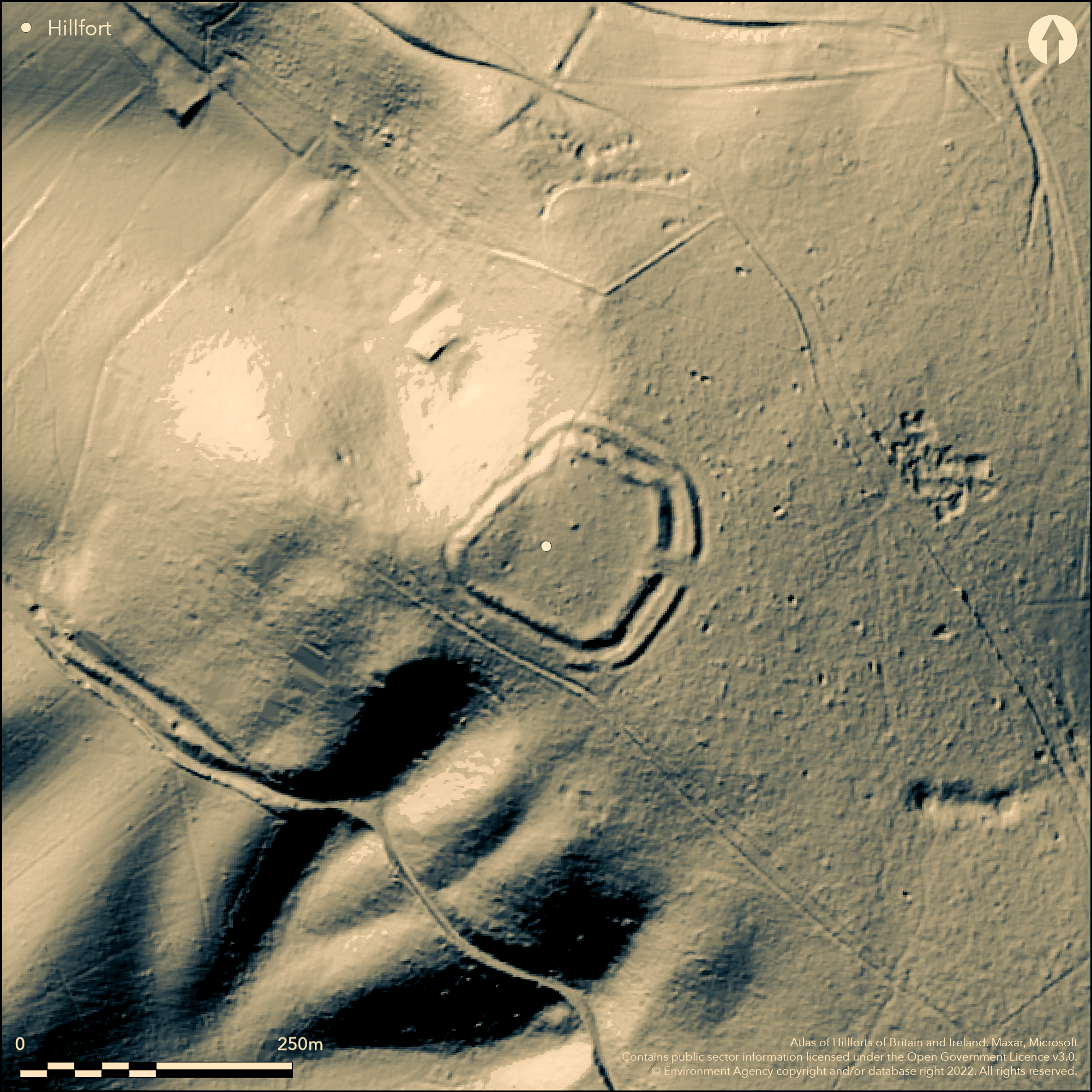
LiDAR 1m DTM Hillshade
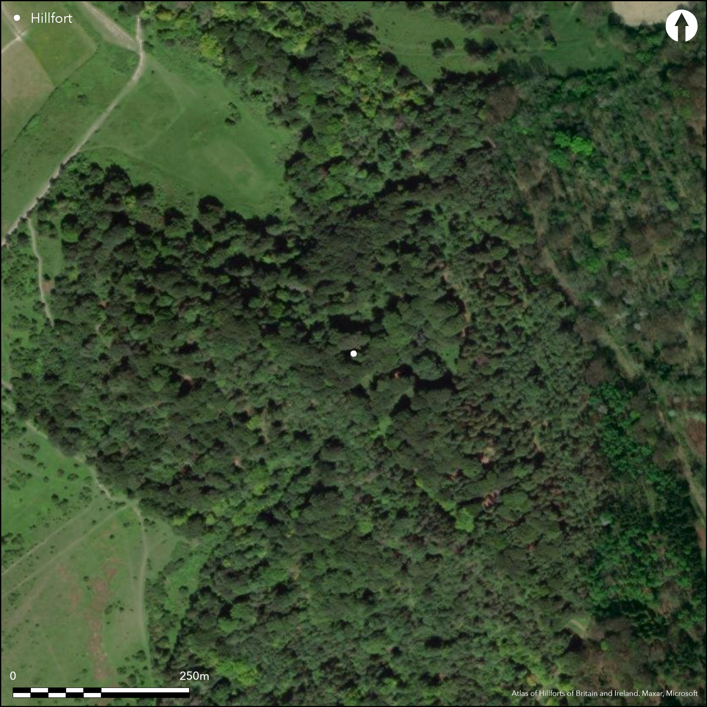
Satellite Imagery
LiDAR 1m DTM Hillshade
Satellite Imagery
Scroll left/right to view further images.
HER: Buckinghamshire 1700000 (150064 (NT))
NMR: SP 80 NW 9 (344187)
SM: 1013937
NGR: SP 8316 0502
X: 483160 Y: 205027 (OSGB36)
Lying within woodland on a prominent spur known as Pulpit Hill, with views across the Vale of Aylesbury to the N, a partially bivallate hillfort of 0.9 ha. D-shaped in plan it measures 100m NE-SW by 90m transversely. The location is naturally defined by steep slopes on all but the SE, supplemented with an artificial scarp in the NW and SW, 10m wide and 1.5-2.5m high, crested with a slight bank. A shallow depression at the foot of the scarp marks the location of the now infilled ditch, although described by Lipscomb (1847) as having deep ditches on the E and S. Double banks and ditches have been constructed in the NE and SE where the ground is less steep. The substantial inner bank measures 6m wide and between 0.5-1.0m high with an 8m wide and 1.5m deep ditch. The outer bank measures 4m wide and 0.8m high with an external ditch approximately 5m wide and 0.7m deep. A simple causewayed entrance 18m wide cuts centrally through the ramparts in the E. No features contemporary with the use of the hillfort are recorded. A possible medieval or post medieval boundary, visible as a narrow bank 1.5m wide and 0.4m high cuts across the ramparts and interior in the W, continuing south eastwards for approximately 200m. The area to the S of the bank shown as ÇWarren Pasture' on the 1840 tithe map, suggests the ramparts in the W were utilized as part of a rabbit warren. A 19th century excavation (Lipscomb 1847) produced sherds from courseware vessels, animal bones, a boar tusk and oyster shells. More recently early Iron Age pottery and daub fragments, a probable Roman knife blade and Neolithic or Bronze Age worked flint have been recovered from the ground surfaces and an Iron Age spearhead from the area of the proposed rabbit warren. Recorded on 1878 1:2,500 OS mapping. Scheduled.
Citizen Science: ✓
Reliability of Data: Confirmed
Reliability of Interpretation: Confirmed
X: -88730 Y: 6752844 (EPSG: 3857)
Longitude: -0.7970789460830244 Latitude: 51.7377435061544 (EPSG:4326)
Country: England; None
Current County or Unitary Authority: Buckinghamshire
Historic County: Buckinghamshire
Current Parish/Community/Council/Townland: Great and Little Kimble cum Marsh; Ellesborough
None
| Extant | ✓ |
| Cropmark | ✗ |
| Likely Destroyed | ✗ |
SSSI.
| Woodland | ✓ |
| Commercial Forestry Plantation | ✗ |
| Parkland | ✗ |
| Pasture (Grazing) | ✗ |
| Arable | ✗ |
| Scrub/Bracken | ✗ |
| Bare Outcrop | ✗ |
| Heather/Moorland | ✗ |
| Heath | ✗ |
| Built-up | ✗ |
| Coastal Grassland | ✗ |
| Other | ✗ |
A contour fort lying on level ground on a prominent spur at 248m OD with views across the Vale of Aylesbury to the N.
| Contour Fort | ✓ |
| Partial Contour Fort | ✗ |
| Promontory Fort | ✗ |
| Hillslope Fort | ✗ |
| Level Terrain Fort | ✗ |
| Marsh Fort | ✗ |
| Multiple Enclosure Fort | ✗ |
| Hilltop | ✓ |
| Coastal Promontory | ✗ |
| Inland Promontory | ✓ |
| Valley Bottom | ✗ |
| Knoll/Hillock/Outcrop | ✗ |
| Ridge | ✗ |
| Cliff/Plateau-edge/Scarp | ✗ |
| Hillslope | ✗ |
| Lowland | ✗ |
| Spur | ✗ |
Dominant Topographic Feature: Prominent spur
| North | ✗ |
| Northeast | ✗ |
| East | ✗ |
| Southeast | ✗ |
| South | ✗ |
| Southwest | ✓ |
| West | ✗ |
| Northwest | ✗ |
| Level | ✗ |
Altitude: 248.0m
The parish boundary between Great and Little Kimble cum Marsh and Ellesborough lies 90m to the W
Boundary Type: Parish/Townland
Early Iron Age pottery and daub fragments, a probable Roman knife blade and Neolithic or Bronze Age worked flint have been recovered from the ground surfaces and an Iron Age spearhead from the area of the proposed rabbit warren.
Reliability: B - Medium
| Pre 1200BC | ✗ |
| 1200BC - 800BC | ✗ |
| 800BC - 400BC | ✓ |
| 400BC - AD50 | ✓ |
| AD50 - AD400 | ✗ |
| AD400 - AD 800 | ✗ |
| Post AD800 | ✗ |
| Unknown | ✗ |
| Pre Hillfort: | None |
| Post Hillfort: | None |
| Artefactual: | None |
| Morphology/Earthwork/Typology: | None |
In Aubrey's Monumenta Britannica (1665-1693). Reported by Lipscomb (1847). Recorded on 1878 1:2,500 OS mapping, Field investigation 1972. Surveyed in 2000 by English Heritage at 1:1000 scale. Scheduled
| 1st Identified Map Depiction (1878): | None |
| Other (1924): | Scheduled |
| Other (1972): | Field investigation |
| Earthwork Survey (2000): | L. Barker |
| 1st Identified Written Reference (None): | None |
No surface features contemporary with the use of the hillfort are recorded. Pottery and metalwork from excavation.
None
| None | ✓ |
| Spring | ✗ |
| Stream | ✗ |
| Pool | ✗ |
| Flush | ✗ |
| Well | ✗ |
| Other | ✗ |
None
| No Known Features | ✓ |
| Round Stone Structures | ✗ |
| Rectangular Stone Structures | ✗ |
| Curvilinear Platforms | ✗ |
| Other Roundhouse Evidence | ✗ |
| Pits | ✗ |
| Quarry Hollows | ✗ |
| Other | ✗ |
No features recorded
| No Known Excavation | ✗ |
| Pits | ✗ |
| Postholes | ✗ |
| Roundhouses | ✗ |
| Rectangular Structures | ✗ |
| Roads/Tracks | ✗ |
| Quarry Hollows | ✗ |
| Other | ✗ |
| Nothing Found | ✓ |
None
| No Known Geophysics | ✓ |
| Pits | ✗ |
| Roundhouses | ✗ |
| Rectangular Structures | ✗ |
| Roads/Tracks | ✗ |
| Quarry Hollows | ✗ |
| Other | ✗ |
| Nothing Found | ✗ |
Oyster shell
| No Known Finds | ✗ |
| Pottery | ✓ |
| Metal | ✓ |
| Metalworking | ✗ |
| Human Bones | ✗ |
| Animal Bones | ✗ |
| Lithics | ✗ |
| Environmental | ✗ |
| Other | ✓ |
Woodland
| APs Not Checked | ✓ |
| None | ✗ |
| Roundhouses | ✗ |
| Rectangular Structures | ✗ |
| Pits | ✗ |
| Postholes | ✗ |
| Roads/Tracks | ✗ |
| Other | ✗ |
A simple causewayed entrance 18m wide, cuts centrally through the ramparts in the E.
| 5: | None |
| 2: | None |
Guard Chambers: ✗
Chevaux de Frise: ✗
| 1. Simple Gap (East): | Inner rampart |
| 1. Simple Gap (East): | Outer rampart |
Partially bivallate hillfort of 0.9 ha. D-shaped in plan it measures 100m NE-SW by 90m transversely. The location is naturally defended by steep slopes on all but the SE, supplemented with an artificial scarp in the NW and SW, 10m wide and 1.5-2.5m high, crested with a slight bank. A shallow depression at the foot of the scarp marks the location of the now infilled ditch, although described by Lipscomb (1847) as having deep ditches on the E and S. Double banks and ditches have been constructed in the NE and SE where the ground is less steep. The substantial inner bank measures 6m wide and between 0.5-1.0m high with an 8m wide and 1.5m deep ditch. The outer bank measures 4m wide and 0.8m high with an external ditch approximately 5m wide and 0.7m deep.
| Area 1: | 0.9ha. |
| Total: | 0.9ha. |
Total Footprint Area: Noneha.
None
| ✗ | None |
| ✓ | None |
| NE Quadrant: | 2 |
| SE Quadrant: | 2 |
| SW Quadrant: | 1 |
| NW Quadrant: | 1 |
| Total: | 2 |
| Partial Univallate | ✓ |
| Univallate | ✗ |
| Partial Bivallate | ✓ |
| Bivallate | ✗ |
| Partial Multivallate | ✗ |
| Multivallate | ✗ |
| Unknown | ✗ |
| Partial Univallate | ✗ |
| Univallate | ✗ |
| Partial Bivallate | ✗ |
| Bivallate | ✗ |
| Partial Multivallate | ✗ |
| Multivallate | ✗ |
Citizen science survey recorded berms in the NE and SE
| None | ✗ |
| Earthen Bank | ✓ |
| Stone Wall | ✗ |
| Rubble | ✗ |
| Wall-walk | ✗ |
| Evidence of Timber | ✗ |
| Vitrification | ✗ |
| Other Burning | ✗ |
| Palisade | ✗ |
| Counter Scarp Bank | ✗ |
| Berm | ✗ |
| Unfinished | ✗ |
| Other | ✗ |
No known excavation of the ramparts
| None | ✗ |
| Earthen Bank | ✗ |
| Stone Wall | ✗ |
| Murus Duplex | ✗ |
| Timber-framed | ✗ |
| Timber-laced | ✗ |
| Vitrification | ✗ |
| Other Burning | ✗ |
| Palisade | ✗ |
| Counter Scarp Bank | ✗ |
| Berm | ✗ |
| Unfinished | ✗ |
| No Known Excavation | ✓ |
| Other | ✗ |
| ✗ | None |
| ✓ | None |
Number of Ditches: 2
| ✗ | None |
Barker, L. 2001. Pulpit Hill, Great and Little Kimble: Iron Age Hillfort. English Heritage Archaeological Investigation Report Series AI/16/2001.
Lipscomb, G 1847. The History and Antiquities of the County of Buckingham. II
Matthews, C. L. and Wainwright, A. 1988. National Trust Archaeological Survey: Pulpit Wood. Unpublished
Atlas of Hillforts:
Wikidata:
This work is licensed under CC BY-SA 4.0

 and should be cited as:
Lock, Gary and Ralston, Ian. 2024. Atlas of Hillforts of Britain and Ireland. Available at: https://hillforts.arch.ox.ac.uk
Document Version 1.1