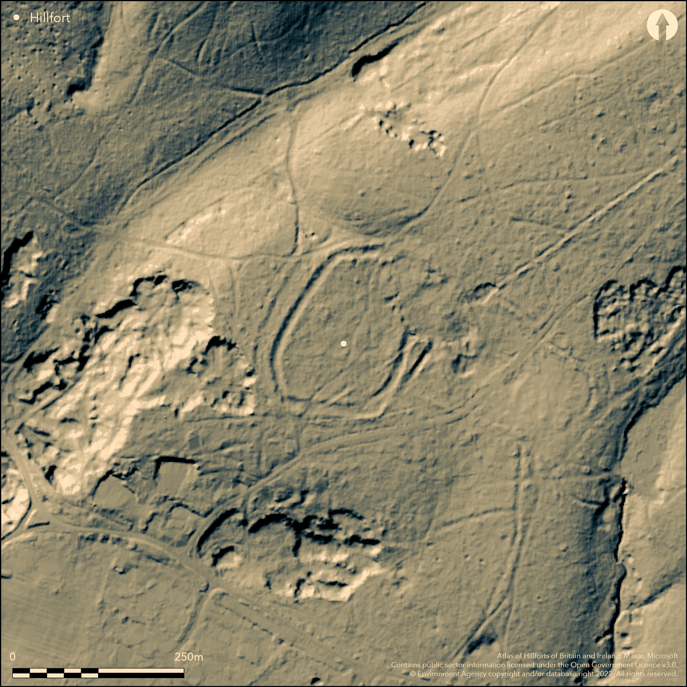
LiDAR 1m DTM Hillshade
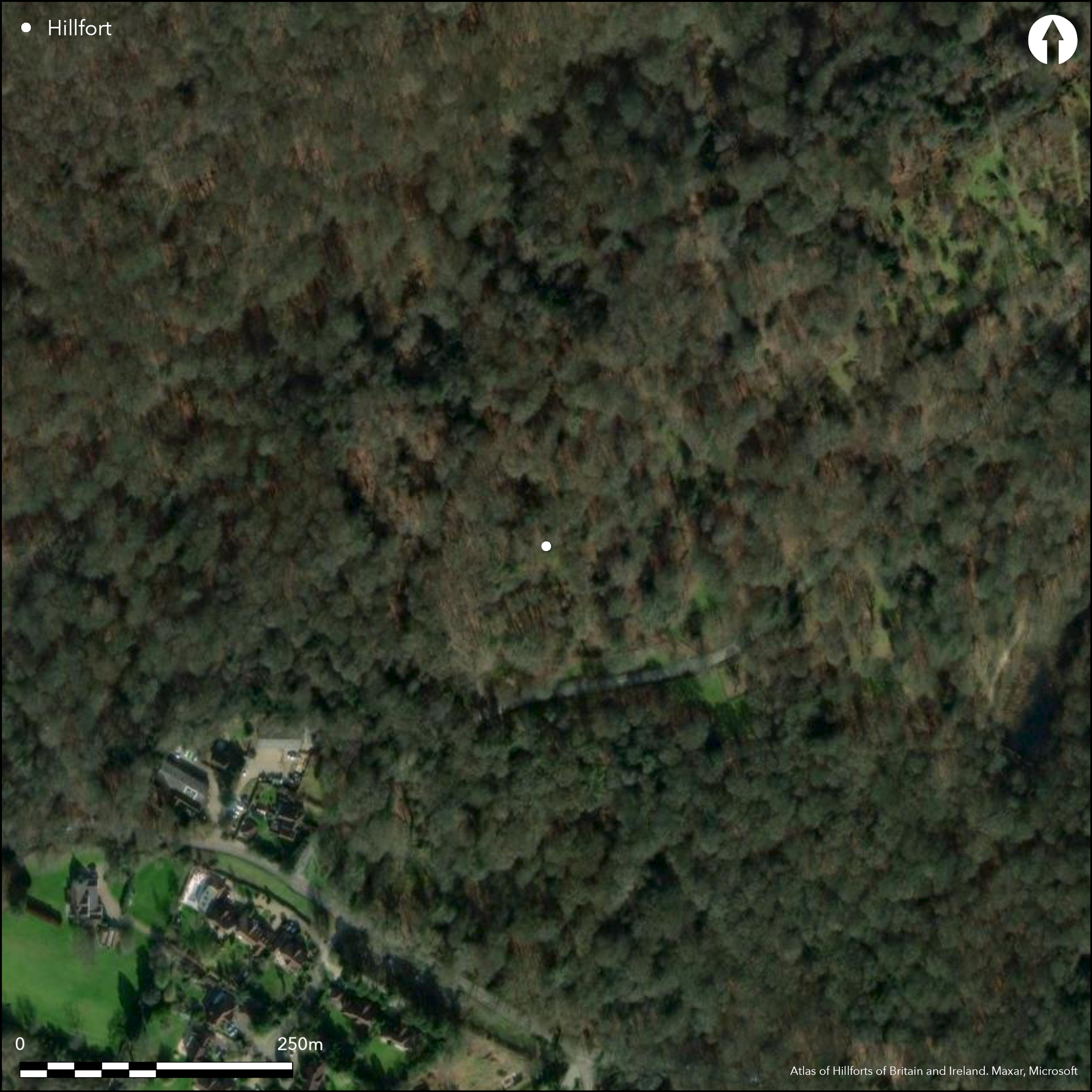
Satellite Imagery
LiDAR 1m DTM Hillshade
Satellite Imagery
Scroll left/right to view further images.
HER: Buckinghamshire 155800000 (None)
NMR: SU 98 SW 16 (251732)
SM: 1013958
NGR: SU 9470 8466
X: 494709 Y: 184668 (OSGB36)
Lying between Victoria Drive and Lord Mayors Drive, at Seven Ways Plain, Burnham Beeches, the remains of a slight univallate hillfort of 1.2ha. Now within woodland, it occupies a broad level spur at 65m OD. An irregular oval in plan, it measures 140m N-S by 100m transversely. It comprises a single ditch 0.7m deep and 10m wide which widens to between 12-15m and becomes more shallow in the S of the hillfort, where it terminates at a narrow causeway in the SW, thought to be an original entrance. A low bank approximately 5m wide and 0.4m high, survives in places along the inner edge of the ditch. Slight traces of a counterscarp are recorded outside the ditch. The interior has been disturbed by quarrying and when Burnham Beeches was used by the Army. No features contemporary with its use as a hillfort are recorded. A track cuts through the enclosure running N to SE. The enclosure has been destroyed by quarrying in the NE and leveled for a car park in the S. A broad outer bank in the E has possibly resulted from quarrying activities. First shown on 1899 1:2,500 OS mapping. The ramparts in the NE are absent by that time. Scheduled. No further investigations, undated.
Citizen Science: ✗
Reliability of Data: Confirmed
Reliability of Interpretation: Confirmed
X: -70730 Y: 6719686 (EPSG: 3857)
Longitude: -0.6353785953921409 Latitude: 51.55290863978464 (EPSG:4326)
Country: England
Current County or Unitary Authority: Buckinghamshire
Historic County: Buckinghamshire
Current Parish/Community/Council/Townland: Burnham
Land under higher level stewardship
| Extant | ✓ |
| Cropmark | ✗ |
| Likely Destroyed | ✓ |
Deciduous ancient woodland
| Woodland | ✓ |
| Commercial Forestry Plantation | ✗ |
| Parkland | ✗ |
| Pasture (Grazing) | ✗ |
| Arable | ✗ |
| Scrub/Bracken | ✗ |
| Bare Outcrop | ✗ |
| Heather/Moorland | ✗ |
| Heath | ✗ |
| Built-up | ✗ |
| Coastal Grassland | ✗ |
| Other | ✗ |
A level terrain fort occupying a broad level spur at 65m OD
| Contour Fort | ✗ |
| Partial Contour Fort | ✗ |
| Promontory Fort | ✗ |
| Hillslope Fort | ✗ |
| Level Terrain Fort | ✓ |
| Marsh Fort | ✗ |
| Multiple Enclosure Fort | ✗ |
| Hilltop | ✓ |
| Coastal Promontory | ✗ |
| Inland Promontory | ✗ |
| Valley Bottom | ✗ |
| Knoll/Hillock/Outcrop | ✗ |
| Ridge | ✗ |
| Cliff/Plateau-edge/Scarp | ✗ |
| Hillslope | ✗ |
| Lowland | ✗ |
| Spur | ✓ |
Dominant Topographic Feature: Level spur
| North | ✗ |
| Northeast | ✗ |
| East | ✗ |
| Southeast | ✗ |
| South | ✗ |
| Southwest | ✗ |
| West | ✗ |
| Northwest | ✓ |
| Level | ✗ |
Altitude: 65.0m
N/A
The site is undated
Reliability: D - None
| Pre 1200BC | ✗ |
| 1200BC - 800BC | ✗ |
| 800BC - 400BC | ✗ |
| 400BC - AD50 | ✗ |
| AD50 - AD400 | ✗ |
| AD400 - AD 800 | ✗ |
| Post AD800 | ✗ |
| Unknown | ✓ |
| Pre Hillfort: | None |
| Post Hillfort: | Quarrying. Construction and removal of War Department huts erected in the 1940s when the whole of the Beeches was fenced off for use by the army. |
Recorded on 1899 1:2,500 OS mapping. Included in RCHM Buckinghamshire 1912. Survey report (Miller and Miller 1977). OS field investigation 1969. Scheduled
| 1st Identified Map Depiction (1899): | None |
| 1st Identified Written Reference (1912): | None |
| Other (1969): | None |
| Earthwork Survey (1977): | None |
| Other (1996): | Scheduled |
No features contemporary with its use as a hillfort are recorded. The interior has been disturbed by quarrying and through its use by the War Department when Burnham Beeches was used by the Army.
Springs are recorded in the area
| None | ✓ |
| Spring | ✗ |
| Stream | ✗ |
| Pool | ✗ |
| Flush | ✗ |
| Well | ✗ |
| Other | ✗ |
None
| No Known Features | ✓ |
| Round Stone Structures | ✗ |
| Rectangular Stone Structures | ✗ |
| Curvilinear Platforms | ✗ |
| Other Roundhouse Evidence | ✗ |
| Pits | ✗ |
| Quarry Hollows | ✗ |
| Other | ✗ |
None
| No Known Excavation | ✓ |
| Pits | ✗ |
| Postholes | ✗ |
| Roundhouses | ✗ |
| Rectangular Structures | ✗ |
| Roads/Tracks | ✗ |
| Quarry Hollows | ✗ |
| Other | ✗ |
| Nothing Found | ✗ |
None
| No Known Geophysics | ✓ |
| Pits | ✗ |
| Roundhouses | ✗ |
| Rectangular Structures | ✗ |
| Roads/Tracks | ✗ |
| Quarry Hollows | ✗ |
| Other | ✗ |
| Nothing Found | ✗ |
None
| No Known Finds | ✓ |
| Pottery | ✗ |
| Metal | ✗ |
| Metalworking | ✗ |
| Human Bones | ✗ |
| Animal Bones | ✗ |
| Lithics | ✗ |
| Environmental | ✗ |
| Other | ✗ |
Wooded
| APs Not Checked | ✓ |
| None | ✗ |
| Roundhouses | ✗ |
| Rectangular Structures | ✗ |
| Pits | ✗ |
| Postholes | ✗ |
| Roads/Tracks | ✗ |
| Other | ✗ |
A narrow causeway in the SW is thought to be an original entrance
| 3: | None |
| 2: | None |
Guard Chambers: ✗
Chevaux de Frise: ✗
| 1. Simple Gap (South west): | Causeway across ditch |
Irregular oval measuring 140m N-S by 100m transversely. It comprises a single ditch 0.7m deep and 10m wide which widens to between 12-15m and becomes more shallow in the S of the hillfort, where it terminates at a narrow causeway in the SW, thought to be an original entrance. A low bank approximately 5m wide and 0.4m high, survives in places along the inner edge of the ditch. Slight traces of a counterscarp are recorded outside the ditch.
| Area 1: | 1.2ha. |
| Total: | 1.2ha. |
Total Footprint Area: Noneha.
None
| ✗ | None |
| ✓ | None |
| NE Quadrant: | 1 |
| SE Quadrant: | 1 |
| SW Quadrant: | 1 |
| NW Quadrant: | 1 |
| Total: | 1 |
| Partial Univallate | ✗ |
| Univallate | ✓ |
| Partial Bivallate | ✗ |
| Bivallate | ✗ |
| Partial Multivallate | ✗ |
| Multivallate | ✗ |
| Unknown | ✗ |
| Partial Univallate | ✗ |
| Univallate | ✗ |
| Partial Bivallate | ✗ |
| Bivallate | ✗ |
| Partial Multivallate | ✗ |
| Multivallate | ✗ |
None
| None | ✗ |
| Earthen Bank | ✓ |
| Stone Wall | ✗ |
| Rubble | ✗ |
| Wall-walk | ✗ |
| Evidence of Timber | ✗ |
| Vitrification | ✗ |
| Other Burning | ✗ |
| Palisade | ✗ |
| Counter Scarp Bank | ✓ |
| Berm | ✗ |
| Unfinished | ✗ |
| Other | ✗ |
None
| None | ✗ |
| Earthen Bank | ✗ |
| Stone Wall | ✗ |
| Murus Duplex | ✗ |
| Timber-framed | ✗ |
| Timber-laced | ✗ |
| Vitrification | ✗ |
| Other Burning | ✗ |
| Palisade | ✗ |
| Counter Scarp Bank | ✗ |
| Berm | ✗ |
| Unfinished | ✗ |
| No Known Excavation | ✓ |
| Other | ✗ |
| ✗ | None |
| ✓ | None |
Number of Ditches: 1
| ✗ | None |
Miller, D. and Miller, D. 1977. The Camp, Seven Ways Plain, Burham. Survey Report. Unpublished
RCHME, 1912. Inventory of the Historic Monuments in Buckinghamshire
Atlas of Hillforts:
Wikidata:
This work is licensed under CC BY-SA 4.0

 and should be cited as:
Lock, Gary and Ralston, Ian. 2024. Atlas of Hillforts of Britain and Ireland. Available at: https://hillforts.arch.ox.ac.uk
Document Version 1.1