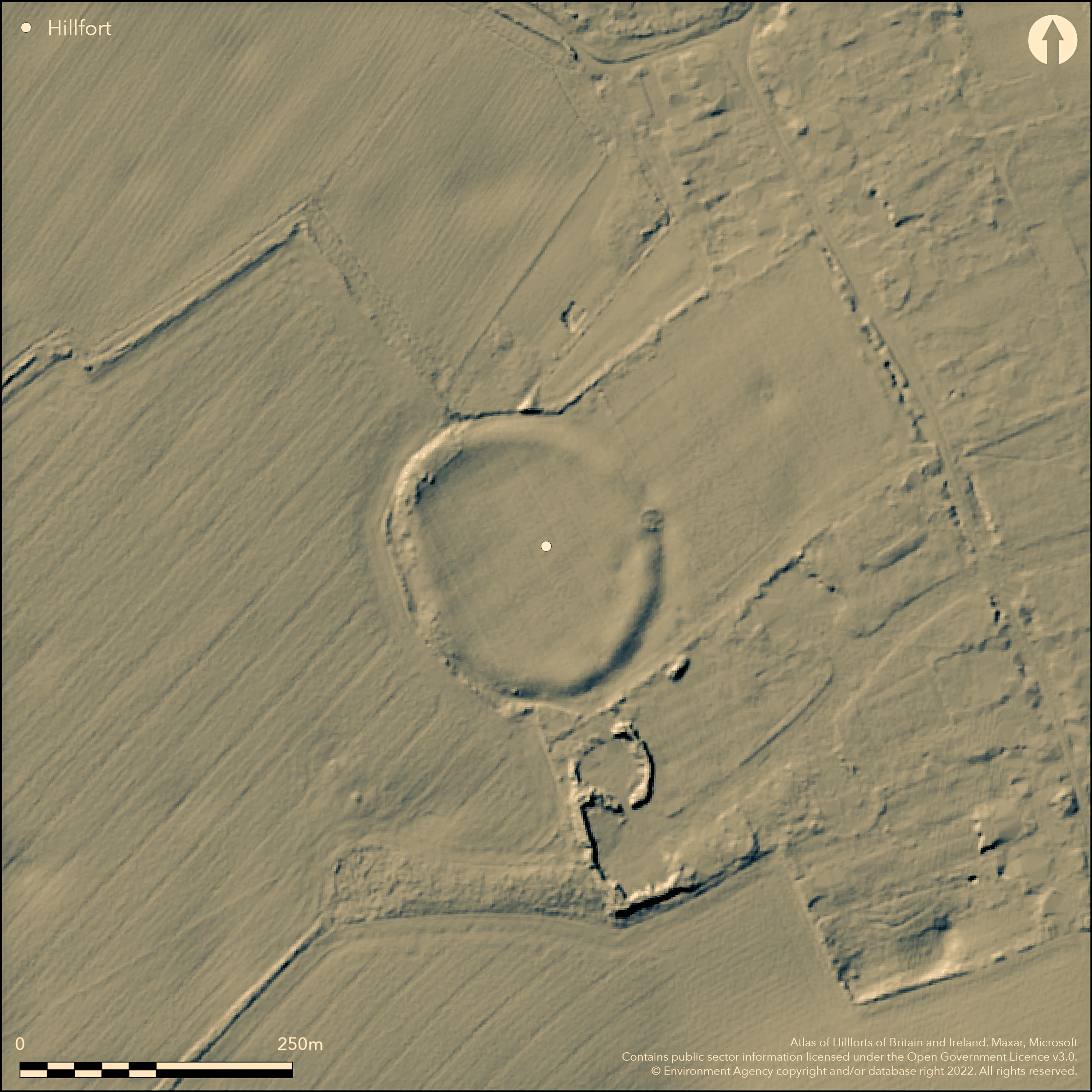
LiDAR 1m DTM Hillshade
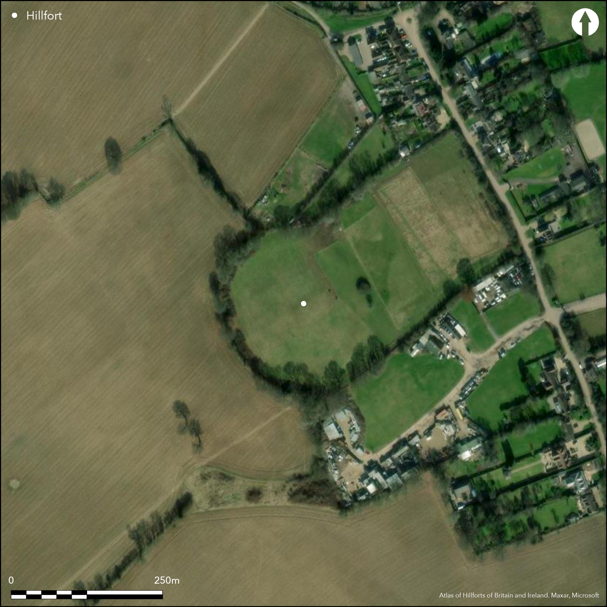
Satellite Imagery
LiDAR 1m DTM Hillshade
Satellite Imagery
Scroll left/right to view further images.
HER: Buckinghamshire 0002200000; 0002200200 (None); N/A None
NMR: SP 90 SE 16 (346313)
SM: 1015485
NGR: SP 9968 0397
X: 499688 Y: 203977 (OSGB36)
A slight, univallate hillfort located within the village of Whelpley Hill. It lies at 163m OD, occupying a broad, plateau on the Chiltern Hills between the Bulbourne and Chess Valleys. Sub-circlar in plan it measures 120m NW-SE by 100m transversely, enclosing approximately 1.3ha. In the 19th century the bank was lined with trees and known locally as Banks Wood, the interior as Round Field. The removal of the trees and subsequent ploughing post 1860 and continuing until after WWII has reduced the earthworks and they are best preserved in the E where the bank measures 0.7m high and between 16-24m wide. A hedge-line runs around the western side. A slight berm has been recorded around the inner face of the bank. The external ditch is 0.9m deep and 8-12m wide but is now infilled and survives as a slight depression. Five entrances, most probably created during the time the interior was used as pasture, were recorded at the time the trees were removed. A single 9m wide entrance in the SE is considered original although there is no causeway across the ditch. A small excavation near this entrance c. 1970 showed the ditch to be over 2m deep. Butchered animal bones were recovered from the ditch fills (EH scheduling information). A geophysical survey (Gover 2000) revealed possible ring ditches. Excavation by Chess Valley Archaeological and Historical Society (CVAHS) in 2013-15, recorded evidence for ditches and postholes (no further details). Owing to the size and circular nature of the site it has been suggested that it could be a late Bronze Age ringwork (Gover 2000). Scheduled as a slight univallate hillfort.
Citizen Science: ✓
Reliability of Data: Confirmed
Reliability of Interpretation: Confirmed
X: -62127 Y: 6750664 (EPSG: 3857)
Longitude: -0.5580929642893646 Latitude: 51.725612494797915 (EPSG:4326)
Country: England; None
Current County or Unitary Authority: Buckinghamshire
Historic County: Buckinghamshire
Current Parish/Community/Council/Townland: Ashley Green; Bovingdon
None
| Extant | ✓ |
| Cropmark | ✗ |
| Likely Destroyed | ✗ |
Trees and hedgerows on the banks
| Woodland | ✓ |
| Commercial Forestry Plantation | ✗ |
| Parkland | ✗ |
| Pasture (Grazing) | ✓ |
| Arable | ✗ |
| Scrub/Bracken | ✗ |
| Bare Outcrop | ✗ |
| Heather/Moorland | ✗ |
| Heath | ✗ |
| Built-up | ✗ |
| Coastal Grassland | ✗ |
| Other | ✗ |
A level terrain fort occupying a broad plateau at 163m OD
| Contour Fort | ✗ |
| Partial Contour Fort | ✗ |
| Promontory Fort | ✗ |
| Hillslope Fort | ✗ |
| Level Terrain Fort | ✓ |
| Marsh Fort | ✗ |
| Multiple Enclosure Fort | ✗ |
| Hilltop | ✓ |
| Coastal Promontory | ✗ |
| Inland Promontory | ✗ |
| Valley Bottom | ✗ |
| Knoll/Hillock/Outcrop | ✗ |
| Ridge | ✗ |
| Cliff/Plateau-edge/Scarp | ✗ |
| Hillslope | ✗ |
| Lowland | ✗ |
| Spur | ✗ |
Dominant Topographic Feature: Broad plateau
| North | ✗ |
| Northeast | ✗ |
| East | ✗ |
| Southeast | ✗ |
| South | ✗ |
| Southwest | ✗ |
| West | ✗ |
| Northwest | ✗ |
| Level | ✓ |
Altitude: 163.0m
The county boundary between Buckinghamshire and Hertfordshire lies approximately 300m to the E and S
Boundary Type: County
The site is undated
Reliability: D - None
| Pre 1200BC | ✗ |
| 1200BC - 800BC | ✗ |
| 800BC - 400BC | ✗ |
| 400BC - AD50 | ✗ |
| AD50 - AD400 | ✗ |
| AD400 - AD 800 | ✗ |
| Post AD800 | ✗ |
| Unknown | ✓ |
| Pre Hillfort: | None |
| Post Hillfort: | None |
Described as a 'circular earth work apparently of the Roman era' by Burgess (1848). Recorded on 1885-1900 OS mapping. Small excavation c. 1970. Field investigation in 1974. Geophysical survey (Gover 2000). 2013-15 (possibly ongoing) excavations by the Chess Valley Archaeological and Historical Society. Scheduled
| 1st Identified Written Reference (1848): | None |
| Other (1946): | Scheduled |
| Excavation (1970): | None |
| Other (1974): | Field investigation |
| Geophysical Survey (2000): | None |
| 1st Identified Map Depiction (None): | None |
| Excavation (None): | None |
Circular features recorded during resistance survey. Investigations by CVAHS have shown that at least one of these is a probable pond
Pond
| None | ✗ |
| Spring | ✗ |
| Stream | ✗ |
| Pool | ✗ |
| Flush | ✗ |
| Well | ✗ |
| Other | ✓ |
None
| No Known Features | ✗ |
| Round Stone Structures | ✗ |
| Rectangular Stone Structures | ✗ |
| Curvilinear Platforms | ✓ |
| Other Roundhouse Evidence | ✗ |
| Pits | ✗ |
| Quarry Hollows | ✗ |
| Other | ✗ |
Ditches, pond
| No Known Excavation | ✗ |
| Pits | ✗ |
| Postholes | ✓ |
| Roundhouses | ✗ |
| Rectangular Structures | ✗ |
| Roads/Tracks | ✗ |
| Quarry Hollows | ✗ |
| Other | ✓ |
| Nothing Found | ✗ |
Ring ditches
| No Known Geophysics | ✗ |
| Pits | ✗ |
| Roundhouses | ✗ |
| Rectangular Structures | ✗ |
| Roads/Tracks | ✗ |
| Quarry Hollows | ✗ |
| Other | ✓ |
| Nothing Found | ✗ |
None
| No Known Finds | ✗ |
| Pottery | ✗ |
| Metal | ✗ |
| Metalworking | ✗ |
| Human Bones | ✗ |
| Animal Bones | ✓ |
| Lithics | ✗ |
| Environmental | ✗ |
| Other | ✗ |
None
| APs Not Checked | ✓ |
| None | ✗ |
| Roundhouses | ✗ |
| Rectangular Structures | ✗ |
| Pits | ✗ |
| Postholes | ✗ |
| Roads/Tracks | ✗ |
| Other | ✗ |
Five entrances, most probably created during the time the interior was used as pasture, were recorded at the time the trees were removed. A single 9m wide entrance in the SE is considered original although there is no causeway across the ditch.
| 5: | None |
| 2: | None |
Guard Chambers: ✗
Chevaux de Frise: ✗
| 1. Simple Gap (South east): | None |
Sub-circlar in plan measuring 120m NW-SE by 100m transversely, enclosing approximately 1.3ha. The earthworks are now reduced and are best preserved in the E where the bank measures 0.7m high and between 16-24m wide. A hedge-line runs around the western side. A slight berm has been recorded around the inner face of the bank. The external ditch is 0.9m deep and 8-12m wide but is now infilled and survives as a slight depression.
| Area 1: | 1.3ha. |
| Total: | 1.3ha. |
Total Footprint Area: Noneha.
None
| ✗ | None |
| ✓ | None |
| NE Quadrant: | 1 |
| SE Quadrant: | 1 |
| SW Quadrant: | 1 |
| NW Quadrant: | 1 |
| Total: | 1 |
| Partial Univallate | ✗ |
| Univallate | ✓ |
| Partial Bivallate | ✗ |
| Bivallate | ✗ |
| Partial Multivallate | ✗ |
| Multivallate | ✗ |
| Unknown | ✗ |
| Partial Univallate | ✗ |
| Univallate | ✗ |
| Partial Bivallate | ✗ |
| Bivallate | ✗ |
| Partial Multivallate | ✗ |
| Multivallate | ✗ |
None
| None | ✗ |
| Earthen Bank | ✓ |
| Stone Wall | ✗ |
| Rubble | ✗ |
| Wall-walk | ✗ |
| Evidence of Timber | ✗ |
| Vitrification | ✗ |
| Other Burning | ✗ |
| Palisade | ✗ |
| Counter Scarp Bank | ✗ |
| Berm | ✓ |
| Unfinished | ✗ |
| Other | ✗ |
No excavation of the ramparts
| None | ✗ |
| Earthen Bank | ✗ |
| Stone Wall | ✗ |
| Murus Duplex | ✗ |
| Timber-framed | ✗ |
| Timber-laced | ✗ |
| Vitrification | ✗ |
| Other Burning | ✗ |
| Palisade | ✗ |
| Counter Scarp Bank | ✗ |
| Berm | ✗ |
| Unfinished | ✗ |
| No Known Excavation | ✓ |
| Other | ✗ |
| ✗ | None |
| ✓ | None |
Number of Ditches: 1
| ✗ | None |
Bryant, S. 1994. The Archaeology of the Chilterns, in Settlement of the Chilterns from 1200 to 100 BC.
Burgess, B. 1848. Parochial Notes, Records of Bucks. Vol 1, 30
Gover. J. 2000. A Geophysical Investigation of Whelpley Hill Enclosure. Unpublished.
Sheahan, J. 1862. History and Topography of Buckinghamshire. 840
Atlas of Hillforts:
Wikidata:
This work is licensed under CC BY-SA 4.0

 and should be cited as:
Lock, Gary and Ralston, Ian. 2024. Atlas of Hillforts of Britain and Ireland. Available at: https://hillforts.arch.ox.ac.uk
Document Version 1.1