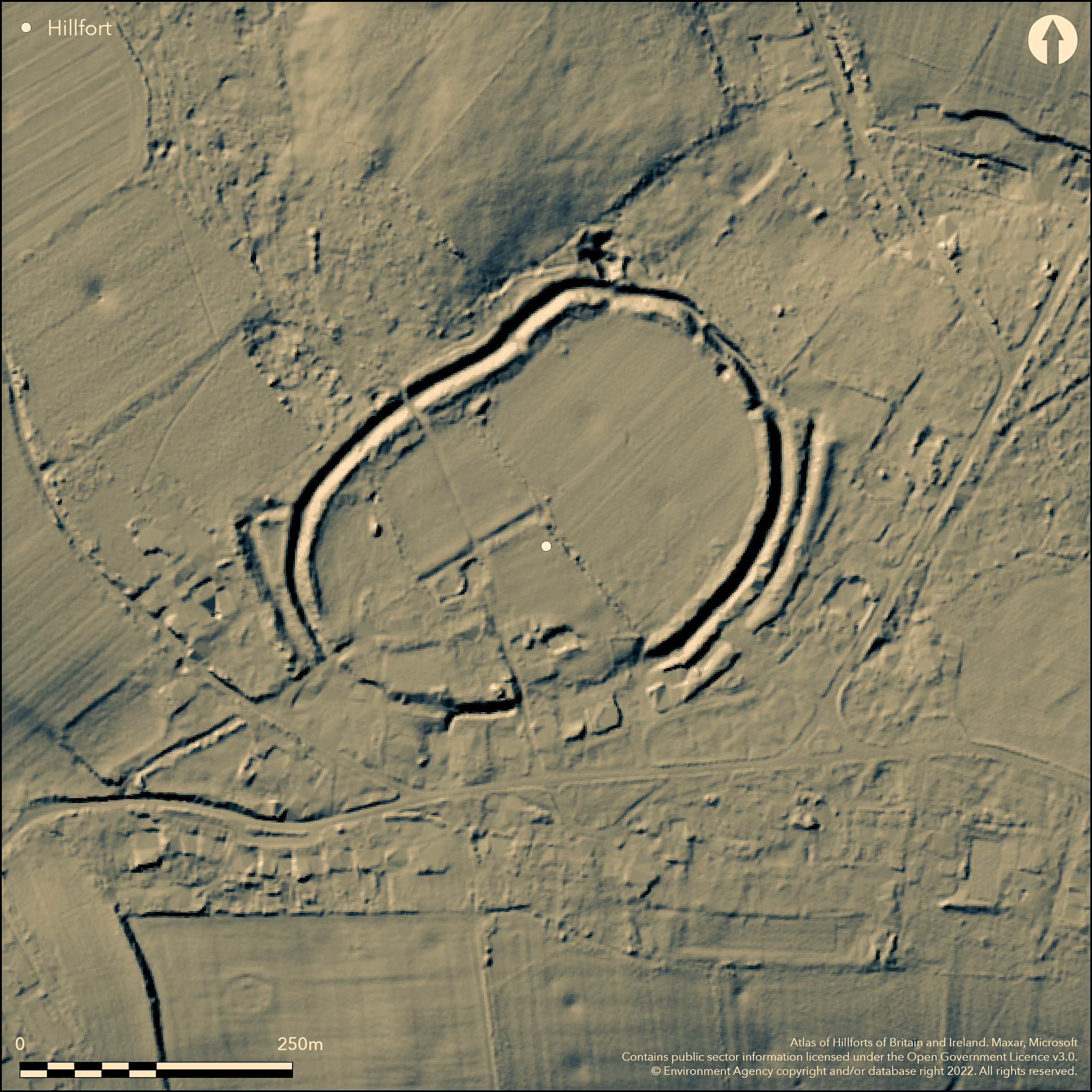
LiDAR 1m DTM Hillshade
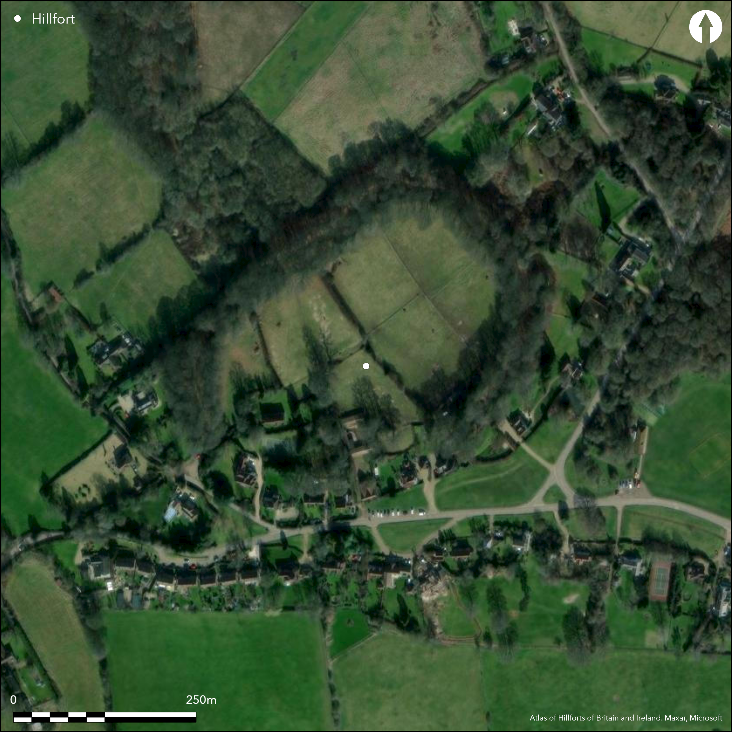
Satellite Imagery
LiDAR 1m DTM Hillshade
Satellite Imagery
Scroll left/right to view further images.
HER: Buckinghamshire 1600000 (None); N/A None
NMR: SP 90 NW 3 (346283)
SM: 1015585
NGR: SP 9301 0722
X: 493010 Y: 207220 (OSGB36)
Lying to the E of Cholesbury Common and 250m to the W of the border with Hertfordshire, a large partially multivallate hillfort enclosing approximately 4.4ha. It occupies a broad plateau close to the highest point of the Chiltern Hills at 187m OD, at the top of the SE facing dip slope. The ramparts are preserved within a belt of woodland, but overlain in the S by housing, gardens and other modern features. The site is approximately oval in plan measuring 310m NE-SW by 230m transversely. It comprises three banks and two medial ditches in the SE and SW and two banks and a medial ditch on the NE and NW. The inner bank averages 8m wide and between 0.8-1.2m high above the internal ground level, the ditch between 6-12m wide and 2.5-3m deep, with steep sides and a flat base. A second bank, possibly a counterscarp, with a maximum width of 6m and height of 1.0m, runs around most of the northern circuit, except at the northernmost point where it has been destroyed by a small quarry. A further line of bank lies outside this bank, extending for approximately 180m in the SW. A second ditch approximately 6m wide and 0.6m deep lies between the two outer banks. In the NW, a section of the external ditch and outer bank beginning in the N, extends in a straight line towards the NW for 90m with the inner defences curving to the NE. Excavation by Kimball in 1932 (Kimball 1933) demonstrated that the outer bank and ditch extended no further N than the extent of the surviving earthworks, and that this terminal was linked to the inner circuit by a short section of bank and ditch which pre-dated the ramparts. A trench placed across the ramparts in the N showed that the old turf line survived beneath both banks, and that the original depth of the ditch was 4m. In the S, a survey in 1912 confirmed that the inner bank and ditch and the second bank, once continued across the area now occupied by housing. Traces of the main ditch are still visible to the rear of gardens and have been recorded during commercial interventions but a small excavation in 1992 found nothing on the projected line of the outer ramparts, possibly indicating that multivallation did not continue in this area (BCAMS 1992; Lightfoot 2002). Several breaks are recorded around the circuit, although the location of the original entrance is unknown but could be in the SW, which later became the entrance to the 13th-14th century church. Kimball (1933) believed only the break in the centre of the NW ramparts was original, with other breaks later additions and suggests a break in the NE was possibly a secondary entrance, connecting the hillfort with Shire Lane, an ancient routeway connecting to the Aylesbury Vale Ridgeway and Grim's Ditch. Within the interior, seven hearths, three of which produced evidence for Iron smelting, and the remains of a clay-lined oven were discovered during excavations in 1932 (ibid.). Late Iron Age (50BC-50AD) pottery fragments were recovered from one of the hearths and numerous pottery sherds dating from the Middle to late Iron Age (c.300-100BC) were distributed across the excavated area. Tile and medieval pot recovered from the interior is believed to derive from manuring although a geophysical survey (Gover 2000) has recorded extensive activity, including circular anomalies, possibly roundhouses, several rectangular and sub-rectangular anomalies and a large square anomaly, which he believes are the remains of a medieval settlement. Shown as 'The Danish Camp' on 1883-84 1:10,560 OS mapping. Scheduled
Citizen Science: ✓
Reliability of Data: Confirmed
Reliability of Interpretation: Confirmed
X: -72790 Y: 6756111 (EPSG: 3857)
Longitude: -0.6538838570073437 Latitude: 51.75590955598854 (EPSG:4326)
Country: England; None
Current County or Unitary Authority: Buckinghamshire
Historic County: Buckinghamshire
Current Parish/Community/Council/Townland: Cholesbury-Cum-St. Leonards; Tring
Housing and gardens are situated where the southern stretch of ramparts once were. A public footpath runs round most of the circumference of the land and across the centre of the hillfort which has resulted in some damage, as has the recent access by mountain bikers. The area near the 'quarry pit' is subject to water erosion.
| Extant | ✓ |
| Cropmark | ✗ |
| Likely Destroyed | ✓ |
None
| Woodland | ✓ |
| Commercial Forestry Plantation | ✗ |
| Parkland | ✗ |
| Pasture (Grazing) | ✓ |
| Arable | ✗ |
| Scrub/Bracken | ✗ |
| Bare Outcrop | ✗ |
| Heather/Moorland | ✗ |
| Heath | ✗ |
| Built-up | ✓ |
| Coastal Grassland | ✗ |
| Other | ✗ |
A hillslope fort located on a broad plateau close to the highest point of the Chiltern Hills at 187m OD, at the top of the SE facing dip slope.
| Contour Fort | ✗ |
| Partial Contour Fort | ✗ |
| Promontory Fort | ✗ |
| Hillslope Fort | ✓ |
| Level Terrain Fort | ✗ |
| Marsh Fort | ✗ |
| Multiple Enclosure Fort | ✗ |
| Hilltop | ✗ |
| Coastal Promontory | ✗ |
| Inland Promontory | ✗ |
| Valley Bottom | ✗ |
| Knoll/Hillock/Outcrop | ✗ |
| Ridge | ✗ |
| Cliff/Plateau-edge/Scarp | ✓ |
| Hillslope | ✓ |
| Lowland | ✗ |
| Spur | ✗ |
Dominant Topographic Feature: Plateau
| North | ✗ |
| Northeast | ✗ |
| East | ✗ |
| Southeast | ✓ |
| South | ✗ |
| Southwest | ✗ |
| West | ✗ |
| Northwest | ✗ |
| Level | ✗ |
Altitude: 187.0m
The county boundary between Buckinghamshire and Hertfordshire lies approximately 220m to the NE
Boundary Type: County
Middle to late Iron Age pottery sherds distributed across the surface (Kimball 1933). The site was possibly constructed over or enhanced an earlier enclosure (Kimball 1933). A 13th century church and more recent buildings and structures lie across the line of the former ramparts and within the interior in the S and SW. The interior is divided into fields and a track runs S to NW across the site
Reliability: B - Medium
| Pre 1200BC | ✗ |
| 1200BC - 800BC | ✗ |
| 800BC - 400BC | ✓ |
| 400BC - AD50 | ✓ |
| AD50 - AD400 | ✗ |
| AD400 - AD 800 | ✗ |
| Post AD800 | ✗ |
| Unknown | ✗ |
| Pre Hillfort: | None |
| Post Hillfort: | None |
| Artefactual: | None |
| Morphology/Earthwork/Typology: | None |
Recorded on 1883-84 1:10,560 OS mapping and in Victoria County Histories (1912). Excavation in 1932 across the interior and the defences. Field investigation in 1972. Several commercial interventions ahead of proposed work in the S. Scheduled. Geophysics 2000.
| 1st Identified Written Reference (1908): | None |
| Other (1921): | Scheduled |
| Excavation (1932): | None |
| Other (1974): | Visit by Hillfort Study Group |
| Geophysical Survey (2000): | J. Gover. |
| 1st Identified Map Depiction (None): | None |
| Excavation (None): | Commercial interventions |
Quarry hollows. Excavations by Kimball (1933) showed the presence of hearths and ovens and evidence suggesting iron smelting, pottery. Gover (2000) recorded circular anomalies, possibly roundhouses and several rectangular and sub-rectangular anomalies and a large square anomaly recorded with geophysics which he believes are the remains of a medieval settlement.
Two ponds are believed to be aquifer fed. Two further ponds lie just outside the defences on Cholesbury Common
| None | ✗ |
| Spring | ✗ |
| Stream | ✗ |
| Pool | ✓ |
| Flush | ✗ |
| Well | ✗ |
| Other | ✓ |
None
| No Known Features | ✗ |
| Round Stone Structures | ✗ |
| Rectangular Stone Structures | ✗ |
| Curvilinear Platforms | ✗ |
| Other Roundhouse Evidence | ✗ |
| Pits | ✗ |
| Quarry Hollows | ✓ |
| Other | ✗ |
Hearth and ovens
| No Known Excavation | ✗ |
| Pits | ✗ |
| Postholes | ✗ |
| Roundhouses | ✗ |
| Rectangular Structures | ✗ |
| Roads/Tracks | ✗ |
| Quarry Hollows | ✗ |
| Other | ✓ |
| Nothing Found | ✗ |
Several rub-rectangular anomalies and a large square anomaly.
| No Known Geophysics | ✗ |
| Pits | ✗ |
| Roundhouses | ✓ |
| Rectangular Structures | ✓ |
| Roads/Tracks | ✗ |
| Quarry Hollows | ✗ |
| Other | ✓ |
| Nothing Found | ✗ |
Middle to late Iron Age pottery sherds. Bloomery slag
| No Known Finds | ✗ |
| Pottery | ✓ |
| Metal | ✗ |
| Metalworking | ✓ |
| Human Bones | ✗ |
| Animal Bones | ✗ |
| Lithics | ✗ |
| Environmental | ✗ |
| Other | ✗ |
None
| APs Not Checked | ✓ |
| None | ✗ |
| Roundhouses | ✗ |
| Rectangular Structures | ✗ |
| Pits | ✗ |
| Postholes | ✗ |
| Roads/Tracks | ✗ |
| Other | ✗ |
The location of the original entrance is unknown. It could be in the SW, which later became the entrance to the 13th-14th century church. Kimball (1933) believed only the break in the centre of the NW defences was original, with other breaks later additions and suggests a break in the NE was possibly a secondary entrance, connecting the hillfort with Shire Lane, an ancient routeway connecting to the Aylesbury Vale Ridgeway and Grim's Ditch.
| 4: | None |
| 2: | None |
Guard Chambers: ✗
Chevaux de Frise: ✗
Large, partially multivallate hillfort enclosing approximately 4.4ha. The defences overlain in the S by housing, gardens and other modern features but elsewhere are preserved in woodland. The site is approximately oval in plan measuring 310m NE-SW by 230m transversely. It comprises three banks and two medial ditches in the SE and SW and two banks and a medial ditch on the NE and NW. The inner bank averages 8m wide and between 0.8-1.2m high above the internal ground level, the ditch between 6-12m wide and 2.5-3m deep, with steep sides and a flat base. A second bank, possibly a counterscarp, with a maximum width of 6m and height of 1.0m, runs around most of the northern defences, except at the northernmost point where it has been destroyed by a small quarry. A further line of defences lie outside this bank, extending for approximately 180m in the SW. A second ditch approximately 6m wide and 0.6m deep lies between the two outer banks. In the NW, a section of the external ditch and outer bank beginning in the N, extends in a straight line towards the NW for 90m with the inner defences curving to the NE. Kimballs excavations demonstrated that the outer bank and ditch extended no further N than the extent of the surviving earthworks, and that this terminal was linked to the inner defences by a short section of bank and ditch which pre-dated the ramparts. A trench placed across the defences in the N showed that the old turf line survived beneath both banks, and that the original depth of the ditch was 4m. A survey in 1912 confirmed that the inner bank and ditch, and the second bank once continued across the area now occupied by housing. Traces of the main ditch are still visible to the rear of gardens and recorded during commercial interventions (BCAMS 1992; Lightfoot 2002). A small excavation in 1992 in one of the gardens found no trace of a bank or ditch on the projected line of the outer defences, possibly indicating that the multivallation did not continue in that area.
| Area 1: | 4.5ha. |
| Total: | 4.5ha. |
Total Footprint Area: 6.3ha.
None
| ✗ | Areas estimated from OS mapping |
| ✓ | None |
| NE Quadrant: | 2 |
| SE Quadrant: | 3 |
| SW Quadrant: | 3 |
| NW Quadrant: | 2 |
| Total: | 3 |
| Partial Univallate | ✗ |
| Univallate | ✗ |
| Partial Bivallate | ✓ |
| Bivallate | ✗ |
| Partial Multivallate | ✓ |
| Multivallate | ✗ |
| Unknown | ✗ |
| Partial Univallate | ✗ |
| Univallate | ✗ |
| Partial Bivallate | ✗ |
| Bivallate | ✗ |
| Partial Multivallate | ✗ |
| Multivallate | ✗ |
None
| None | ✗ |
| Earthen Bank | ✓ |
| Stone Wall | ✗ |
| Rubble | ✗ |
| Wall-walk | ✗ |
| Evidence of Timber | ✗ |
| Vitrification | ✗ |
| Other Burning | ✗ |
| Palisade | ✗ |
| Counter Scarp Bank | ✓ |
| Berm | ✗ |
| Unfinished | ✗ |
| Other | ✗ |
None
| None | ✗ |
| Earthen Bank | ✓ |
| Stone Wall | ✗ |
| Murus Duplex | ✗ |
| Timber-framed | ✗ |
| Timber-laced | ✗ |
| Vitrification | ✗ |
| Other Burning | ✗ |
| Palisade | ✗ |
| Counter Scarp Bank | ✗ |
| Berm | ✗ |
| Unfinished | ✗ |
| No Known Excavation | ✗ |
| Other | ✗ |
| ✗ | None |
| ✓ | None |
Number of Ditches: 2
| ✗ | None |
BCAMS, 1992. An Archaeological Evaluation at Moat House, Cholesbury, Buckinghamshire, Buckinghamshire County Museum Archaeology Service. Unpublished
Gover, J, 2000. A Geophysical Survey of Cholesbury Camp, The Chiltern Hills, Buckinghamshire. unpublished
Kimball, D. 1933. Cholesbury Camp, J Brit Archaeol Assoc 39, 187-21
Lightfoot, M. 2002. An Archaeological Evaluation at the Old Vicarage, Cholesbury, Buckinghamshire.
Archaeological Services and Consultancy Ltd
Page, W. 1908.The Victoria history of the county of Buckingham, Vol 2, 22-24
Atlas of Hillforts:
Wikidata:
This work is licensed under CC BY-SA 4.0

 and should be cited as:
Lock, Gary and Ralston, Ian. 2024. Atlas of Hillforts of Britain and Ireland. Available at: https://hillforts.arch.ox.ac.uk
Document Version 1.1