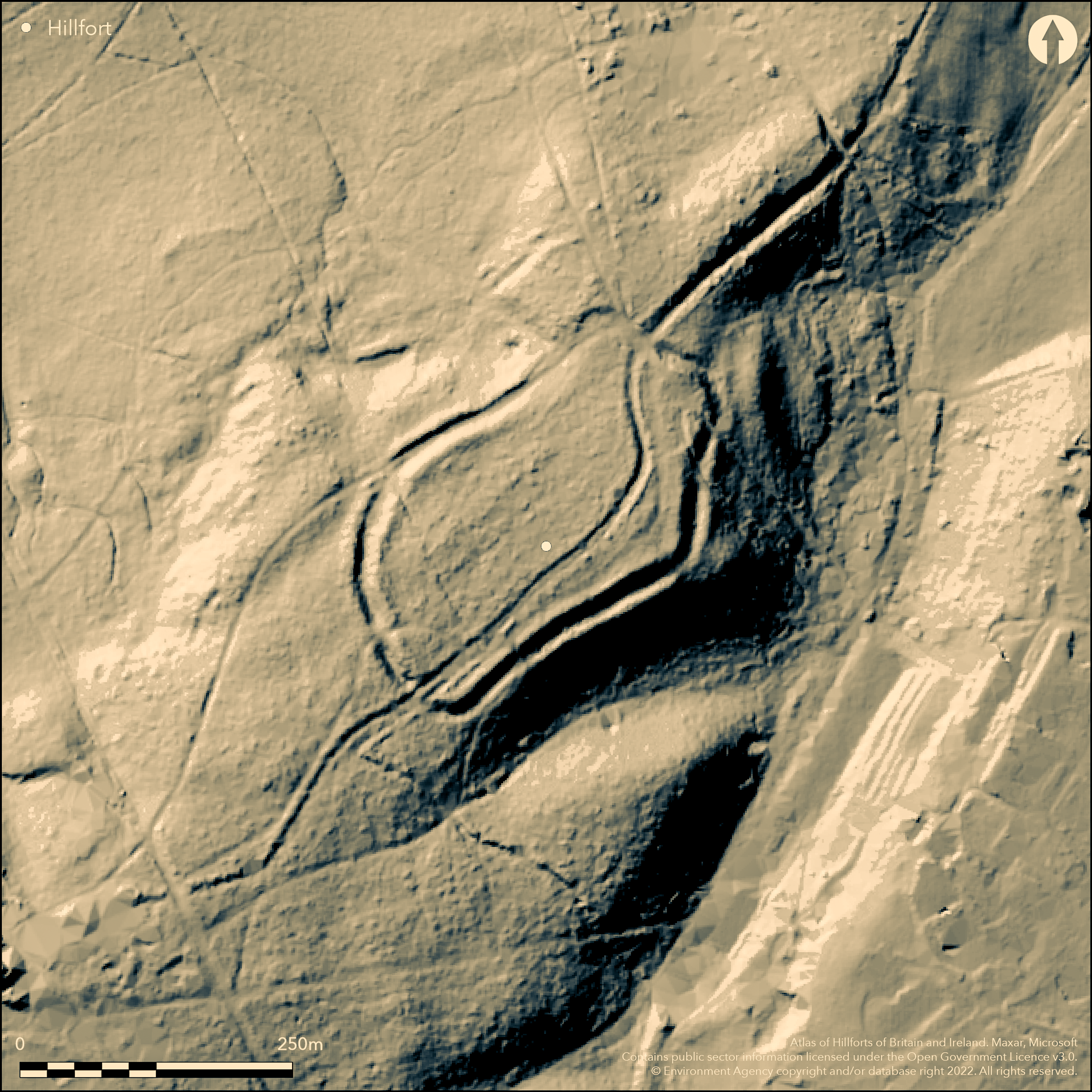
LiDAR 1m DTM Hillshade
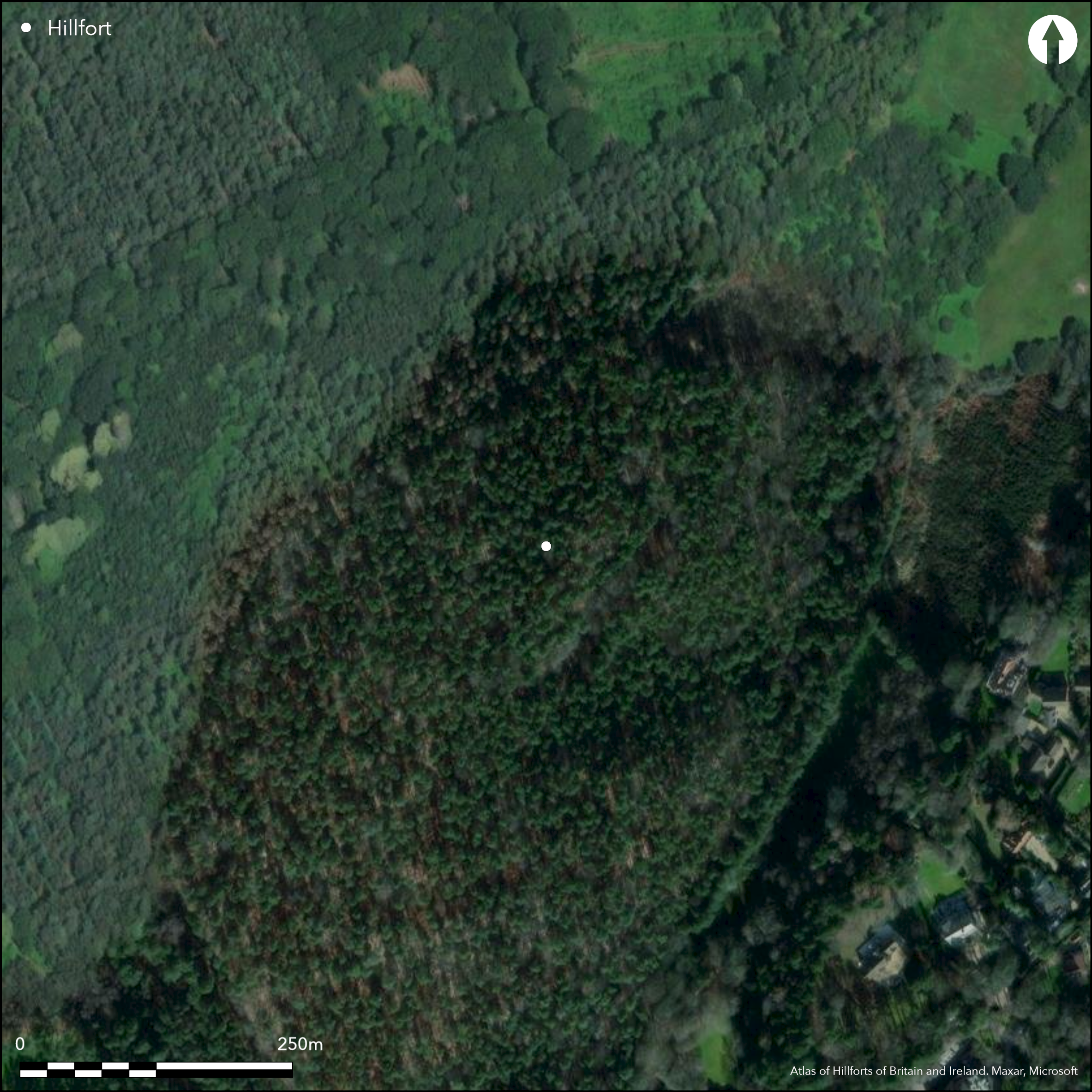
Satellite Imagery
LiDAR 1m DTM Hillshade
Satellite Imagery
Scroll left/right to view further images.
HER: Milton Keynes MMK623 (None)
NMR: SP 93 SW 4 (346675)
SM: 1011302
NGR: SP 9210 3480
X: 492103 Y: 234807 (OSGB36)
Lying to the W of Aspley Heath within Wavendon Wood, a univallate contour fort of 2.4ha, possibly unfinished. It occupies the end of a projecting spur at 160m OD with the ground falling away in the NW and N. Rectangular in plan with rounded corners, it measures 210m NE-SW by 130m transversely and comprises a bank and external well-preserved ditch up to 2m deep. The ramparts follow the 150m contour, with the natural steepness of the hillslope enhanced by scarping and are strongest in the SE. Elsewhere they have been reduced or levelled. A counterscarp bank has been been identified on the NW and SE sides. A series of forest paths converge in the N where the ramparts are unfinished or damaged. An original entrance lies in the SW corner where a causeway across the ditch was confirmed through limited excavation (Berry 1926, 363-383). The excavations also produced 1st century BC to 1st century AD pottery. The banks have been denuded by forestry and medieval or modern tracks. No internal features are recorded. Recorded on 1884 1:2,500 OS mapping. Scheduled.
Citizen Science: ✗
Reliability of Data: Confirmed
Reliability of Interpretation: Confirmed
X: -73434 Y: 6800854 (EPSG: 3857)
Longitude: -0.6596657905700343 Latitude: 52.00402821496575 (EPSG:4326)
Country: England; None
Current County or Unitary Authority: Milton Keynes
Historic County: Buckinghamshire
Current Parish/Community/Council/Townland: Wavendon; Bow Brickhill and Woburn Sands
The earthwork has been mutilated at the N corner by paths and afforestation
| Extant | ✓ |
| Cropmark | ✗ |
| Likely Destroyed | ✗ |
None
| Woodland | ✓ |
| Commercial Forestry Plantation | ✗ |
| Parkland | ✗ |
| Pasture (Grazing) | ✗ |
| Arable | ✗ |
| Scrub/Bracken | ✗ |
| Bare Outcrop | ✗ |
| Heather/Moorland | ✗ |
| Heath | ✗ |
| Built-up | ✗ |
| Coastal Grassland | ✗ |
| Other | ✗ |
A contour fort lying at 160m OD at the northern end of a small, steep-sided spur.
| Contour Fort | ✓ |
| Partial Contour Fort | ✗ |
| Promontory Fort | ✗ |
| Hillslope Fort | ✗ |
| Level Terrain Fort | ✗ |
| Marsh Fort | ✗ |
| Multiple Enclosure Fort | ✗ |
| Hilltop | ✓ |
| Coastal Promontory | ✗ |
| Inland Promontory | ✗ |
| Valley Bottom | ✗ |
| Knoll/Hillock/Outcrop | ✗ |
| Ridge | ✗ |
| Cliff/Plateau-edge/Scarp | ✗ |
| Hillslope | ✗ |
| Lowland | ✗ |
| Spur | ✓ |
Dominant Topographic Feature: Spur
| North | ✓ |
| Northeast | ✗ |
| East | ✗ |
| Southeast | ✗ |
| South | ✗ |
| Southwest | ✗ |
| West | ✓ |
| Northwest | ✓ |
| Level | ✗ |
Altitude: 160.0m
The boundary between Milton Keynes and Mid Bedfordshire lies 100m to the E. The parish boundary between Bow Brickhill and Woburn Sands (Milton Keynes) lies to the W
Boundary Type: Parish/Townland
The site has been dated by pottery to 1st century BC to 1st century AD
Reliability: B - Medium
| Pre 1200BC | ✗ |
| 1200BC - 800BC | ✗ |
| 800BC - 400BC | ✗ |
| 400BC - AD50 | ✓ |
| AD50 - AD400 | ✓ |
| AD400 - AD 800 | ✗ |
| Post AD800 | ✗ |
| Unknown | ✗ |
| Pre Hillfort: | None |
| Post Hillfort: | None |
| Artefactual: | Pottery |
Recorded on 1884 1:2,500 OS mapping; Included in VCH Bucks. Excavations in 1924. Field investigation in 1972. Scheduled
| 1st Identified Map Depiction (1884): | None |
| 1st Identified Written Reference (1908): | None |
| Excavation (1924): | None |
| Other (1933): | Scheduled |
| Other (1972): | Field investigation |
No internal features are recorded
None
| None | ✓ |
| Spring | ✗ |
| Stream | ✗ |
| Pool | ✗ |
| Flush | ✗ |
| Well | ✗ |
| Other | ✗ |
None
| No Known Features | ✓ |
| Round Stone Structures | ✗ |
| Rectangular Stone Structures | ✗ |
| Curvilinear Platforms | ✗ |
| Other Roundhouse Evidence | ✗ |
| Pits | ✗ |
| Quarry Hollows | ✗ |
| Other | ✗ |
Ramparts only investigated
| No Known Excavation | ✓ |
| Pits | ✗ |
| Postholes | ✗ |
| Roundhouses | ✗ |
| Rectangular Structures | ✗ |
| Roads/Tracks | ✗ |
| Quarry Hollows | ✗ |
| Other | ✗ |
| Nothing Found | ✗ |
None
| No Known Geophysics | ✓ |
| Pits | ✗ |
| Roundhouses | ✗ |
| Rectangular Structures | ✗ |
| Roads/Tracks | ✗ |
| Quarry Hollows | ✗ |
| Other | ✗ |
| Nothing Found | ✗ |
None
| No Known Finds | ✗ |
| Pottery | ✓ |
| Metal | ✗ |
| Metalworking | ✗ |
| Human Bones | ✗ |
| Animal Bones | ✗ |
| Lithics | ✗ |
| Environmental | ✗ |
| Other | ✗ |
Woodland
| APs Not Checked | ✓ |
| None | ✗ |
| Roundhouses | ✗ |
| Rectangular Structures | ✗ |
| Pits | ✗ |
| Postholes | ✗ |
| Roads/Tracks | ✗ |
| Other | ✗ |
Entrance in the SW shown by excavation to be original (Berry 1926)
| 3: | The site is open in the N, possibly destroyed or unfinished. There is also a break in the ramparts in the NE |
| 2: | None |
Guard Chambers: ✗
Chevaux de Frise: ✗
| 1. Simple Gap (South west): | None |
Univallate contour fort of 2.4ha, possibly unfinished. Rectangular in plan with rounded corners, it measures 210m NE-SW by 130m transversely and comprises a bank and external well-preserved ditch up to 2m deep. The defences follow the 150m contour with the natural steepness of the hillslope enhanced by scarping. The defences are strongest in the SE but elsewhere have been reduced or levelled. A counterscarp bank has been been identified on the NW and SE sides. The defences in the N are unfinished or damaged.
| Area 1: | 2.4ha. |
| Total: | 2.4ha. |
Total Footprint Area: Noneha.
None
| ✗ | None |
| ✗ | None |
| NE Quadrant: | None |
| SE Quadrant: | 1 |
| SW Quadrant: | 1 |
| NW Quadrant: | None |
| Total: | 1 |
| Partial Univallate | ✓ |
| Univallate | ✗ |
| Partial Bivallate | ✗ |
| Bivallate | ✗ |
| Partial Multivallate | ✗ |
| Multivallate | ✗ |
| Unknown | ✗ |
| Partial Univallate | ✗ |
| Univallate | ✗ |
| Partial Bivallate | ✗ |
| Bivallate | ✗ |
| Partial Multivallate | ✗ |
| Multivallate | ✗ |
Possibly unfinished in the N
| None | ✗ |
| Earthen Bank | ✓ |
| Stone Wall | ✗ |
| Rubble | ✗ |
| Wall-walk | ✗ |
| Evidence of Timber | ✗ |
| Vitrification | ✗ |
| Other Burning | ✗ |
| Palisade | ✗ |
| Counter Scarp Bank | ✓ |
| Berm | ✗ |
| Unfinished | ✓ |
| Other | ✗ |
Limited excavation
| None | ✗ |
| Earthen Bank | ✓ |
| Stone Wall | ✗ |
| Murus Duplex | ✗ |
| Timber-framed | ✗ |
| Timber-laced | ✗ |
| Vitrification | ✗ |
| Other Burning | ✗ |
| Palisade | ✗ |
| Counter Scarp Bank | ✗ |
| Berm | ✗ |
| Unfinished | ✗ |
| No Known Excavation | ✗ |
| Other | ✗ |
| ✗ | None |
| ✓ | None |
Number of Ditches: 1
| ✗ | None |
Anon. 1924. Notes: Excavations at Danesborough Camp, Bucks. Antiq J, 4, 418
Berry, J. 1924. Excavation at Danesborough Camp. Rec Buckinghamshire. 1919-26, vol II pt 8, 351
Berry, J. 1926. Excavations at Danesborough Camp. Rec Buckinghamshire. 1919-26 vol II, pt 6, 363-383
Page, W. 1908. Victoria County History of Buckinghamshire. 2, 22
Atlas of Hillforts:
Wikidata:
This work is licensed under CC BY-SA 4.0

 and should be cited as:
Lock, Gary and Ralston, Ian. 2024. Atlas of Hillforts of Britain and Ireland. Available at: https://hillforts.arch.ox.ac.uk
Document Version 1.1