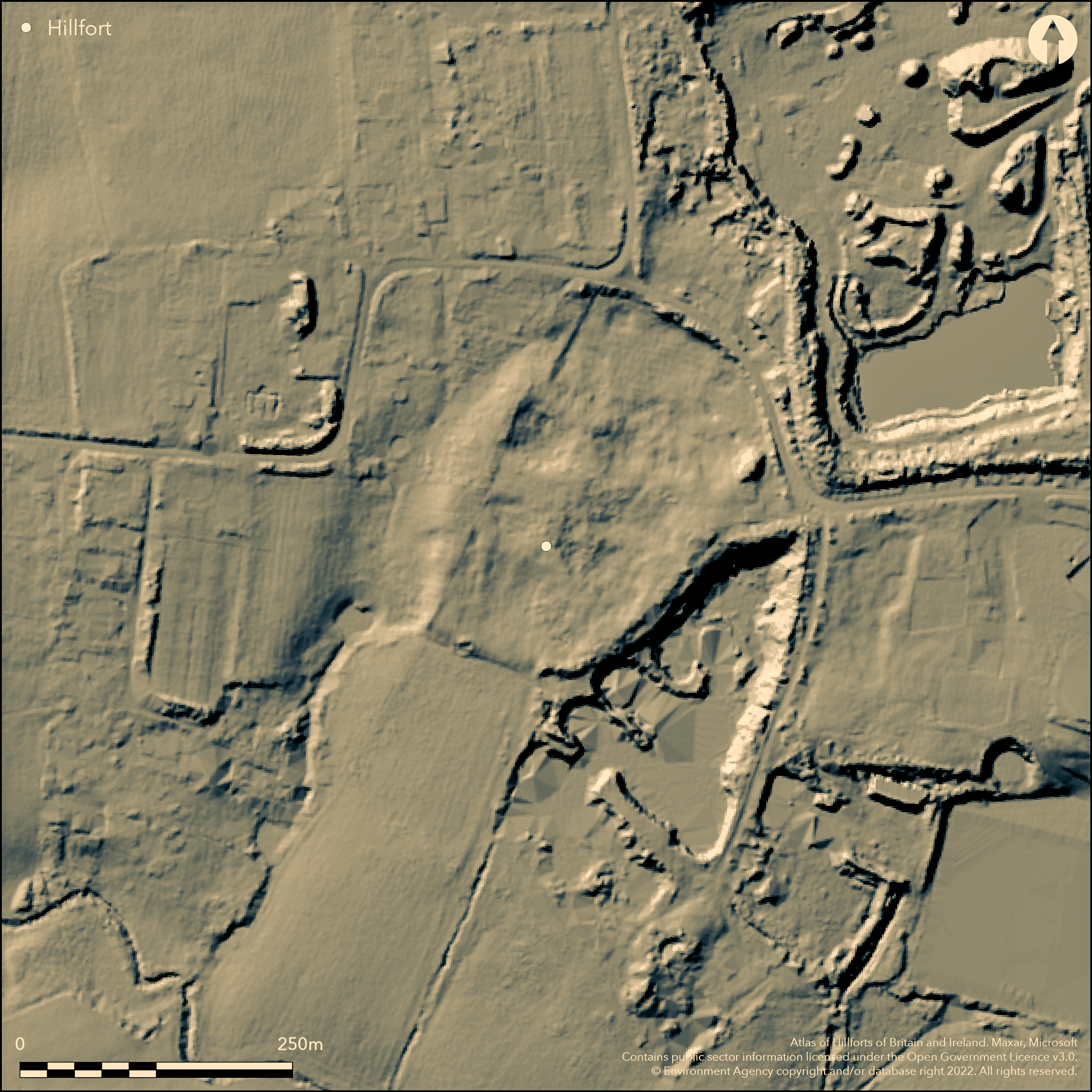
LiDAR 1m DTM Hillshade
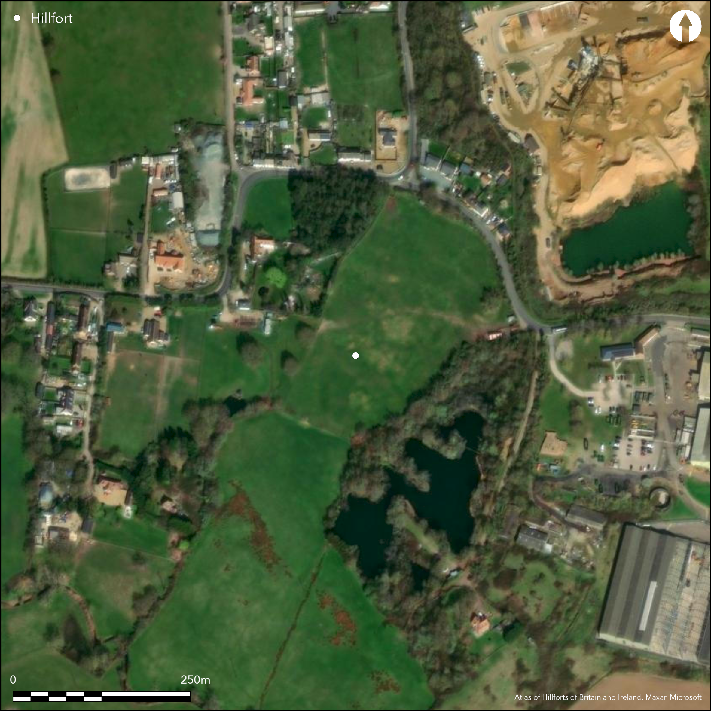
Satellite Imagery
LiDAR 1m DTM Hillshade
Satellite Imagery
Scroll left/right to view further images.
HER: Essex 12051 (None)
NMR: TL 90 SE 3 (383385)
SM: 1014142
NGR: TL 9725 0125
X: 597251 Y: 201250 (OSGB36)
On the Dengie Peninsula, a slight univallate plateau fort lying to the S of Asheldham Pits nature reserve. It lies on a plateau on a slight S-trending slope and would have been visible from the S and SE. Approximately 90 percent of the interior was destroyed through gravel extraction in the 19th and early 20th centuries (Bedwin 1985, 1991). A small area of woodland lies in the NW. Oval in form, a single bank and external ditch enclose approximately 3.5ha. The ramparts survive in the E and S with the bank 0.7m high in the E and the ditch as a shallow depression. Excavation has shown this was originally 3.5m wide and 3.6m deep (Priddy 1986). It was recut in the late Saxon or early medieval period, when it was made shallower but was increased to 11.0m wide. Middle Saxon pottery c. 7th-9th centuries was recovered from the fills (ibid.). In the W the ramparts follow the natural scarp and in the N the enclosed area is defined by the curve in the road. Evidence for wooden posts show the bank had been revetted. The location of an entrance is unconfirmed, although a possible entrance to the camp was observed in 1893 prior to the building of Southminster water tower, where a trench with 'swampy bottom' had been lined with a rough basketwork of large hazel sticks covered with clay and a coating of gravel. An axehead and 10th century Viking knife were found at that time. Iron Age pottery sherds and worked flints were also recovered. Internal features and traces of the ditch in the NW were recorded in the 1920's and 30's and Iron Age pottery including vessels with cremations in the 1940s although no internal features contemporary with the use of the hillfort are known. The excavations in 1985 showed the hillfort was constructed in the early Iron Age. The old land surface revealed traces of cultivation preceding the construction of the hillfort, although analysis on soils from the surface show a pre-hillfort environment that was pastoral, dominated by grassland. Postholes and a pit were also recorded and evidence for a middle Iron Age granary that had been destroyed by fire. Large pieces of charcoal derived from planks, stake tips and staves were considered to come from a small oak barrel. One middle Iron Age pit contained large amounts of carbonised grain. Roman pottery sherds were discovered in c.1932 by the tenant of Brook Farm and earlier, in 1893, both Romano-British and Anglo Saxon pottery was recovered as surface finds. The outline of the hillfort is recorded as field boundaries until 1897-8, where it is recorded as 'Camp' on 1:10,560 OS mapping. Scheduled.
Citizen Science: ✗
Reliability of Data: Confirmed
Reliability of Interpretation: Confirmed
X: 94789 Y: 6741631 (EPSG: 3857)
Longitude: 0.8515022528806729 Latitude: 51.67532125684833 (EPSG:4326)
Country: England; None
Current County or Unitary Authority: Essex
Historic County: Essex
Current Parish/Community/Council/Townland: Asheldham; Southminster
Mutilated by disused gravel diggings and shown as Gravel Pit Field on the 1838 Tithe Map (Bedwin 1991). Further extraction in 1920s and 30s. Rough grazing in 1991, now overgrown with scrub.
| Extant | ✓ |
| Cropmark | ✗ |
| Likely Destroyed | ✓ |
Gravel pits. Small area of woodland in the NW
| Woodland | ✓ |
| Commercial Forestry Plantation | ✗ |
| Parkland | ✗ |
| Pasture (Grazing) | ✗ |
| Arable | ✗ |
| Scrub/Bracken | ✓ |
| Bare Outcrop | ✗ |
| Heather/Moorland | ✗ |
| Heath | ✗ |
| Built-up | ✗ |
| Coastal Grassland | ✗ |
| Other | ✓ |
A partial contour fort lying at approximately 20m OD on a plateau on a slight S-trending slope towards to Asheldham Brook
| Contour Fort | ✗ |
| Partial Contour Fort | ✓ |
| Promontory Fort | ✗ |
| Hillslope Fort | ✗ |
| Level Terrain Fort | ✗ |
| Marsh Fort | ✗ |
| Multiple Enclosure Fort | ✗ |
| Hilltop | ✓ |
| Coastal Promontory | ✗ |
| Inland Promontory | ✗ |
| Valley Bottom | ✗ |
| Knoll/Hillock/Outcrop | ✗ |
| Ridge | ✗ |
| Cliff/Plateau-edge/Scarp | ✓ |
| Hillslope | ✗ |
| Lowland | ✓ |
| Spur | ✗ |
Dominant Topographic Feature: Plateau
| North | ✗ |
| Northeast | ✗ |
| East | ✗ |
| Southeast | ✗ |
| South | ✗ |
| Southwest | ✗ |
| West | ✗ |
| Northwest | ✗ |
| Level | ✓ |
Altitude: 20.0m
Asheldham Brook to the S forms the parish boundary between Asheldham and Southminster
Boundary Type: Parish/Townland
Excavated artefactual evidence suggest occupation from the Iron Age, with activity continuing into the Roman, Anglo Saxon and possibly later periods.
Reliability: B - Medium
| Pre 1200BC | ✗ |
| 1200BC - 800BC | ✗ |
| 800BC - 400BC | ✓ |
| 400BC - AD50 | ✓ |
| AD50 - AD400 | ✗ |
| AD400 - AD 800 | ✗ |
| Post AD800 | ✗ |
| Unknown | ✗ |
| Pre Hillfort: | None |
| Post Hillfort: | None |
| Artefactual: | None |
Recorded on 1987-8 1:10,560 OS mapping. Recorded by RCHME 1923; Monument inspection in 1978. (Couchman 1979, 70). Survey and excavation in 1985 (Bedwin 1985; 1991). Scheduled
| 1st Identified Written Reference (1923): | Royal Commission on Historical Monuments (England) 1923. An inventory of the historical monuments in Essex. Volume IV [south-east] |
| Other (1963): | Scheduled |
| Other (1979): | Monument inspection |
| Excavation (1985): | (Bedwin 1985) |
| Earthwork Survey (1985): | Contour survey at 1:250. |
| 1st Identified Map Depiction (None): | None |
Ninety percent of the interior was destroyed by gravel quarrying in the 19th and 20th centuries. Pits and postholes from excavation, pottery, metal, grain.
Asheldham Brook in the S
| None | ✓ |
| Spring | ✗ |
| Stream | ✗ |
| Pool | ✗ |
| Flush | ✗ |
| Well | ✗ |
| Other | ✗ |
None
| No Known Features | ✓ |
| Round Stone Structures | ✗ |
| Rectangular Stone Structures | ✗ |
| Curvilinear Platforms | ✗ |
| Other Roundhouse Evidence | ✗ |
| Pits | ✗ |
| Quarry Hollows | ✗ |
| Other | ✗ |
None
| No Known Excavation | ✗ |
| Pits | ✓ |
| Postholes | ✓ |
| Roundhouses | ✗ |
| Rectangular Structures | ✗ |
| Roads/Tracks | ✗ |
| Quarry Hollows | ✗ |
| Other | ✗ |
| Nothing Found | ✗ |
None
| No Known Geophysics | ✓ |
| Pits | ✗ |
| Roundhouses | ✗ |
| Rectangular Structures | ✗ |
| Roads/Tracks | ✗ |
| Quarry Hollows | ✗ |
| Other | ✗ |
| Nothing Found | ✗ |
Carbonised grain, vessels with cremations
| No Known Finds | ✗ |
| Pottery | ✓ |
| Metal | ✓ |
| Metalworking | ✗ |
| Human Bones | ✓ |
| Animal Bones | ✗ |
| Lithics | ✓ |
| Environmental | ✓ |
| Other | ✗ |
Mostly destroyed
| APs Not Checked | ✓ |
| None | ✗ |
| Roundhouses | ✗ |
| Rectangular Structures | ✗ |
| Pits | ✗ |
| Postholes | ✗ |
| Roads/Tracks | ✗ |
| Other | ✗ |
A possible entrance to the camp was observed in 1893, although no obvious entrances could be determined in 1985 (Bedwin 1991)
| None: | None |
| 2: | None |
Guard Chambers: ✗
Chevaux de Frise: ✗
Slight univallate plateau fort. Oval in form, a single bank and external ditch enclose approximately 3.5ha. The ramparts survive in the E and S with the bank 0.7m high in the E and the ditch as a shallow depression. Excavation has shown this was originally 3.5m wide and 3.6m deep. It was recut in the late Saxon or early medieval period, when it was made shallower but was increased to 11.0m wide. Evidence for wooden posts show the bank had been revetted.
| Area 1: | 3.5ha. |
| Total: | 3.5ha. |
Total Footprint Area: Noneha.
None
| ✗ | None |
| ✓ | None |
| NE Quadrant: | 1 |
| SE Quadrant: | 1 |
| SW Quadrant: | 1 |
| NW Quadrant: | 1 |
| Total: | 1 |
| Partial Univallate | ✗ |
| Univallate | ✓ |
| Partial Bivallate | ✗ |
| Bivallate | ✗ |
| Partial Multivallate | ✗ |
| Multivallate | ✗ |
| Unknown | ✗ |
| Partial Univallate | ✗ |
| Univallate | ✗ |
| Partial Bivallate | ✗ |
| Bivallate | ✗ |
| Partial Multivallate | ✗ |
| Multivallate | ✗ |
None
| None | ✗ |
| Earthen Bank | ✓ |
| Stone Wall | ✗ |
| Rubble | ✗ |
| Wall-walk | ✗ |
| Evidence of Timber | ✗ |
| Vitrification | ✗ |
| Other Burning | ✗ |
| Palisade | ✗ |
| Counter Scarp Bank | ✗ |
| Berm | ✗ |
| Unfinished | ✗ |
| Other | ✗ |
Evidence for wooden posts suggests some form of timber revetting
| None | ✗ |
| Earthen Bank | ✓ |
| Stone Wall | ✗ |
| Murus Duplex | ✗ |
| Timber-framed | ✓ |
| Timber-laced | ✗ |
| Vitrification | ✗ |
| Other Burning | ✗ |
| Palisade | ✗ |
| Counter Scarp Bank | ✗ |
| Berm | ✗ |
| Unfinished | ✗ |
| No Known Excavation | ✗ |
| Other | ✗ |
| ✗ | None |
| ✓ | None |
Number of Ditches: 1
| ✗ | None |
Anon. 1985. Recent Work of the County Archaeological Section. Essex Archaeol Hist News 92, 5-6
Bedwin, O, 1991. Asheldham Camp An Early Iron Age Hill Fort: The 1985 Excavations. Essex Archaeol Hist. Vol. 22, 13-37
Bedwin, O, 1985. Asheldham Camp 1985. Essex Archaeol Hist. Vol. 16, 14
Couchman, C.R. 1979. Work of the County Council Archaeological Section, 1978. Essex Archaeol Hist. Vol 11, 70
Laver, P.G. 1930. Surecastre, or the camp at Asheldham. Essex Archaeol Hist. Vol 19, New Ser, 183-4
Priddy, D. 1986. Excavations in Essex 1985. Essex Archaeol Hist. Vol 17, 156
Priddy, D. 1982. Work of the County Council Archaeological Section, 1981. Essex Archaeol Hist. Vol 14, 117
Atlas of Hillforts:
Wikidata:
This work is licensed under CC BY-SA 4.0

 and should be cited as:
Lock, Gary and Ralston, Ian. 2024. Atlas of Hillforts of Britain and Ireland. Available at: https://hillforts.arch.ox.ac.uk
Document Version 1.1