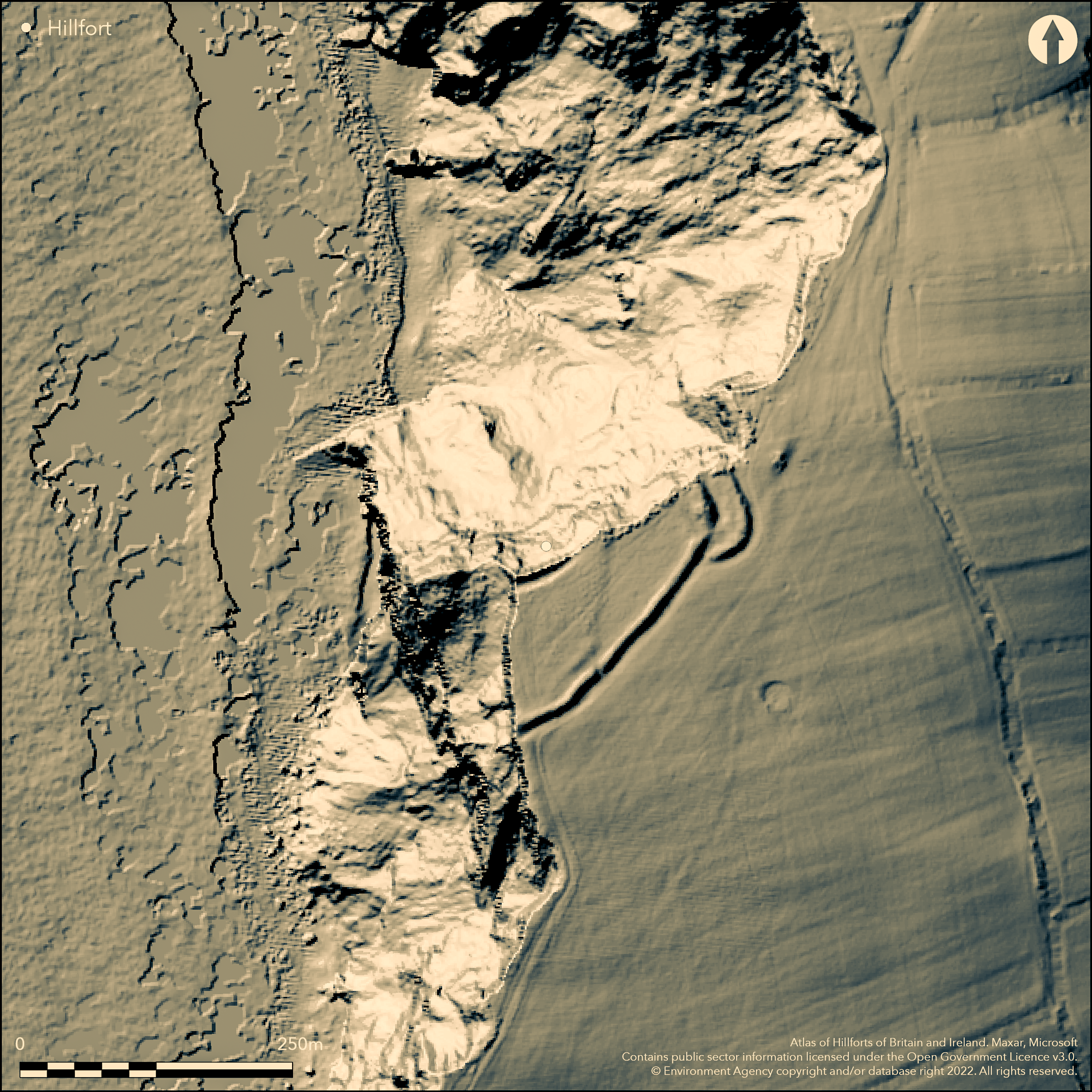
LiDAR 1m DTM Hillshade
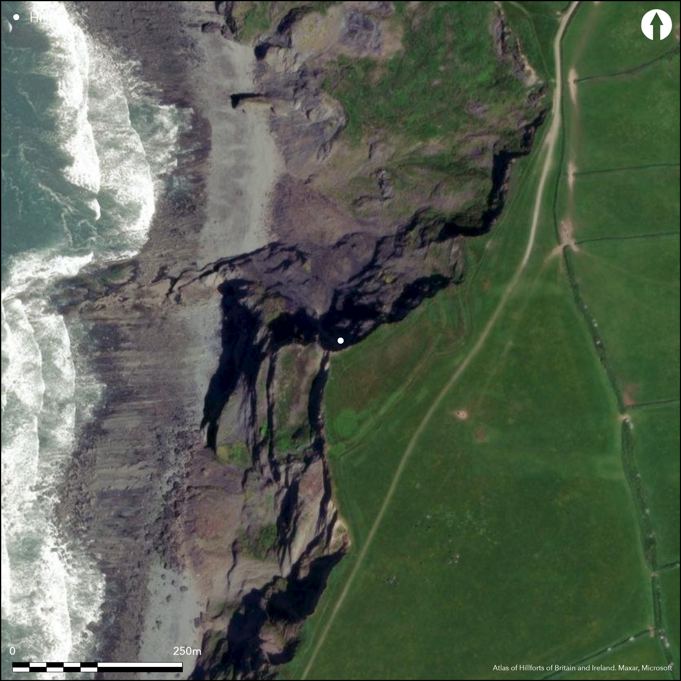
Satellite Imagery
LiDAR 1m DTM Hillshade
Satellite Imagery
Scroll left/right to view further images.
HER: Devon MDV48 (None)
NMR: SS 21 671948 (32107)
SM: 1003845
NGR: SS21671948
X: 221640 Y: 119523 (OSGB36)
Prominent coastal promontory fort on WNW-facing promontory of Embury Beacon overlooking sea to W. Precipitous sea cliffs to coast and sea on W, moderate, then steep, to part-wooded stream valley on NE-SE. This now cliff-edge site being rapidly eroded away by coastal erosion and may have been more inland, and of a partial contour nature, in prehistory rather than a true promontory fort, but this is only conjecture. Therefore enclosed area not estimated. Two ramparts and ditch cut off promontory on NE-SW. Inner rampart to 2.2m high of simple unrevetted construction, with material from V-shaped ditch, 7m wide and to 1.9m deep, found by excavation 1972 (Jeffries 1974), Four post holes found on crest. Possible barbican type entrance on E side. Outer rampart, 1.5m high and 6.5m wide, and outer ditch. Bank contained large stones and possibly revetted, with stones now in ditch. Interior evidence found: nineteen post holes, three stake holes and two hearths found in gully behind inner bank. Between the banks possible foundation 4.5m long and 1m wide on undisturbed bedrock and possible pond or water trough. Pottery, mainly late Iron Age Glastonbury ware, associated with postholes sealed by bank spill. Beach pebbles scattered over site and in topsoil pile of 36 probable sling stones inside inner rampart. On 1st Ed. OS map (1885-86). Undated.
Citizen Science: ✗
Reliability of Data: Confirmed
Reliability of Interpretation: Confirmed
X: -505448 Y: 6611999 (EPSG: 3857)
Longitude: -4.540514463353463 Latitude: 50.94742214877058 (EPSG:4326)
Country: England
Current County or Unitary Authority: Devon
Historic County: Devon
Current Parish/Community/Council/Townland: Hartland
Rapid coastal erosion. National Trust site. South West Coast Path through site.
| Extant | ✓ |
| Cropmark | ✗ |
| Likely Destroyed | ✗ |
Coastal grassland.
| Woodland | ✗ |
| Commercial Forestry Plantation | ✗ |
| Parkland | ✗ |
| Pasture (Grazing) | ✗ |
| Arable | ✗ |
| Scrub/Bracken | ✗ |
| Bare Outcrop | ✗ |
| Heather/Moorland | ✗ |
| Heath | ✗ |
| Built-up | ✗ |
| Coastal Grassland | ✓ |
| Other | ✗ |
Prominent coastal promontory fort on WNW-facing promontory of Embury Beacon overlooking sea to W. Precipitous sea cliffs to coast and sea on W quadrants, moderate, then steep, to part-wooded stream valley on NE-SE.
| Contour Fort | ✗ |
| Partial Contour Fort | ✗ |
| Promontory Fort | ✓ |
| Hillslope Fort | ✗ |
| Level Terrain Fort | ✗ |
| Marsh Fort | ✗ |
| Multiple Enclosure Fort | ✗ |
| Hilltop | ✗ |
| Coastal Promontory | ✓ |
| Inland Promontory | ✗ |
| Valley Bottom | ✗ |
| Knoll/Hillock/Outcrop | ✗ |
| Ridge | ✗ |
| Cliff/Plateau-edge/Scarp | ✗ |
| Hillslope | ✗ |
| Lowland | ✗ |
| Spur | ✗ |
Dominant Topographic Feature: Coastal promontory.
| North | ✗ |
| Northeast | ✗ |
| East | ✗ |
| Southeast | ✗ |
| South | ✗ |
| Southwest | ✗ |
| West | ✗ |
| Northwest | ✓ |
| Level | ✗ |
Altitude: 157.0m
N/A
None.
Reliability: D - None
| Pre 1200BC | ✗ |
| 1200BC - 800BC | ✗ |
| 800BC - 400BC | ✗ |
| 400BC - AD50 | ✗ |
| AD50 - AD400 | ✗ |
| AD400 - AD 800 | ✗ |
| Post AD800 | ✗ |
| Unknown | ✓ |
| Pre Hillfort: | None |
| Post Hillfort: | None |
On 1st Ed. OS map (1885-86). Excavation J.S. Jefferies, DOE 1972-73. Measured survey RCHME 1997, ref. no. 1086466.
| Earthwork Survey (1997): | Measured survey RCHME. |
| 1st Identified Map Depiction (None): | OS map. |
| Excavation (None): | J.S. Jefferies, DOE. |
Interesting interior evidence found. 19 postholes, three stake holes and two hearths found in gully behind inner bank. Between the banks possible foundation 4.5m long and 1m wide on undisturbed bedrock and possible pond or water trough. Pottery, mainly late Iron Age Glastonbury ware associated with post holes sealed by bank spill. Beach pebbles scattered over site and in topsoil pile of 36 probable sling stones inside inner rampart.
Between the banks possible foundation 4.5m long and 1m wide on undisturbed bedrock and possible pond or water trough.
| None | ✗ |
| Spring | ✗ |
| Stream | ✗ |
| Pool | ✓ |
| Flush | ✗ |
| Well | ✗ |
| Other | ✗ |
None
| No Known Features | ✓ |
| Round Stone Structures | ✗ |
| Rectangular Stone Structures | ✗ |
| Curvilinear Platforms | ✗ |
| Other Roundhouse Evidence | ✗ |
| Pits | ✗ |
| Quarry Hollows | ✗ |
| Other | ✗ |
19 postholes, three stake holes and two hearths.
| No Known Excavation | ✗ |
| Pits | ✗ |
| Postholes | ✓ |
| Roundhouses | ✗ |
| Rectangular Structures | ✗ |
| Roads/Tracks | ✗ |
| Quarry Hollows | ✗ |
| Other | ✓ |
| Nothing Found | ✗ |
None
| No Known Geophysics | ✓ |
| Pits | ✗ |
| Roundhouses | ✗ |
| Rectangular Structures | ✗ |
| Roads/Tracks | ✗ |
| Quarry Hollows | ✗ |
| Other | ✗ |
| Nothing Found | ✗ |
Pottery, mainly late Iron Age Glastonbury ware associated with post holes sealed by bank spill. Beach pebbles scattered over site and in topsoil pile of 36 probable sling stones inside inner rampart.
| No Known Finds | ✗ |
| Pottery | ✓ |
| Metal | ✗ |
| Metalworking | ✗ |
| Human Bones | ✗ |
| Animal Bones | ✗ |
| Lithics | ✗ |
| Environmental | ✗ |
| Other | ✓ |
None
| APs Not Checked | ✓ |
| None | ✗ |
| Roundhouses | ✗ |
| Rectangular Structures | ✗ |
| Pits | ✗ |
| Postholes | ✗ |
| Roads/Tracks | ✗ |
| Other | ✗ |
Possible barbican type entrance on E side.
| 1: | None |
| 2: | None |
Guard Chambers: ✗
Chevaux de Frise: ✗
| 1. Barbican (East): | Possible. |
Two ramparts and ditch cut off promontory on NE-SW. Inner rampart to 2.2m high of simple unrevetted construction, with material from V-shaped ditch, 7m wide and to 1.9m deep, found by excavation 1972, Four post holes found on crest. Outer rampart, 1.5m high and 6.5m wide, and outer ditch. Bank contained large stones and possibly revetted, with stones now in ditch.
| Area 1: | 0.78ha. |
| Total: | 0.78ha. |
Total Footprint Area: Noneha.
None
| ✗ | Area plainly reduced by seaward slumping |
| ✗ | None |
| NE Quadrant: | 2 |
| SE Quadrant: | 2 |
| SW Quadrant: | 2 |
| NW Quadrant: | 0 |
| Total: | 2 |
| Partial Univallate | ✗ |
| Univallate | ✗ |
| Partial Bivallate | ✓ |
| Bivallate | ✗ |
| Partial Multivallate | ✗ |
| Multivallate | ✗ |
| Unknown | ✗ |
| Partial Univallate | ✗ |
| Univallate | ✗ |
| Partial Bivallate | ✗ |
| Bivallate | ✗ |
| Partial Multivallate | ✗ |
| Multivallate | ✗ |
None
| None | ✗ |
| Earthen Bank | ✓ |
| Stone Wall | ✗ |
| Rubble | ✗ |
| Wall-walk | ✗ |
| Evidence of Timber | ✗ |
| Vitrification | ✗ |
| Other Burning | ✗ |
| Palisade | ✗ |
| Counter Scarp Bank | ✗ |
| Berm | ✗ |
| Unfinished | ✗ |
| Other | ✗ |
Inner rampart to 2.2m high of simple unrevetted construction, with material from V-shaped ditch, 7m wide and to 1.9m deep, found by excavation 1972, Four post holes found on crest (palisade?). Outer rampart, 1.5m high and 6.5m wide, and outer ditch. Bank contained large stones and possibly revetted, with stones now in ditch.
| None | ✗ |
| Earthen Bank | ✓ |
| Stone Wall | ✓ |
| Murus Duplex | ✗ |
| Timber-framed | ✗ |
| Timber-laced | ✗ |
| Vitrification | ✗ |
| Other Burning | ✗ |
| Palisade | ✓ |
| Counter Scarp Bank | ✗ |
| Berm | ✗ |
| Unfinished | ✗ |
| No Known Excavation | ✗ |
| Other | ✗ |
| ✗ | None |
| ✓ | Inner ditch V-shaped. |
Number of Ditches: 2
| ✗ | None |
M.J.Fletcher and S. Probert 1997. Embury Beacon, Hartland, Devonshire 1997. An Archaeological Survey by the Royal Commission On The Historical Monuments of England. Unpublished RCHME report.
Jeffries, J.S. 1974, An excavation on the coastal promontory fort of Embury Beacon, Devon, Proc. Prehist. Soc, 40, 136-56.
Wall, J.C. 1906. Ancient Earthworks, In ed W. Page, The Victoria County History of the County of Devon, Vol I, London: James Street, Haymarket, 576-77.
Atlas of Hillforts:
Wikidata:
This work is licensed under CC BY-SA 4.0

 and should be cited as:
Lock, Gary and Ralston, Ian. 2024. Atlas of Hillforts of Britain and Ireland. Available at: https://hillforts.arch.ox.ac.uk
Document Version 1.1