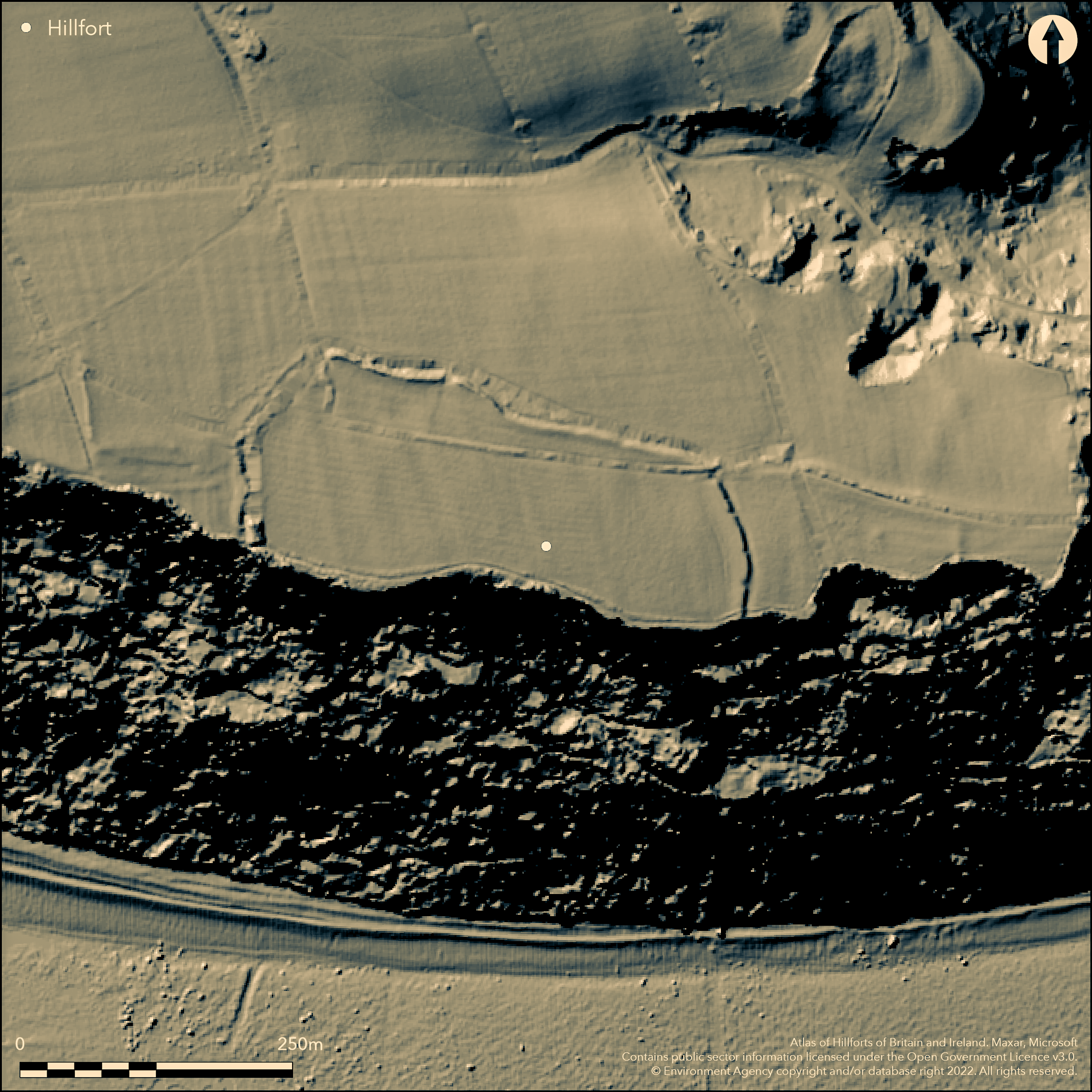
LiDAR 1m DTM Hillshade
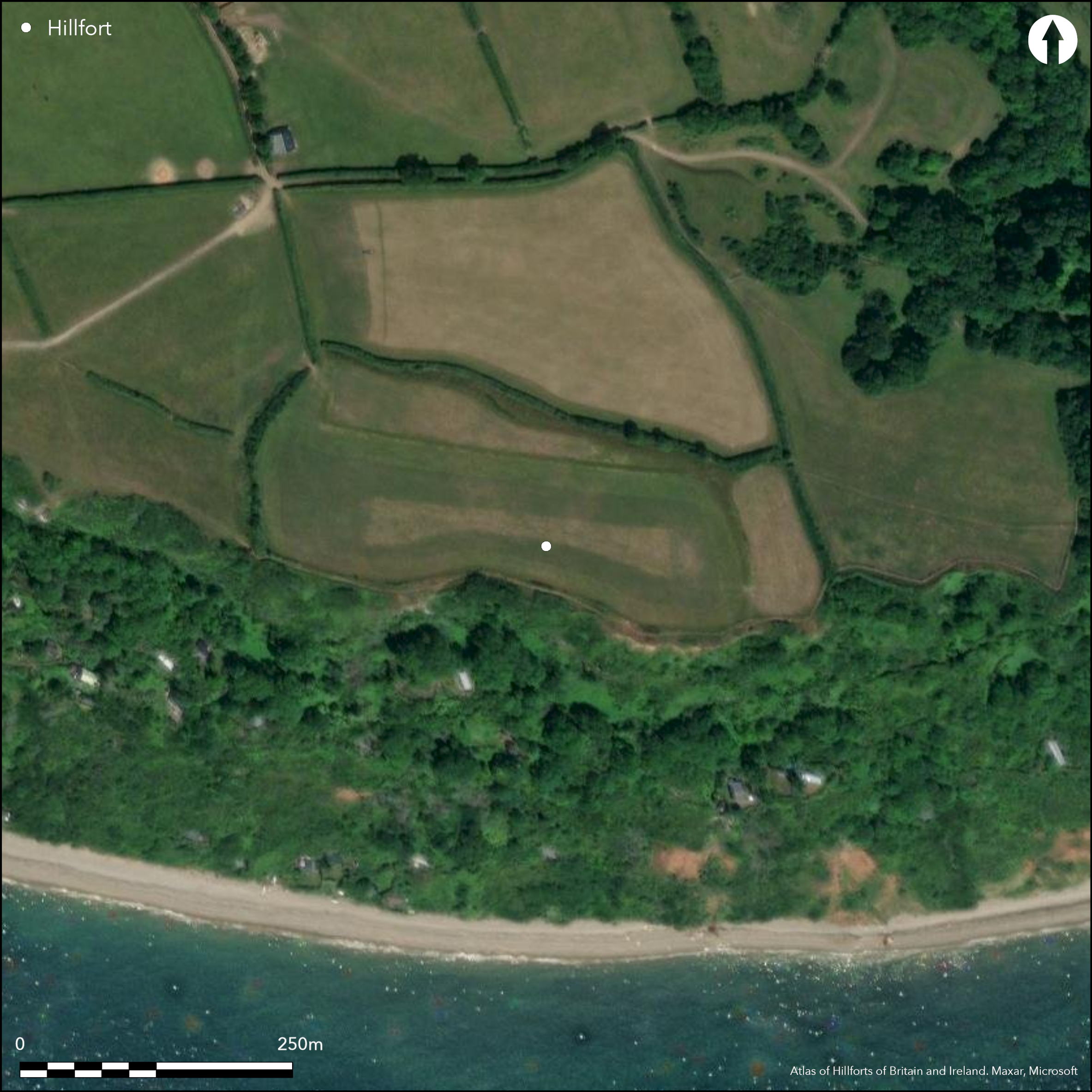
Satellite Imagery
LiDAR 1m DTM Hillshade
Satellite Imagery
Scroll left/right to view further images.
HER: Devon MDV10899 (None)
NMR: SY 18 NE 11 (448903)
SM: 1017772
NGR: SY18828819
X: 318867 Y: 88175 (OSGB36)
Univallate level terrain fort located on S-facing chalk plateau at Berry Cliff, Branscombe directly above sea to S. Very steep, but not precipitous, cliffs to S, level surrounds elsewhere. Roughly sub-rectangular shaped measures c. 315m E-W by 140m, with flat internal area of c. 3ha. Defended on N, E and W sides by earthen and flint rampart to 1m high and 4m wide on N and E, with U-shaped ditch, 4.5m wide with maximum depth 1.1m, and counterscarp visible on N. Rampart on W and NW now only short stretch to 0.5m high. It is probable that the middle chalk cliff face has been eroded back since prehistory and that the site could have formed a complete circuit. Original inturned entrance at NW corner, with passage c. 17m long, S inturn 14m long, 6m wide and 0.6m high. Corresponding inturn much damaged by vehicle access giving gap 2m-3m wide. Small holes in ditch bottom dug by P.O. Hutchinson 1872, three on NW defence and one to SW. Found natural, yellow clay 0.91m below surface and several beach pebbles, possible slingstones. South West Coast Path on S at cliff edge. Interior pasture with trees on surrounds, wooded cliffs on S quadrants. Sporadic dumping has occurred on N and NW ditch infilled as result. On 1st Ed. OS map (1889). Undated.
Citizen Science: ✗
Reliability of Data: Confirmed
Reliability of Interpretation: Confirmed
X: -350649 Y: 6566198 (EPSG: 3857)
Longitude: -3.1499330476742182 Latitude: 50.68748447927264 (EPSG:4326)
Country: England
Current County or Unitary Authority: Devon
Historic County: Devon
Current Parish/Community/Council/Townland: Branscombe
South West Coast Path on S at cliff edge. Sporadic dumping has occurred on N and NW ditch infilled as result.
| Extant | ✓ |
| Cropmark | ✗ |
| Likely Destroyed | ✗ |
Interior pasture with trees on surrounds, wooded cliffs on S quadrants.
| Woodland | ✗ |
| Commercial Forestry Plantation | ✗ |
| Parkland | ✗ |
| Pasture (Grazing) | ✓ |
| Arable | ✗ |
| Scrub/Bracken | ✗ |
| Bare Outcrop | ✗ |
| Heather/Moorland | ✗ |
| Heath | ✗ |
| Built-up | ✗ |
| Coastal Grassland | ✗ |
| Other | ✗ |
Univallate level terrain fort located on S-facing chalk plateau at Berry Cliff, Branscombe directly above sea to S. Very steep, but not precipitous, cliffs to S, level surrounds elsewhere.
| Contour Fort | ✗ |
| Partial Contour Fort | ✗ |
| Promontory Fort | ✗ |
| Hillslope Fort | ✗ |
| Level Terrain Fort | ✓ |
| Marsh Fort | ✗ |
| Multiple Enclosure Fort | ✗ |
| Hilltop | ✗ |
| Coastal Promontory | ✗ |
| Inland Promontory | ✗ |
| Valley Bottom | ✗ |
| Knoll/Hillock/Outcrop | ✗ |
| Ridge | ✗ |
| Cliff/Plateau-edge/Scarp | ✓ |
| Hillslope | ✗ |
| Lowland | ✗ |
| Spur | ✗ |
Dominant Topographic Feature: Plateau edge
| North | ✗ |
| Northeast | ✗ |
| East | ✗ |
| Southeast | ✗ |
| South | ✗ |
| Southwest | ✗ |
| West | ✗ |
| Northwest | ✗ |
| Level | ✓ |
Altitude: 137.0m
N/A
None.
Reliability: D - None
| Pre 1200BC | ✗ |
| 1200BC - 800BC | ✗ |
| 800BC - 400BC | ✗ |
| 400BC - AD50 | ✗ |
| AD50 - AD400 | ✗ |
| AD400 - AD 800 | ✗ |
| Post AD800 | ✗ |
| Unknown | ✓ |
| Pre Hillfort: | None |
| Post Hillfort: | Possible post-medieval garden site. |
Mentioned in 18th century, Dean Miles, Dean of Exeter, noting in 'Parochial Collections' as 'a small encampment on ye cliff of which there are some small remains, but ye mounds are very slight'. Small diggings by P.O.Hutchinson 1872. On 1st Ed. OS map (1889). RCHME survey, ref. no. 762179.
| Excavation (1872): | P.O. Hutchinson |
| 1st Identified Map Depiction (1889): | OS map. |
| 1st Identified Written Reference (None): | Dean Miles, Dean of Exeter, mention. |
| Earthwork Survey (None): | None |
Several beach pebbles, possible slingstones found in 1872 ditch diggings.
None
| None | ✓ |
| Spring | ✗ |
| Stream | ✗ |
| Pool | ✗ |
| Flush | ✗ |
| Well | ✗ |
| Other | ✗ |
None
| No Known Features | ✓ |
| Round Stone Structures | ✗ |
| Rectangular Stone Structures | ✗ |
| Curvilinear Platforms | ✗ |
| Other Roundhouse Evidence | ✗ |
| Pits | ✗ |
| Quarry Hollows | ✗ |
| Other | ✗ |
None
| No Known Excavation | ✗ |
| Pits | ✗ |
| Postholes | ✗ |
| Roundhouses | ✗ |
| Rectangular Structures | ✗ |
| Roads/Tracks | ✗ |
| Quarry Hollows | ✗ |
| Other | ✗ |
| Nothing Found | ✓ |
None
| No Known Geophysics | ✓ |
| Pits | ✗ |
| Roundhouses | ✗ |
| Rectangular Structures | ✗ |
| Roads/Tracks | ✗ |
| Quarry Hollows | ✗ |
| Other | ✗ |
| Nothing Found | ✗ |
Several beach pebbles, possible slingstones found in 1872 ditch diggings.
| No Known Finds | ✗ |
| Pottery | ✗ |
| Metal | ✗ |
| Metalworking | ✗ |
| Human Bones | ✗ |
| Animal Bones | ✗ |
| Lithics | ✗ |
| Environmental | ✗ |
| Other | ✓ |
None
| APs Not Checked | ✓ |
| None | ✗ |
| Roundhouses | ✗ |
| Rectangular Structures | ✗ |
| Pits | ✗ |
| Postholes | ✗ |
| Roads/Tracks | ✗ |
| Other | ✗ |
Original inturned entrance at NW corner, with passage c. 17m long, S inturn 14m long, 6m wide and 0.6m high. Corresponding inturn much damaged by vehicle access giving gap 2m-3m wide.
| 1: | None |
| 2: | None |
Guard Chambers: ✗
Chevaux de Frise: ✗
| 1. In-turned (North west): | Damaged. |
| 1. Passage-way/Corridor (North west): | Passage c. 17m long. |
Defended on N, E and W sides by earthen and flint rampart to 1m high and 4m wide on N and E, with U-shaped ditch, 4.5m wide with maximum depth 1.1m, and counterscarp visible on N. Rampart on W and NW now only short stretch to 0.5m high. It is probable that the middle chalk cliff face has been eroded back since prehistory and that the site could have formed a complete circuit. Small holes in ditch bottom dug by P.O. Hutchinson 1872, three on NW defence and one to SW. Found natural, yellow clay 0.91m below surface.
| Area 1: | 3.0ha. |
| Total: | 3.0ha. |
Total Footprint Area: Noneha.
None
| ✗ | None |
| ✗ | It is probable that the middle chalk cliff face has been eroded back since prehistory and that the site could have formed a complete circuit. |
| NE Quadrant: | 1 |
| SE Quadrant: | 0 |
| SW Quadrant: | 0 |
| NW Quadrant: | 1 |
| Total: | 1 |
| Partial Univallate | ✓ |
| Univallate | ✗ |
| Partial Bivallate | ✗ |
| Bivallate | ✗ |
| Partial Multivallate | ✗ |
| Multivallate | ✗ |
| Unknown | ✗ |
| Partial Univallate | ✗ |
| Univallate | ✗ |
| Partial Bivallate | ✗ |
| Bivallate | ✗ |
| Partial Multivallate | ✗ |
| Multivallate | ✗ |
Earthen bank with flint nodules. Counterscarp visible on N.
| None | ✗ |
| Earthen Bank | ✓ |
| Stone Wall | ✗ |
| Rubble | ✗ |
| Wall-walk | ✗ |
| Evidence of Timber | ✗ |
| Vitrification | ✗ |
| Other Burning | ✗ |
| Palisade | ✗ |
| Counter Scarp Bank | ✓ |
| Berm | ✗ |
| Unfinished | ✗ |
| Other | ✗ |
Small holes in ditch bottom dug by P.O. Hutchinson 1872, three on NW defence and one to SW. Found natural, yellow clay 0.91m below surface.
| None | ✗ |
| Earthen Bank | ✗ |
| Stone Wall | ✗ |
| Murus Duplex | ✗ |
| Timber-framed | ✗ |
| Timber-laced | ✗ |
| Vitrification | ✗ |
| Other Burning | ✗ |
| Palisade | ✗ |
| Counter Scarp Bank | ✗ |
| Berm | ✗ |
| Unfinished | ✗ |
| No Known Excavation | ✗ |
| Other | ✓ |
| ✗ | None |
| ✓ | U-shaped ditch. |
Number of Ditches: 1
| ✗ | None |
Hutchinson P. O. 1909. A History of Sidmouth, 1, 58.
Miles, Jeremiah, Dean of Exeter, 1747-62. Branscombe, Parochial Collections, 4.
Wall, J.C. 1906. Ancient Earthworks, In W. Page (ed), The Victoria County History of the County of Devon, Vol I, London: James Street, Haymarket, 575.
Atlas of Hillforts:
Wikidata:
This work is licensed under CC BY-SA 4.0

 and should be cited as:
Lock, Gary and Ralston, Ian. 2024. Atlas of Hillforts of Britain and Ireland. Available at: https://hillforts.arch.ox.ac.uk
Document Version 1.1