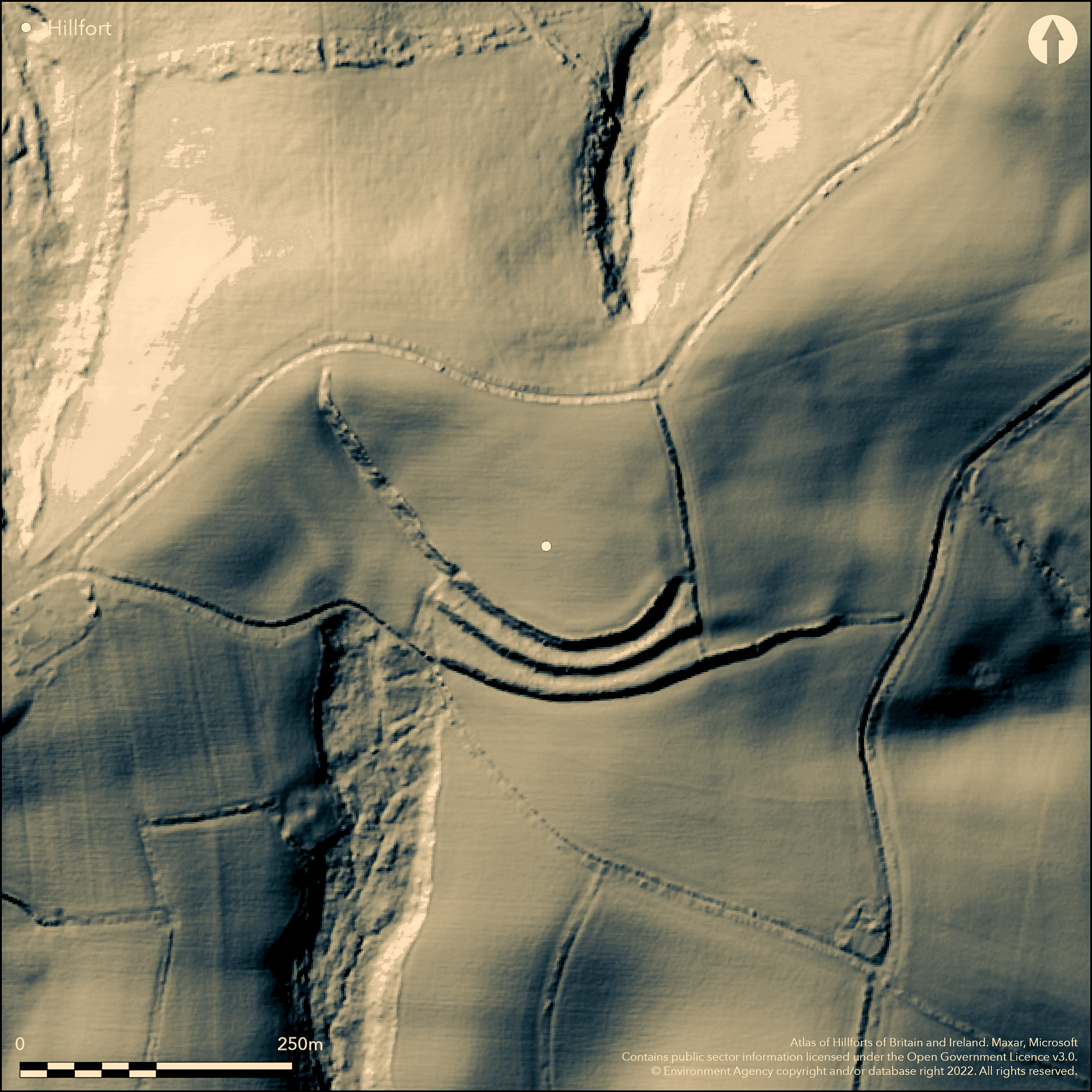
LiDAR 1m DTM Hillshade
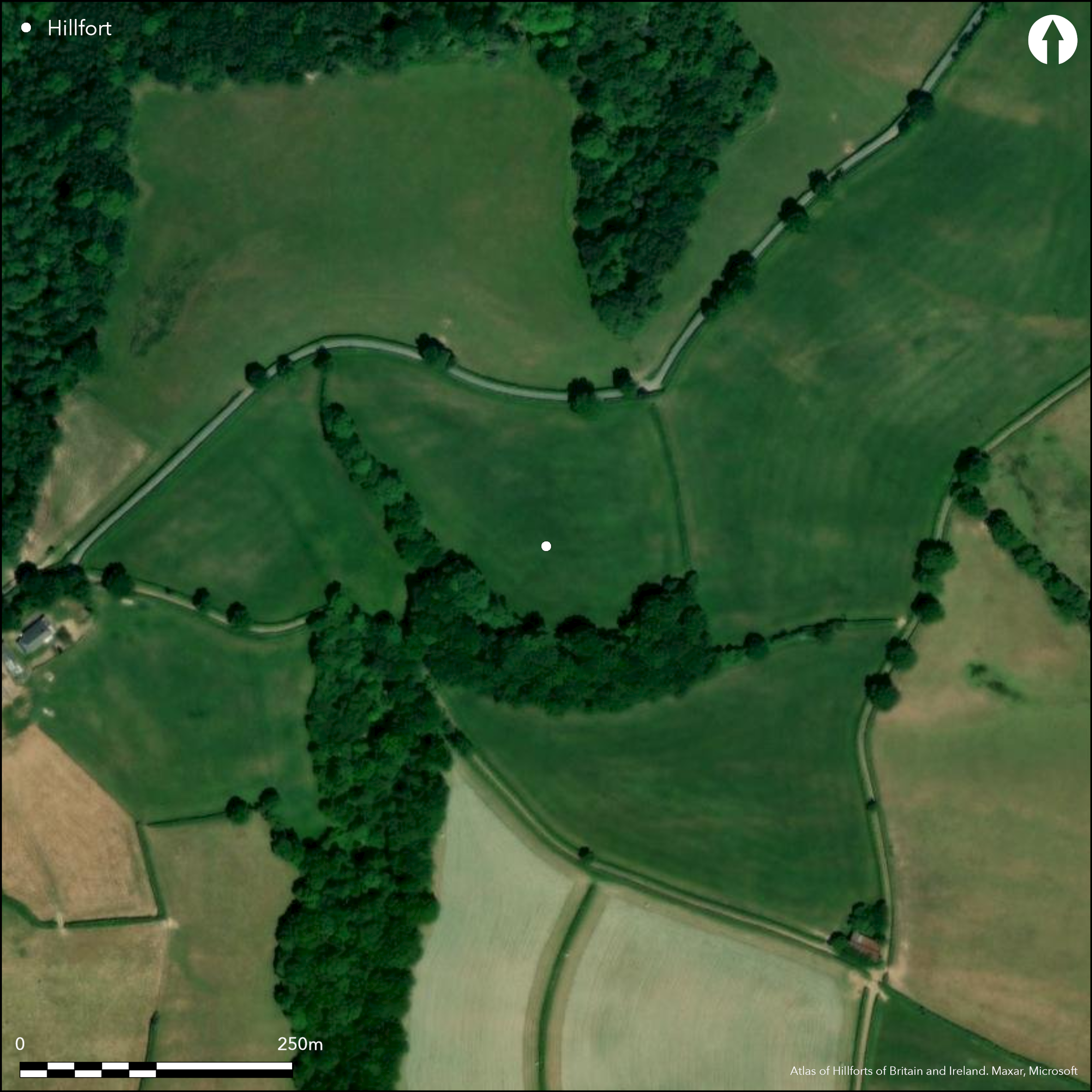
Satellite Imagery
LiDAR 1m DTM Hillshade
Satellite Imagery
Scroll left/right to view further images.
HER: Devon MDV9425 (None)
NMR: SX 89 NW 1 (447429)
SM: 1003826
NGR: SX80869717
X: 280875 Y: 97163 (OSGB36)
Part cropmark of multivallate contour hillfort located on prominent hill of Castle Down above W bank of Culvery Brook SW of Crediton. Extensive views, especially N over River Yeo valley. Steep surrounding slopes, less along ridge on SSE. Pear-shaped with internal area c. 2ha. Originally triple ramparts, now only surviving in part on S, where three prominent ramparts and medial ditches curve around the hill through deciduous woodland for c. 160m. The rest of circuit nearly ploughed-out and destroyed in arable fields, apart from steep, wooded, outer scarp of inner rampart on NW. Hedge bank tops inner rampart with faint traces of quarry scoops/ditch around circuit interior. Traces of earthworks in fields to E and W of site marked on Lady Fox's plan of 1950. Position of entrance unclear. On 1st Ed. OS map (1889). Minimal investigations, undated.
Citizen Science: ✗
Reliability of Data: Confirmed
Reliability of Interpretation: Confirmed
X: -410820 Y: 6579255 (EPSG: 3857)
Longitude: -3.690457580002022 Latitude: 50.76173250496911 (EPSG:4326)
Country: England
Current County or Unitary Authority: Devon
Historic County: Devon
Current Parish/Community/Council/Townland: Crediton Hamlets
Mostly ploughed-out and cropmark. Only part of S survives. Affected by road/track to Demmitts Farm on N. On Heritage at Risk Register (2015).
| Extant | ✓ |
| Cropmark | ✓ |
| Likely Destroyed | ✓ |
Cultivated regime, pasture and wood. Access road/track.
| Woodland | ✓ |
| Commercial Forestry Plantation | ✗ |
| Parkland | ✗ |
| Pasture (Grazing) | ✓ |
| Arable | ✓ |
| Scrub/Bracken | ✗ |
| Bare Outcrop | ✗ |
| Heather/Moorland | ✗ |
| Heath | ✗ |
| Built-up | ✗ |
| Coastal Grassland | ✗ |
| Other | ✓ |
Cropmark of multivallate contour hillfort located on prominent hill of Castle Down above W bank of Culvery Brook SW of Crediton. Extensive views, especially N over River Yeo valley. Steep surrounding slopes, less along ridge on SSE.
| Contour Fort | ✓ |
| Partial Contour Fort | ✗ |
| Promontory Fort | ✗ |
| Hillslope Fort | ✗ |
| Level Terrain Fort | ✗ |
| Marsh Fort | ✗ |
| Multiple Enclosure Fort | ✗ |
| Hilltop | ✓ |
| Coastal Promontory | ✗ |
| Inland Promontory | ✗ |
| Valley Bottom | ✗ |
| Knoll/Hillock/Outcrop | ✗ |
| Ridge | ✗ |
| Cliff/Plateau-edge/Scarp | ✗ |
| Hillslope | ✗ |
| Lowland | ✗ |
| Spur | ✗ |
Dominant Topographic Feature: Hill top
| North | ✗ |
| Northeast | ✗ |
| East | ✗ |
| Southeast | ✗ |
| South | ✗ |
| Southwest | ✗ |
| West | ✗ |
| Northwest | ✗ |
| Level | ✓ |
Altitude: 170.0m
N/A
None.
Reliability: D - None
| Pre 1200BC | ✗ |
| 1200BC - 800BC | ✗ |
| 800BC - 400BC | ✗ |
| 400BC - AD50 | ✗ |
| AD50 - AD400 | ✗ |
| AD400 - AD 800 | ✗ |
| Post AD800 | ✗ |
| Unknown | ✓ |
| Pre Hillfort: | None |
| Post Hillfort: | None |
On Woolcombe MSS 1830-47. On 1st Ed. OS map (1889). RCHME survey, ref. no. 762130.
| 1st Identified Map Depiction (1889): | OS map. |
| 1st Identified Written Reference (None): | On Woolcombe Manuscript. |
| Earthwork Survey (None): | None |
Faint traces of quarry scoops/ditch to inner rampart around circuit interior.
None
| None | ✓ |
| Spring | ✗ |
| Stream | ✗ |
| Pool | ✗ |
| Flush | ✗ |
| Well | ✗ |
| Other | ✗ |
Faint traces of quarry scoops/ditch to inner rampart around circuit interior.
| No Known Features | ✗ |
| Round Stone Structures | ✗ |
| Rectangular Stone Structures | ✗ |
| Curvilinear Platforms | ✗ |
| Other Roundhouse Evidence | ✗ |
| Pits | ✗ |
| Quarry Hollows | ✓ |
| Other | ✗ |
None
| No Known Excavation | ✓ |
| Pits | ✗ |
| Postholes | ✗ |
| Roundhouses | ✗ |
| Rectangular Structures | ✗ |
| Roads/Tracks | ✗ |
| Quarry Hollows | ✗ |
| Other | ✗ |
| Nothing Found | ✗ |
None
| No Known Geophysics | ✓ |
| Pits | ✗ |
| Roundhouses | ✗ |
| Rectangular Structures | ✗ |
| Roads/Tracks | ✗ |
| Quarry Hollows | ✗ |
| Other | ✗ |
| Nothing Found | ✗ |
None
| No Known Finds | ✓ |
| Pottery | ✗ |
| Metal | ✗ |
| Metalworking | ✗ |
| Human Bones | ✗ |
| Animal Bones | ✗ |
| Lithics | ✗ |
| Environmental | ✗ |
| Other | ✗ |
None
| APs Not Checked | ✓ |
| None | ✗ |
| Roundhouses | ✗ |
| Rectangular Structures | ✗ |
| Pits | ✗ |
| Postholes | ✗ |
| Roads/Tracks | ✗ |
| Other | ✗ |
Position of entrance unclear.
| 0: | None |
| 2: | None |
Guard Chambers: ✗
Chevaux de Frise: ✗
Originally triple ramparts, now only surviving in part on S, where three prominent ramparts and medial ditches curve around the hill through deciduous woodland for c. 160m. The rest of circuit nearly ploughed-out and destroyed in arable fields, apart from steep, wooded, outer scarp of inner rampart on NW. Hedge bank tops inner rampart.
| Area 1: | 2.0ha. |
| Total: | 2.0ha. |
Total Footprint Area: Noneha.
None
| ✗ | None |
| ✗ | Originally triple ramparts, now only surviving in part on S. |
| NE Quadrant: | 0 |
| SE Quadrant: | 3 |
| SW Quadrant: | 3 |
| NW Quadrant: | 0 |
| Total: | 3 |
| Partial Univallate | ✗ |
| Univallate | ✗ |
| Partial Bivallate | ✗ |
| Bivallate | ✗ |
| Partial Multivallate | ✓ |
| Multivallate | ✗ |
| Unknown | ✗ |
| Partial Univallate | ✗ |
| Univallate | ✗ |
| Partial Bivallate | ✗ |
| Bivallate | ✗ |
| Partial Multivallate | ✗ |
| Multivallate | ✗ |
None
| None | ✗ |
| Earthen Bank | ✓ |
| Stone Wall | ✗ |
| Rubble | ✗ |
| Wall-walk | ✗ |
| Evidence of Timber | ✗ |
| Vitrification | ✗ |
| Other Burning | ✗ |
| Palisade | ✗ |
| Counter Scarp Bank | ✗ |
| Berm | ✗ |
| Unfinished | ✗ |
| Other | ✗ |
None
| None | ✗ |
| Earthen Bank | ✗ |
| Stone Wall | ✗ |
| Murus Duplex | ✗ |
| Timber-framed | ✗ |
| Timber-laced | ✗ |
| Vitrification | ✗ |
| Other Burning | ✗ |
| Palisade | ✗ |
| Counter Scarp Bank | ✗ |
| Berm | ✗ |
| Unfinished | ✗ |
| No Known Excavation | ✓ |
| Other | ✗ |
| ✗ | None |
| ✓ | None |
Number of Ditches: 3
| ✗ | None |
Wall, J.C. 1906. Ancient Earthworks, In W. Page (ed), The Victoria County History of the County of Devon, Vol I, London: James Street, Haymarket.
Woollcombe MSS, c.1830-47 Devon and Exeter Institution Library.
Atlas of Hillforts:
Wikidata:
This work is licensed under CC BY-SA 4.0

 and should be cited as:
Lock, Gary and Ralston, Ian. 2024. Atlas of Hillforts of Britain and Ireland. Available at: https://hillforts.arch.ox.ac.uk
Document Version 1.1