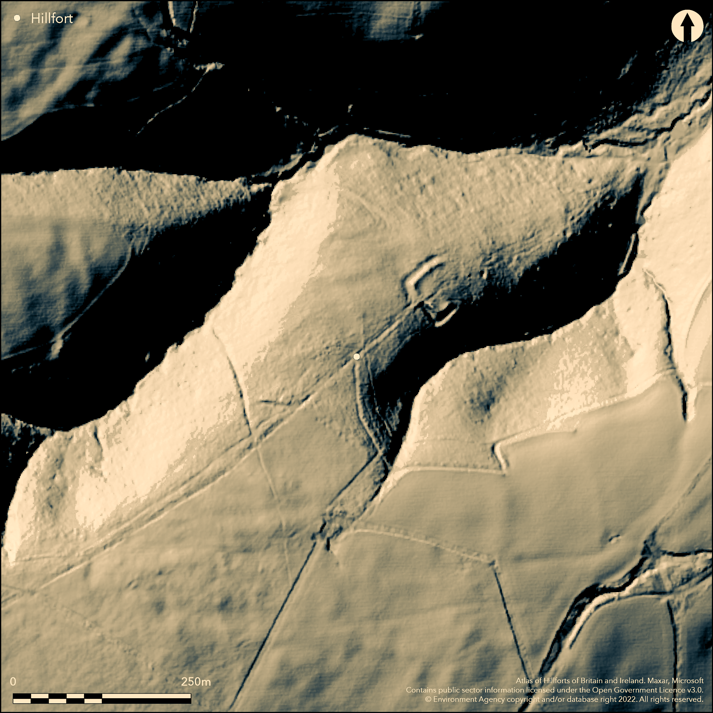
LiDAR 1m DTM Hillshade
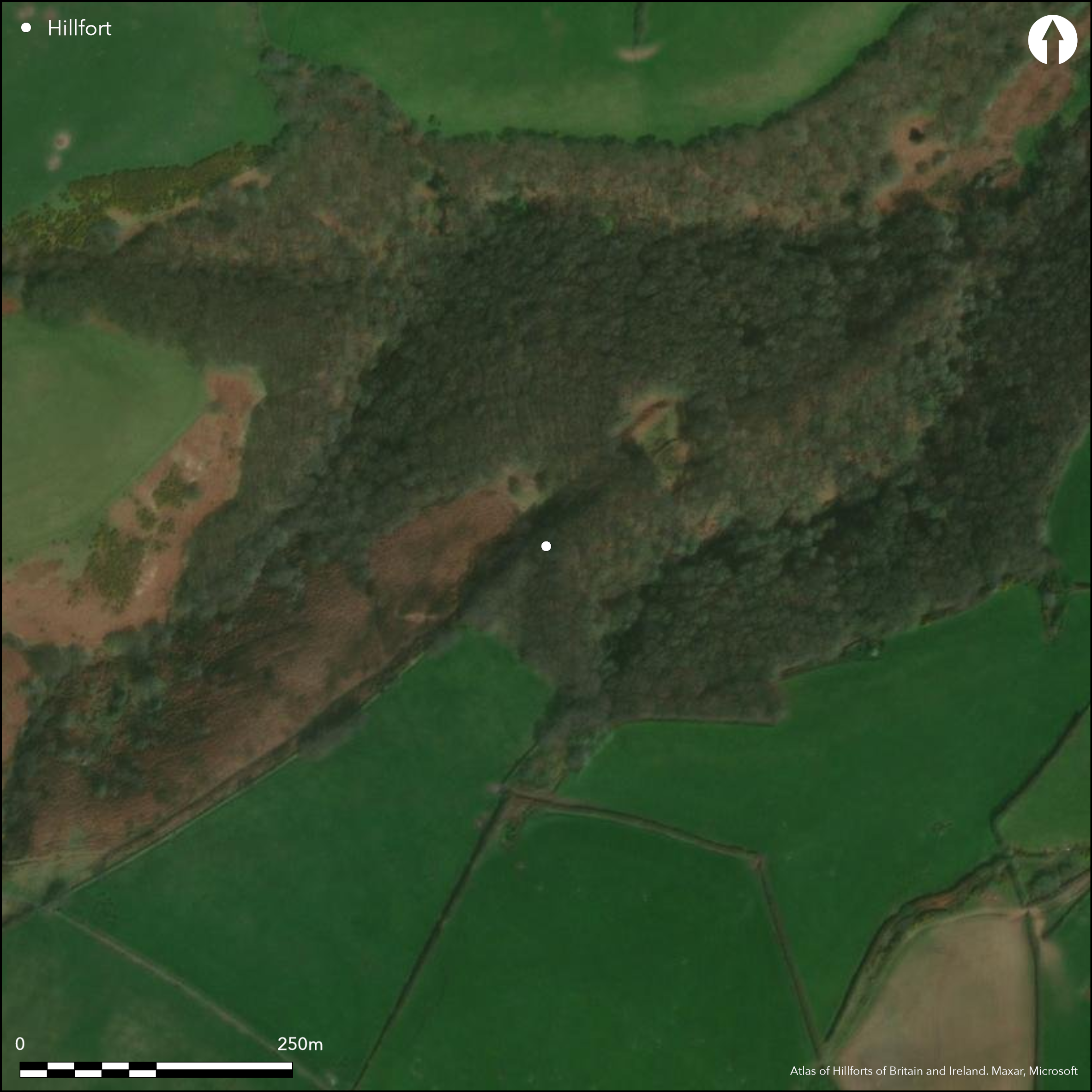
Satellite Imagery
LiDAR 1m DTM Hillshade
Satellite Imagery
Scroll left/right to view further images.
HER: Exmoor National Park MSO7896 (None)
NMR: SS 84 SE 3 (35939)
SM: 1006204
NGR: SS 8585 4490
X: 285850 Y: 144900 (OSGB36)
Possible hillslope fort sited on small shelf part-way down steep NE-facing slope of high narrow promontory which runs for c. 400m between two coombs 250m apart NE-SW. Within Berry Castle Wood. Site rectangular on shelf only c. 70m wide by 60m NE on moderate then steep slope, with area estimated at c. 0.4ha. Overlooked on W. The site is questionable for a hillfort and could be just a hillslope enclosure or indeed medieval farmstead or hunting lodge site, although banks massive. Defined by single bank and ditch on N, S and W, absent on E where slope very steep. Short length of outer bank and ditch on SE. Banks c. to 1.5m high internally and to 3m high externally from ditch bottom, all c. 6m across. Entrance unclear, possibly on S. No sign of structures, but interior may have been part levelled. Outwork c. 150m to SW. Stone-faced, beech-topped boundary bank runs through centre of site marking parish boundary. Site possibly unfinished. Wooded. On 1st Ed. OS map (1889). Few investigations. Undated.
Citizen Science: ✗
Reliability of Data: Confirmed
Reliability of Interpretation: Unconfirmed
X: -404641 Y: 6655297 (EPSG: 3857)
Longitude: -3.6349509498874673 Latitude: 51.19183303214155 (EPSG:4326)
Country: England; None
Current County or Unitary Authority: Devon
Historic County: Devon
Current Parish/Community/Council/Townland: Luccombe; Porlock
None
| Extant | ✓ |
| Cropmark | ✗ |
| Likely Destroyed | ✗ |
Wooded within Berry Castle Wood. Overgrown with bracken and scrub.
| Woodland | ✓ |
| Commercial Forestry Plantation | ✗ |
| Parkland | ✗ |
| Pasture (Grazing) | ✗ |
| Arable | ✗ |
| Scrub/Bracken | ✓ |
| Bare Outcrop | ✗ |
| Heather/Moorland | ✗ |
| Heath | ✗ |
| Built-up | ✗ |
| Coastal Grassland | ✗ |
| Other | ✗ |
Possible hillslope fort sited on small shelf part-way down steep NE-facing slope of high narrow promontory which runs for c. 400m between two coombs 250m apart NE-SW.
| Contour Fort | ✗ |
| Partial Contour Fort | ✗ |
| Promontory Fort | ✗ |
| Hillslope Fort | ✓ |
| Level Terrain Fort | ✗ |
| Marsh Fort | ✗ |
| Multiple Enclosure Fort | ✗ |
| Hilltop | ✗ |
| Coastal Promontory | ✗ |
| Inland Promontory | ✓ |
| Valley Bottom | ✗ |
| Knoll/Hillock/Outcrop | ✗ |
| Ridge | ✗ |
| Cliff/Plateau-edge/Scarp | ✗ |
| Hillslope | ✓ |
| Lowland | ✗ |
| Spur | ✗ |
Dominant Topographic Feature: Promontory
| North | ✗ |
| Northeast | ✗ |
| East | ✗ |
| Southeast | ✗ |
| South | ✗ |
| Southwest | ✗ |
| West | ✗ |
| Northwest | ✗ |
| Level | ✓ |
Altitude: 411.0m
Boundary Type: Parish/Townland
None.
Reliability: D - None
| Pre 1200BC | ✗ |
| 1200BC - 800BC | ✗ |
| 800BC - 400BC | ✗ |
| 400BC - AD50 | ✗ |
| AD50 - AD400 | ✗ |
| AD400 - AD 800 | ✗ |
| Post AD800 | ✗ |
| Unknown | ✓ |
| Pre Hillfort: | None |
| Post Hillfort: | None |
On 1st Ed. OS map (1889). Field investigations Ordnance Survey 1965, 1987. Surveyed at 1:1000 scale as part of the RCHME Exmoor Project 1997. Surveyed part of Exmoor Scheduled Monument Condition Assessment. 2015.
| 1st Identified Map Depiction (1889): | OS map. |
| Earthwork Survey (1997): | Surveyed at 1:1000 scale as part of the RCHME Exmoor Project. |
| Earthwork Survey (2015): | Surveyed part of Exmoor Scheduled Monument Condition Assessment. |
| Other (None): | Field investigations OS. |
No sign of structures, but interior may have been part levelled.
None
| None | ✓ |
| Spring | ✗ |
| Stream | ✗ |
| Pool | ✗ |
| Flush | ✗ |
| Well | ✗ |
| Other | ✗ |
No sign of structures, but interior may have been part levelled.
| No Known Features | ✓ |
| Round Stone Structures | ✗ |
| Rectangular Stone Structures | ✗ |
| Curvilinear Platforms | ✗ |
| Other Roundhouse Evidence | ✗ |
| Pits | ✗ |
| Quarry Hollows | ✗ |
| Other | ✗ |
None
| No Known Excavation | ✓ |
| Pits | ✗ |
| Postholes | ✗ |
| Roundhouses | ✗ |
| Rectangular Structures | ✗ |
| Roads/Tracks | ✗ |
| Quarry Hollows | ✗ |
| Other | ✗ |
| Nothing Found | ✗ |
None
| No Known Geophysics | ✓ |
| Pits | ✗ |
| Roundhouses | ✗ |
| Rectangular Structures | ✗ |
| Roads/Tracks | ✗ |
| Quarry Hollows | ✗ |
| Other | ✗ |
| Nothing Found | ✗ |
None
| No Known Finds | ✓ |
| Pottery | ✗ |
| Metal | ✗ |
| Metalworking | ✗ |
| Human Bones | ✗ |
| Animal Bones | ✗ |
| Lithics | ✗ |
| Environmental | ✗ |
| Other | ✗ |
None
| APs Not Checked | ✓ |
| None | ✗ |
| Roundhouses | ✗ |
| Rectangular Structures | ✗ |
| Pits | ✗ |
| Postholes | ✗ |
| Roads/Tracks | ✗ |
| Other | ✗ |
Entrance uncertain, but may be on S.
| 0: | None |
| 2: | None |
Guard Chambers: ✗
Chevaux de Frise: ✗
| 1. Simple Gap (South): | Uncertain. |
Defined by single bank and ditch on N, S and W, absent on E where slope very steep. Short length of outer bank and ditch on SE. Banks c. to 1.5m high internally and to 3m high externally from ditch bottom, all c. 6m across.
| Area 1: | 0.4ha. |
| Total: | 0.4ha. |
Total Footprint Area: Noneha.
None
| ✗ | Estimated area. |
| ✗ | Bank absent on E. |
| NE Quadrant: | 1 |
| SE Quadrant: | 2 |
| SW Quadrant: | 1 |
| NW Quadrant: | 1 |
| Total: | 2 |
| Partial Univallate | ✓ |
| Univallate | ✗ |
| Partial Bivallate | ✓ |
| Bivallate | ✗ |
| Partial Multivallate | ✗ |
| Multivallate | ✗ |
| Unknown | ✗ |
| Partial Univallate | ✗ |
| Univallate | ✗ |
| Partial Bivallate | ✗ |
| Bivallate | ✗ |
| Partial Multivallate | ✗ |
| Multivallate | ✗ |
Possibly stony earthen bank and unfinished.
| None | ✗ |
| Earthen Bank | ✓ |
| Stone Wall | ✗ |
| Rubble | ✓ |
| Wall-walk | ✗ |
| Evidence of Timber | ✗ |
| Vitrification | ✗ |
| Other Burning | ✗ |
| Palisade | ✗ |
| Counter Scarp Bank | ✗ |
| Berm | ✗ |
| Unfinished | ✓ |
| Other | ✗ |
None
| None | ✗ |
| Earthen Bank | ✗ |
| Stone Wall | ✗ |
| Murus Duplex | ✗ |
| Timber-framed | ✗ |
| Timber-laced | ✗ |
| Vitrification | ✗ |
| Other Burning | ✗ |
| Palisade | ✗ |
| Counter Scarp Bank | ✗ |
| Berm | ✗ |
| Unfinished | ✗ |
| No Known Excavation | ✓ |
| Other | ✗ |
| ✗ | None |
| ✓ | None |
Number of Ditches: 1
| ✗ | None |
Allcroft, A.H. 1908. Earthwork of England : prehistoric, Roman, Saxon, Danish, Norman, and mediaeval, London: Macmillan, 207.
Burrow, E.J. 1924. The ancient earthworks and camps of Somerset, Cheltenham: E.J. Burrow, 62-3.
Burrow, I. 1981. Hillfort and hill-top settlement in Somerset in the first to eighth centuries AD, British Archaeological Report (BAR) British Series 1, 91.
Dobson, D.P. 1931, The Archaeology of Somerset, 206.
Grinsell, L.V. 1970. The archaeology of Exmoor : Bideford Bay to Bridgwater, Newton Abbot: David and Charles, 79,85,201.
Page, J.L.W. 1890. An Exploration of Exmoor and the Hill Country of West Somerset: With Notes on Its Archaeology, 85-6.
Page, W. ed. 1911. Ancient earthworks, The Victoria History of Somerset, Volume Two, The Victoria History of the Counties of England, London: Constable and Co, 479.
Savage, J. 1830. History of the Hundred of Carhampton, 91-2.
Whybrow, C. 1967. Some multivallate hillforts on Exmoor and in North Devon, Proc Devon Archaeol Soc, 9-11.
Wilson-North, R. 1997. Berry Castle, Porlock, Somerset, Unpublished RCHME report.
<31> Gent, T. and Manning, P., 2015, Exmoor National Park Scheduled Monument Condition Survey 2015 - Draft (Report). SEM8278.
Atlas of Hillforts:
Wikidata:
This work is licensed under CC BY-SA 4.0

 and should be cited as:
Lock, Gary and Ralston, Ian. 2024. Atlas of Hillforts of Britain and Ireland. Available at: https://hillforts.arch.ox.ac.uk
Document Version 1.1