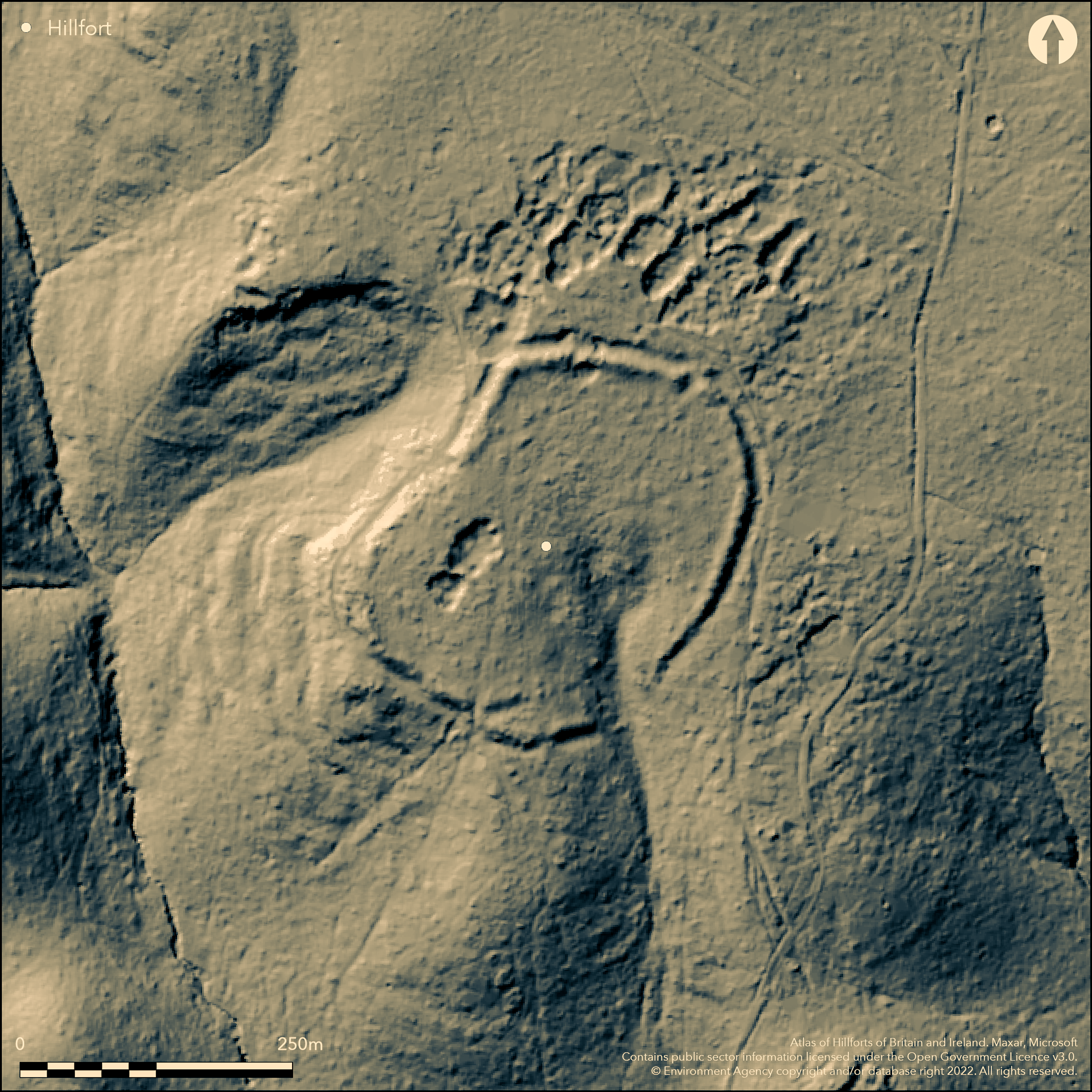
LiDAR 1m DTM Hillshade
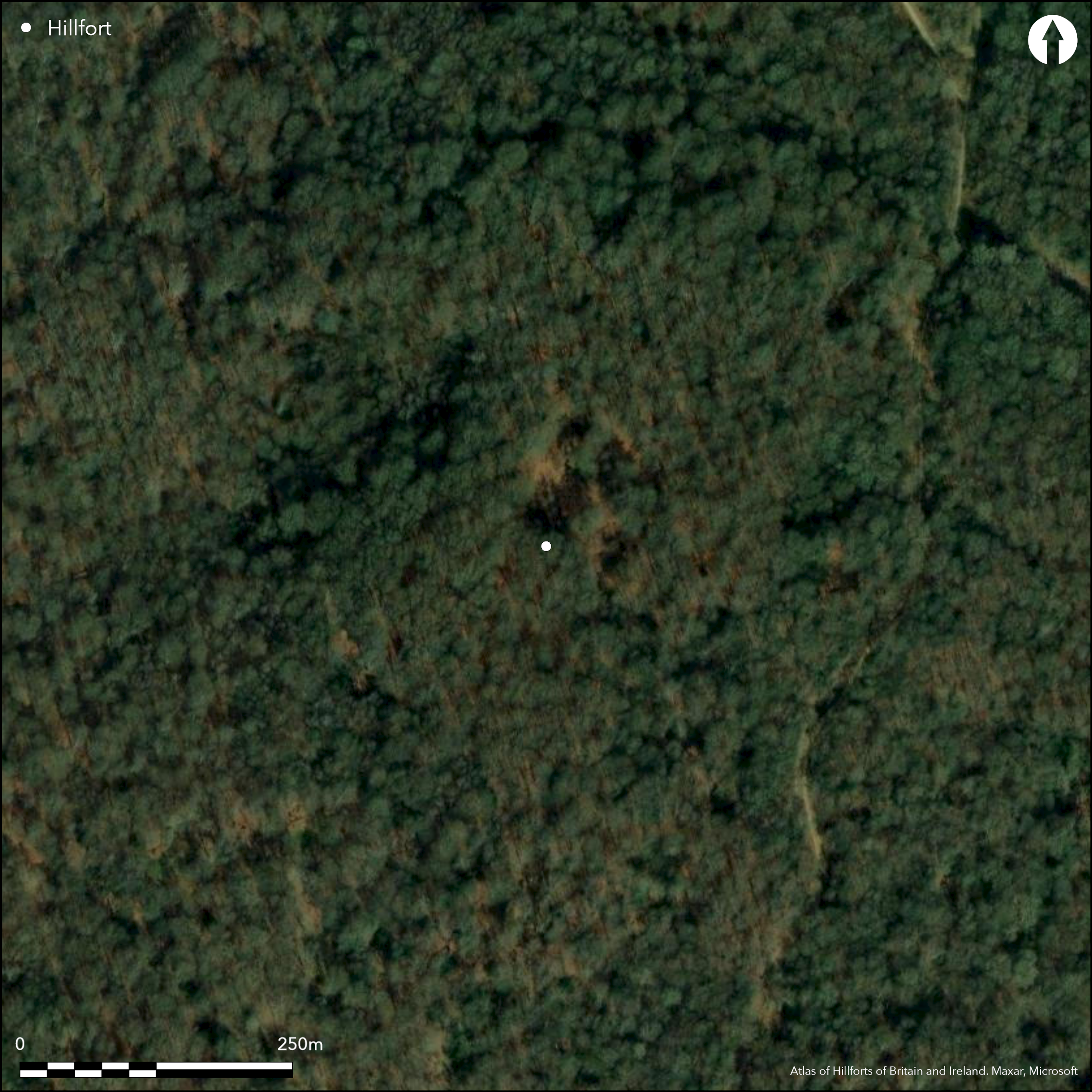
Satellite Imagery
LiDAR 1m DTM Hillshade
Satellite Imagery
Scroll left/right to view further images.
HER: Essex 130 (None)
NMR: TQ 49 NW 4 (408256)
SM: 1013518
NGR: TQ 4186 9752
X: 541868 Y: 197525 (OSGB36)
Within Epping Forest, a slight univallate hillfort of 2.6ha. It occupies the SW-facing slope of a promontory below the crest of a ridge, with the enclosure following the contours in the SW, beyond which the ground drops away steeply. It was first recorded in 1872 (Cowper 1876) and became known as Cowper's Camp. It is located approximately 3km to the SW of Ambresbury Banks (Atlas No. 3533), a similar hillfort in both size and construction. The hillfort is set back in stream valleys with poor visibility. Roughly oval in form, with a single bank 1m high above the interior and between 8-18m wide and an external 8m wide ditch. Traces of a counter scarp have been recorded in the N which might have once continued all around the circuit. The partially infilled ditch is up to 1.4m deep but survives only as a buried feature in places. Excavation has shown it has a V-shaped profile. It has been partially obliterated by the road on the W side. The location of the original entrance is unproven although a possible entrance lies in the S where there is a 4.3m wide causeway across the ditch (Warren 1928, 118). Breaks occur all around the circuit and a spring issuing from the SW corner has created a gap of over 40m in this area. Later quarrying has taken place within the interior and no features contemporary with the use of the enclosure have been recorded. Investigated in 1882, when four cuttings were made through the bank and ditch by members of Essex Field Club, including General Pitt-Rivers and Worthington Smith. Flint flakes, a flint chisel or axe and fragments of pottery were unearthed. Excavated further by Hazzledine Warren in 1926-27 (ibid.), who believed the enclosure was both unfinished and a slight bank on a different alignment within the interior marked a change during construction of the hillfort, with it being extended further than originally planned. A hearth with burnt flints was found, but this might have been a later feature. Large numbers of flints were recovered including a number of 'mint' condition flint implements suggestive of an earlier flint industry on the site. Excavations in the 1950's and 70's concentrated on recovering further Mesolithic remains and flint tools (Wymer and Bonsall 1977). A marshy area lies outside the enclosure in the SW, which in common with Ambresbury Banks might have been a dammed pool. The site is recorded on 1920 1:2,500 OS mapping. Scheduled.
Citizen Science: ✗
Reliability of Data: Confirmed
Reliability of Interpretation: Confirmed
X: 5524 Y: 6738623 (EPSG: 3857)
Longitude: 0.04962568334288632 Latitude: 51.65856078004725 (EPSG:4326)
Country: England
Current County or Unitary Authority: Essex
Historic County: Essex
Current Parish/Community/Council/Townland: Loughton
None
| Extant | ✓ |
| Cropmark | ✗ |
| Likely Destroyed | ✗ |
None
| Woodland | ✓ |
| Commercial Forestry Plantation | ✗ |
| Parkland | ✗ |
| Pasture (Grazing) | ✗ |
| Arable | ✗ |
| Scrub/Bracken | ✗ |
| Bare Outcrop | ✗ |
| Heather/Moorland | ✗ |
| Heath | ✗ |
| Built-up | ✗ |
| Coastal Grassland | ✗ |
| Other | ✗ |
A partial contour fort lying at 101m OD on an inland promontory on the Epping Forest plateau
| Contour Fort | ✗ |
| Partial Contour Fort | ✓ |
| Promontory Fort | ✗ |
| Hillslope Fort | ✗ |
| Level Terrain Fort | ✗ |
| Marsh Fort | ✗ |
| Multiple Enclosure Fort | ✗ |
| Hilltop | ✗ |
| Coastal Promontory | ✗ |
| Inland Promontory | ✓ |
| Valley Bottom | ✗ |
| Knoll/Hillock/Outcrop | ✗ |
| Ridge | ✗ |
| Cliff/Plateau-edge/Scarp | ✗ |
| Hillslope | ✗ |
| Lowland | ✗ |
| Spur | ✗ |
Dominant Topographic Feature: Promontory of the Epping Forest plateau
| North | ✗ |
| Northeast | ✗ |
| East | ✗ |
| Southeast | ✗ |
| South | ✗ |
| Southwest | ✓ |
| West | ✗ |
| Northwest | ✗ |
| Level | ✗ |
Altitude: 101.0m
N/A
Coarse and finewares considered to be early and late iron Age in date were recovered during excavations in 1927-8
Reliability: B - Medium
| Pre 1200BC | ✗ |
| 1200BC - 800BC | ✗ |
| 800BC - 400BC | ✓ |
| 400BC - AD50 | ✓ |
| AD50 - AD400 | ✗ |
| AD400 - AD 800 | ✗ |
| Post AD800 | ✗ |
| Unknown | ✗ |
| Pre Hillfort: | None |
| Post Hillfort: | None |
| Artefactual: | Pottery |
First recorded in 1872 by a Mr Cowper and known as 'Cowper's Camp'. Recorded on 1920 1:2,500 OS mapping. Excavation in 1882, 1926 with plans and sections. Further excavations in 1954, 1959 and 1971 concerned with the Mesolithic flint industry (Wymer & Bonsall 1977). Field investigations in 1969 and 1975. Scheduled.
| 1st Identified Written Reference (1872): | None |
| Excavation (1882): | Essex Field Club |
| 1st Identified Map Depiction (1920): | None |
| Excavation (1926): | Warren (1928) |
| Other (1963): | Scheduled |
| Other (1969): | Field investigation |
| Other (1975): | Field investigation |
| Excavation (None): | Wymer (1977) |
No features confirmed as contemporary have been recovered. A hearth was discovered during excavation but could be a later feature. Pottery, lithics and charcoal.
A spring issues from the SW corner of the enclosure and a possible dammed pool lies outside
| None | ✗ |
| Spring | ✓ |
| Stream | ✗ |
| Pool | ✗ |
| Flush | ✗ |
| Well | ✗ |
| Other | ✗ |
None
| No Known Features | ✓ |
| Round Stone Structures | ✗ |
| Rectangular Stone Structures | ✗ |
| Curvilinear Platforms | ✗ |
| Other Roundhouse Evidence | ✗ |
| Pits | ✗ |
| Quarry Hollows | ✗ |
| Other | ✗ |
Hearth
| No Known Excavation | ✗ |
| Pits | ✗ |
| Postholes | ✗ |
| Roundhouses | ✗ |
| Rectangular Structures | ✗ |
| Roads/Tracks | ✗ |
| Quarry Hollows | ✗ |
| Other | ✓ |
| Nothing Found | ✗ |
None
| No Known Geophysics | ✓ |
| Pits | ✗ |
| Roundhouses | ✗ |
| Rectangular Structures | ✗ |
| Roads/Tracks | ✗ |
| Quarry Hollows | ✗ |
| Other | ✗ |
| Nothing Found | ✗ |
Charcoal
| No Known Finds | ✗ |
| Pottery | ✓ |
| Metal | ✗ |
| Metalworking | ✗ |
| Human Bones | ✗ |
| Animal Bones | ✗ |
| Lithics | ✓ |
| Environmental | ✗ |
| Other | ✓ |
Woodland
| APs Not Checked | ✓ |
| None | ✗ |
| Roundhouses | ✗ |
| Rectangular Structures | ✗ |
| Pits | ✗ |
| Postholes | ✗ |
| Roads/Tracks | ✗ |
| Other | ✗ |
Breaks occur all around the defences and a spring issuing from the SW corner has created a gap of over 40m in this area. Seven breaks are recorded around the circuit on a plan created in 1883 (https://seax.essexcc.gov.uk/Result_Details.aspx?DocID=313224). The location of the original entrance is unproven although a possible entrance lies in the S where there is a 4.3m wide causeway across the ditch (Warren 1928, 118)
| 7: | None |
| 2: | None |
Guard Chambers: ✗
Chevaux de Frise: ✗
| 1. Other Forms (South): | Causeway across ditch |
Slight univallate hillfort of 2.6ha. Roughly oval in form, with a single bank 1m high above the interior and between 8-18m wide and an external 8m wide ditch. Traces of a counter scarp have been recorded in the N which might have once continued all around the circuit. The partially infilled ditch is up to 1.4m deep but survives only as a buried feature in places. Excavation has shown it has a V-shaped profile. It has been partially obliterated by the road on the W side.
| Area 1: | 2.6ha. |
| Total: | 2.6ha. |
Total Footprint Area: Noneha.
None
| ✗ | None |
| ✓ | Number of breaks around the circuit |
| NE Quadrant: | 1 |
| SE Quadrant: | 1 |
| SW Quadrant: | 1 |
| NW Quadrant: | 1 |
| Total: | 1 |
| Partial Univallate | ✗ |
| Univallate | ✓ |
| Partial Bivallate | ✗ |
| Bivallate | ✗ |
| Partial Multivallate | ✗ |
| Multivallate | ✗ |
| Unknown | ✗ |
| Partial Univallate | ✗ |
| Univallate | ✗ |
| Partial Bivallate | ✗ |
| Bivallate | ✗ |
| Partial Multivallate | ✗ |
| Multivallate | ✗ |
Excavated by Hazzledine Warren in 1926-27 who believed the enclosure was unfinished
| None | ✗ |
| Earthen Bank | ✓ |
| Stone Wall | ✗ |
| Rubble | ✗ |
| Wall-walk | ✗ |
| Evidence of Timber | ✗ |
| Vitrification | ✗ |
| Other Burning | ✗ |
| Palisade | ✗ |
| Counter Scarp Bank | ✓ |
| Berm | ✗ |
| Unfinished | ✓ |
| Other | ✗ |
Yellow loamy sand (Bagshot Sands) with an irregular layer of white bleached sand in the lower level (Hazzledine Warren 1926-9)
| None | ✗ |
| Earthen Bank | ✓ |
| Stone Wall | ✗ |
| Murus Duplex | ✗ |
| Timber-framed | ✗ |
| Timber-laced | ✗ |
| Vitrification | ✗ |
| Other Burning | ✗ |
| Palisade | ✗ |
| Counter Scarp Bank | ✗ |
| Berm | ✗ |
| Unfinished | ✗ |
| No Known Excavation | ✗ |
| Other | ✗ |
| ✗ | None |
| ✓ | None |
Number of Ditches: 1
| ✗ | None |
Cowper, B.H. 1876. Ancient Earthworks in Epping Forest. Arch J. Vol 33, 244-249
Warren, S.H. 1928. Report on Excavations in Loughton Camp, in Epping Forest. Carried out by the Essex Field Club during 1926 and 1927. Essex Natur (1926-9), 22, 117-138. https://www.essexfieldclub.org.uk/portal/p/Archive/s/023/o/0117. Accessed Nov 2015
Wymer, J.J. and Bonsall, C.J. 1977. Gazetteer of Mesolithic sites in England and Wales, with a gazetteer of Upper Palaeolithic sites in England and Wales. CBA research reports Vol 1, 92
Atlas of Hillforts:
Wikidata:
This work is licensed under CC BY-SA 4.0

 and should be cited as:
Lock, Gary and Ralston, Ian. 2024. Atlas of Hillforts of Britain and Ireland. Available at: https://hillforts.arch.ox.ac.uk
Document Version 1.1