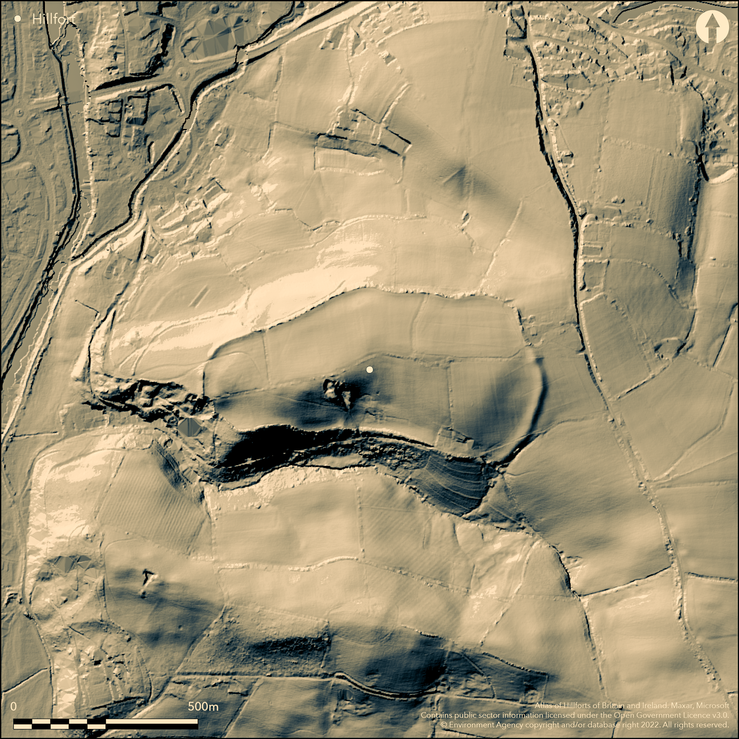
LiDAR 1m DTM Hillshade
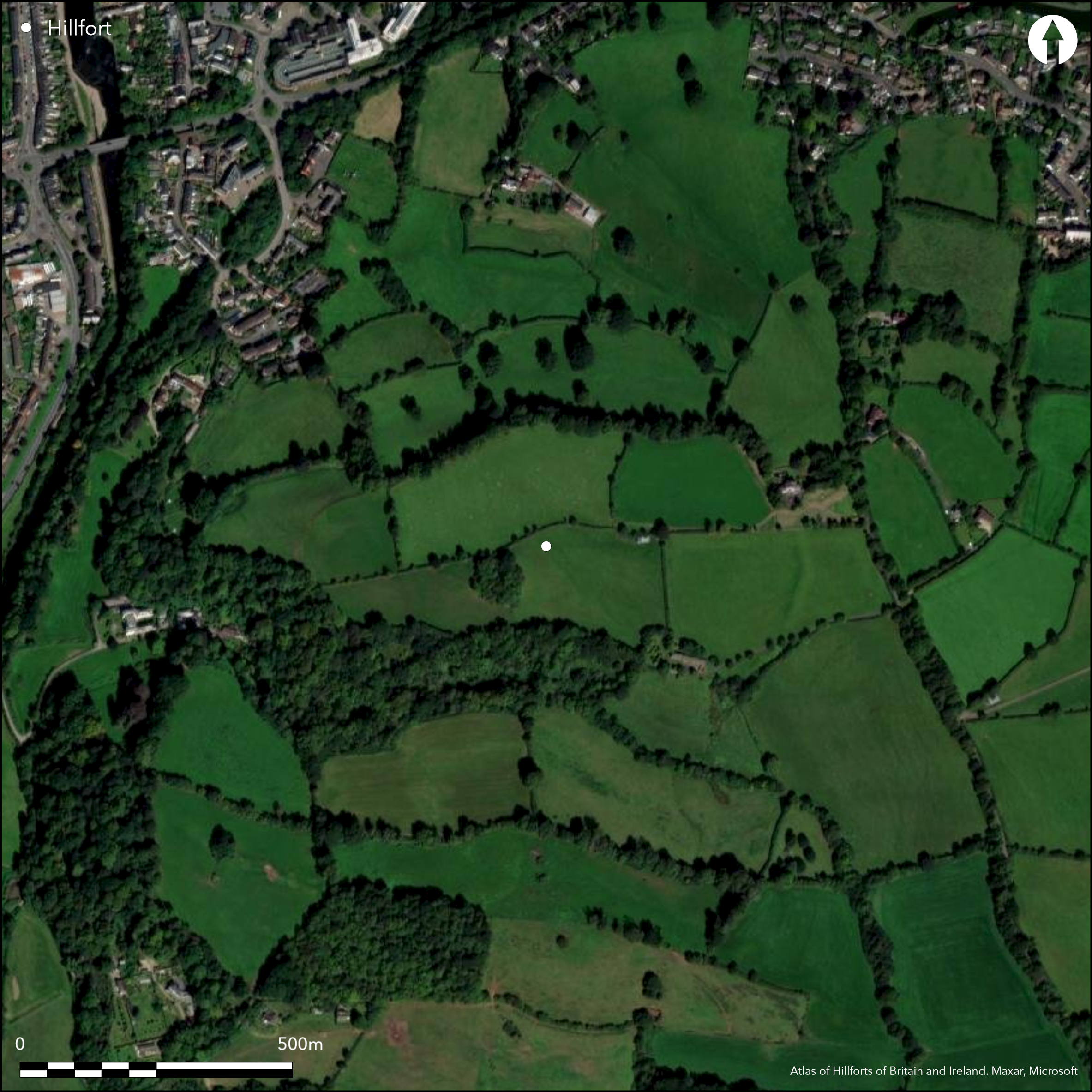
Satellite Imagery
LiDAR 1m DTM Hillshade
Satellite Imagery
Scroll left/right to view further images.
HER: Devon MDV1360 (None)
NMR: SS 91 SE 8 (36443)
SM: 1020156
NGR: SS95901175
X: 295838 Y: 111783 (OSGB36)
Large partial contour hillfort saddling a prominent WSW-facing ridge above confluence of Rivers Exe and Lowman to W and valley of another tributary of the Exe to S. Steep or very steep surrounding slopes, on all sides apart from moderate along spur to ENE. Split up into six fields with hedge boundaries. Site very extensive enclosing the hill for 10ha, but rampartss now slight in places, massive in others, with ramparts on all sides but no apparent ditch, possibly because ramparts seem to augment the steep topography. To N rampart to 3m high externally above steep natural scarp and within field boundary. To W rampart to only 1.2m high, although c. 10m wide. At SW apex rampart massive, again within field boundary and above very steep to precipitous slope and continues as to 3.2m bank externally and 11m wide along S side. To SE and E, although rampart to 2.5m high and 25m wide in places, buildings of Castle Barn and Cranmore Cottage have cut into the earthwork. Several steep slopes in interior. Original W entrance with 7m wide gap. Small and inconclusive excavation 1930. Chance finds of Bronze Age blade and Iron Age and Saxon coins on slopes below hillfort. Improved pasture, with field boundaries and scattered trees, and with trees on N and SW boundaries. Most of rampart ploughed-out or field bank. Interior cut into by two small quarries. On 1st Ed. OS map (1890). Undated.
Citizen Science: ✗
Reliability of Data: Confirmed
Reliability of Interpretation: Confirmed
X: -387674 Y: 6602926 (EPSG: 3857)
Longitude: -3.482536419609863 Latitude: 50.896043314251216 (EPSG:4326)
Country: England
Current County or Unitary Authority: Devon
Historic County: Devon
Current Parish/Community/Council/Townland: Tiverton
Most of rampart ploughed-out or field bank. Split up into six fields. Interior cut into by two small quarries. To SE and E, although rampart to 2.5m high and 25m wide in places, buildings of Castle Barn and Cranmore Cottage have cut into the earthwork.
| Extant | ✓ |
| Cropmark | ✗ |
| Likely Destroyed | ✗ |
Improved pasture, with field boundaries and scattered trees, and with trees on N and SW boundaries. Buildings on SE and E sides. Interior cut into by two small quarries.
| Woodland | ✗ |
| Commercial Forestry Plantation | ✗ |
| Parkland | ✗ |
| Pasture (Grazing) | ✓ |
| Arable | ✗ |
| Scrub/Bracken | ✗ |
| Bare Outcrop | ✗ |
| Heather/Moorland | ✗ |
| Heath | ✗ |
| Built-up | ✓ |
| Coastal Grassland | ✗ |
| Other | ✓ |
Large partial contour hillfort saddling a prominent WSW-facing spur above confluence of Rivers Exe and Lowman to W and valley of another tributary of the Exe to S. Steep or very steep surrounding slopes on all sides apart from moderate along spur to ENE.
| Contour Fort | ✗ |
| Partial Contour Fort | ✓ |
| Promontory Fort | ✗ |
| Hillslope Fort | ✗ |
| Level Terrain Fort | ✗ |
| Marsh Fort | ✗ |
| Multiple Enclosure Fort | ✗ |
| Hilltop | ✗ |
| Coastal Promontory | ✗ |
| Inland Promontory | ✗ |
| Valley Bottom | ✗ |
| Knoll/Hillock/Outcrop | ✗ |
| Ridge | ✓ |
| Cliff/Plateau-edge/Scarp | ✗ |
| Hillslope | ✗ |
| Lowland | ✗ |
| Spur | ✗ |
Dominant Topographic Feature: Ridge
| North | ✗ |
| Northeast | ✗ |
| East | ✗ |
| Southeast | ✗ |
| South | ✗ |
| Southwest | ✗ |
| West | ✓ |
| Northwest | ✗ |
| Level | ✗ |
Altitude: 155.0m
N/A
None.
Reliability: D - None
| Pre 1200BC | ✗ |
| 1200BC - 800BC | ✗ |
| 800BC - 400BC | ✗ |
| 400BC - AD50 | ✗ |
| AD50 - AD400 | ✗ |
| AD400 - AD 800 | ✗ |
| Post AD800 | ✗ |
| Unknown | ✓ |
| Pre Hillfort: | None |
| Post Hillfort: | 1549 engagement when insurgents defeated by the King's troop. |
On 1st Ed. OS map (1890). Small and inconclusive excavation 1930 - no details. MPP Fieldwork H.K. Gerrard, 1999.
| 1st Identified Map Depiction (1890): | OS map. |
| Excavation (1930): | Small and inconclusive excavation - no details. |
| Other (1999): | MPP Fieldwork H.K. Gerrard. |
Chance finds of Bronze Age blade and Iron Age and Saxon coins on slopes below hillfort.
None
| None | ✓ |
| Spring | ✗ |
| Stream | ✗ |
| Pool | ✗ |
| Flush | ✗ |
| Well | ✗ |
| Other | ✗ |
None
| No Known Features | ✓ |
| Round Stone Structures | ✗ |
| Rectangular Stone Structures | ✗ |
| Curvilinear Platforms | ✗ |
| Other Roundhouse Evidence | ✗ |
| Pits | ✗ |
| Quarry Hollows | ✗ |
| Other | ✗ |
No details.
| No Known Excavation | ✗ |
| Pits | ✗ |
| Postholes | ✗ |
| Roundhouses | ✗ |
| Rectangular Structures | ✗ |
| Roads/Tracks | ✗ |
| Quarry Hollows | ✗ |
| Other | ✓ |
| Nothing Found | ✗ |
None
| No Known Geophysics | ✓ |
| Pits | ✗ |
| Roundhouses | ✗ |
| Rectangular Structures | ✗ |
| Roads/Tracks | ✗ |
| Quarry Hollows | ✗ |
| Other | ✗ |
| Nothing Found | ✗ |
Chance finds of Bronze Age blade and Iron Age and Saxon coins on slopes below hillfort.
| No Known Finds | ✓ |
| Pottery | ✗ |
| Metal | ✗ |
| Metalworking | ✗ |
| Human Bones | ✗ |
| Animal Bones | ✗ |
| Lithics | ✗ |
| Environmental | ✗ |
| Other | ✗ |
None
| APs Not Checked | ✓ |
| None | ✗ |
| Roundhouses | ✗ |
| Rectangular Structures | ✗ |
| Pits | ✗ |
| Postholes | ✗ |
| Roads/Tracks | ✗ |
| Other | ✗ |
Original W entrance with 7m wide gap. Modern gap with track on S.
| 2: | Modern gap with track on S side. |
| 2: | None |
Guard Chambers: ✗
Chevaux de Frise: ✗
| 1. Simple Gap (West): | None |
Defences now slight in places, massive in others, with ramparts on all sides but no apparent ditch, possibly because defences seem to augment the steep topography. To N rampart to 3m high externally above steep natural scarp and within field boundary. To W rampart to only 1.2m high, although c. 10m wide. At SW apex rampart massive, again within field boundary and above very steep to precipitous slope and continues as to 3.2m bank externally and 11m wide along S side. To SE and E, although rampart to 2.5m high and 25m wide in places, buildings of Castle Barn and Cranmore Cottage have cut into the earthwork.
| Area 1: | 10.0ha. |
| Total: | 10.0ha. |
Total Footprint Area: Noneha.
None
| ✗ | None |
| ✓ | None |
| NE Quadrant: | 1 |
| SE Quadrant: | 1 |
| SW Quadrant: | 1 |
| NW Quadrant: | 1 |
| Total: | 1 |
| Partial Univallate | ✗ |
| Univallate | ✓ |
| Partial Bivallate | ✗ |
| Bivallate | ✗ |
| Partial Multivallate | ✗ |
| Multivallate | ✗ |
| Unknown | ✗ |
| Partial Univallate | ✗ |
| Univallate | ✗ |
| Partial Bivallate | ✗ |
| Bivallate | ✗ |
| Partial Multivallate | ✗ |
| Multivallate | ✗ |
None
| None | ✗ |
| Earthen Bank | ✓ |
| Stone Wall | ✗ |
| Rubble | ✗ |
| Wall-walk | ✗ |
| Evidence of Timber | ✗ |
| Vitrification | ✗ |
| Other Burning | ✗ |
| Palisade | ✗ |
| Counter Scarp Bank | ✗ |
| Berm | ✗ |
| Unfinished | ✗ |
| Other | ✗ |
No details.
| None | ✗ |
| Earthen Bank | ✗ |
| Stone Wall | ✗ |
| Murus Duplex | ✗ |
| Timber-framed | ✗ |
| Timber-laced | ✗ |
| Vitrification | ✗ |
| Other Burning | ✗ |
| Palisade | ✗ |
| Counter Scarp Bank | ✗ |
| Berm | ✗ |
| Unfinished | ✗ |
| No Known Excavation | ✗ |
| Other | ✓ |
| ✗ | None |
| ✗ | No apparent ditch. |
Number of Ditches: 0
| ✗ | None |
Wall, J.C. 1906. Ancient Earthworks, In W. Page (ed), The Victoria County History of the County of Devon, Vol I, London: James Street, Haymarket, 600-01.
Atlas of Hillforts:
Wikidata:
This work is licensed under CC BY-SA 4.0

 and should be cited as:
Lock, Gary and Ralston, Ian. 2024. Atlas of Hillforts of Britain and Ireland. Available at: https://hillforts.arch.ox.ac.uk
Document Version 1.1