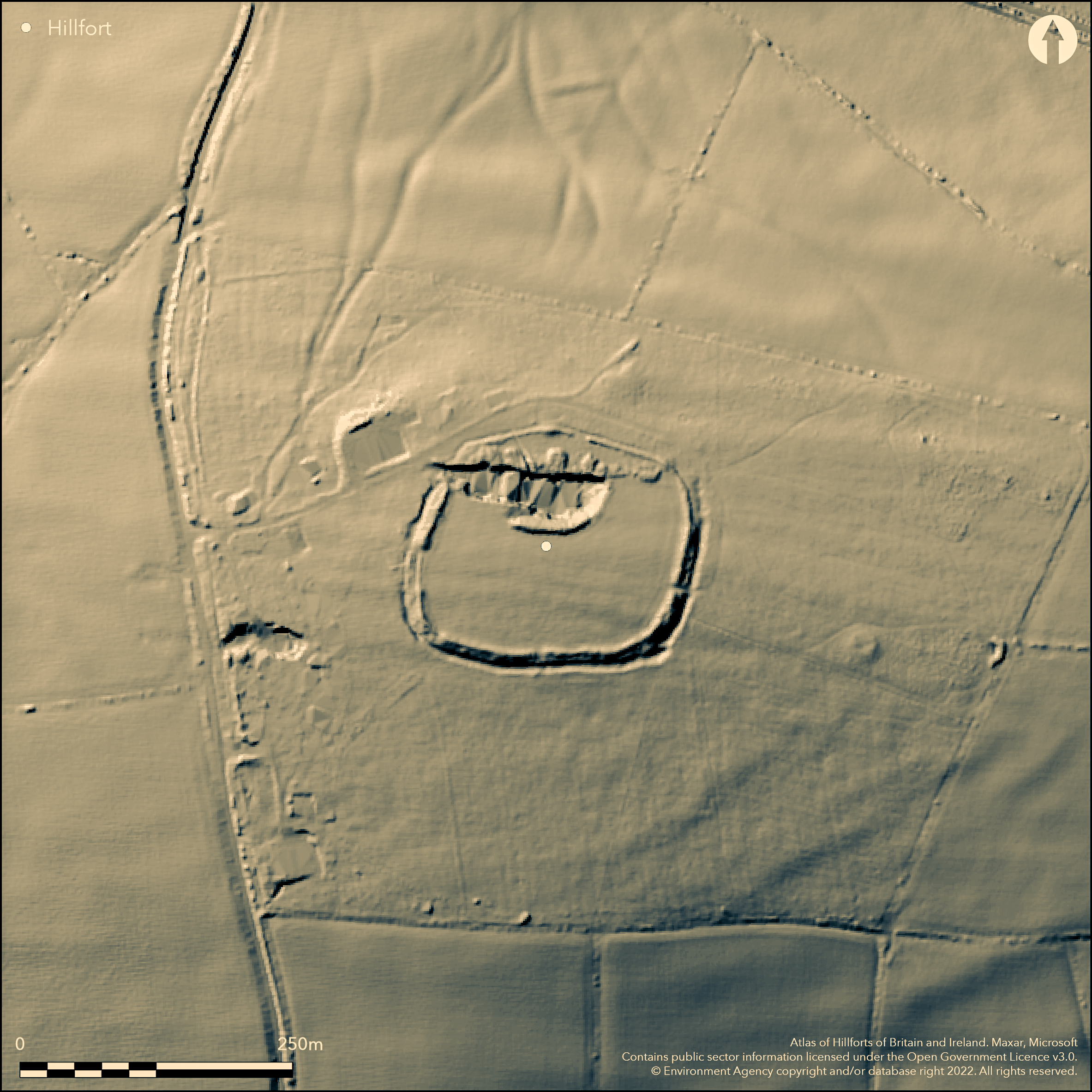
LiDAR 1m DTM Hillshade
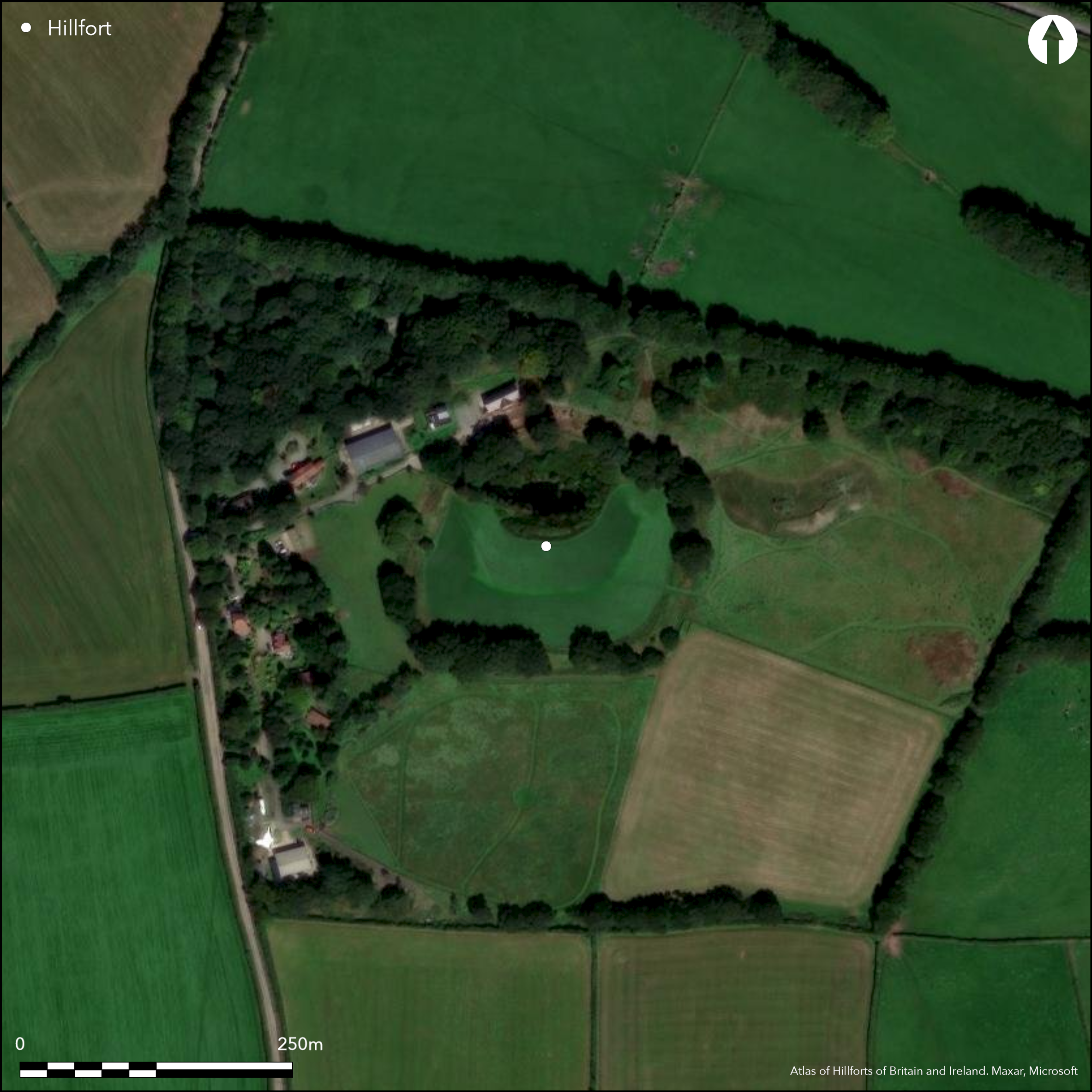
Satellite Imagery
LiDAR 1m DTM Hillshade
Satellite Imagery
Scroll left/right to view further images.
HER: Devon MDV1985 (None)
NMR: SS 63 NE 15 (34539)
SM: 1002534
NGR: SS66673580
X: 266669 Y: 135821 (OSGB36)
Commanding, univallate, partial contour hillfort located on high crest and NW-facing slope of SE-NW ridge of Mockham Down and above Mockham Down Plantation on NW. Extensive views to Exmoor on NE and to headwaters of River Yeo and sea on NW. Steep surrounding slopes, less to ridge summit on SE. Internal area c. 1.6ha. Worn surrounding rampart for most of circuit, but still reaches c. 2.5m above ditch bottom on SE, with irregular ditch, 1m deep on SE, variable berm between bank and ditch and counterscarp. These irregularities, plus the bank and ditch on N and W appearing little more than a marking-out bank, rising to only 0.9m above a 0.3m deep ditch, suggest that site is unfinished and gang working a possibility. NW entrance probably by large gravel-pit. Hollow ways or trackways, possibly medieval, to N of fort. Interior pasture, banks trees and scrub. Although rampart worn, site still prominent and clearly seen from air. On 1st Ed. OS map (1889). Undated.
Citizen Science: ✗
Reliability of Data: Confirmed
Reliability of Interpretation: Confirmed
X: -434806 Y: 6640080 (EPSG: 3857)
Longitude: -3.905925596690495 Latitude: 51.1060819787212 (EPSG:4326)
Country: England; None
Current County or Unitary Authority: Devon
Historic County: Devon
Current Parish/Community/Council/Townland: Brayford; Stoke Rivers
NW entrance damaged by large gravel-pit; although rampart worn but still prominent and site clearly seen from air.
| Extant | ✓ |
| Cropmark | ✗ |
| Likely Destroyed | ✓ |
Interior pasture, banks trees and scrub. Large gravel pit on N.
| Woodland | ✓ |
| Commercial Forestry Plantation | ✗ |
| Parkland | ✗ |
| Pasture (Grazing) | ✓ |
| Arable | ✗ |
| Scrub/Bracken | ✗ |
| Bare Outcrop | ✗ |
| Heather/Moorland | ✗ |
| Heath | ✗ |
| Built-up | ✗ |
| Coastal Grassland | ✗ |
| Other | ✓ |
Commanding, univallate, partial contour hillfort located on high crest and NW-facing slope of SE-NW ridge of Mockham Down and above Mockham Down Plantation on NW. Extensive views to Exmoor on NE and to headwaters of River Yeo and sea on NW. Steep surrounding slopes, less to ridge summit on SE.
| Contour Fort | ✗ |
| Partial Contour Fort | ✓ |
| Promontory Fort | ✗ |
| Hillslope Fort | ✗ |
| Level Terrain Fort | ✗ |
| Marsh Fort | ✗ |
| Multiple Enclosure Fort | ✗ |
| Hilltop | ✗ |
| Coastal Promontory | ✗ |
| Inland Promontory | ✗ |
| Valley Bottom | ✗ |
| Knoll/Hillock/Outcrop | ✗ |
| Ridge | ✓ |
| Cliff/Plateau-edge/Scarp | ✗ |
| Hillslope | ✗ |
| Lowland | ✗ |
| Spur | ✗ |
Dominant Topographic Feature: Ridge
| North | ✗ |
| Northeast | ✗ |
| East | ✗ |
| Southeast | ✗ |
| South | ✗ |
| Southwest | ✗ |
| West | ✗ |
| Northwest | ✓ |
| Level | ✗ |
Altitude: 308.0m
Boundary Type: Parish/Townland
None.
Reliability: D - None
| Pre 1200BC | ✗ |
| 1200BC - 800BC | ✗ |
| 800BC - 400BC | ✗ |
| 400BC - AD50 | ✗ |
| AD50 - AD400 | ✗ |
| AD400 - AD 800 | ✗ |
| Post AD800 | ✗ |
| Unknown | ✓ |
| Pre Hillfort: | None |
| Post Hillfort: | None |
On 1st Ed. OS map (1889). Aerial photograph interpretation English Heritage Exmoor National Park NMP 2007. Desk assessment Mockham Down Farm South West Archaeology 2014. Watching Briefs South West Archaeology 2014.
| 1st Identified Map Depiction (1889): | OS map. |
| Other (2007): | Aerial photograph interpretation English Heritage Exmoor National Park NMP. |
| Other (2014): | Watching Briefs South West Archaeology. |
| Other (2014): | Desk assessment Mockham Down Farm South West Archaeology. |
Site clearly seen from air, but no apparent features.
None
| None | ✓ |
| Spring | ✗ |
| Stream | ✗ |
| Pool | ✗ |
| Flush | ✗ |
| Well | ✗ |
| Other | ✗ |
None
| No Known Features | ✓ |
| Round Stone Structures | ✗ |
| Rectangular Stone Structures | ✗ |
| Curvilinear Platforms | ✗ |
| Other Roundhouse Evidence | ✗ |
| Pits | ✗ |
| Quarry Hollows | ✗ |
| Other | ✗ |
None
| No Known Excavation | ✓ |
| Pits | ✗ |
| Postholes | ✗ |
| Roundhouses | ✗ |
| Rectangular Structures | ✗ |
| Roads/Tracks | ✗ |
| Quarry Hollows | ✗ |
| Other | ✗ |
| Nothing Found | ✗ |
None
| No Known Geophysics | ✓ |
| Pits | ✗ |
| Roundhouses | ✗ |
| Rectangular Structures | ✗ |
| Roads/Tracks | ✗ |
| Quarry Hollows | ✗ |
| Other | ✗ |
| Nothing Found | ✗ |
None
| No Known Finds | ✓ |
| Pottery | ✗ |
| Metal | ✗ |
| Metalworking | ✗ |
| Human Bones | ✗ |
| Animal Bones | ✗ |
| Lithics | ✗ |
| Environmental | ✗ |
| Other | ✗ |
Site clearly seen from air, but no apparent features.
| APs Not Checked | ✗ |
| None | ✓ |
| Roundhouses | ✗ |
| Rectangular Structures | ✗ |
| Pits | ✗ |
| Postholes | ✗ |
| Roads/Tracks | ✗ |
| Other | ✗ |
NW entrance posibly removed by large gravel-pit.
| 1: | None |
| 2: | Possible NW entrance possibly removed by quarrying. |
Guard Chambers: ✗
Chevaux de Frise: ✗
| 1. Simple Gap (North west): | Type of entrance not determined. Simple gap default. |
Worn surrounding rampart for most of circuit, but still reaches c. 2.5m above ditch bottom on SE, with irregular ditch, 1m deep on SE, variable berm between bank and ditch and counterscarp. These irregularities, plus the bank and ditch on N and W appearing little more than a marking-out bank, rising to only 0.9m above a 0.3m deep ditch, suggest that site is unfinished and gang working a possibility.
| Area 1: | 1.6ha. |
| Total: | 1.6ha. |
Total Footprint Area: Noneha.
None
| ✗ | None |
| ✓ | None |
| NE Quadrant: | 1 |
| SE Quadrant: | 1 |
| SW Quadrant: | 1 |
| NW Quadrant: | 1 |
| Total: | 1 |
| Partial Univallate | ✗ |
| Univallate | ✓ |
| Partial Bivallate | ✗ |
| Bivallate | ✗ |
| Partial Multivallate | ✗ |
| Multivallate | ✗ |
| Unknown | ✗ |
| Partial Univallate | ✗ |
| Univallate | ✗ |
| Partial Bivallate | ✗ |
| Bivallate | ✗ |
| Partial Multivallate | ✗ |
| Multivallate | ✗ |
Berm and counterscarp in evidence. Site possibly unfinished.
| None | ✗ |
| Earthen Bank | ✓ |
| Stone Wall | ✗ |
| Rubble | ✗ |
| Wall-walk | ✗ |
| Evidence of Timber | ✗ |
| Vitrification | ✗ |
| Other Burning | ✗ |
| Palisade | ✗ |
| Counter Scarp Bank | ✓ |
| Berm | ✓ |
| Unfinished | ✓ |
| Other | ✗ |
None
| None | ✗ |
| Earthen Bank | ✗ |
| Stone Wall | ✗ |
| Murus Duplex | ✗ |
| Timber-framed | ✗ |
| Timber-laced | ✗ |
| Vitrification | ✗ |
| Other Burning | ✗ |
| Palisade | ✗ |
| Counter Scarp Bank | ✗ |
| Berm | ✗ |
| Unfinished | ✗ |
| No Known Excavation | ✓ |
| Other | ✗ |
| ✓ | Irregularities in construction, plus the bank and ditch on N and W appearing little more than a marking-out bank, rising to only 0.9m above a 0.3m deep ditch, suggest that site is unfinished and gang working a possibility. |
| ✓ | None |
Number of Ditches: 1
| ✗ | None |
Morris, B. 2014. Mockham Down Farm, Devon: results of an archaeological impact assessment, South West Archaeology evaluation and assessment report.
Wall, J.C. 1906. Ancient Earthworks, In W. Page (ed), The Victoria County History of the County of Devon, Vol I, London: James Street, Haymarket, 603-04.
Walls, S. 2014. Monitoring of lodges and associated works at Mockham Down, Devon, South West Archaeology evaluation and assessment report.
Atlas of Hillforts:
Wikidata:
This work is licensed under CC BY-SA 4.0

 and should be cited as:
Lock, Gary and Ralston, Ian. 2024. Atlas of Hillforts of Britain and Ireland. Available at: https://hillforts.arch.ox.ac.uk
Document Version 1.1