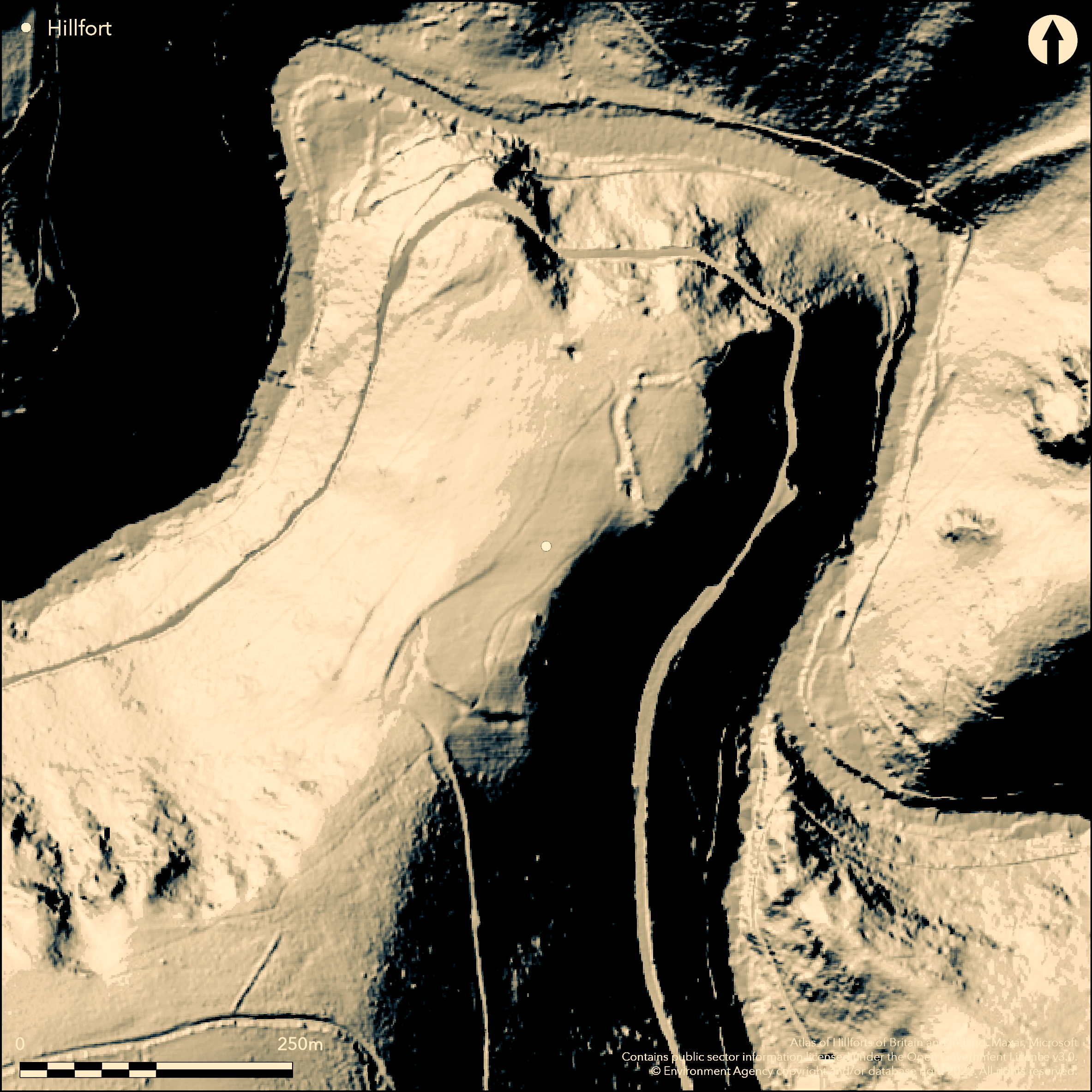
LiDAR 1m DTM Hillshade
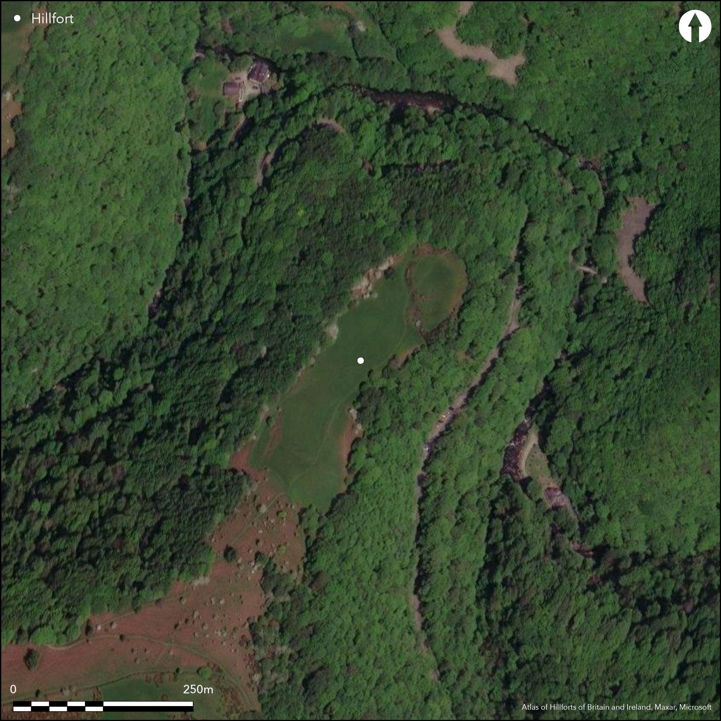
Satellite Imagery
LiDAR 1m DTM Hillshade
Satellite Imagery
Scroll left/right to view further images.
HER: Exmoor National Park MDE1247 (MDV687)
NMR: SS 74 NW 14 (35179)
SM: 1020805
NGR: SS74284877
X: 274274 Y: 148771 (OSGB36)
Multiple enclosure fort located on NE-facing promontory above pronounced bend and gorge of East Lyn River on N, E and W, and confluence with tributary to SE. Very steep to precipitous slopes to N, E and W, steep along promontory to SW. Site itself slopes genty to SW. At first sight fort appears to be a univallate hillslope enclosure with outwork or cross bank to c. 150m to SW, but no reason to believe that both part of same site and same period, hence designation. Promontory measures c. 300m long and 50-100m wide. The total interior area of the site is 1.45ha, with inner enclosure, 74m N-S by 40m and interior area 0.28 ha sited at NE end of spur. Earth and stone rampart, 4.2m wide and 1.4m above outer ditch bottom on W. Rampart topped by earth and stone bank, 3m wide and 0.6m high, formed from ditch spoil. Ditch is 4.8m wide and c. 1m deep with possible slight traces counterscarp. Similar but less well defined on N. On E and SE the very steep natural slopes provide adequate definition, but probably scarped to emphasise matters. The simple entrance, about 3m wide, is in the north-west where there is a slight causeway over the ditch. About 150m SW of inner enclosure, cutting across the widening S summit of promontory cross-ridge bank oriented SE-NW c. 82m long, with ditch, 10.5m wide and 1.4m deep, and inner stony bank, 5.5m wide and to 1.2m high. This, in effect, forms an outer enclosure and S boundary of the total enclosure. Near central gap in rampart probably modern with original entrance possibly at NW end where gap before very steep slopes. Small circular platform overlooking entrance may be original. Internal scarp forming platform in interior possibly natural, possible rectangular structure and turf-covered banks in interior probably later. Rough grass, bracken and scrub. Deciduous Myrtleberry Wood surrounds on N, E and W. Well-preserved despite 19th century trial pits for iron ore (costeans) and spoil heaps. Old footpath crosses the site from the NNE-SSW. On 1st Ed. OS map (1889). Few investigations. Undated.
Citizen Science: ✗
Reliability of Data: Confirmed
Reliability of Interpretation: Confirmed
X: -423224 Y: 6661047 (EPSG: 3857)
Longitude: -3.801883922429622 Latitude: 51.22419284211785 (EPSG:4326)
Country: England; None
Current County or Unitary Authority: Devon
Historic County: Devon
Current Parish/Community/Council/Townland: Lynton and Lynmouth; Countisbury
Well preserved despite 19th century trial pits for iron ore (costeans) and spoil heaps. Old footpath crosses the site from the NNE-SSW.
| Extant | ✓ |
| Cropmark | ✗ |
| Likely Destroyed | ✗ |
Rough grass, bracken and scrub. Deciduous Myrtleberry Wood surrounds on N, E and W.
| Woodland | ✗ |
| Commercial Forestry Plantation | ✗ |
| Parkland | ✗ |
| Pasture (Grazing) | ✓ |
| Arable | ✗ |
| Scrub/Bracken | ✗ |
| Bare Outcrop | ✗ |
| Heather/Moorland | ✗ |
| Heath | ✗ |
| Built-up | ✗ |
| Coastal Grassland | ✗ |
| Other | ✗ |
Multiple enclosure fort located on NE-facing promontory above pronounced bend and gorge of East Lyn River on N, E and W, and confluence with tributary to SE. Very steep to precipitous slopes to N, E and W, steep along promontory to SW.
| Contour Fort | ✗ |
| Partial Contour Fort | ✗ |
| Promontory Fort | ✗ |
| Hillslope Fort | ✗ |
| Level Terrain Fort | ✗ |
| Marsh Fort | ✗ |
| Multiple Enclosure Fort | ✓ |
| Hilltop | ✗ |
| Coastal Promontory | ✗ |
| Inland Promontory | ✓ |
| Valley Bottom | ✗ |
| Knoll/Hillock/Outcrop | ✗ |
| Ridge | ✗ |
| Cliff/Plateau-edge/Scarp | ✗ |
| Hillslope | ✗ |
| Lowland | ✗ |
| Spur | ✓ |
Dominant Topographic Feature: Spur promontory.
| North | ✗ |
| Northeast | ✗ |
| East | ✗ |
| Southeast | ✗ |
| South | ✗ |
| Southwest | ✓ |
| West | ✗ |
| Northwest | ✗ |
| Level | ✗ |
Altitude: 185.0m
Boundary Type: Parish/Townland
None.
Reliability: D - None
| Pre 1200BC | ✗ |
| 1200BC - 800BC | ✗ |
| 800BC - 400BC | ✗ |
| 400BC - AD50 | ✗ |
| AD50 - AD400 | ✗ |
| AD400 - AD 800 | ✗ |
| Post AD800 | ✗ |
| Unknown | ✓ |
| Pre Hillfort: | None |
| Post Hillfort: | None |
On 1st Ed. OS map (1889). Measured survey RCHME West Exmoor Project 1993-96. Aerial photograph interpretation English Heritage Exmoor National Park NMP 2002.
| 1st Identified Map Depiction (1889): | OS map. |
| Other (1989): | Visited by Hillfort Study Group |
| Other (2002): | Aerial photograph interpretation English Heritage Exmoor National Park NMP |
| Earthwork Survey (None): | Measured survey RCHME West Exmoor Project 1993-96. |
Small circular platform overlooking entrance to cross-ridge bank may be original. Internal scarp forming platform in interior possibly natural, possible rectangular structure and turf-covered banks in interior probably later.
None
| None | ✓ |
| Spring | ✗ |
| Stream | ✗ |
| Pool | ✗ |
| Flush | ✗ |
| Well | ✗ |
| Other | ✗ |
None
| No Known Features | ✗ |
| Round Stone Structures | ✗ |
| Rectangular Stone Structures | ✗ |
| Curvilinear Platforms | ✗ |
| Other Roundhouse Evidence | ✗ |
| Pits | ✗ |
| Quarry Hollows | ✗ |
| Other | ✓ |
None
| No Known Excavation | ✓ |
| Pits | ✗ |
| Postholes | ✗ |
| Roundhouses | ✗ |
| Rectangular Structures | ✗ |
| Roads/Tracks | ✗ |
| Quarry Hollows | ✗ |
| Other | ✗ |
| Nothing Found | ✗ |
None
| No Known Geophysics | ✓ |
| Pits | ✗ |
| Roundhouses | ✗ |
| Rectangular Structures | ✗ |
| Roads/Tracks | ✗ |
| Quarry Hollows | ✗ |
| Other | ✗ |
| Nothing Found | ✗ |
None
| No Known Finds | ✓ |
| Pottery | ✗ |
| Metal | ✗ |
| Metalworking | ✗ |
| Human Bones | ✗ |
| Animal Bones | ✗ |
| Lithics | ✗ |
| Environmental | ✗ |
| Other | ✗ |
None
| APs Not Checked | ✓ |
| None | ✗ |
| Roundhouses | ✗ |
| Rectangular Structures | ✗ |
| Pits | ✗ |
| Postholes | ✗ |
| Roads/Tracks | ✗ |
| Other | ✗ |
Simple entrance to inner enclosure, c. 3m wide, on NW where slight causeway over ditch. Near central gap in rampart probably modern with original entrance possibly at NW end of crossridge bank on SW where gap before very steep slopes possibly approached by hollow way. Small circular platform overlooking entrance may be original.
| 3: | Central gap to cross-ridge bank probably modern. |
| 2: | None |
Guard Chambers: ✗
Chevaux de Frise: ✗
| 1. Simple Gap (North west): | Inner enclosure entrance slight causeway over ditch. |
| 2. Hollow Way (South west): | At NW end of crossridge bank. Entrance possibly approached by hollow way. |
| 2. Other Forms (South west): | Small circular platform overlooking entrance may be original. |
Earth and stone rampart to inner enclosure, 4.2m wide and 1.4m above outer ditch bottom on W. Rampart topped by earth and stone bank, 3m wide and 0.6m high, formed from ditch spoil. Ditch is 4.8m wide and c. 1m deep with possible slight traces counterscarp. Similar but less well defined on N. On E and SE the very steep natural slopes provide adequate defence, but probably scarped to emphasise matters. About 150m SW of enclosure cutting across the widening S summit of promontory cross-ridge earthwork oriented SE-NW c. 82m long, with ditch, 10.5m wide and 1.4m deep, and inner stony bank, 5.5m wide and to 1.2m high.
| Area 1: | 0.28ha. |
| Area 2: | 1.45ha. |
| Total: | 1.45ha. |
Total Footprint Area: Noneha.
None
| ✗ | None |
| ✓ | Scarped on E and SE. |
| NE Quadrant: | 1 |
| SE Quadrant: | 1 |
| SW Quadrant: | 1 |
| NW Quadrant: | 1 |
| Total: | 1 |
| Partial Univallate | ✗ |
| Univallate | ✓ |
| Partial Bivallate | ✗ |
| Bivallate | ✗ |
| Partial Multivallate | ✗ |
| Multivallate | ✗ |
| Unknown | ✗ |
| Partial Univallate | ✗ |
| Univallate | ✗ |
| Partial Bivallate | ✗ |
| Bivallate | ✗ |
| Partial Multivallate | ✗ |
| Multivallate | ✗ |
Earth and stone banks. Possible slight traces counterscarp.
| None | ✗ |
| Earthen Bank | ✓ |
| Stone Wall | ✗ |
| Rubble | ✓ |
| Wall-walk | ✗ |
| Evidence of Timber | ✗ |
| Vitrification | ✗ |
| Other Burning | ✗ |
| Palisade | ✗ |
| Counter Scarp Bank | ✓ |
| Berm | ✗ |
| Unfinished | ✗ |
| Other | ✗ |
None
| None | ✗ |
| Earthen Bank | ✗ |
| Stone Wall | ✗ |
| Murus Duplex | ✗ |
| Timber-framed | ✗ |
| Timber-laced | ✗ |
| Vitrification | ✗ |
| Other Burning | ✗ |
| Palisade | ✗ |
| Counter Scarp Bank | ✗ |
| Berm | ✗ |
| Unfinished | ✗ |
| No Known Excavation | ✓ |
| Other | ✗ |
| ✗ | None |
| ✓ | Ditches to inner enclosure and cross-ridge bank. |
Number of Ditches: 2
| ✗ | None |
Grinsell, L.V. 1970. The archaeology of Exmoor : Bideford Bay to Bridgwater, 83.
Atlas of Hillforts:
Wikidata:
This work is licensed under CC BY-SA 4.0

 and should be cited as:
Lock, Gary and Ralston, Ian. 2024. Atlas of Hillforts of Britain and Ireland. Available at: https://hillforts.arch.ox.ac.uk
Document Version 1.1