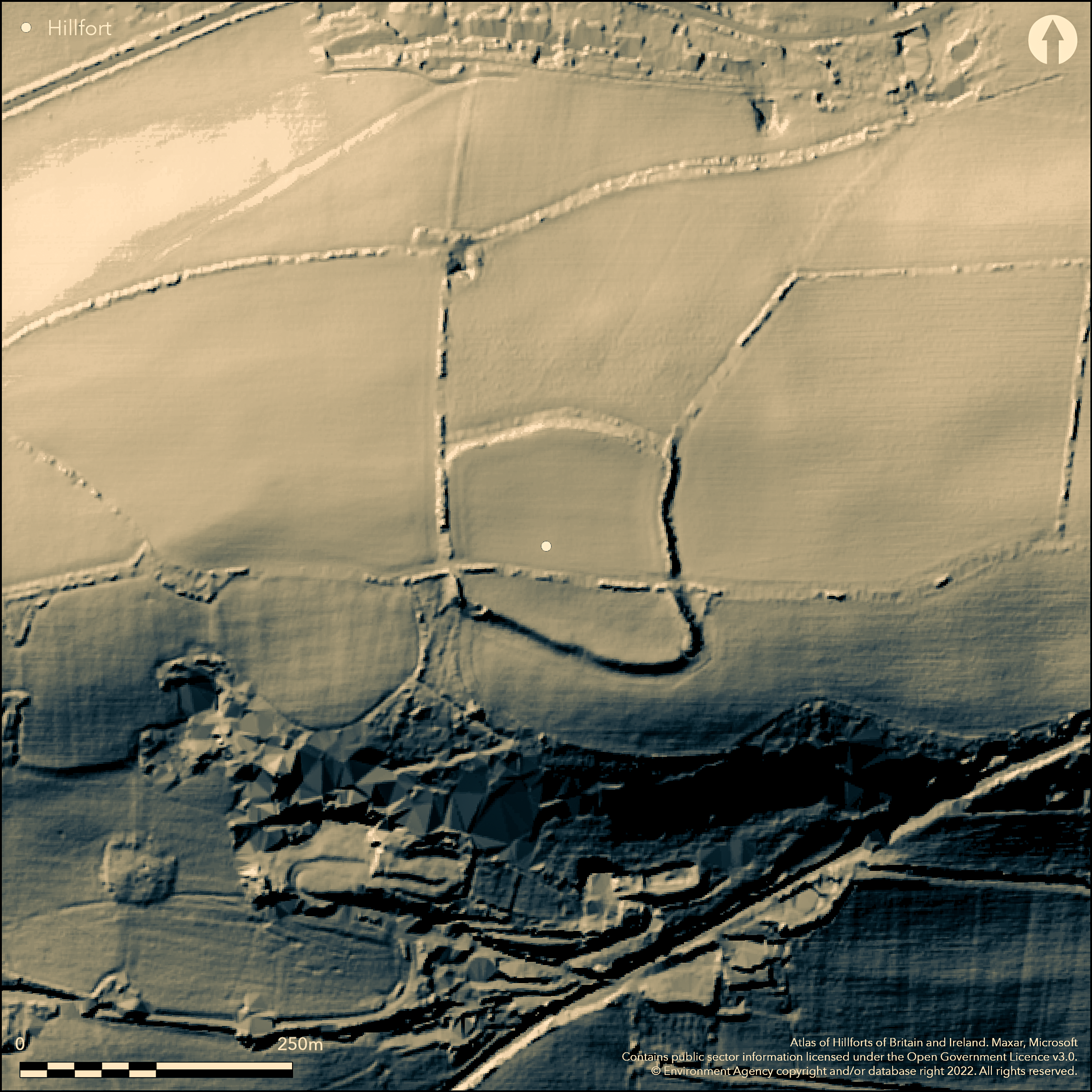
LiDAR 1m DTM Hillshade
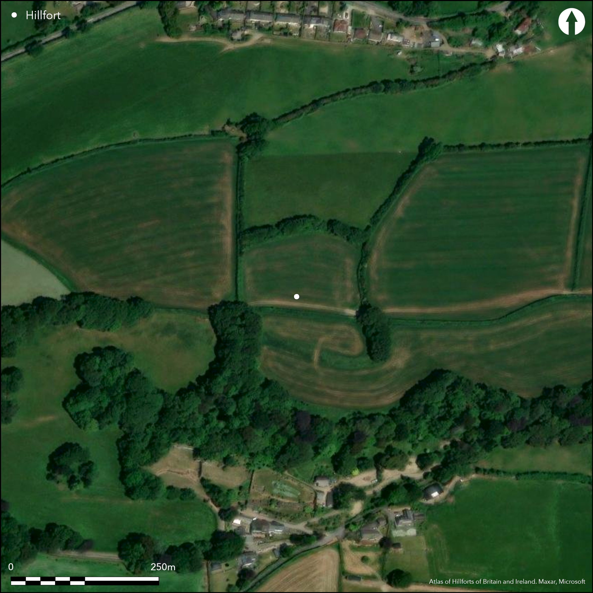
Satellite Imagery
LiDAR 1m DTM Hillshade
Satellite Imagery
Scroll left/right to view further images.
HER: Devon MDV921 (None)
NMR: SS 53 NE 1 (33788)
SM: 1002514
NGR: SS56933520
X: 256924 Y: 135176 (OSGB36)
Multivallate contour hillfort located on end of E-W ridge above River Yeo to SE and Bradiford Water to W, both flowing into lower reaches of River Taw to SW where meets the sea. Slopes fall gently to W and fairly steeply to N and S. Measures c. 122m each way internally, with area c. 1.5ha. Ramparts much reduced, except where preserved by hedge boundaries. Smoothed glacis type bank ,1.5m-2.6m high, to N and S and mutilated raised banks, forming field boundaries to 2.7m high externally and revetted in places, to E and W, that on E also visible as ploughed down bank to 0.6m high. Two fragments of outer ditch to 1m deep visible on SE corner and on SE; rest shows as berm to 6m wide and probably buried feature. Damaged overlapping entrance probably just S of middle of E side. Outlying damaged cross-ridge bank and ditch runs for c. 143m, 420m to to E, and possibly further where overlapping entrance. Improved pasture. Partly cultivated in past. Possibly reused as the burh at Pilton listed in the 10th century Burgal Hidage. On 1st Ed. OS map (1889). Minimal investigations, undated.
Citizen Science: ✗
Reliability of Data: Confirmed
Reliability of Interpretation: Confirmed
X: -450263 Y: 6638636 (EPSG: 3857)
Longitude: -4.044777702371659 Latitude: 51.097934637773335 (EPSG:4326)
Country: England; None
Current County or Unitary Authority: Devon
Historic County: Devon
Current Parish/Community/Council/Townland: West Pilton; Shirwell
Damaged and affected by field boundaries. On Heritage at Risk Register (2015).
| Extant | ✓ |
| Cropmark | ✗ |
| Likely Destroyed | ✓ |
Improved pasture. Partly cultivated in past.
| Woodland | ✗ |
| Commercial Forestry Plantation | ✗ |
| Parkland | ✗ |
| Pasture (Grazing) | ✓ |
| Arable | ✗ |
| Scrub/Bracken | ✗ |
| Bare Outcrop | ✗ |
| Heather/Moorland | ✗ |
| Heath | ✗ |
| Built-up | ✗ |
| Coastal Grassland | ✗ |
| Other | ✗ |
Large multivallate contour hillfort located on end of E-W ridge above River Yeo to Se and Bradiford Water to W, both flowing into lower reaches of River Taw to SW where meets the sea. Slopes fall gently to W and fairly steeply to N and S. Poor defensive position.
| Contour Fort | ✓ |
| Partial Contour Fort | ✗ |
| Promontory Fort | ✗ |
| Hillslope Fort | ✗ |
| Level Terrain Fort | ✗ |
| Marsh Fort | ✗ |
| Multiple Enclosure Fort | ✗ |
| Hilltop | ✗ |
| Coastal Promontory | ✗ |
| Inland Promontory | ✗ |
| Valley Bottom | ✗ |
| Knoll/Hillock/Outcrop | ✗ |
| Ridge | ✓ |
| Cliff/Plateau-edge/Scarp | ✗ |
| Hillslope | ✗ |
| Lowland | ✗ |
| Spur | ✗ |
Dominant Topographic Feature: Ridge
| North | ✗ |
| Northeast | ✗ |
| East | ✗ |
| Southeast | ✗ |
| South | ✗ |
| Southwest | ✗ |
| West | ✗ |
| Northwest | ✗ |
| Level | ✓ |
Altitude: 139.0m
Boundary Type: Parish/Townland
None.
Reliability: D - None
| Pre 1200BC | ✗ |
| 1200BC - 800BC | ✗ |
| 800BC - 400BC | ✗ |
| 400BC - AD50 | ✗ |
| AD50 - AD400 | ✗ |
| AD400 - AD 800 | ✗ |
| Post AD800 | ✗ |
| Unknown | ✓ |
| Pre Hillfort: | None |
| Post Hillfort: | Possibly reused as the burh at Pilton listed in 10th century Burgal Hidage. |
On Woollcombe MSS, c.1830-47. On 1st Ed. OS map (1889). Burh at Pilton listed in tenth century Burgal Hidage, dated to shortly before 925 AD.
| 1st Identified Map Depiction (1889): | OS map. |
| 1st Identified Written Reference (None): | Burh at Pilton listed in tenth century Burgal Hidage. |
| Other (None): | On Woollcombe MSS. |
None.
None
| None | ✓ |
| Spring | ✗ |
| Stream | ✗ |
| Pool | ✗ |
| Flush | ✗ |
| Well | ✗ |
| Other | ✗ |
None
| No Known Features | ✓ |
| Round Stone Structures | ✗ |
| Rectangular Stone Structures | ✗ |
| Curvilinear Platforms | ✗ |
| Other Roundhouse Evidence | ✗ |
| Pits | ✗ |
| Quarry Hollows | ✗ |
| Other | ✗ |
None
| No Known Excavation | ✓ |
| Pits | ✗ |
| Postholes | ✗ |
| Roundhouses | ✗ |
| Rectangular Structures | ✗ |
| Roads/Tracks | ✗ |
| Quarry Hollows | ✗ |
| Other | ✗ |
| Nothing Found | ✗ |
None
| No Known Geophysics | ✓ |
| Pits | ✗ |
| Roundhouses | ✗ |
| Rectangular Structures | ✗ |
| Roads/Tracks | ✗ |
| Quarry Hollows | ✗ |
| Other | ✗ |
| Nothing Found | ✗ |
None
| No Known Finds | ✓ |
| Pottery | ✗ |
| Metal | ✗ |
| Metalworking | ✗ |
| Human Bones | ✗ |
| Animal Bones | ✗ |
| Lithics | ✗ |
| Environmental | ✗ |
| Other | ✗ |
None
| APs Not Checked | ✓ |
| None | ✗ |
| Roundhouses | ✗ |
| Rectangular Structures | ✗ |
| Pits | ✗ |
| Postholes | ✗ |
| Roads/Tracks | ✗ |
| Other | ✗ |
Damaged overlapping entrance probably just S of middle of E side.
| 1: | None |
| 2: | None |
Guard Chambers: ✗
Chevaux de Frise: ✗
| 1. Over-lapping (South east): | Damaged. |
Ramparts much reduced, except where preserved by hedge boundaries. Smoothed glacis type bank ,1.5m-2.6m high, to N and S and mutilated raised banks, forming field boundaries to 2.7m high externally and revetted in places, to E and W, that on E also visible as ploughed down bank to 0.6m high. Two fragments of outer ditch to 1m deep visible on SE corner and on SE; rest shows as berm to 6m wide and probably buried feature.
| Area 1: | 1.5ha. |
| Total: | 1.5ha. |
Total Footprint Area: Noneha.
None
| ✗ | None |
| ✓ | None |
| NE Quadrant: | 1 |
| SE Quadrant: | 1 |
| SW Quadrant: | 1 |
| NW Quadrant: | 1 |
| Total: | 1 |
| Partial Univallate | ✗ |
| Univallate | ✓ |
| Partial Bivallate | ✗ |
| Bivallate | ✗ |
| Partial Multivallate | ✗ |
| Multivallate | ✗ |
| Unknown | ✗ |
| Partial Univallate | ✗ |
| Univallate | ✗ |
| Partial Bivallate | ✗ |
| Bivallate | ✗ |
| Partial Multivallate | ✗ |
| Multivallate | ✗ |
Ditch shows as berm 6m wide.
| None | ✗ |
| Earthen Bank | ✓ |
| Stone Wall | ✗ |
| Rubble | ✗ |
| Wall-walk | ✗ |
| Evidence of Timber | ✗ |
| Vitrification | ✗ |
| Other Burning | ✗ |
| Palisade | ✗ |
| Counter Scarp Bank | ✗ |
| Berm | ✓ |
| Unfinished | ✗ |
| Other | ✗ |
None
| None | ✗ |
| Earthen Bank | ✗ |
| Stone Wall | ✗ |
| Murus Duplex | ✗ |
| Timber-framed | ✗ |
| Timber-laced | ✗ |
| Vitrification | ✗ |
| Other Burning | ✗ |
| Palisade | ✗ |
| Counter Scarp Bank | ✗ |
| Berm | ✗ |
| Unfinished | ✗ |
| No Known Excavation | ✓ |
| Other | ✗ |
| ✗ | None |
| ✓ | Two fragments of outer ditch to 1m deep, one at SE corner, other on SE. Rest show as 6m wide berm and probably buried feature. |
Number of Ditches: 1
| ✗ | None |
Wall, J.C. 1906. Ancient Earthworks, In W. Page (ed), The Victoria County History of the County of Devon, Vol I, London: James Street, Haymarket, 608-09.
Woollcombe MSS, c.1830-47 Devon and Exeter Institution Library.
Atlas of Hillforts:
Wikidata:
This work is licensed under CC BY-SA 4.0

 and should be cited as:
Lock, Gary and Ralston, Ian. 2024. Atlas of Hillforts of Britain and Ireland. Available at: https://hillforts.arch.ox.ac.uk
Document Version 1.1