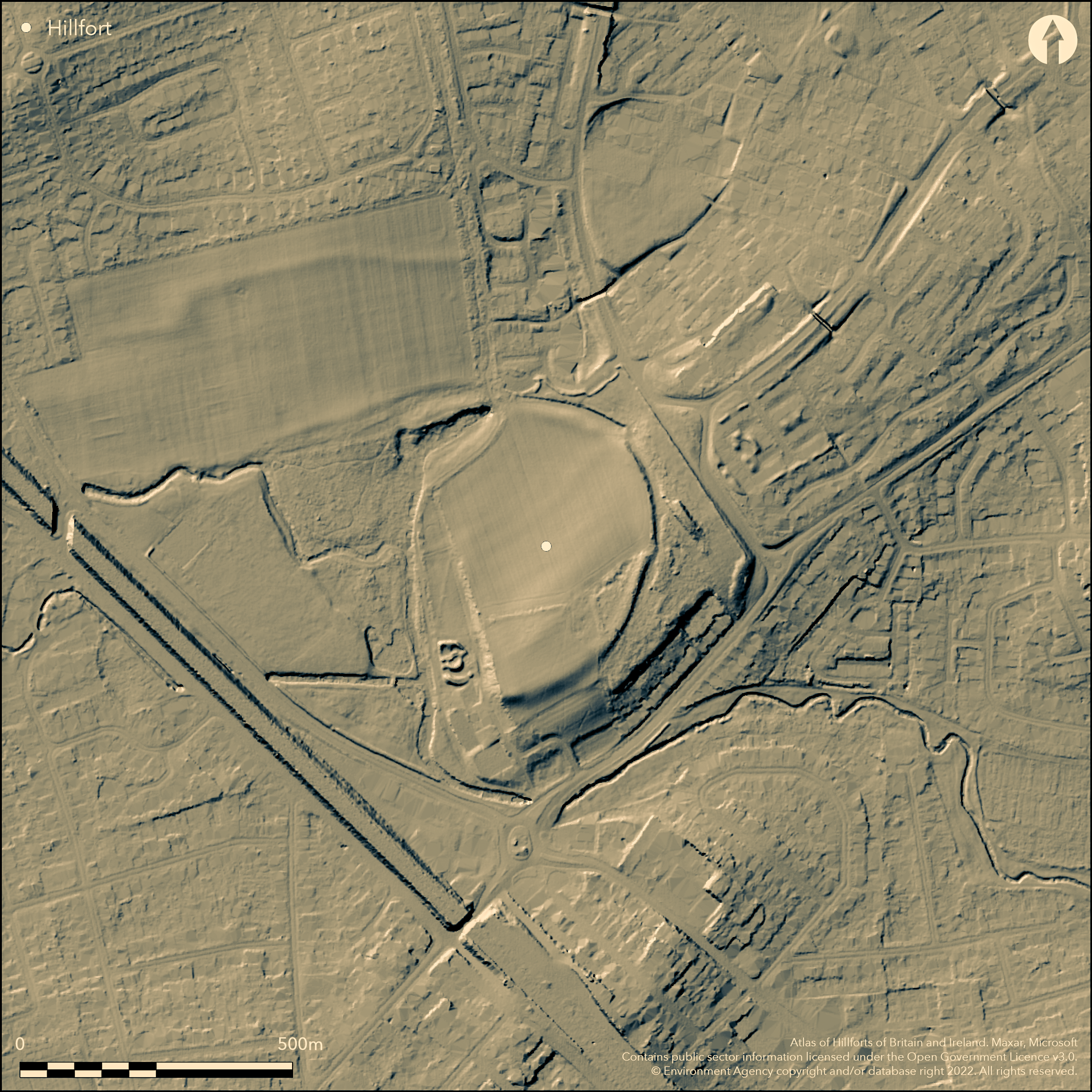
LiDAR 1m DTM Hillshade
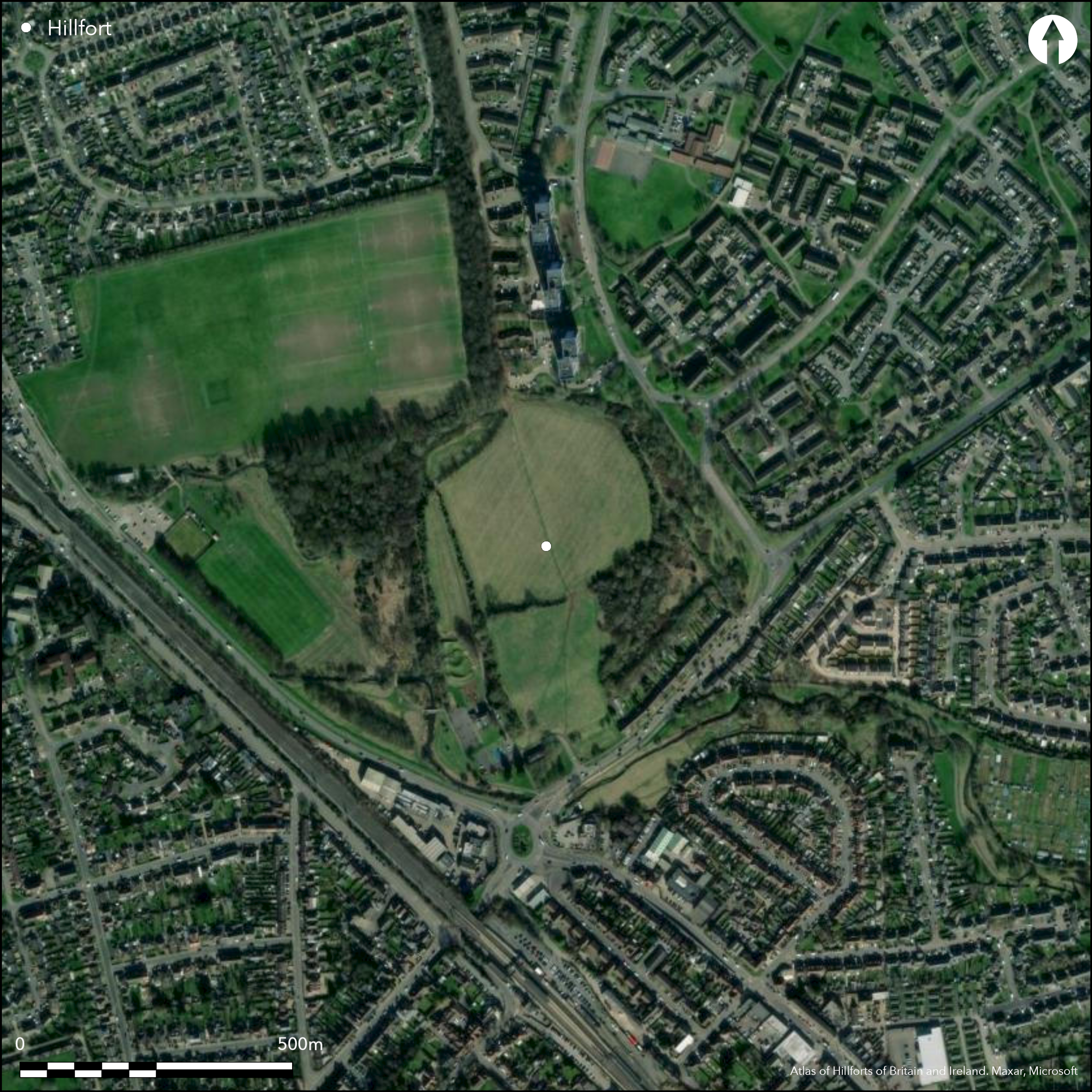
Satellite Imagery
LiDAR 1m DTM Hillshade
Satellite Imagery
Scroll left/right to view further images.
HER: Central Bedfordshire and Luton 820 (None)
NMR: TL 02 SE 2 (359652)
SM: 1015558
NGR: TL 06153 24607
X: 506153 Y: 224607 (OSGB36)
Lying within Leagrave Park, Luton, a D-shaped enclosure probably having many periods of use, possibly once utilised as a hillfort. The site is scheduled as a Neolithic enclosure. The enclosure measures 250m NE-SW by 350m transversely forming an arc to the W of the River Lea, enclosing 5.8ha, which rises directly in the NW corner of the enclosure where it continues around the W of the site. It lies on a gentle W-facing slope at 123m OD at the northern end of a wide valley which cuts across the Chiltern Hills in South Bedfordshire. The chalk and gravel bank has been partially denuded by ploughing but survives best in the N, E and S where it stands up to 1m high with an external flat-bottomed ditch 15-20m wide, now partially infilled and probably originally waterlogged or marshy (Dyer 1964). Excavation in 1971 showed the bank had probably been revetted at the front with turf (Dyer 1972, 5). In the W a slight straight scarp is defined by a hedgerow and the River Lea might once have served as a boundary on this side. A large collection of late Neolithic and early Bronze Age flints, including leaf-shaped and barbed and tanged arrowheads were recovered from within and in the vicinity of the enclosure in the 19th century. The site has seen three episodes of excavation: In 1953 trial excavations across the bank and ditch in the N and E produced Neolithic grooved Ware pottery and animal bones from the lower ditch fills in the E and a small hut was found outside the perimeter in the N (Dyer 1964). In 1971 a trench in the SE produced later Neolithic Windmill Hill pottery (Dyer 1972, 5). Geophysical surveys were undertaken in 1971 and 1985 with poor results although the 1985 survey produced evidence for pits and a ditch outside the enclosure in the SE (David 1985). No entrance has been identified. Large amounts of Roman and Iron Age pottery were found in the upper fills of the enclosure ditch suggesting possible settlement during these periods. Ridge and furrow cultivation has been observed across the interior in the N. The site is recorded on 1880 1:2,500 OS mapping. Scheduled
Citizen Science: ✗
Reliability of Data: Confirmed
Reliability of Interpretation: Unconfirmed
X: -51008 Y: 6783841 (EPSG: 3857)
Longitude: -0.45820849822896625 Latitude: 51.90984765823383 (EPSG:4326)
Country: England
Current County or Unitary Authority: Luton
Historic County: Bedfordshire
Current Parish/Community/Council/Townland: Luton
None
| Extant | ✓ |
| Cropmark | ✗ |
| Likely Destroyed | ✗ |
Deciduous woodland in SE corner, the remaining area appears to be recreational grassland or parkland
| Woodland | ✓ |
| Commercial Forestry Plantation | ✗ |
| Parkland | ✓ |
| Pasture (Grazing) | ✗ |
| Arable | ✗ |
| Scrub/Bracken | ✗ |
| Bare Outcrop | ✗ |
| Heather/Moorland | ✗ |
| Heath | ✗ |
| Built-up | ✗ |
| Coastal Grassland | ✗ |
| Other | ✓ |
A possible hillslope fort lying on a gentle W-facing slope at 123m OD
| Contour Fort | ✗ |
| Partial Contour Fort | ✗ |
| Promontory Fort | ✗ |
| Hillslope Fort | ✓ |
| Level Terrain Fort | ✗ |
| Marsh Fort | ✗ |
| Multiple Enclosure Fort | ✗ |
| Hilltop | ✗ |
| Coastal Promontory | ✗ |
| Inland Promontory | ✗ |
| Valley Bottom | ✗ |
| Knoll/Hillock/Outcrop | ✗ |
| Ridge | ✗ |
| Cliff/Plateau-edge/Scarp | ✗ |
| Hillslope | ✓ |
| Lowland | ✗ |
| Spur | ✗ |
Dominant Topographic Feature: Gentle W-facing slope
| North | ✗ |
| Northeast | ✗ |
| East | ✗ |
| Southeast | ✗ |
| South | ✗ |
| Southwest | ✗ |
| West | ✓ |
| Northwest | ✗ |
| Level | ✗ |
Altitude: 123.0m
N/A
A multi-period site but no direct dating for it being a hillfort although Iron Age pottery in the upper ditch fills suggests some occupation. Large collection of late Neolithic and early Bronze Age flints, including leaf-shaped and barbed and tanged arrowheads; Neolithic grooved Ware pottery; Neolithic Windmill Hill pottery. Large amount of Romano-British and Iron Age pottery in upper fills of ditch. James Dyer in personal correspondence to the SMR in 1982 reported samples had been taken for radiocarbon dating. It is uncertain if these were ever processed.
Reliability: D - None
| Pre 1200BC | ✗ |
| 1200BC - 800BC | ✗ |
| 800BC - 400BC | ✗ |
| 400BC - AD50 | ✗ |
| AD50 - AD400 | ✗ |
| AD400 - AD 800 | ✗ |
| Post AD800 | ✗ |
| Unknown | ✓ |
| Pre Hillfort: | Possible Neolithic and/or early Bronze Age activity |
| Post Hillfort: | Large amount of Romano-British pottery suggests possible settlement activity. Later ridge and furrow cultivation. |
| Artefactual: | None |
Reference in Davis (1885, 39) Recorded on 1880, 1:2,500 OS mapping. Excavated in 1953, 1971 and 1982. Geophysical surveys 1971 and 1985. Field investigations 1961 and 1975; Surveyed in 1994 by RCHME (ref: 909582). Scheduled
| 1st Identified Written Reference (1855): | None |
| 1st Identified Map Depiction (1880): | None |
| Other (1924): | Scheduled |
| Other (1961): | Field investigation |
| Other (1975): | Field investigation |
| Earthwork Survey (1994): | None |
| Excavation (None): | None |
| Geophysical Survey (None): | Magnetometry and resistance |
No internal features have been found. Ridge and furrow cultivation has been observed across the interior in the N. Pottery and lithics.
The River Lee rises as a series of springs in the NW corner. Excavations by Dyer (1968) showed the ditch had been waterlogged and possibly marshy in the past
| None | ✗ |
| Spring | ✓ |
| Stream | ✗ |
| Pool | ✗ |
| Flush | ✗ |
| Well | ✗ |
| Other | ✗ |
None
| No Known Features | ✓ |
| Round Stone Structures | ✗ |
| Rectangular Stone Structures | ✗ |
| Curvilinear Platforms | ✗ |
| Other Roundhouse Evidence | ✗ |
| Pits | ✗ |
| Quarry Hollows | ✗ |
| Other | ✗ |
None
| No Known Excavation | ✗ |
| Pits | ✗ |
| Postholes | ✗ |
| Roundhouses | ✗ |
| Rectangular Structures | ✗ |
| Roads/Tracks | ✗ |
| Quarry Hollows | ✗ |
| Other | ✗ |
| Nothing Found | ✓ |
Pits and a ditch outside the enclosure in the SE
| No Known Geophysics | ✗ |
| Pits | ✗ |
| Roundhouses | ✗ |
| Rectangular Structures | ✗ |
| Roads/Tracks | ✗ |
| Quarry Hollows | ✗ |
| Other | ✗ |
| Nothing Found | ✓ |
None
| No Known Finds | ✗ |
| Pottery | ✓ |
| Metal | ✗ |
| Metalworking | ✗ |
| Human Bones | ✗ |
| Animal Bones | ✗ |
| Lithics | ✓ |
| Environmental | ✗ |
| Other | ✗ |
None
| APs Not Checked | ✓ |
| None | ✗ |
| Roundhouses | ✗ |
| Rectangular Structures | ✗ |
| Pits | ✗ |
| Postholes | ✗ |
| Roads/Tracks | ✗ |
| Other | ✗ |
The location of entrances is unknown, although Dyer (1964) speculated that it might be where the modern farm track and public footpath passes through the site in the N.
| 1: | None |
| 2: | Unknown |
Guard Chambers: ✗
Chevaux de Frise: ✗
D-shaped enclosure measuring 250m NE-SW by 350m transversely forming an arc to the W of the River Lea. Chalk and gravel bank now partially denuded by ploughing and possibly revetted at the front with turves. It survives best in the N,E and S where it stands up to 1m high with an external ditch 15-20m wide, now partially infilled. In the W a slight straight scarp is defined by a hedgerow and the River Lea might once have served as a boundary on this side.
| Area 1: | 5.8ha. |
| Total: | 5.8ha. |
Total Footprint Area: Noneha.
None
| ✗ | None |
| ✓ | Ramparts levelled in places |
| NE Quadrant: | 1 |
| SE Quadrant: | 1 |
| SW Quadrant: | 1 |
| NW Quadrant: | 1 |
| Total: | 1 |
| Partial Univallate | ✗ |
| Univallate | ✓ |
| Partial Bivallate | ✗ |
| Bivallate | ✗ |
| Partial Multivallate | ✗ |
| Multivallate | ✗ |
| Unknown | ✗ |
| Partial Univallate | ✗ |
| Univallate | ✗ |
| Partial Bivallate | ✗ |
| Bivallate | ✗ |
| Partial Multivallate | ✗ |
| Multivallate | ✗ |
None
| None | ✗ |
| Earthen Bank | ✓ |
| Stone Wall | ✗ |
| Rubble | ✗ |
| Wall-walk | ✗ |
| Evidence of Timber | ✗ |
| Vitrification | ✗ |
| Other Burning | ✗ |
| Palisade | ✗ |
| Counter Scarp Bank | ✗ |
| Berm | ✗ |
| Unfinished | ✗ |
| Other | ✗ |
Chalk rubble and gravel
| None | ✗ |
| Earthen Bank | ✗ |
| Stone Wall | ✗ |
| Murus Duplex | ✗ |
| Timber-framed | ✗ |
| Timber-laced | ✗ |
| Vitrification | ✗ |
| Other Burning | ✗ |
| Palisade | ✗ |
| Counter Scarp Bank | ✗ |
| Berm | ✗ |
| Unfinished | ✗ |
| No Known Excavation | ✗ |
| Other | ✓ |
| ✗ | None |
| ✓ | None |
Number of Ditches: 1
| ✗ | None |
David, A.E.U. 1985. Waulud's Bank, Luton, Beds: Report on geophysical survey, 1985. Ancient Monuments Laboratory report No 4741.
Davis, F. 1855. History of Luton, with its Hamlets etc. Luton, J. Wiseman
Dyer, J. F. 1964. A Secondary Neolithic Camp at Waulud's Bank, Leagrave. Bedfordshire Archaeol J. 2, 1-15
Dyer J. 1972. Waulud's Bank, Leagrave, Bedfordshire. CBA Grp 9 Newsl 2.
Atlas of Hillforts:
Wikidata:
This work is licensed under CC BY-SA 4.0

 and should be cited as:
Lock, Gary and Ralston, Ian. 2024. Atlas of Hillforts of Britain and Ireland. Available at: https://hillforts.arch.ox.ac.uk
Document Version 1.1