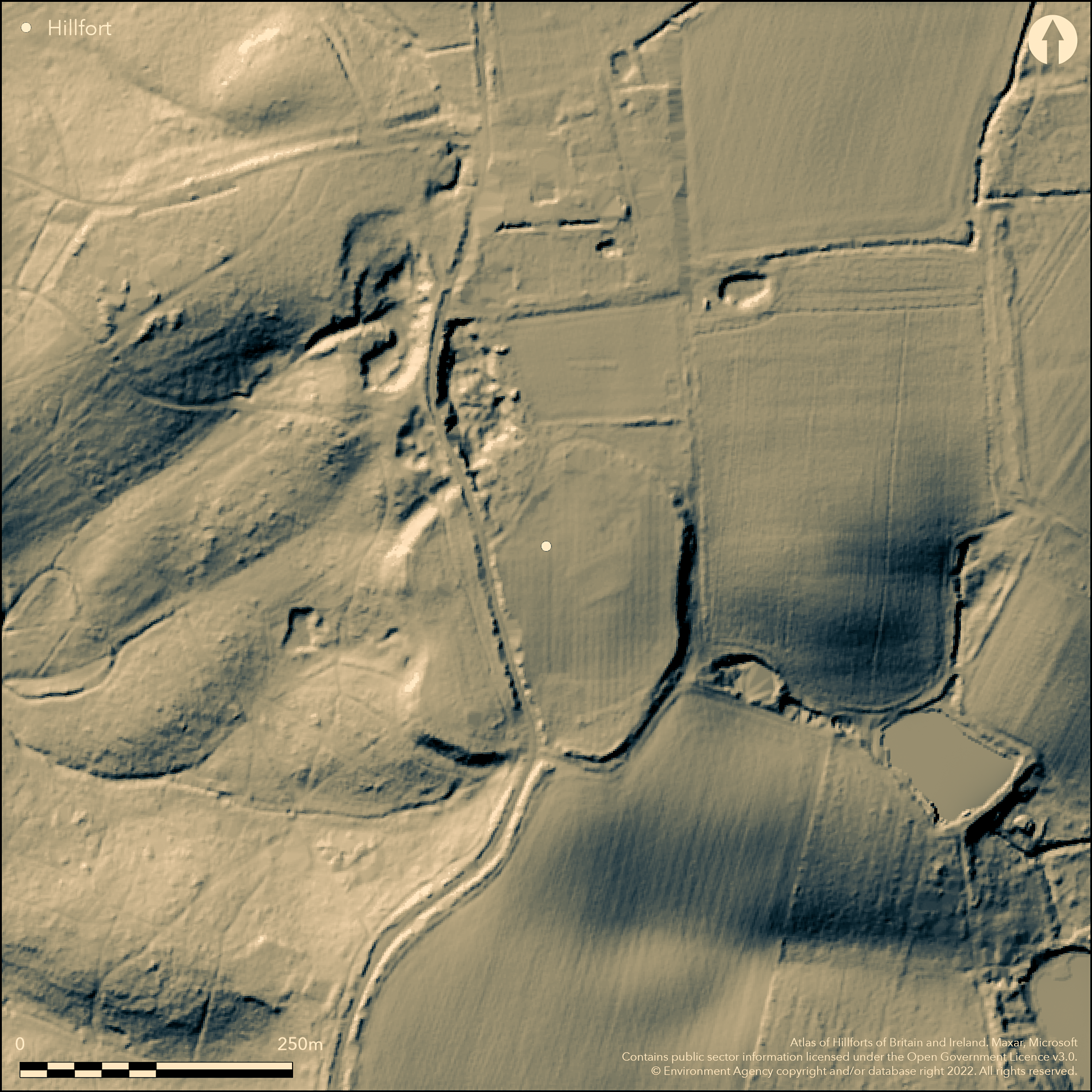
LiDAR 1m DTM Hillshade
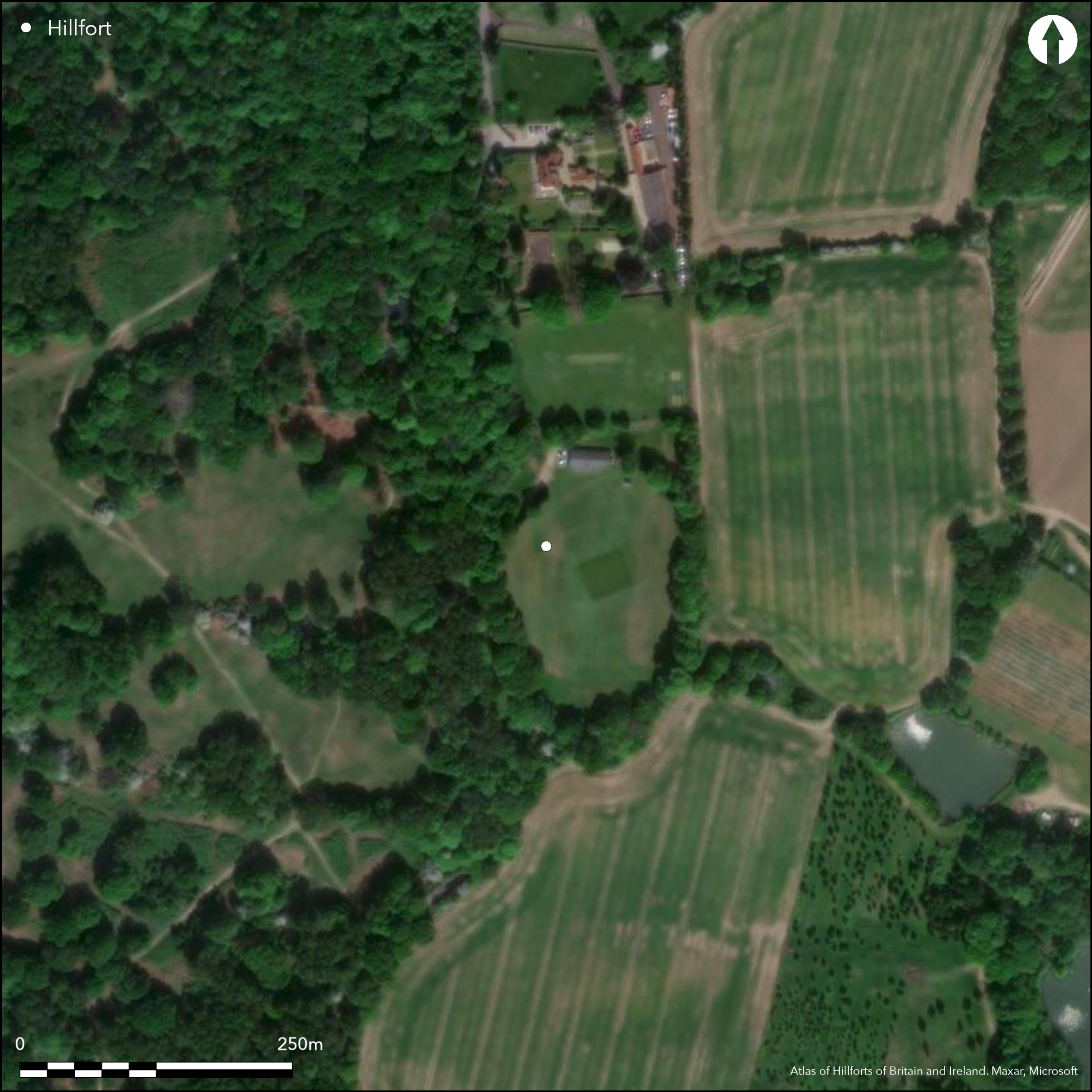
Satellite Imagery
LiDAR 1m DTM Hillshade
Satellite Imagery
Scroll left/right to view further images.
HER: Essex 531 (None)
NMR: TQ 59 SE 5 (411617)
SM: 1013833
NGR: TQ 5788 9465
X: 557880 Y: 194650 (OSGB36)
A slight univallate hillfort lying 300m to the W of Calcott Hall Farm within South Weald Country Park. It occupies a slight hillslope at approximately 98-102m OD. A road running S-NNW cuts the ramparts, beyond which the western side lies within woodland. Almost circular in plan it comprises a single bank and external ditch enclosing approximately 2.8ha. It survives as a slight earthwork in the W. Between the bank and ditch the scarp slope has been modified and is up to 3m high. Elsewhere the levelled bank is indicated only as a slight break in slope. The ditch It is now partially in-filled in places, elsewhere it survives as a buried feature. Two trenches excavated in 1990 (Medlycott et al. 1995) showed it to be 3.4m wide and 1.4m deep with steep sides which tapered to an approximately 1.5m wide flattened bottom. Silts at the bottom of the ditch were considered to have formed under waterlogged conditions shortly after the ditch was dug. A limited number of pottery sherds recovered from near the base of the ditch were dated 1st century BC-1st century AD, suggesting it was constructed in the late Iron Age. The ditch was recut between the 10th and 12th centuries AD. One entrance survives in the S with a slightly in-turned terminal in the E (Isserlin 1995, 44). Behind the rampart a linear slot from which charcoal, burnt clay and burnt stones were recovered, was interpreted as a possible revetment slot. An oval posthole and further postholes running at right angles and parallel to the rampart were also recorded. A cricket ground and pavilion now lies inside in the NE. Recorded on 1872-3, 1:2,500 OS mapping.
Citizen Science: ✗
Reliability of Data: Confirmed
Reliability of Interpretation: Confirmed
X: 31129 Y: 6733224 (EPSG: 3857)
Longitude: 0.27963342069005803 Latitude: 51.62846467475133 (EPSG:4326)
Country: England
Current County or Unitary Authority: Essex
Historic County: Essex
Current Parish/Community/Council/Townland: Brentwood
Survives in poor condition. Ploughed in the E in the past. Ramparts are almost levelled and were dug into for foxes in the 19th century. Used for allotments during WWII
| Extant | ✓ |
| Cropmark | ✗ |
| Likely Destroyed | ✓ |
The western side of the hillfort lies within Weald Country Park, formerly Weald Deer Park. South Weald cricket ground lies in the N.
| Woodland | ✓ |
| Commercial Forestry Plantation | ✗ |
| Parkland | ✗ |
| Pasture (Grazing) | ✗ |
| Arable | ✗ |
| Scrub/Bracken | ✗ |
| Bare Outcrop | ✗ |
| Heather/Moorland | ✗ |
| Heath | ✗ |
| Built-up | ✗ |
| Coastal Grassland | ✗ |
| Other | ✓ |
A slight hillslope fort lying at 98-102m OD
| Contour Fort | ✗ |
| Partial Contour Fort | ✗ |
| Promontory Fort | ✗ |
| Hillslope Fort | ✓ |
| Level Terrain Fort | ✗ |
| Marsh Fort | ✗ |
| Multiple Enclosure Fort | ✗ |
| Hilltop | ✗ |
| Coastal Promontory | ✗ |
| Inland Promontory | ✗ |
| Valley Bottom | ✗ |
| Knoll/Hillock/Outcrop | ✗ |
| Ridge | ✗ |
| Cliff/Plateau-edge/Scarp | ✗ |
| Hillslope | ✓ |
| Lowland | ✗ |
| Spur | ✗ |
Dominant Topographic Feature: Slight hillslope
| North | ✓ |
| Northeast | ✗ |
| East | ✗ |
| Southeast | ✗ |
| South | ✗ |
| Southwest | ✗ |
| West | ✗ |
| Northwest | ✗ |
| Level | ✗ |
Altitude: 100.0m
N/A
A small number of pottery sherds recovered from near the base of the ditch dated to 1st century BC-1st century AD. Neolithic and medieval evidence.
Reliability: B - Medium
| Pre 1200BC | ✗ |
| 1200BC - 800BC | ✗ |
| 800BC - 400BC | ✗ |
| 400BC - AD50 | ✗ |
| AD50 - AD400 | ✓ |
| AD400 - AD 800 | ✗ |
| Post AD800 | ✗ |
| Unknown | ✗ |
| Pre Hillfort: | None |
| Post Hillfort: | None |
| Artefactual: | None |
Recorded on 1872-3, 1:2,500 OS mapping. A reported meeting of the Essex Field Club (1889, 211) provides a description of the site as given by a Mr Miller Christy in 1884. Field Investigations in 1953, 1957, 1975. Watching brief in 1975, Earthwork survey in 1994 (Isserlin 1995). Excavated in 1990. Scheduled
| 1st Identified Written Reference (1884): | None |
| Other (1975): | Watching brief - unpublished, nothing recorded |
| Excavation (1990): | None |
| Earthwork Survey (1994): | Essex County Council Field Archaeology Group |
| 1st Identified Map Depiction (None): | None |
Behind the rampart a linear slot from which charcoal, burnt clay and burnt stones were recovered was interpreted as a possible revetment slot. An oval posthole and further postholes running at right angles and parallel to the rampart were also recorded. Pottery from ditch
Springs and ponds are shown in the area
| None | ✓ |
| Spring | ✗ |
| Stream | ✗ |
| Pool | ✗ |
| Flush | ✗ |
| Well | ✗ |
| Other | ✗ |
None
| No Known Features | ✓ |
| Round Stone Structures | ✗ |
| Rectangular Stone Structures | ✗ |
| Curvilinear Platforms | ✗ |
| Other Roundhouse Evidence | ✗ |
| Pits | ✗ |
| Quarry Hollows | ✗ |
| Other | ✗ |
Ramparts only investigated
| No Known Excavation | ✓ |
| Pits | ✗ |
| Postholes | ✗ |
| Roundhouses | ✗ |
| Rectangular Structures | ✗ |
| Roads/Tracks | ✗ |
| Quarry Hollows | ✗ |
| Other | ✗ |
| Nothing Found | ✗ |
None
| No Known Geophysics | ✓ |
| Pits | ✗ |
| Roundhouses | ✗ |
| Rectangular Structures | ✗ |
| Roads/Tracks | ✗ |
| Quarry Hollows | ✗ |
| Other | ✗ |
| Nothing Found | ✗ |
None
| No Known Finds | ✗ |
| Pottery | ✓ |
| Metal | ✗ |
| Metalworking | ✗ |
| Human Bones | ✗ |
| Animal Bones | ✗ |
| Lithics | ✗ |
| Environmental | ✗ |
| Other | ✗ |
None
| APs Not Checked | ✗ |
| None | ✓ |
| Roundhouses | ✗ |
| Rectangular Structures | ✗ |
| Pits | ✗ |
| Postholes | ✗ |
| Roads/Tracks | ✗ |
| Other | ✗ |
One entrance survives in the S with slighlty in-turned terminal in the E. Shown on plan of phasing (isserlin 1995, 44)
| 2: | None |
| 2: | None |
Guard Chambers: ✗
Chevaux de Frise: ✗
| 1. In-turned (South): | None |
Slight univallate hillfort. Almost circular in plan, comprising a single bank and external ditch enclosing approximately 2.8ha. It survives as a slight earthwork in the W. Between the bank and ditch the scarp slope has been modified and is up to 3m high in places. Elsewhere the levelled bank is indicated only as a slight break in slope. The ditch It is now partially in-filled in places, elsewhere it survives as a buried feature. Excavation showed it to be 3.4m wide and 1.4m deep, flat-bottomed with steep sides which tapered to approximately 1.5m wide at the bottom. The ditch was recut between the 10th and 12th centuries AD.
| Area 1: | 2.8ha. |
| Total: | 2.8ha. |
Total Footprint Area: Noneha.
None
| ✗ | None |
| ✓ | None |
| NE Quadrant: | 1 |
| SE Quadrant: | 1 |
| SW Quadrant: | 1 |
| NW Quadrant: | 1 |
| Total: | 1 |
| Partial Univallate | ✗ |
| Univallate | ✓ |
| Partial Bivallate | ✗ |
| Bivallate | ✗ |
| Partial Multivallate | ✗ |
| Multivallate | ✗ |
| Unknown | ✗ |
| Partial Univallate | ✗ |
| Univallate | ✗ |
| Partial Bivallate | ✗ |
| Bivallate | ✗ |
| Partial Multivallate | ✗ |
| Multivallate | ✗ |
Earthen bank in W
| None | ✗ |
| Earthen Bank | ✓ |
| Stone Wall | ✗ |
| Rubble | ✗ |
| Wall-walk | ✗ |
| Evidence of Timber | ✗ |
| Vitrification | ✗ |
| Other Burning | ✗ |
| Palisade | ✗ |
| Counter Scarp Bank | ✗ |
| Berm | ✗ |
| Unfinished | ✗ |
| Other | ✗ |
None
| None | ✗ |
| Earthen Bank | ✓ |
| Stone Wall | ✗ |
| Murus Duplex | ✗ |
| Timber-framed | ✗ |
| Timber-laced | ✗ |
| Vitrification | ✗ |
| Other Burning | ✗ |
| Palisade | ✗ |
| Counter Scarp Bank | ✗ |
| Berm | ✗ |
| Unfinished | ✗ |
| No Known Excavation | ✗ |
| Other | ✗ |
| ✗ | None |
| ✓ | None |
Number of Ditches: 1
| ✗ | None |
Anon. 1889. The Essex Field Club Meeting at Ingatestone, in the Writtle and Blackmore High Woods, and at Writtle Park, Saturday, May 11th, 1889. Essex Natur. Vol 3,
Isserlin, R. M. J. 1995. Analytical field survey at two Essex "hillforts": South Weald Camp and Langdon Hills. Essex Archaeol Hist. 26, 40-52
Medlycott, M., Bedwin, O. and Godbold, S. 1995. South Weald Camp-a probable Late Iron Age hillfort: excavations 1990. Essex Archaeol Hist', 26, 53-64
Atlas of Hillforts:
Wikidata:
This work is licensed under CC BY-SA 4.0

 and should be cited as:
Lock, Gary and Ralston, Ian. 2024. Atlas of Hillforts of Britain and Ireland. Available at: https://hillforts.arch.ox.ac.uk
Document Version 1.1