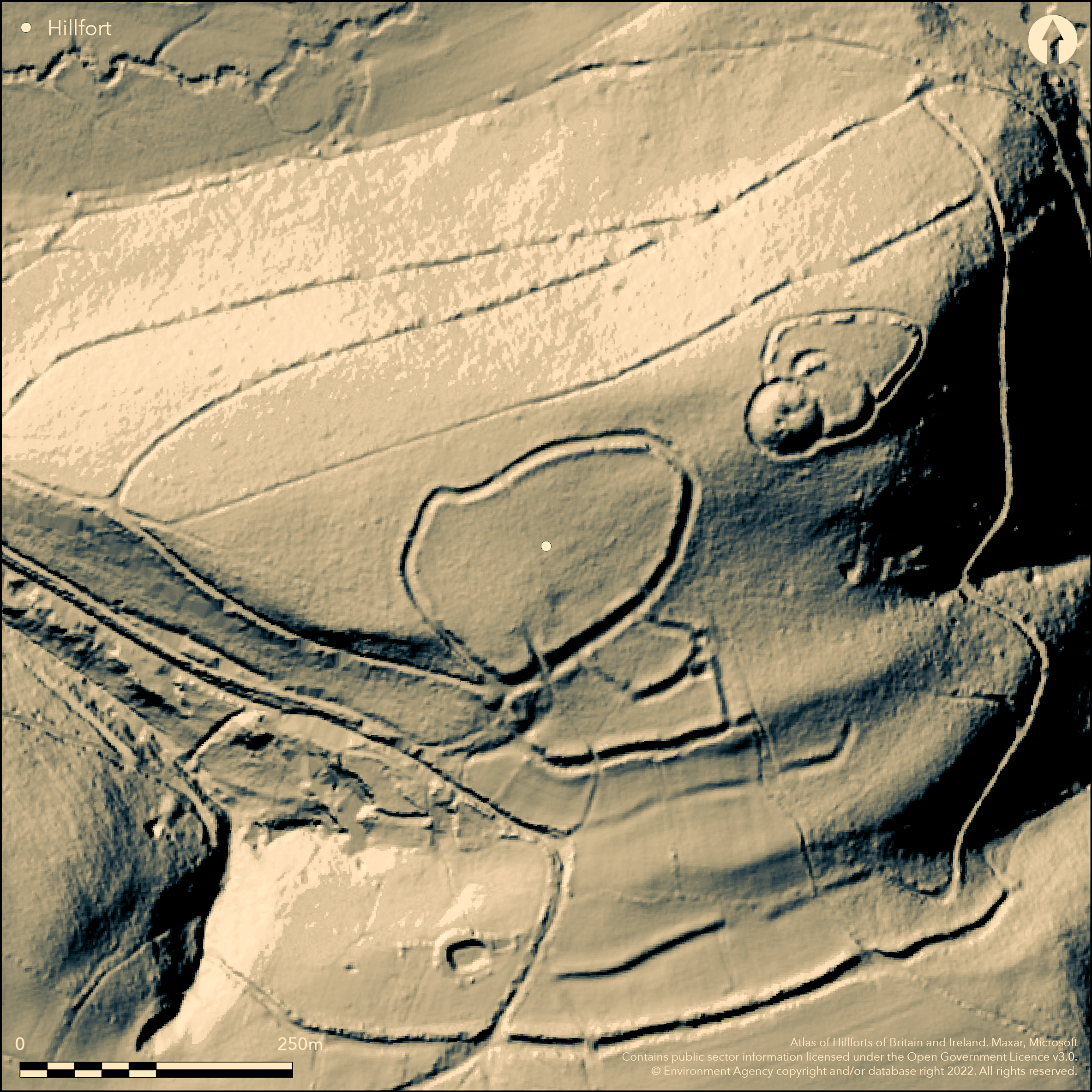
LiDAR 1m DTM Hillshade
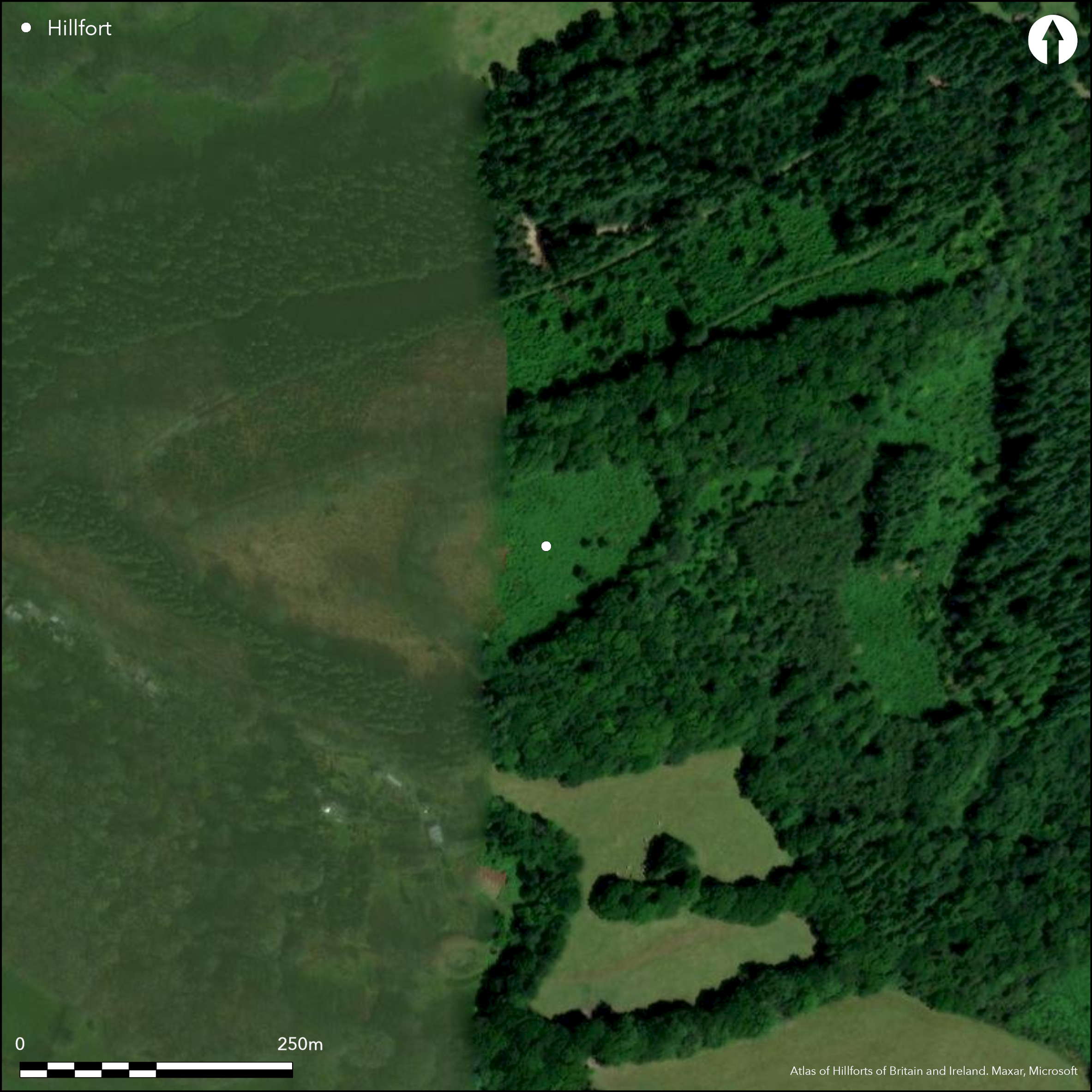
Satellite Imagery
LiDAR 1m DTM Hillshade
Satellite Imagery
Scroll left/right to view further images.
HER: Devon MDV5628 (None)
NMR: SX 48 NE 2 (438070)
SM: 1018519
NGR: SX49548754
X: 249540 Y: 87531 (OSGB36)
Complex, probable multiple enclosure hillfort located at N end of prominent ridge promontory overlooking valleys of River Lew and one of its major tributaries. Steep surrounding slopes. Site lies juxtaposed to motte with two baileys 36m to its NW. Hillfort roughly oval measuring c. 144m E-W by 94m, with internal area of inner enclosure c. 1.4ha, total site area c. 4.8ha. Defined by two ramparts and ditches, outermost ditch mostly buried feature. Outer rampart 9m wide and 1.3m high; inner ditch 7.2m wide and 0.8m deep; inner rampart 6.8m wide and 2.2m high. On S side series of smaller irregular shaped enclosures with bank and ditch and five outer defensive ramparts and ditches to S. The outermost bank links two naturally steep valley slopes to form major outer line and thus cut off the ridge promontory. SE entrance to one of these enclosure and central entrance to fourth outer rampart. This long line of banks has been cut through for field access over the years. Within upper fill of ditch stone built farm building and well, probably during 19th century. On 1st Ed. OS map (1884). Minimal investigations, undated.
Citizen Science: ✗
Reliability of Data: Confirmed
Reliability of Interpretation: Confirmed
X: -459809 Y: 6562756 (EPSG: 3857)
Longitude: -4.130532218781781 Latitude: 50.667889994284195 (EPSG:4326)
Country: England
Current County or Unitary Authority: Devon
Historic County: Devon
Current Parish/Community/Council/Townland: Bridestowe
Generally good condition despite trees. Within upper fill of ditch stone built farm building and well, probably during 19th century.
| Extant | ✓ |
| Cropmark | ✗ |
| Likely Destroyed | ✗ |
Dense woodland within Burley Wood.
| Woodland | ✓ |
| Commercial Forestry Plantation | ✗ |
| Parkland | ✗ |
| Pasture (Grazing) | ✗ |
| Arable | ✗ |
| Scrub/Bracken | ✗ |
| Bare Outcrop | ✗ |
| Heather/Moorland | ✗ |
| Heath | ✗ |
| Built-up | ✗ |
| Coastal Grassland | ✗ |
| Other | ✗ |
Complex, multiple enclosure hillfort located at N end of prominent ridge promontory overlooking valleys of River Lew and one of its major tributaries. Steep surrounding slopes.
| Contour Fort | ✗ |
| Partial Contour Fort | ✗ |
| Promontory Fort | ✗ |
| Hillslope Fort | ✗ |
| Level Terrain Fort | ✗ |
| Marsh Fort | ✗ |
| Multiple Enclosure Fort | ✓ |
| Hilltop | ✗ |
| Coastal Promontory | ✗ |
| Inland Promontory | ✗ |
| Valley Bottom | ✗ |
| Knoll/Hillock/Outcrop | ✗ |
| Ridge | ✓ |
| Cliff/Plateau-edge/Scarp | ✗ |
| Hillslope | ✗ |
| Lowland | ✗ |
| Spur | ✗ |
Dominant Topographic Feature: Ridge
| North | ✗ |
| Northeast | ✗ |
| East | ✗ |
| Southeast | ✗ |
| South | ✗ |
| Southwest | ✗ |
| West | ✗ |
| Northwest | ✗ |
| Level | ✓ |
Altitude: 213.0m
N/A
Reliability: D - None
| Pre 1200BC | ✗ |
| 1200BC - 800BC | ✗ |
| 800BC - 400BC | ✗ |
| 400BC - AD50 | ✗ |
| AD50 - AD400 | ✗ |
| AD400 - AD 800 | ✗ |
| Post AD800 | ✗ |
| Unknown | ✓ |
| Pre Hillfort: | None |
| Post Hillfort: | None |
On 1st Ed. OS map (1884).
| 1st Identified Map Depiction (1884): | OS map. |
| Other (1972): | Visited by Hillfort Study Group |
None.
None
| None | ✓ |
| Spring | ✗ |
| Stream | ✗ |
| Pool | ✗ |
| Flush | ✗ |
| Well | ✗ |
| Other | ✗ |
Possible quarry type depressions to SE.
| No Known Features | ✗ |
| Round Stone Structures | ✗ |
| Rectangular Stone Structures | ✗ |
| Curvilinear Platforms | ✗ |
| Other Roundhouse Evidence | ✗ |
| Pits | ✗ |
| Quarry Hollows | ✓ |
| Other | ✗ |
None
| No Known Excavation | ✓ |
| Pits | ✗ |
| Postholes | ✗ |
| Roundhouses | ✗ |
| Rectangular Structures | ✗ |
| Roads/Tracks | ✗ |
| Quarry Hollows | ✗ |
| Other | ✗ |
| Nothing Found | ✗ |
None
| No Known Geophysics | ✓ |
| Pits | ✗ |
| Roundhouses | ✗ |
| Rectangular Structures | ✗ |
| Roads/Tracks | ✗ |
| Quarry Hollows | ✗ |
| Other | ✗ |
| Nothing Found | ✗ |
None
| No Known Finds | ✓ |
| Pottery | ✗ |
| Metal | ✗ |
| Metalworking | ✗ |
| Human Bones | ✗ |
| Animal Bones | ✗ |
| Lithics | ✗ |
| Environmental | ✗ |
| Other | ✗ |
None
| APs Not Checked | ✓ |
| None | ✗ |
| Roundhouses | ✗ |
| Rectangular Structures | ✗ |
| Pits | ✗ |
| Postholes | ✗ |
| Roads/Tracks | ✗ |
| Other | ✗ |
SE entrance to one of defended enclosures and central entrance to fourth outer rampart.
| None: | Long defensive line has been cut through for field access over the years. Number of gaps not specified. |
| 2: | None |
Guard Chambers: ✗
Chevaux de Frise: ✗
| 1. Simple Gap (South east): | Entrance to one of defended enclosures. |
| 2. Simple Gap (South east): | Entrance through fourth outer bank. |
Defined by two ramparts and ditches, outermost ditch mostly buried feature. Outer rampart 9m wide and 1.3m high; inner ditch 7.2m wide and 0.8m deep; inner rampart 6.8m wide and 2.2m high. On S side series of smaller irregular shaped defended enclosures with bank and ditch and five outer defensive ramparts and ditches to S. The outermost bank links two naturally steep valley slopes to form major defensive outer line and thus cut off the ridge promontory.
| Area 1: | 1.4ha. |
| Area 2: | 4.8ha. |
| Total: | 4.8ha. |
Total Footprint Area: Noneha.
None
| ✓ | Probably phased construction visible, but no direct evidence. |
| ✓ | None |
| NE Quadrant: | 2 |
| SE Quadrant: | 7 |
| SW Quadrant: | 7 |
| NW Quadrant: | 2 |
| Total: | 7 |
| Partial Univallate | ✗ |
| Univallate | ✗ |
| Partial Bivallate | ✓ |
| Bivallate | ✗ |
| Partial Multivallate | ✓ |
| Multivallate | ✗ |
| Unknown | ✗ |
| Partial Univallate | ✗ |
| Univallate | ✗ |
| Partial Bivallate | ✗ |
| Bivallate | ✗ |
| Partial Multivallate | ✗ |
| Multivallate | ✗ |
None
| None | ✗ |
| Earthen Bank | ✓ |
| Stone Wall | ✗ |
| Rubble | ✗ |
| Wall-walk | ✗ |
| Evidence of Timber | ✗ |
| Vitrification | ✗ |
| Other Burning | ✗ |
| Palisade | ✗ |
| Counter Scarp Bank | ✗ |
| Berm | ✗ |
| Unfinished | ✗ |
| Other | ✗ |
None
| None | ✗ |
| Earthen Bank | ✗ |
| Stone Wall | ✗ |
| Murus Duplex | ✗ |
| Timber-framed | ✗ |
| Timber-laced | ✗ |
| Vitrification | ✗ |
| Other Burning | ✗ |
| Palisade | ✗ |
| Counter Scarp Bank | ✗ |
| Berm | ✗ |
| Unfinished | ✗ |
| No Known Excavation | ✓ |
| Other | ✗ |
| ✗ | None |
| ✓ | Possibly seven, but uncertain. |
Number of Ditches: 7
| ✗ | None |
Wall, J.C. 1906. Ancient Earthworks, In W. Page (ed), The Victoria County History of the County of Devon, Vol I, London: James Street, Haymarket, 616-18.
Atlas of Hillforts:
Wikidata:
This work is licensed under CC BY-SA 4.0

 and should be cited as:
Lock, Gary and Ralston, Ian. 2024. Atlas of Hillforts of Britain and Ireland. Available at: https://hillforts.arch.ox.ac.uk
Document Version 1.1