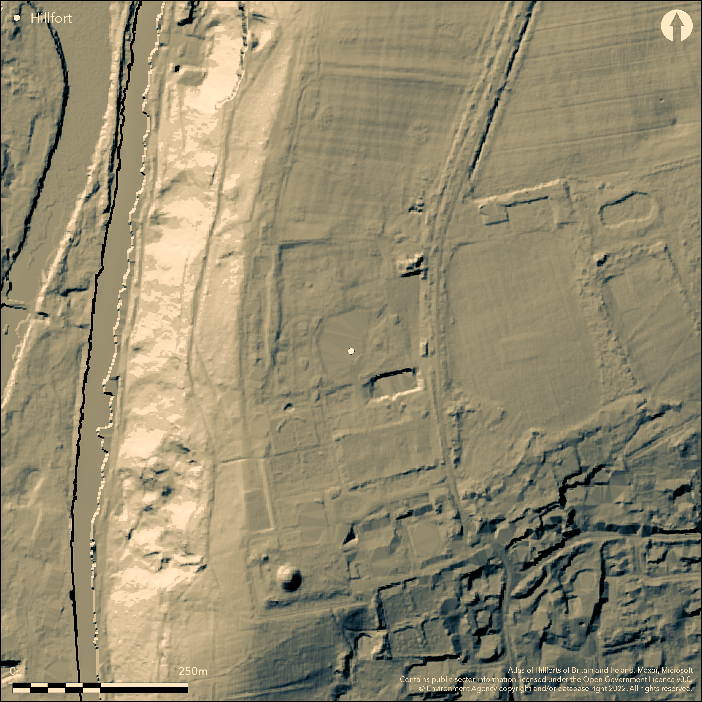
LiDAR 1m DTM Hillshade
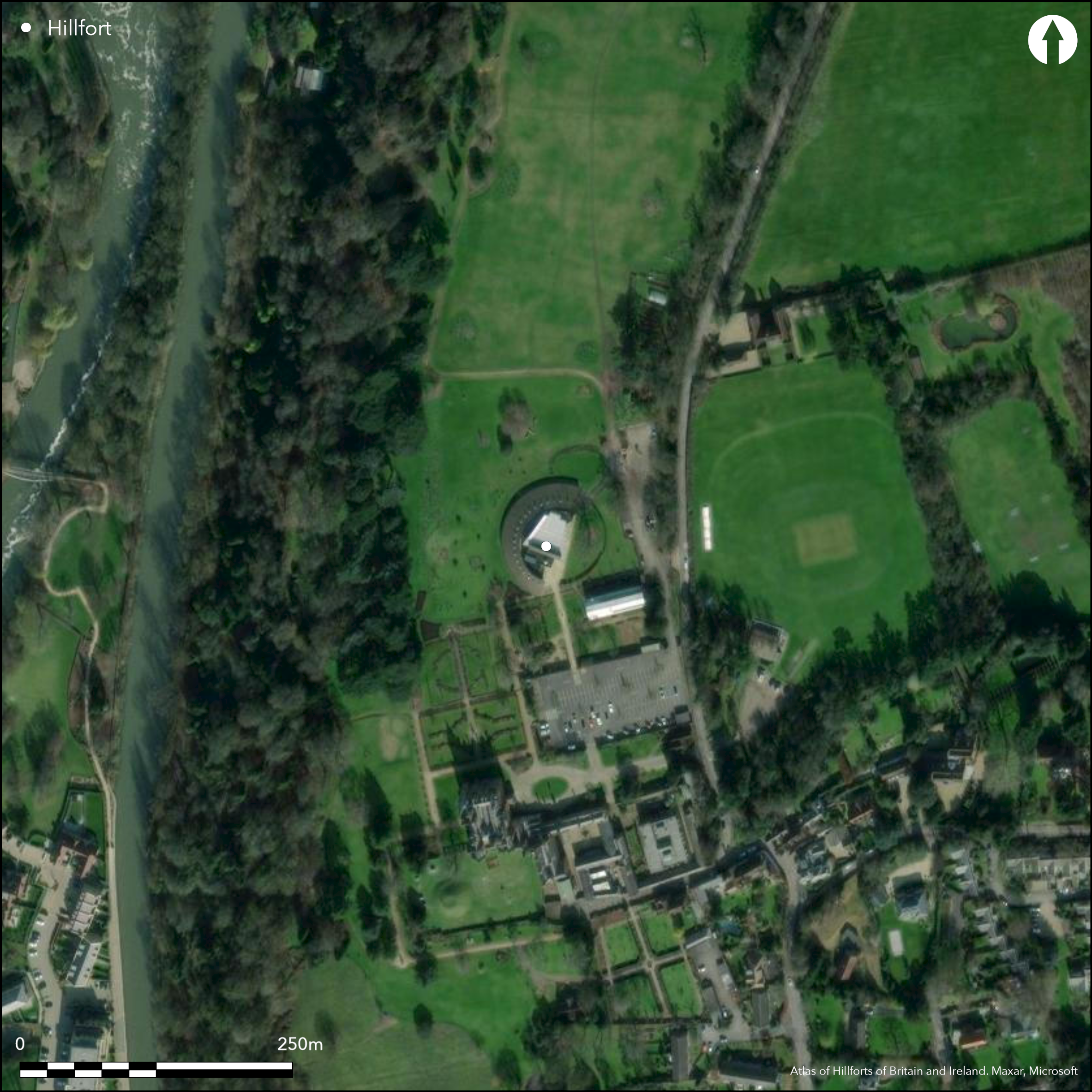
Satellite Imagery
LiDAR 1m DTM Hillshade
Satellite Imagery
Scroll left/right to view further images.
HER: Buckinghamshire 632100000 (None)
NMR: SU 98 SW 153 (1314186)
SM: None
NGR: SU 9066 8237
X: 490667 Y: 182370 (OSGB36)
At Taplow Court, a multi-period hillfort of at least three phases, re-discovered during an evaluation in 1998 and further investigated in 1999/2000 (Allen and Lamdin-Whymark 2001; Allen et. al. 2009). The site lies on the brow of a projecting spur on the E bank of the River Thames, overlooking the Thames floodplain. In common with Rams Hill (Atlas No. 0167) and Castle Hill (Atlas No. 0142), both in Oxfordshire, the site originated from a late Bronze Age hilltop enclosure. Evidence from within the interior suggests this period of occupation spanned the 11th-9th centuries BC with the first phase of enclosure a fence-line with postholes set 1m apart. To the W of this was a palisade trench, beyond which was a second line of postholes spaced 2.5m apart, their function and temporal relationship to the palisade trench uncertain, but possibly a further phase of enclosure. Four metres to the E of the palisade, a V-shaped ditch 6m wide and 2.6m deep followed the line of palisade, narrowing and terminating in the N at what is probably an entrance. Radiocarbon and OSL dating and artefacts gave a late Bronze Age-early Iron Age date for the ditch. To the E of this, additional lines of postholes possibly represent further palisades that preceded the construction of the ditch. Later in the Iron Age, after a hiatus, a U-shaped ditch 8-9m wide and 2.8m deep with straight sides, which also terminated in the N, was constructed to the E of the V-shaped ditch. The upcast created a bank which overlay the earlier V-shaped ditch and into which a frame for a timber-laced rampart was constructed. Deposits of charcoal and burnt timber show this was later destroyed by fire. Chalk slabs found in the ditch fills suggest the bank was also faced with stone. Running eastwards from the terminal of the U-shaped ditch was a smaller, 3m wide ditch, which at 7-8m turned at right-angles to run NE across the line of the opening. This is interpreted as a possible hornwork constructed during the Iron Age. A further outer ditch 7m wide and 1.2m deep discovered during a watching brief, might represent an enlargement of the site in a later phase of enclosure but remains undated. The E, S and W sides of the hillfort have been determined by excavation and topography, but the northern extent is uncertain. The site was reoccupied in the early Saxon period, possibly by individuals of high status. In-situ Mesolithic and early Neolithic flint and sherds from a collared urn recovered from a number of tree-throws and other hollows attest to earlier activity on the hill. Resistance survey carried out by Marlow Archaeological Society in 2005. The site is not recorded on OS mapping.
Citizen Science: ✗
Reliability of Data: Confirmed
Reliability of Interpretation: Confirmed
X: -77284 Y: 6716107 (EPSG: 3857)
Longitude: -0.694253025676528 Latitude: 51.532914746932875 (EPSG:4326)
Country: England; None
Current County or Unitary Authority: Buckinghamshire
Historic County: Buckinghamshire
Current Parish/Community/Council/Townland: Taplow
Ploughed out
| Extant | ✗ |
| Cropmark | ✗ |
| Likely Destroyed | ✓ |
None
| Woodland | ✓ |
| Commercial Forestry Plantation | ✗ |
| Parkland | ✗ |
| Pasture (Grazing) | ✓ |
| Arable | ✗ |
| Scrub/Bracken | ✗ |
| Bare Outcrop | ✗ |
| Heather/Moorland | ✗ |
| Heath | ✗ |
| Built-up | ✓ |
| Coastal Grassland | ✗ |
| Other | ✗ |
A partial contour fort lying at 67m OD on the brow of a projecting spur on the E bank of the River Thames.
| Contour Fort | ✗ |
| Partial Contour Fort | ✓ |
| Promontory Fort | ✗ |
| Hillslope Fort | ✗ |
| Level Terrain Fort | ✗ |
| Marsh Fort | ✗ |
| Multiple Enclosure Fort | ✗ |
| Hilltop | ✓ |
| Coastal Promontory | ✗ |
| Inland Promontory | ✗ |
| Valley Bottom | ✗ |
| Knoll/Hillock/Outcrop | ✗ |
| Ridge | ✗ |
| Cliff/Plateau-edge/Scarp | ✗ |
| Hillslope | ✗ |
| Lowland | ✗ |
| Spur | ✓ |
Dominant Topographic Feature: Projecting spur
| North | ✗ |
| Northeast | ✗ |
| East | ✗ |
| Southeast | ✗ |
| South | ✓ |
| Southwest | ✗ |
| West | ✓ |
| Northwest | ✗ |
| Level | ✗ |
Altitude: 67.0m
The River Thames to the E is the boundary between Buckinghamshire and Windsor and Maidenhead
Boundary Type: Other
15 radiocarbon dates and 6 OSL samples. Silts within the hillfort from the upper part are 2905 ± 300 BP (present = AD 2000) and 2690 ± 210 BP, which overlap in the range 2900 to 2605, or 900-605 BC (at 95% confidence) (Allen and Lamdin-Whymark 2000). Late Bronze Age-early Iron Age pottery. Horn (Forthcoming) suggests Hillfort LBA: 1030-860 BC terminus ante quem, Hillfort end LBA: 870-540 BC terminus ante quem, Hillfort start IA: 480-400 cal. BC, Hillfort end IA: c. 4th century BC. In-situ Mesolithic and early Neolithic flint and sherds from a collared urn recovered from a number of tree-throws and other hollows. Late Bronze Age hilltop enclosure. Saxon burial mound and inhumation and Saxon building; early Christian church; medieval manor house; large Victorian house, now home to a Buddhist organisation
Reliability: A - High
| Pre 1200BC | ✗ |
| 1200BC - 800BC | ✓ |
| 800BC - 400BC | ✓ |
| 400BC - AD50 | ✗ |
| AD50 - AD400 | ✗ |
| AD400 - AD 800 | ✗ |
| Post AD800 | ✗ |
| Unknown | ✗ |
| Pre Hillfort: | None |
| Post Hillfort: | None |
| Artefactual: | Pottery |
| C14: | None |
| Other: | OSL |
The Victoria County History recounts the discovery of a ditch and rampart underlying the foundations during the demolition of the church in 1853. Evaluation in 1998 by Wessex Archaeology and excavated in 1999/2000 by Oxford Archaeology (Allen and Lamdin-Whymark 2000, 22-28; 2001, 286-289)
| 1st Identified Written Reference (1908): | None |
| Geophysical Survey (2005): | None |
| Excavation (None): | None |
The interior of the hillfort was not investigated. Many finds from excavation, pottery, metal, animal bones, lithics, environmental.
River Thames lies to the W
| None | ✓ |
| Spring | ✗ |
| Stream | ✗ |
| Pool | ✗ |
| Flush | ✗ |
| Well | ✗ |
| Other | ✗ |
None
| No Known Features | ✓ |
| Round Stone Structures | ✗ |
| Rectangular Stone Structures | ✗ |
| Curvilinear Platforms | ✗ |
| Other Roundhouse Evidence | ✗ |
| Pits | ✗ |
| Quarry Hollows | ✗ |
| Other | ✗ |
Not investigated
| No Known Excavation | ✓ |
| Pits | ✗ |
| Postholes | ✗ |
| Roundhouses | ✗ |
| Rectangular Structures | ✗ |
| Roads/Tracks | ✗ |
| Quarry Hollows | ✗ |
| Other | ✗ |
| Nothing Found | ✗ |
Unable to locate report
| No Known Geophysics | ✗ |
| Pits | ✗ |
| Roundhouses | ✗ |
| Rectangular Structures | ✗ |
| Roads/Tracks | ✗ |
| Quarry Hollows | ✗ |
| Other | ✓ |
| Nothing Found | ✗ |
None
| No Known Finds | ✗ |
| Pottery | ✓ |
| Metal | ✓ |
| Metalworking | ✗ |
| Human Bones | ✗ |
| Animal Bones | ✓ |
| Lithics | ✓ |
| Environmental | ✓ |
| Other | ✗ |
None
| APs Not Checked | ✓ |
| None | ✗ |
| Roundhouses | ✗ |
| Rectangular Structures | ✗ |
| Pits | ✗ |
| Postholes | ✗ |
| Roads/Tracks | ✗ |
| Other | ✗ |
A possible break with hornwork lies in the NE, identified from both the V-shaped and later U-shaped ditches terminating in the same location and a possible hornwork extending from the U-shaped ditch, identified from a 3m wide ditch which at 7-8m turned at right-angles to run NE across the line of the opening
| 1: | Only one break has been identified, although the site has not been fully investigated |
| 2: | In the NE late Bronze Age enclosure |
Guard Chambers: ✗
Chevaux de Frise: ✗
| 1. Hornwork (North east): | None |
Earliest phase composed of fencelines and palisades. These were overlain with upcast from a V-shaped ditch, which was itself overlain by a sand a gravel rampart constructed from the upcast from a U-shaped ditch which was backed by a timber-laced rampart. A further outer ditch 7m wide and 1.2m deep discovered during a watching brief, might represent an enlargement of the defences, but is undated. The extent of the enclosed area is unknown.
| Area 1: | Noneha. |
| Total: | Noneha. |
Total Footprint Area: Noneha.
None
| ✓ | Possibly several phases of palisade prior to construction of hillfort |
| ✗ | Unknown |
| NE Quadrant: | 2 |
| SE Quadrant: | 2 |
| SW Quadrant: | None |
| NW Quadrant: | None |
| Total: | 2 |
| Partial Univallate | ✗ |
| Univallate | ✗ |
| Partial Bivallate | ✓ |
| Bivallate | ✗ |
| Partial Multivallate | ✗ |
| Multivallate | ✗ |
| Unknown | ✗ |
| Partial Univallate | ✗ |
| Univallate | ✗ |
| Partial Bivallate | ✗ |
| Bivallate | ✗ |
| Partial Multivallate | ✗ |
| Multivallate | ✗ |
Ploughed down
| None | ✓ |
| Earthen Bank | ✗ |
| Stone Wall | ✗ |
| Rubble | ✗ |
| Wall-walk | ✗ |
| Evidence of Timber | ✗ |
| Vitrification | ✗ |
| Other Burning | ✗ |
| Palisade | ✗ |
| Counter Scarp Bank | ✗ |
| Berm | ✗ |
| Unfinished | ✗ |
| Other | ✗ |
Sand and gravel bank, possibly faced with stone
| None | ✗ |
| Earthen Bank | ✓ |
| Stone Wall | ✓ |
| Murus Duplex | ✗ |
| Timber-framed | ✗ |
| Timber-laced | ✓ |
| Vitrification | ✗ |
| Other Burning | ✓ |
| Palisade | ✓ |
| Counter Scarp Bank | ✗ |
| Berm | ✗ |
| Unfinished | ✗ |
| No Known Excavation | ✗ |
| Other | ✗ |
| ✗ | None |
| ✓ | Two main phases of ditches. Further outer ditch undated |
Number of Ditches: 2
| ✗ | None |
Allen, T, and Lamdin-Whymark, H. 2001. The Taplow Hillfort. Current Archaeol. 175. 286-289
Allen, T., Hayden, C. and Lamdin-Whymark, H. 2009. From Bronze Age Enclosure to Anglo-Saxon Settlement: Archaeological Excavations at Taplow Hillfort 1999-2005. Thames Valley Landscapes Monograph
Horn, J. Forthcoming. The dating of hillforts in Britain and Ireland. Unpublished PhD thesis, University of Edinburgh.
Maricevic, D. and Lamdin-Whymark, H. 2005. Taplow Court (Phase 2), Taplow, Buckinghamshire. Archaeological Evaluation Report. Oxford Archaeology. https://library.thehumanjourney.net/460/1/TAPC05.pdfA.pdf. Accessed October 2015.
Marlow Archaeological Society, 2005. Taplow Court: Fieldwork Record Drawings - Survey & Resistivity October 2005. Unpublished.
Page, W. (ed) 1908. The Victoria Hstory of the County of Buckingham
Atlas of Hillforts:
Wikidata:
This work is licensed under CC BY-SA 4.0

 and should be cited as:
Lock, Gary and Ralston, Ian. 2024. Atlas of Hillforts of Britain and Ireland. Available at: https://hillforts.arch.ox.ac.uk
Document Version 1.1