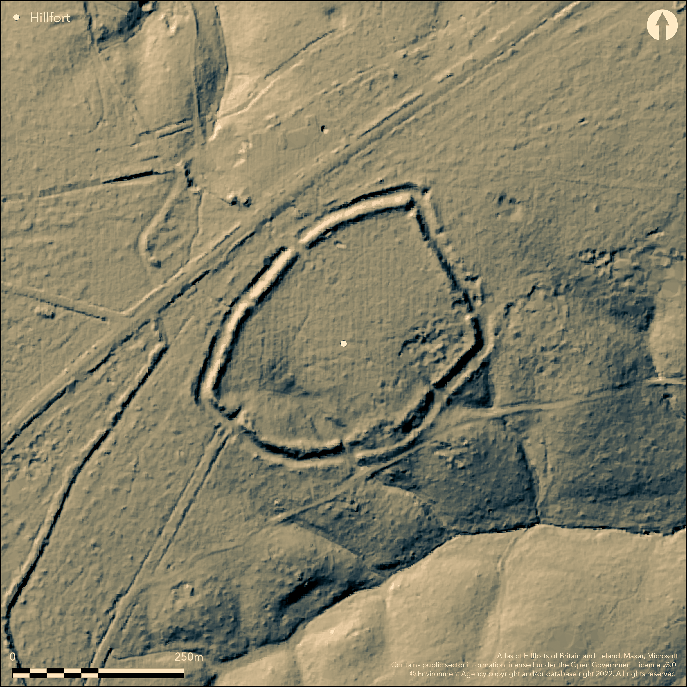
LiDAR 1m DTM Hillshade
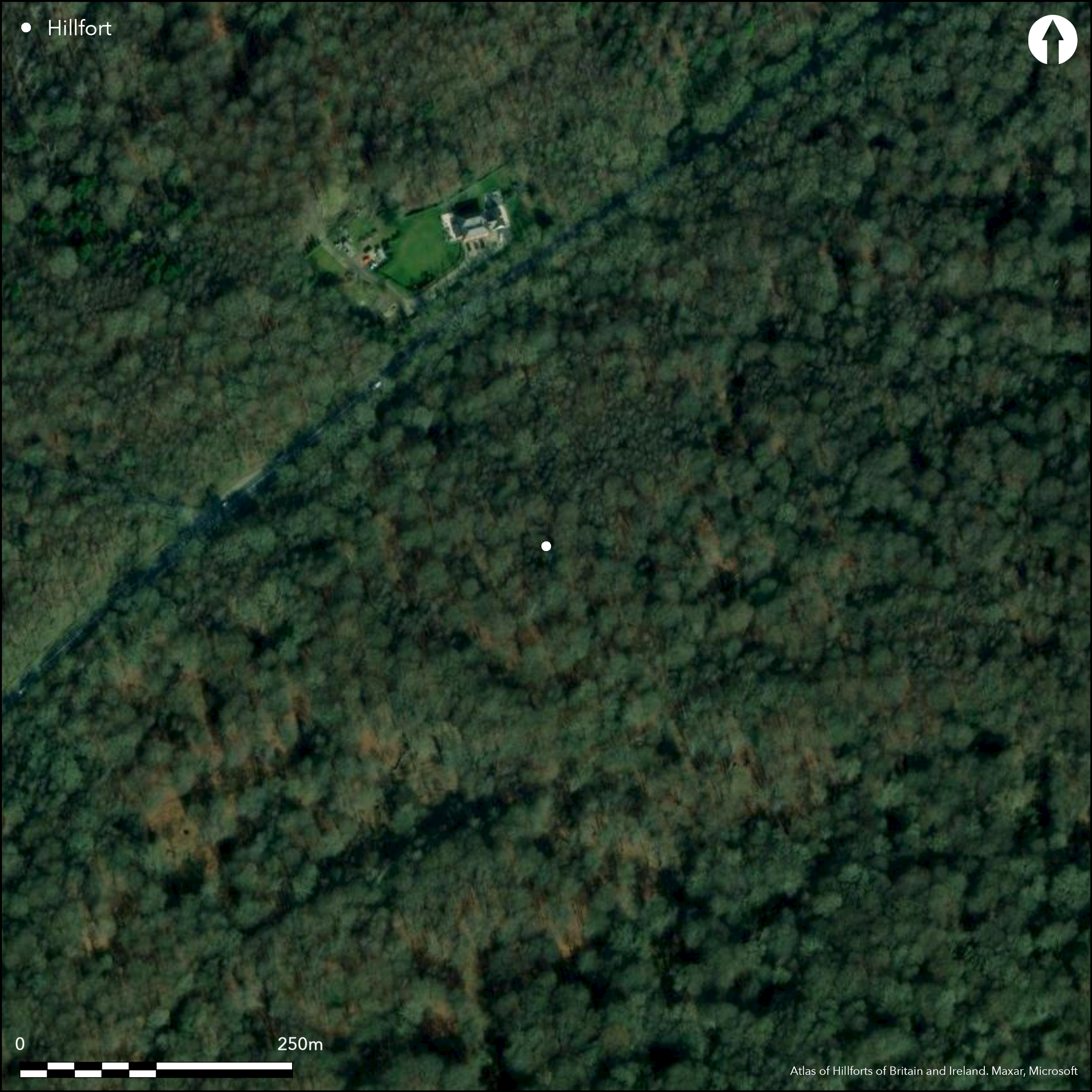
Satellite Imagery
LiDAR 1m DTM Hillshade
Satellite Imagery
Scroll left/right to view further images.
HER: Essex 24-26 (None)
NMR: TL 40 SW 6 (369868)
SM: 1013517
NGR: TL 4378 0030
X: 543780 Y: 200300 (OSGB36)
A slight univallate hillfort the NW of Theydon Bois Golf Course, lying at the highest point within Epping Forest and 3km to the NE from Loughton Camp (Atlas No. 3483). Sub-rectangular in form it encloses approximately 5ha. It occupies a ridge of sand and gravel which slopes gently to the SE at between 109-116m OD. The earthen bank of dump construction stands approximately 1.3-2.2m high and 13m wide with a counterscarp 0.4-1.0m high and 5m wide. The 7-10m wide flat-bottomed ditch is now silted up. A berm lies between the bank and ditch. Six breaks cut through the circuit, with only the one in the NW considered to be original, constructed as a stone revetted rectangular passage, possibly with inner and outer gates and approached by a causeway across the ditch. The bank terminals were revetted with coursed stone blocks. The head of a small valley lies within the interior in the SE from which a stream breaches the bank, although augering suggests the bank was originally complete. No internal occupation has been identified. The site has been dated from pottery recovered from the ditch, to the second half of first millennium BC with some reuse in the later Iron Age. The interior is crossed by medieval tracks and it was quarried for sand and gravel. Wild Service trees, a relict species, lie in the vicinity of the enclosure and this has been interpreted as the area still being wooded when the hillfort was constructed. Gold coins of Tasciovanus and Cunobelin were discovered by a metal detectorist in the vicinity of the hillfort. There are also unverified reports of finds of a spearhead, pottery, coin and a knife. Small amounts of worked flint including a barbed and tanged arrowhead was recovered from the ditch fills, suggesting 2nd millennium BC origins. Excavated by Pitt Rivers in 1881, with further investigations in 1933, 1956, 1958 and 1968 concentrated mainly on the ramparts with only a small area of the interior investigated (Alexander et. al. 1978). A resistance survey of 1.6ha was undertaken in 1958. Recorded on 1870-72, 1:2,500 OS mapping.
Citizen Science: ✗
Reliability of Data: Confirmed
Reliability of Interpretation: Confirmed
X: 8726 Y: 6743011 (EPSG: 3857)
Longitude: 0.07839006123558473 Latitude: 51.6830099619214 (EPSG:4326)
Country: England; None
Current County or Unitary Authority: Essex
Historic County: Essex
Current Parish/Community/Council/Townland: Epping Upland; Waltham Abbey, Theydon Bois
Disturbed by quarrying in the SE sector
| Extant | ✓ |
| Cropmark | ✗ |
| Likely Destroyed | ✗ |
None
| Woodland | ✓ |
| Commercial Forestry Plantation | ✗ |
| Parkland | ✗ |
| Pasture (Grazing) | ✗ |
| Arable | ✗ |
| Scrub/Bracken | ✗ |
| Bare Outcrop | ✗ |
| Heather/Moorland | ✗ |
| Heath | ✗ |
| Built-up | ✗ |
| Coastal Grassland | ✗ |
| Other | ✗ |
A hillslope fort lying on a ridge of sand and gravel at between 109-116m OD. The ridge slopes gently to the SE.
| Contour Fort | ✗ |
| Partial Contour Fort | ✗ |
| Promontory Fort | ✗ |
| Hillslope Fort | ✓ |
| Level Terrain Fort | ✗ |
| Marsh Fort | ✗ |
| Multiple Enclosure Fort | ✗ |
| Hilltop | ✗ |
| Coastal Promontory | ✗ |
| Inland Promontory | ✗ |
| Valley Bottom | ✗ |
| Knoll/Hillock/Outcrop | ✗ |
| Ridge | ✓ |
| Cliff/Plateau-edge/Scarp | ✗ |
| Hillslope | ✓ |
| Lowland | ✗ |
| Spur | ✗ |
Dominant Topographic Feature: Ridge
| North | ✗ |
| Northeast | ✗ |
| East | ✗ |
| Southeast | ✓ |
| South | ✗ |
| Southwest | ✗ |
| West | ✗ |
| Northwest | ✗ |
| Level | ✗ |
Altitude: 116.0m
The hillfort lies at the junction of a number of parish boundaries. The boundary between Epping Upland and Waltham Abbey runs NW-SE through the enclosure. The parish boundary between Epping Upland and Theydon Bois lies 150m to the SE. The parish boundary between Waltham Abbey and Theydon Bois lies to the 100m to the SW.
Boundary Type: Parish/Townland
Small amounts of worked flint including a barbed and tanged arrowhead were recovered from the ditch fills, suggesting 2nd millennium BC origins. The main works are dated by excavated pottery the the second half of the first millennium with use in the later Iron Age
Reliability: B - Medium
| Pre 1200BC | ✗ |
| 1200BC - 800BC | ✓ |
| 800BC - 400BC | ✓ |
| 400BC - AD50 | ✓ |
| AD50 - AD400 | ✗ |
| AD400 - AD 800 | ✗ |
| Post AD800 | ✗ |
| Unknown | ✗ |
| Pre Hillfort: | None |
| Post Hillfort: | None |
| Artefactual: | Pottery |
Reference in Morant (1768). Recorded on 1870-72 1:2,500 OS mapping. Field investigations in 1969 and 1975. Excavated by Pitt Rivers in 1881, with further excavations in 1933, 1956, 1958 and 1968 (Alexander et al. 1978). Resistance survey in 1958. Scheduled
| 1st Identified Written Reference (1768): | None |
| Excavation (1881): | Pitt Rivers |
| Other (1923): | Scheduled |
| Geophysical Survey (1958): | Resistance |
| Other (1969): | Field investigation |
| Other (1975): | Field investigation |
| 1st Identified Map Depiction (None): | None |
| Excavation (None): | Alexander et al. 1978 |
The interior has been quarried for sand and gravel and no features contemporary with the enclosure are recorded. Unverified reports of metal detected finds of a spearhead, pottery, coin and knife. Small amounts of worked flint including a barbed and tanged arrowhead recovered from the ditch fills
A stream flows S-E through a gap in the bank
| None | ✗ |
| Spring | ✗ |
| Stream | ✓ |
| Pool | ✗ |
| Flush | ✗ |
| Well | ✗ |
| Other | ✗ |
None
| No Known Features | ✓ |
| Round Stone Structures | ✗ |
| Rectangular Stone Structures | ✗ |
| Curvilinear Platforms | ✗ |
| Other Roundhouse Evidence | ✗ |
| Pits | ✗ |
| Quarry Hollows | ✗ |
| Other | ✗ |
None
| No Known Excavation | ✗ |
| Pits | ✗ |
| Postholes | ✗ |
| Roundhouses | ✗ |
| Rectangular Structures | ✗ |
| Roads/Tracks | ✗ |
| Quarry Hollows | ✗ |
| Other | ✗ |
| Nothing Found | ✓ |
Small anomalies
| No Known Geophysics | ✗ |
| Pits | ✗ |
| Roundhouses | ✗ |
| Rectangular Structures | ✗ |
| Roads/Tracks | ✗ |
| Quarry Hollows | ✗ |
| Other | ✗ |
| Nothing Found | ✓ |
None
| No Known Finds | ✗ |
| Pottery | ✓ |
| Metal | ✓ |
| Metalworking | ✗ |
| Human Bones | ✗ |
| Animal Bones | ✗ |
| Lithics | ✓ |
| Environmental | ✗ |
| Other | ✗ |
Lies within woodland
| APs Not Checked | ✓ |
| None | ✗ |
| Roundhouses | ✗ |
| Rectangular Structures | ✗ |
| Pits | ✗ |
| Postholes | ✗ |
| Roads/Tracks | ✗ |
| Other | ✗ |
Six breaks cut through the circuit, with only the one in the NW considered to be original, constructed as a stone revetted rectangular passage, possibly with inner and outer gates and approached by a causeway across the ditch. The bank terminals were revetted with coursed stone blocks.
| 6: | None |
| 2: | None |
Guard Chambers: ✗
Chevaux de Frise: ✗
| 1. Passage-way/Corridor (North west): | None |
Univallate and sub-rectangular in form. It encloses approximately 5ha. It occupies level ground on a ridge of sand and gravel beyond which it slopes gently to the SE. The earthen bank is of dump construction and stands approximately 1.3-2.2m high and 13m wide with a counterscarp 0.4-1.0m high and 5m wide. The 7-10m wide flat-bottomed ditch is now silted up. A berm lies between the bank and ditch.
| Area 1: | 5.0ha. |
| Total: | 5.0ha. |
Total Footprint Area: Noneha.
None
| ✗ | None |
| ✓ | None |
| NE Quadrant: | 1 |
| SE Quadrant: | 1 |
| SW Quadrant: | 1 |
| NW Quadrant: | 1 |
| Total: | 1 |
| Partial Univallate | ✗ |
| Univallate | ✓ |
| Partial Bivallate | ✗ |
| Bivallate | ✗ |
| Partial Multivallate | ✗ |
| Multivallate | ✗ |
| Unknown | ✗ |
| Partial Univallate | ✗ |
| Univallate | ✗ |
| Partial Bivallate | ✗ |
| Bivallate | ✗ |
| Partial Multivallate | ✗ |
| Multivallate | ✗ |
None
| None | ✗ |
| Earthen Bank | ✓ |
| Stone Wall | ✗ |
| Rubble | ✗ |
| Wall-walk | ✗ |
| Evidence of Timber | ✗ |
| Vitrification | ✗ |
| Other Burning | ✗ |
| Palisade | ✗ |
| Counter Scarp Bank | ✓ |
| Berm | ✓ |
| Unfinished | ✗ |
| Other | ✗ |
None
| None | ✗ |
| Earthen Bank | ✓ |
| Stone Wall | ✗ |
| Murus Duplex | ✗ |
| Timber-framed | ✗ |
| Timber-laced | ✗ |
| Vitrification | ✗ |
| Other Burning | ✗ |
| Palisade | ✗ |
| Counter Scarp Bank | ✗ |
| Berm | ✗ |
| Unfinished | ✗ |
| No Known Excavation | ✗ |
| Other | ✗ |
| ✗ | None |
| ✓ | None |
Number of Ditches: 1
| ✗ | None |
Alexander, J.A., Cotton, M.A., Mackay, R.R., Hazzledine Warren, S. 1978. Ambresbury Banks, An Iron Age Camp In Epping Forest, Essex: a report of the excavations on 1933, 1956, 1958 and 1968. Essex Archaeol Hist 10, 189-205
Morant, P. 1768. History and Antiquities of Essex, II London
Atlas of Hillforts:
Wikidata:
This work is licensed under CC BY-SA 4.0

 and should be cited as:
Lock, Gary and Ralston, Ian. 2024. Atlas of Hillforts of Britain and Ireland. Available at: https://hillforts.arch.ox.ac.uk
Document Version 1.1