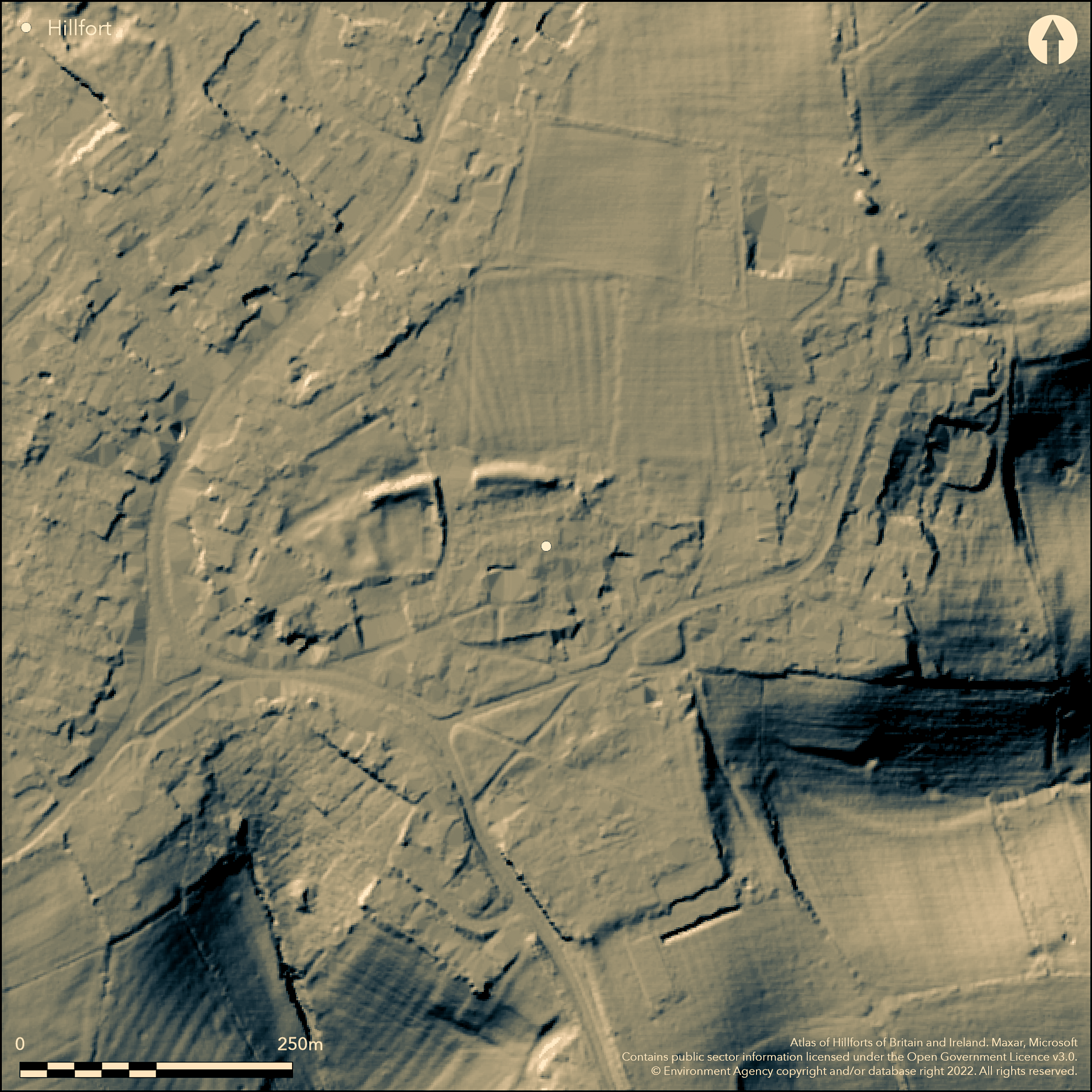
LiDAR 1m DTM Hillshade
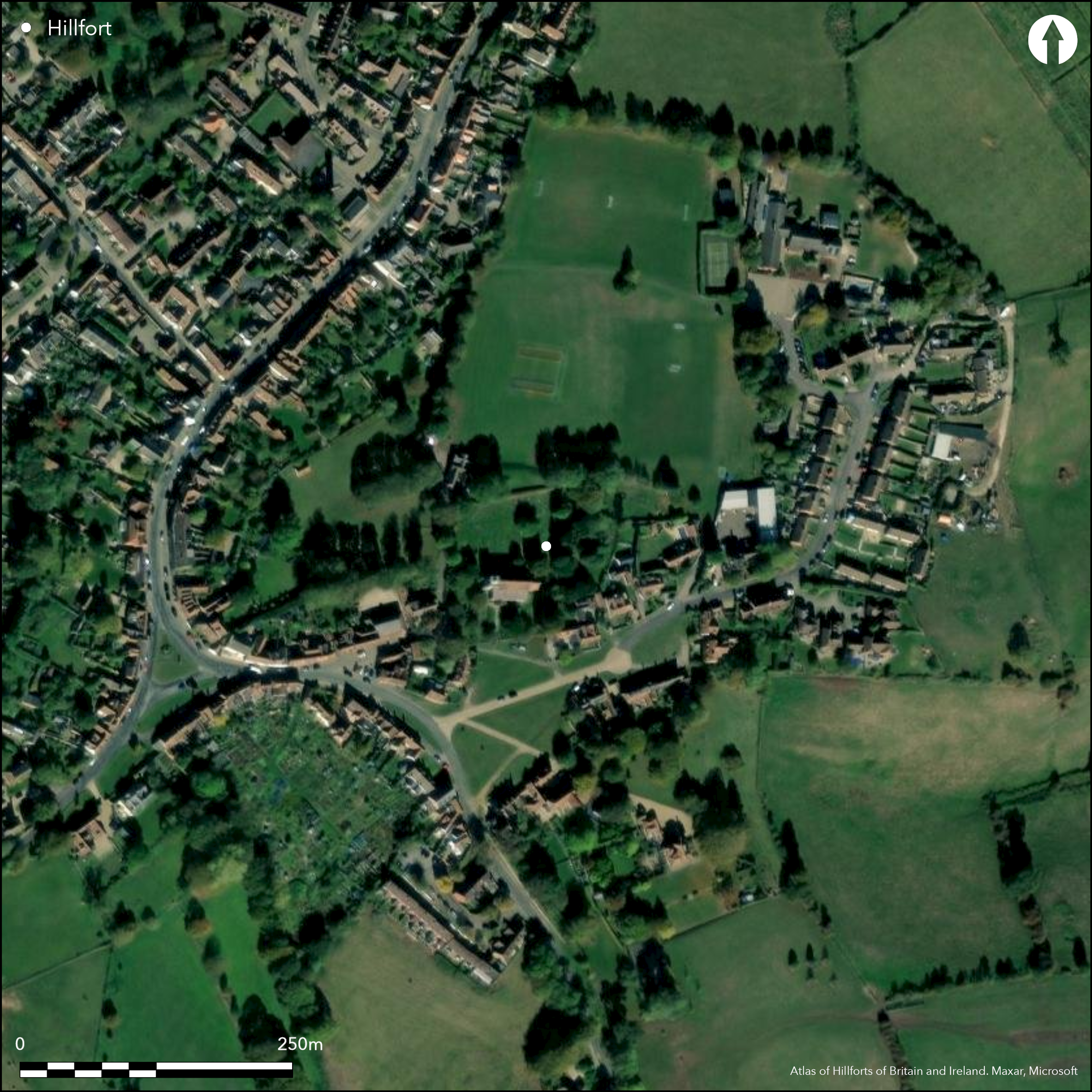
Satellite Imagery
LiDAR 1m DTM Hillshade
Satellite Imagery
Scroll left/right to view further images.
HER: Buckinghamshire 10601000 (None)
NMR: SP 61 SE 11 (340949)
SM: 1006925
NGR: SP 6564 1388
X: 465649 Y: 213882 (OSGB36)
Lying 50m to the N of All Saints Church, Brill, earthworks, first recorded by Lipscomb (1847), possibly the remains of a former hillfort rampart (Farley 1989) located on a level plateau on the summit of a rise at 189m OD. Farley identified a slope from higher land which formed most of the eastern part of a nearby garden and also suggested the curve of the former ditch traces the curve of Brill high street in the W. Today, the works comprise an earthen bank 120m in length lying to the N of the church, which if complete would form an enclosure 300m in diameter enclosing 0.28ha. The bank survives in two parts cut by a track to playing fields. The section to the E of the track comprises a single bank and that to the W of the track, as a bank with a ditch on the N side, which curves inwards on the W. Damage occurred in 1973 when a section of the bank in the E was removed by machine and pushed into the ditch. In 1977 the bank was recorded as 2.5m high and 14m wide, with a partially in-filled ditch. Sherds of Iron Age pottery, recovered from the disturbed soil was passed to the Museum (ibid.). The site has been variously attributed to the Iron Age, Saxon, medieval and civil war periods, but support for an Iron Age date followed an investigation of the ditch fills during a watching brief, which produced Iron Age pottery sherds (ibid.). Burnt grain found 2cm above the natural ironstone during the digging of a grave is interpreted as coming from the base of a pit. A limited excavation in 2005, just to the N of the earthworks, recovered only a single sherd of Iron Age pottery, the remainder of the finds being medieval and modern (Gilbert 2005). A short length of bank is recorded on modern OS mapping. Scheduled as 'Earthworks'.
Citizen Science: ✗
Reliability of Data: Confirmed
Reliability of Interpretation: Unconfirmed
X: -116770 Y: 6767585 (EPSG: 3857)
Longitude: -1.0489614241664726 Latitude: 51.81967162198653 (EPSG:4326)
Country: England
Current County or Unitary Authority: Buckinghamshire
Historic County: Buckinghamshire
Current Parish/Community/Council/Townland: Brill
Destroyed by housing and associated infrastructure
| Extant | ✓ |
| Cropmark | ✗ |
| Likely Destroyed | ✓ |
Playing fields
| Woodland | ✗ |
| Commercial Forestry Plantation | ✗ |
| Parkland | ✓ |
| Pasture (Grazing) | ✗ |
| Arable | ✗ |
| Scrub/Bracken | ✗ |
| Bare Outcrop | ✗ |
| Heather/Moorland | ✗ |
| Heath | ✗ |
| Built-up | ✓ |
| Coastal Grassland | ✗ |
| Other | ✓ |
A possible former contour fort occupying a level plateau on the summit of a rise at 189m OD
| Contour Fort | ✗ |
| Partial Contour Fort | ✓ |
| Promontory Fort | ✗ |
| Hillslope Fort | ✗ |
| Level Terrain Fort | ✗ |
| Marsh Fort | ✗ |
| Multiple Enclosure Fort | ✗ |
| Hilltop | ✓ |
| Coastal Promontory | ✗ |
| Inland Promontory | ✗ |
| Valley Bottom | ✗ |
| Knoll/Hillock/Outcrop | ✗ |
| Ridge | ✗ |
| Cliff/Plateau-edge/Scarp | ✗ |
| Hillslope | ✗ |
| Lowland | ✗ |
| Spur | ✗ |
Dominant Topographic Feature: Summit of a rise
| North | ✗ |
| Northeast | ✗ |
| East | ✗ |
| Southeast | ✗ |
| South | ✗ |
| Southwest | ✗ |
| West | ✗ |
| Northwest | ✗ |
| Level | ✓ |
Altitude: 189.0m
N/A
Small amounts of Iron Age pottery have been found
Reliability: B - Medium
| Pre 1200BC | ✗ |
| 1200BC - 800BC | ✗ |
| 800BC - 400BC | ✓ |
| 400BC - AD50 | ✓ |
| AD50 - AD400 | ✗ |
| AD400 - AD 800 | ✗ |
| Post AD800 | ✗ |
| Unknown | ✗ |
| Pre Hillfort: | None |
| Post Hillfort: | None |
| Artefactual: | None |
Recorded by Lipscomb (1847) and included in the RCHM inventory 1912, but described as possible Civil War earthworks. Watching brief during the extension to the cricket pavilion in the W (Farley 1989). Recorded on 1979-80 OS mapping
| 1st Identified Written Reference (1847): | None |
| Other (1987): | Watching brief |
| 1st Identified Map Depiction (None): | None |
| Other (None): | Scheduled |
Burnt grain found 2cm above the natural ironstone during the digging of a grave is interpreted as coming from the base of a pit. Pottery.
Springs lie in the vicinity
| None | ✓ |
| Spring | ✗ |
| Stream | ✗ |
| Pool | ✗ |
| Flush | ✗ |
| Well | ✗ |
| Other | ✗ |
None
| No Known Features | ✓ |
| Round Stone Structures | ✗ |
| Rectangular Stone Structures | ✗ |
| Curvilinear Platforms | ✗ |
| Other Roundhouse Evidence | ✗ |
| Pits | ✗ |
| Quarry Hollows | ✗ |
| Other | ✗ |
None
| No Known Excavation | ✗ |
| Pits | ✓ |
| Postholes | ✗ |
| Roundhouses | ✗ |
| Rectangular Structures | ✗ |
| Roads/Tracks | ✗ |
| Quarry Hollows | ✗ |
| Other | ✗ |
| Nothing Found | ✗ |
None
| No Known Geophysics | ✓ |
| Pits | ✗ |
| Roundhouses | ✗ |
| Rectangular Structures | ✗ |
| Roads/Tracks | ✗ |
| Quarry Hollows | ✗ |
| Other | ✗ |
| Nothing Found | ✗ |
Burnt grain
| No Known Finds | ✗ |
| Pottery | ✓ |
| Metal | ✗ |
| Metalworking | ✗ |
| Human Bones | ✗ |
| Animal Bones | ✗ |
| Lithics | ✗ |
| Environmental | ✗ |
| Other | ✓ |
None
| APs Not Checked | ✓ |
| None | ✗ |
| Roundhouses | ✗ |
| Rectangular Structures | ✗ |
| Pits | ✗ |
| Postholes | ✗ |
| Roads/Tracks | ✗ |
| Other | ✗ |
A single length of bank, possibly the northern side of a possible enclosure. The bank is now cut by an entrance to playing fields, with the ditch curving inwards on the western side.
| 1: | Breaks occur around most of the proposed circuit caused by modern housing, gardens and associated infrastructure |
| 2: | None |
Guard Chambers: ✗
Chevaux de Frise: ✗
| 1. In-turned (North): | Inturned on western side |
Comprises an earthen bank 120m in length lying to the N of the church, which if complete would form an enclosure 300m in diameter enclosing 0.28ha. Farley identified a slope from higher land which formed most of the eastern part of a nearby garden and also suggested the curve of the former ditch traces the curve of Brill high street in the W. The earthworks survive in two parts cut by a track to playing fields. The section to the E of the track survives as a single bank and that to the W of the track, as a bank with a ditch on the N side, which curves inwards on the W. In 1977 the bank was recorded as 2.5m high and 14m wide, with a partially in-filled ditch. Damage occurred in 1973 when a section of the bank in the E was removed by machine and pushed into the ditch.
| Area 1: | Noneha. |
| Total: | Noneha. |
Total Footprint Area: Noneha.
None
| ✗ | Area estimated at 0.28ha if circuit complete |
| ✗ | Unknown |
| NE Quadrant: | None |
| SE Quadrant: | None |
| SW Quadrant: | None |
| NW Quadrant: | 1 |
| Total: | 1 |
| Partial Univallate | ✓ |
| Univallate | ✗ |
| Partial Bivallate | ✗ |
| Bivallate | ✗ |
| Partial Multivallate | ✗ |
| Multivallate | ✗ |
| Unknown | ✗ |
| Partial Univallate | ✗ |
| Univallate | ✗ |
| Partial Bivallate | ✗ |
| Bivallate | ✗ |
| Partial Multivallate | ✗ |
| Multivallate | ✗ |
None
| None | ✗ |
| Earthen Bank | ✓ |
| Stone Wall | ✗ |
| Rubble | ✗ |
| Wall-walk | ✗ |
| Evidence of Timber | ✗ |
| Vitrification | ✗ |
| Other Burning | ✗ |
| Palisade | ✗ |
| Counter Scarp Bank | ✗ |
| Berm | ✗ |
| Unfinished | ✗ |
| Other | ✗ |
None
| None | ✗ |
| Earthen Bank | ✗ |
| Stone Wall | ✗ |
| Murus Duplex | ✗ |
| Timber-framed | ✗ |
| Timber-laced | ✗ |
| Vitrification | ✗ |
| Other Burning | ✗ |
| Palisade | ✗ |
| Counter Scarp Bank | ✗ |
| Berm | ✗ |
| Unfinished | ✗ |
| No Known Excavation | ✓ |
| Other | ✗ |
| ✗ | None |
| ✓ | None |
Number of Ditches: 1
| ✗ | None |
Farley, M. 1989. An Iron Age Hillfort at Brill? Rec Buckinghamshire. 31, 27-32 and Pl III-IV
Gilbert, D. 2005. An Archaeological Excavation at Brill Sports and Social Club, Church Street, Brill, Buckinghamshire. John Moore Heritage Services. 2005.
Lipscomb, G. 1847. The History and Antiquities of the County of Buckinghamshire 1640-1660. London, J. & W. Robins
Royal Commission on Historical Monuments (England) 1912. An inventory of the historical monuments in Buckinghamshire, I (south), 67
Atlas of Hillforts:
Wikidata:
This work is licensed under CC BY-SA 4.0

 and should be cited as:
Lock, Gary and Ralston, Ian. 2024. Atlas of Hillforts of Britain and Ireland. Available at: https://hillforts.arch.ox.ac.uk
Document Version 1.1