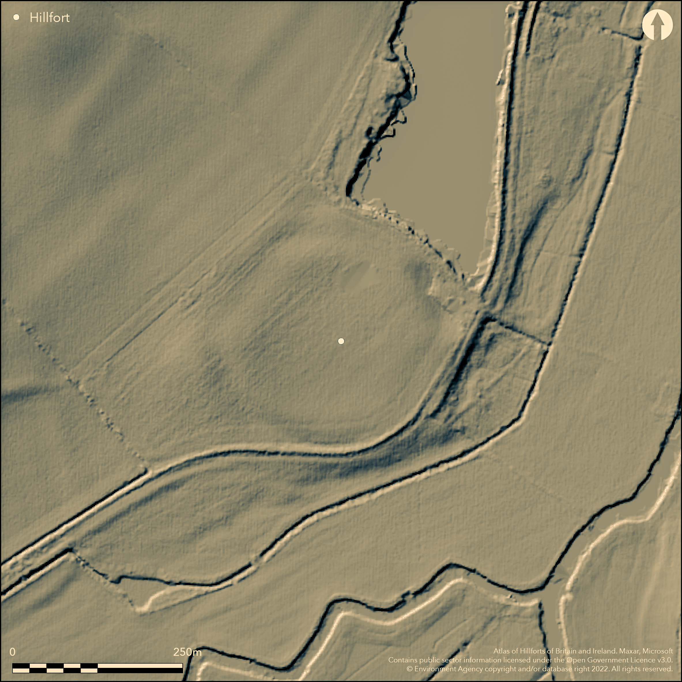
LiDAR 1m DTM Hillshade
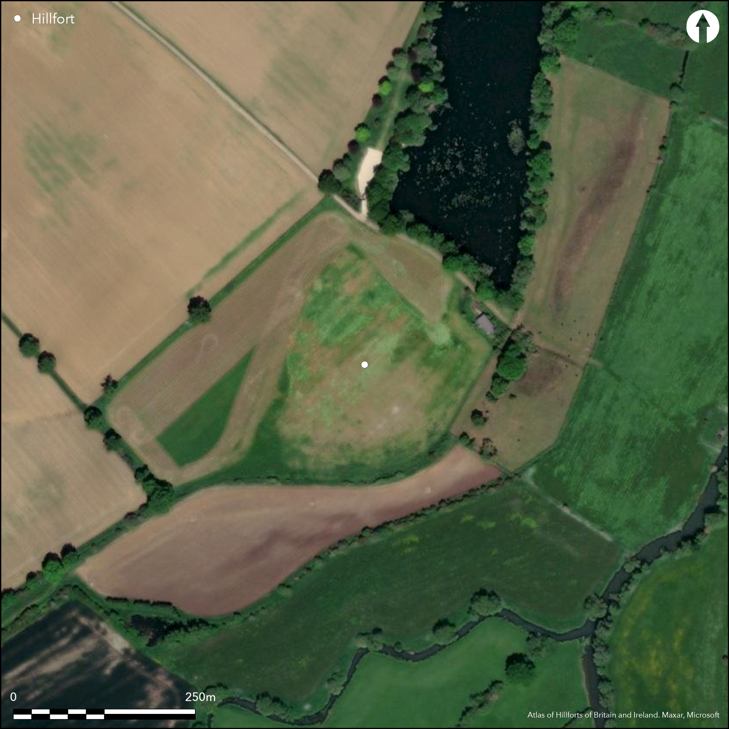
Satellite Imagery
LiDAR 1m DTM Hillshade
Satellite Imagery
Scroll left/right to view further images.
HER: Buckinghamshire 78500000 (None)
NMR: SP 73 SW 8 (343005)
SM: 1018453
NGR: SP 7244 3471
X: 472443 Y: 234715 (OSGB36)
Lying 500m to the E of Home Farm, Maids Moreton, a slight univallate hillfort of approximately 2.8ha. It lies at the base of a slope at 78m OD on the northern side of the floodplain of the Great Ouse River. It was first recorded as a cropmark in 1946, but assumed to have been extant in the 19th century, when a section of the Grand Union Canal was built around the perimeter in the SE. Circular in form, it measures 200m in diameter, the ditch surviving as a broad depression 10-15m wide and 0.8m deep, with the internal bank as a slight earthwork in places or as a spread of stone rubble on the field surface. The location of the entrance is unknown. No internal features are recorded. In 1976 an Iron Age socketed axe, the largest to be found in the country, was ploughed up in the centre of the enclosure (Manning and Saunders 1972). The site is contained within a single arable field and partially visible as a cropmark on 1999 Google Earth imagery. Recorded on 1972-78 1:2,500 OS mapping. Minimal investigations, undated.
Citizen Science: ✗
Reliability of Data: Confirmed
Reliability of Interpretation: Confirmed
X: -105312 Y: 6801231 (EPSG: 3857)
Longitude: -0.946033124563707 Latitude: 52.00611155518003 (EPSG:4326)
Country: England; None
Current County or Unitary Authority: Buckinghamshire
Historic County: Buckinghamshire
Current Parish/Community/Council/Townland: Maids Moreton; Foscott, Thornborough, Bedford
2015 Heritage at Risk Register - recorded as extensive significant problems. Vulnerable from arable ploughing
| Extant | ✗ |
| Cropmark | ✓ |
| Likely Destroyed | ✗ |
None
| Woodland | ✗ |
| Commercial Forestry Plantation | ✗ |
| Parkland | ✗ |
| Pasture (Grazing) | ✗ |
| Arable | ✓ |
| Scrub/Bracken | ✗ |
| Bare Outcrop | ✗ |
| Heather/Moorland | ✗ |
| Heath | ✗ |
| Built-up | ✗ |
| Coastal Grassland | ✗ |
| Other | ✗ |
A partial contour fort lying on level ground at the base of a slope at 78m OD. Located on the northern side of the Great Ouse River floodplain
| Contour Fort | ✗ |
| Partial Contour Fort | ✓ |
| Promontory Fort | ✗ |
| Hillslope Fort | ✗ |
| Level Terrain Fort | ✓ |
| Marsh Fort | ✗ |
| Multiple Enclosure Fort | ✗ |
| Hilltop | ✗ |
| Coastal Promontory | ✗ |
| Inland Promontory | ✗ |
| Valley Bottom | ✗ |
| Knoll/Hillock/Outcrop | ✗ |
| Ridge | ✗ |
| Cliff/Plateau-edge/Scarp | ✗ |
| Hillslope | ✗ |
| Lowland | ✓ |
| Spur | ✗ |
Dominant Topographic Feature: Northern side of the Great Ouse River floodplain
| North | ✗ |
| Northeast | ✗ |
| East | ✗ |
| Southeast | ✗ |
| South | ✗ |
| Southwest | ✗ |
| West | ✗ |
| Northwest | ✗ |
| Level | ✓ |
Altitude: 78.0m
The parish boundary between Maids Moreton and Foscott follows the line of the enclosure in the N. Maids Morton and Thornborough parish boundary lies 200m to the E, and Maids Moreton and Buckingham 130m to the S, following the line of the Great Ouse River
Boundary Type: Parish/Townland
The site is undated
Reliability: D - None
| Pre 1200BC | ✗ |
| 1200BC - 800BC | ✗ |
| 800BC - 400BC | ✗ |
| 400BC - AD50 | ✗ |
| AD50 - AD400 | ✗ |
| AD400 - AD 800 | ✗ |
| Post AD800 | ✗ |
| Unknown | ✓ |
| Pre Hillfort: | Possibly, socketed axe found on surface |
| Post Hillfort: | None |
Discovered on an aerial photograph in 1946. Field investigation in 1974. Recorded on 1972-78 OS mapping. Scheduled
| Other (1946): | Aerial photograph |
| Other (1974): | Field investigation |
| Other (1999): | Scheduled |
| 1st Identified Map Depiction (None): | None |
No internal features are recorded. Socketed axe as surface find.
River Great Ouse to the S
| None | ✓ |
| Spring | ✗ |
| Stream | ✗ |
| Pool | ✗ |
| Flush | ✗ |
| Well | ✗ |
| Other | ✗ |
None
| No Known Features | ✓ |
| Round Stone Structures | ✗ |
| Rectangular Stone Structures | ✗ |
| Curvilinear Platforms | ✗ |
| Other Roundhouse Evidence | ✗ |
| Pits | ✗ |
| Quarry Hollows | ✗ |
| Other | ✗ |
None
| No Known Excavation | ✓ |
| Pits | ✗ |
| Postholes | ✗ |
| Roundhouses | ✗ |
| Rectangular Structures | ✗ |
| Roads/Tracks | ✗ |
| Quarry Hollows | ✗ |
| Other | ✗ |
| Nothing Found | ✗ |
None
| No Known Geophysics | ✓ |
| Pits | ✗ |
| Roundhouses | ✗ |
| Rectangular Structures | ✗ |
| Roads/Tracks | ✗ |
| Quarry Hollows | ✗ |
| Other | ✗ |
| Nothing Found | ✗ |
Surface find
| No Known Finds | ✗ |
| Pottery | ✗ |
| Metal | ✓ |
| Metalworking | ✗ |
| Human Bones | ✗ |
| Animal Bones | ✗ |
| Lithics | ✗ |
| Environmental | ✗ |
| Other | ✗ |
None
| APs Not Checked | ✗ |
| None | ✓ |
| Roundhouses | ✗ |
| Rectangular Structures | ✗ |
| Pits | ✗ |
| Postholes | ✗ |
| Roads/Tracks | ✗ |
| Other | ✗ |
The location of entrances is unknown
| None: | None |
| 2: | None |
Guard Chambers: ✗
Chevaux de Frise: ✗
Slight univallate hillfort of approximately 2.8ha. Circular in form it measures 200m in diameter, the ditch surviving as a broad depression 10-15m wide and 0.8m deep, with the internal bank as a slight earthwork in places or as a spread of stone rubble on the field surface.
| Area 1: | 2.8ha. |
| Total: | 2.8ha. |
Total Footprint Area: Noneha.
None
| ✗ | None |
| ✓ | None |
| NE Quadrant: | 1 |
| SE Quadrant: | 1 |
| SW Quadrant: | 1 |
| NW Quadrant: | 1 |
| Total: | 1 |
| Partial Univallate | ✗ |
| Univallate | ✓ |
| Partial Bivallate | ✗ |
| Bivallate | ✗ |
| Partial Multivallate | ✗ |
| Multivallate | ✗ |
| Unknown | ✗ |
| Partial Univallate | ✗ |
| Univallate | ✗ |
| Partial Bivallate | ✗ |
| Bivallate | ✗ |
| Partial Multivallate | ✗ |
| Multivallate | ✗ |
A spread of stone rubble, assumed to derive from the bank is visible on the field surface
| None | ✗ |
| Earthen Bank | ✓ |
| Stone Wall | ✗ |
| Rubble | ✓ |
| Wall-walk | ✗ |
| Evidence of Timber | ✗ |
| Vitrification | ✗ |
| Other Burning | ✗ |
| Palisade | ✗ |
| Counter Scarp Bank | ✗ |
| Berm | ✗ |
| Unfinished | ✗ |
| Other | ✗ |
None
| None | ✗ |
| Earthen Bank | ✗ |
| Stone Wall | ✗ |
| Murus Duplex | ✗ |
| Timber-framed | ✗ |
| Timber-laced | ✗ |
| Vitrification | ✗ |
| Other Burning | ✗ |
| Palisade | ✗ |
| Counter Scarp Bank | ✗ |
| Berm | ✗ |
| Unfinished | ✗ |
| No Known Excavation | ✓ |
| Other | ✗ |
| ✗ | None |
| ✓ | None |
Number of Ditches: 1
| ✗ | None |
Manning, W. H. and Saunders, C. 1972. A socketed iron axe from Maids Moreton, Buckinghamshire. Antiq J 52, 276-92
Atlas of Hillforts:
Wikidata:
This work is licensed under CC BY-SA 4.0

 and should be cited as:
Lock, Gary and Ralston, Ian. 2024. Atlas of Hillforts of Britain and Ireland. Available at: https://hillforts.arch.ox.ac.uk
Document Version 1.1