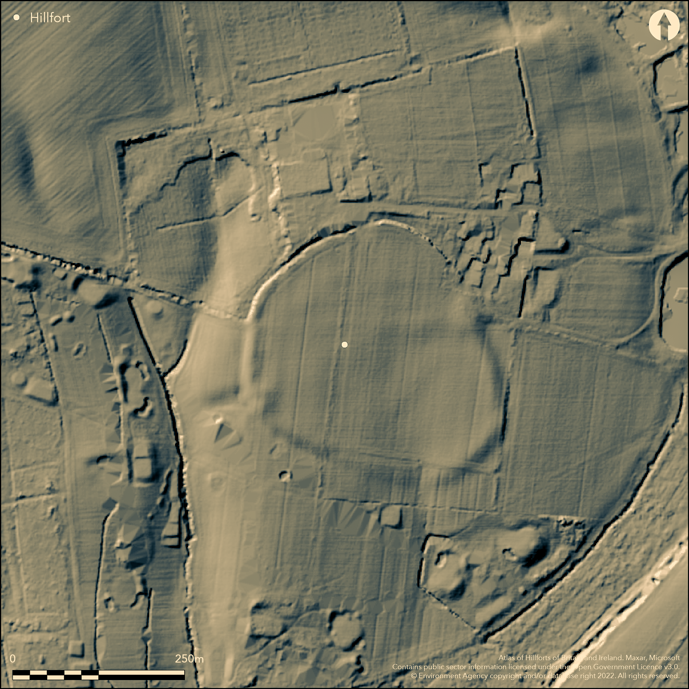
LiDAR 1m DTM Hillshade
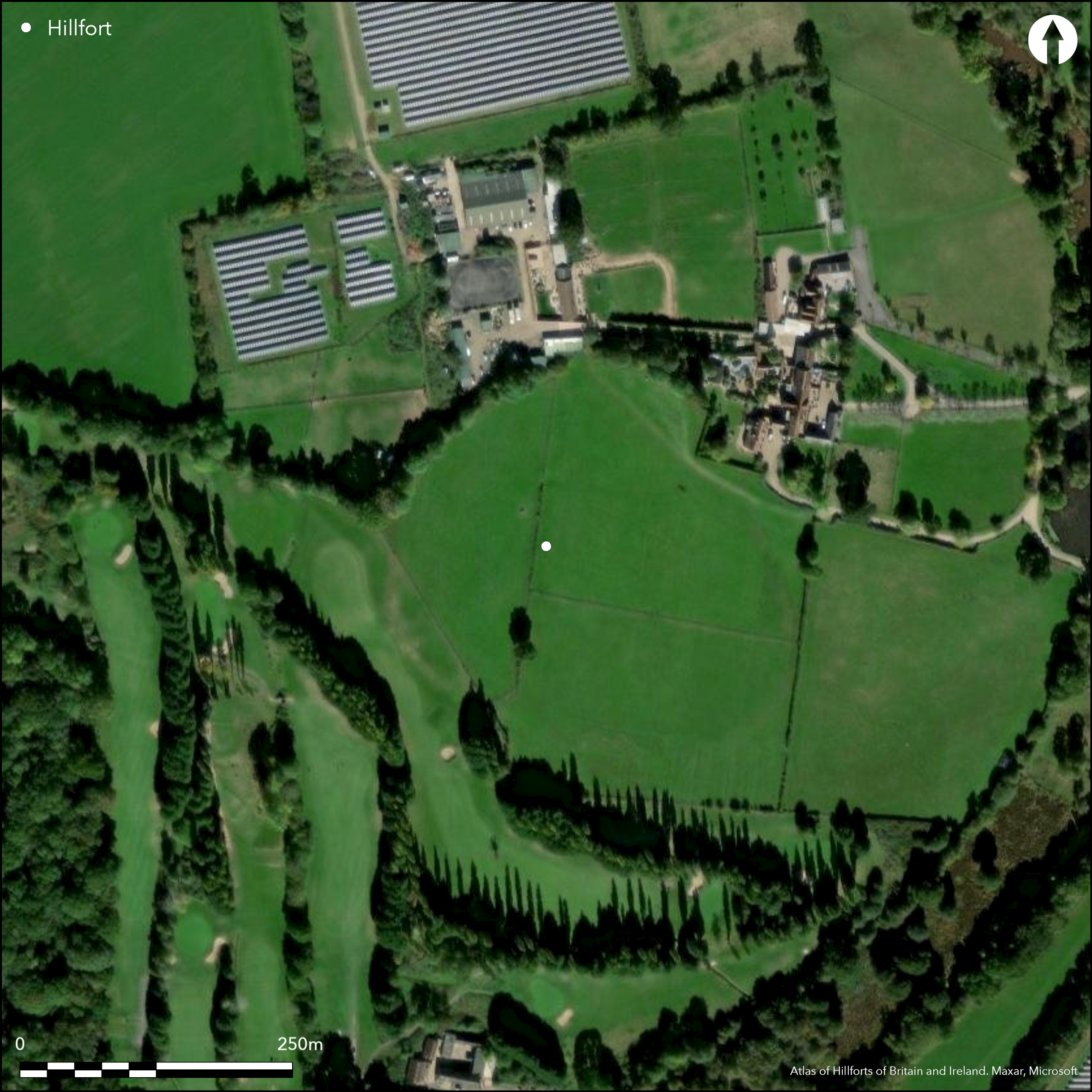
Satellite Imagery
LiDAR 1m DTM Hillshade
Satellite Imagery
Scroll left/right to view further images.
HER: Dorset MDO7793 (None)
NMR: SY 99 SW 4 (457414)
SM: 1016725
NGR: SY929942
X: 392895 Y: 94224 (OSGB36)
Hillslope fort located on SE-facing London Clay slope of hill, between 30m and 60m O.D., overlooking marshy land to Lytchett Bay and Poole Harbour. Generally moderate surrounding slopes, sharp drop into shallow gully with stream on W, and another, less marked, gully on E. Roughly circular c. 220m by 200m across, with area c. 3.4ha. Formerly enclosed by single rampart and outer ditch, but now traces only and ditch largely filled. Possibly best on SW where ditch bottom to bank top c. 2m max. Possible inturned entrances on E and W and uncertain gaps in the rampart to N and S. 1881 hoard of Iron Age bronze and iron objects found on W side of fort included, among others, a fragment of bronze mirror, pair of iron rings, part of a bronze chape, two iron sledge hammers and two bronze bull figurines, now in Dorset County Museum. Generally cultivated and much reduced by ploughing. Intrusive development on N and golf course S to W Partly overlain by house and gardens of Higher Bulbury Farm. On 1:25,000 OS map (1937-1961).
Citizen Science: ✗
Reliability of Data: Confirmed
Reliability of Interpretation: Confirmed
X: -234004 Y: 6576752 (EPSG: 3857)
Longitude: -2.102094550850554 Latitude: 50.74750959572382 (EPSG:4326)
Country: England; None
Current County or Unitary Authority: Dorset
Historic County: Dorset
Current Parish/Community/Council/Townland: Lychett Minster and Upton; Morden
Much reduced by ploughing. Intrusive development on N and golf course S to W Partly overlain by house and gardens of Higher Bulbury Farm.
| Extant | ✓ |
| Cropmark | ✗ |
| Likely Destroyed | ✓ |
Cultivated..
| Woodland | ✗ |
| Commercial Forestry Plantation | ✗ |
| Parkland | ✗ |
| Pasture (Grazing) | ✓ |
| Arable | ✓ |
| Scrub/Bracken | ✗ |
| Bare Outcrop | ✗ |
| Heather/Moorland | ✗ |
| Heath | ✗ |
| Built-up | ✗ |
| Coastal Grassland | ✗ |
| Other | ✗ |
Hillslope fort located on SE-facing London Clay slope of hill, between 30m and 60m O.D., overlooking marshy land to Lytchett Bay and Poole Harbour. Generally moderate surrounding slopes, sharp drop into shallow gully with stream on W, and another, less marked, gully on E.
| Contour Fort | ✗ |
| Partial Contour Fort | ✗ |
| Promontory Fort | ✗ |
| Hillslope Fort | ✓ |
| Level Terrain Fort | ✗ |
| Marsh Fort | ✗ |
| Multiple Enclosure Fort | ✗ |
| Hilltop | ✗ |
| Coastal Promontory | ✗ |
| Inland Promontory | ✗ |
| Valley Bottom | ✗ |
| Knoll/Hillock/Outcrop | ✗ |
| Ridge | ✗ |
| Cliff/Plateau-edge/Scarp | ✗ |
| Hillslope | ✓ |
| Lowland | ✗ |
| Spur | ✗ |
Dominant Topographic Feature: Hillslope
| North | ✗ |
| Northeast | ✗ |
| East | ✗ |
| Southeast | ✓ |
| South | ✗ |
| Southwest | ✗ |
| West | ✗ |
| Northwest | ✗ |
| Level | ✗ |
Altitude: 45.0m
Boundary Type: Parish/Townland
Hoard dated to early 1st century AD, but site probably earlier origins.
Reliability: C - Low
| Pre 1200BC | ✗ |
| 1200BC - 800BC | ✗ |
| 800BC - 400BC | ✗ |
| 400BC - AD50 | ✓ |
| AD50 - AD400 | ✗ |
| AD400 - AD 800 | ✗ |
| Post AD800 | ✗ |
| Unknown | ✗ |
| Pre Hillfort: | None |
| Post Hillfort: | None |
| Artefactual: | Hoard. |
Excavation E. Cunninton 1884. Desk assessment for Bulbury Wood Golf Course A.C. Archaeology 1996. Watching Brief 1997. On 1:25,000 OS map (1937-1961)
| Excavation (1884): | E. Cunnington. |
| Other (1996): | Desk assessment A.C. Archaeology. |
| Other (1997): | Watching Brief. |
| 1st Identified Map Depiction (None): | None |
Famous chance hoard find 1881 of 1st century AD found on W side of fort included two bronze bull figurines, part of a collared mirror handle and a fragment of decorated mirror plate, two bronze rings from snaffle bit, fragment iron sword hilt and bronze chape, tankard handle mirror handles, eight glass annular beads, four bronze mounts for chariot yoke, two iron sledge-hammers, long narrow iron axe and iron fragments and iron anchor, together with iron chain. Also thick iron nails, possible iron timber clamps. Half sandstone quern piece of fine bronze chain and fragments of black wellburnt pottery. Suggested by Cunliffe (1972) as burial(s) or ironsmith's stock in trade.
Water in gully c. 46m outside fort.
| None | ✓ |
| Spring | ✗ |
| Stream | ✗ |
| Pool | ✗ |
| Flush | ✗ |
| Well | ✗ |
| Other | ✗ |
None
| No Known Features | ✓ |
| Round Stone Structures | ✗ |
| Rectangular Stone Structures | ✗ |
| Curvilinear Platforms | ✗ |
| Other Roundhouse Evidence | ✗ |
| Pits | ✗ |
| Quarry Hollows | ✗ |
| Other | ✗ |
None
| No Known Excavation | ✗ |
| Pits | ✗ |
| Postholes | ✗ |
| Roundhouses | ✗ |
| Rectangular Structures | ✗ |
| Roads/Tracks | ✗ |
| Quarry Hollows | ✗ |
| Other | ✗ |
| Nothing Found | ✓ |
None
| No Known Geophysics | ✓ |
| Pits | ✗ |
| Roundhouses | ✗ |
| Rectangular Structures | ✗ |
| Roads/Tracks | ✗ |
| Quarry Hollows | ✗ |
| Other | ✗ |
| Nothing Found | ✗ |
Famous chance hoard find 1881 of 1st century AD found on W side of fort included two bronze bull figurines, part of a collared mirror handle and a fragment of decorated mirror plate, two bronze rings from snaffle bit, fragment iron sword hilt and bronze chape, tankard handle mirror handles, eight glass annular beads, four bronze mounts for chariot yoke, two iron sledge-hammers, long narrow iron axe and iron fragments and iron anchor, together with iron chain. Also thick iron nails, possible iron timber clamps. Half sandstone quern piece of fine bronze chain and fragments of black wellburnt pottery. i
| No Known Finds | ✗ |
| Pottery | ✓ |
| Metal | ✓ |
| Metalworking | ✗ |
| Human Bones | ✗ |
| Animal Bones | ✗ |
| Lithics | ✗ |
| Environmental | ✗ |
| Other | ✗ |
None
| APs Not Checked | ✓ |
| None | ✗ |
| Roundhouses | ✗ |
| Rectangular Structures | ✗ |
| Pits | ✗ |
| Postholes | ✗ |
| Roads/Tracks | ✗ |
| Other | ✗ |
Possible inturned entrances on E and W and uncertain gaps in rampart to N and S.
| 4: | Gaps in N and S uncertain. |
| 2: | E and W possibly original. |
Guard Chambers: ✗
Chevaux de Frise: ✗
| 1. In-turned (East): | Possibly original. |
| 2. In-turned (West): | Possibly original. |
| 3. Simple Gap (North): | Uncertain. |
| 4. Simple Gap (South): | Uncertain. |
Formerly enclosed by single rampart with outer ditch, but now traces only and ditch largely filled. Possibly best on SW, where ditch bottom to bank top c. 2m max.
| Area 1: | 3.4ha. |
| Total: | 3.4ha. |
Total Footprint Area: Noneha.
None
| ✗ | None |
| ✓ | None |
| NE Quadrant: | 1 |
| SE Quadrant: | 1 |
| SW Quadrant: | 1 |
| NW Quadrant: | 1 |
| Total: | 1 |
| Partial Univallate | ✗ |
| Univallate | ✓ |
| Partial Bivallate | ✗ |
| Bivallate | ✗ |
| Partial Multivallate | ✗ |
| Multivallate | ✗ |
| Unknown | ✗ |
| Partial Univallate | ✗ |
| Univallate | ✗ |
| Partial Bivallate | ✗ |
| Bivallate | ✗ |
| Partial Multivallate | ✗ |
| Multivallate | ✗ |
None
| None | ✗ |
| Earthen Bank | ✓ |
| Stone Wall | ✗ |
| Rubble | ✗ |
| Wall-walk | ✗ |
| Evidence of Timber | ✗ |
| Vitrification | ✗ |
| Other Burning | ✗ |
| Palisade | ✗ |
| Counter Scarp Bank | ✗ |
| Berm | ✗ |
| Unfinished | ✗ |
| Other | ✗ |
None
| None | ✓ |
| Earthen Bank | ✗ |
| Stone Wall | ✗ |
| Murus Duplex | ✗ |
| Timber-framed | ✗ |
| Timber-laced | ✗ |
| Vitrification | ✗ |
| Other Burning | ✗ |
| Palisade | ✗ |
| Counter Scarp Bank | ✗ |
| Berm | ✗ |
| Unfinished | ✗ |
| No Known Excavation | ✗ |
| Other | ✗ |
| ✗ | None |
| ✓ | Ditch largely filled. |
Number of Ditches: 1
| ✗ | None |
Brown, I. 2009. Beacons in the landscape. The hillforts of England and Wales, Oxford: Windgather Press/Oxbow Books.
Cunliffe, B. 1972. The late Iron Age metalwork from Bulbury, Dorset, Antiq J, 52, 293-308.
Cunnington, E.. On a hoard of bronze, iron, and other objects found in Bulbury Camp, Dorset. Arch J. xlviii. 115-120.
Farrar, R.A.H. 1964. Archaeological notes and news for 1964. Recent discoveries and accessions. Proc Dorset Natur Hist Archaeol Soc, 86, 115.
Gale, J. 2003. Prehistoric Dorset, Stroud: Tempus Publishing.
RCHME 1970. An inventory of historical monuments in the County of Dorset, Vol 2: south-east, No 30, part 3. London: RCHME.
Atlas of Hillforts:
Wikidata:
This work is licensed under CC BY-SA 4.0

 and should be cited as:
Lock, Gary and Ralston, Ian. 2024. Atlas of Hillforts of Britain and Ireland. Available at: https://hillforts.arch.ox.ac.uk
Document Version 1.1