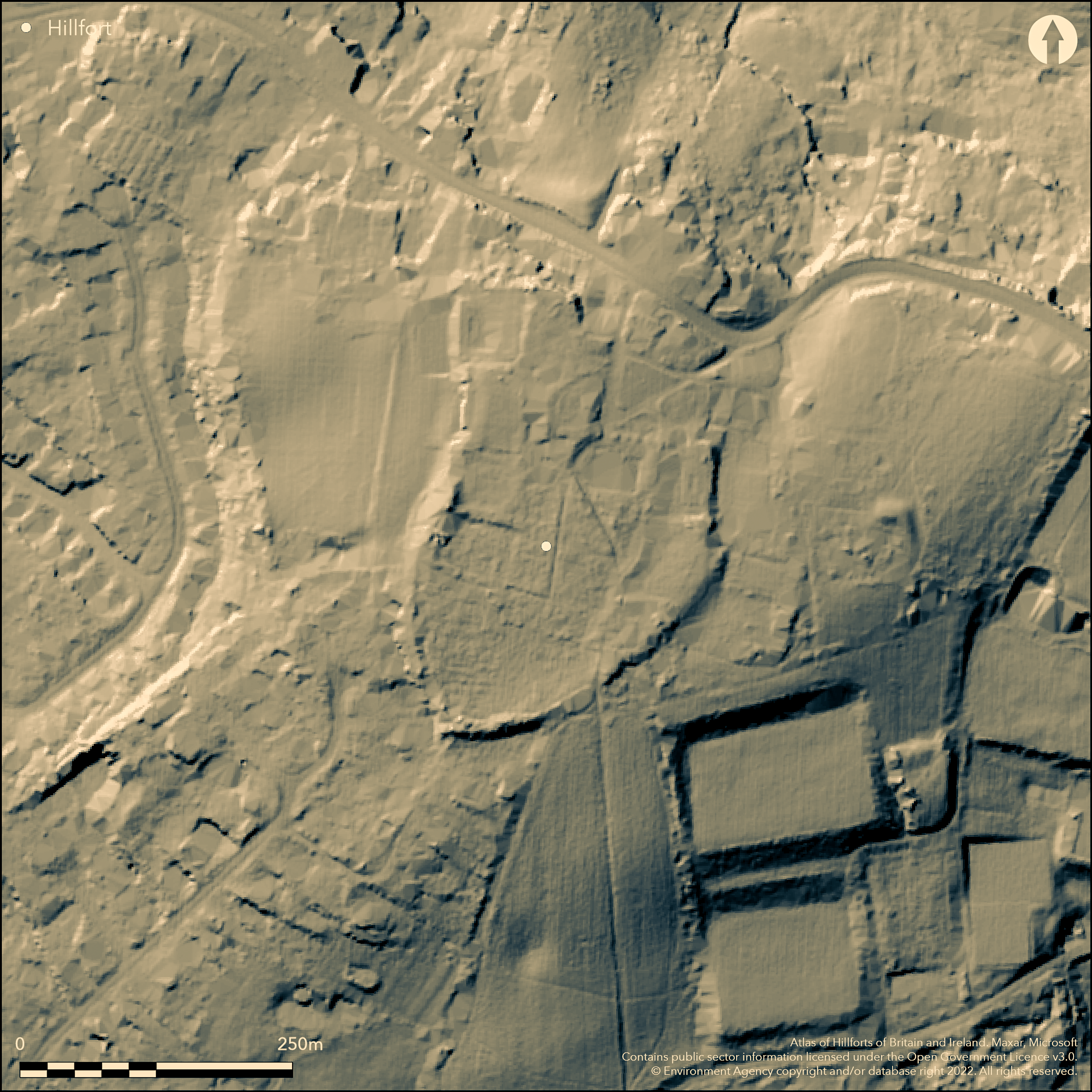
LiDAR 1m DTM Hillshade
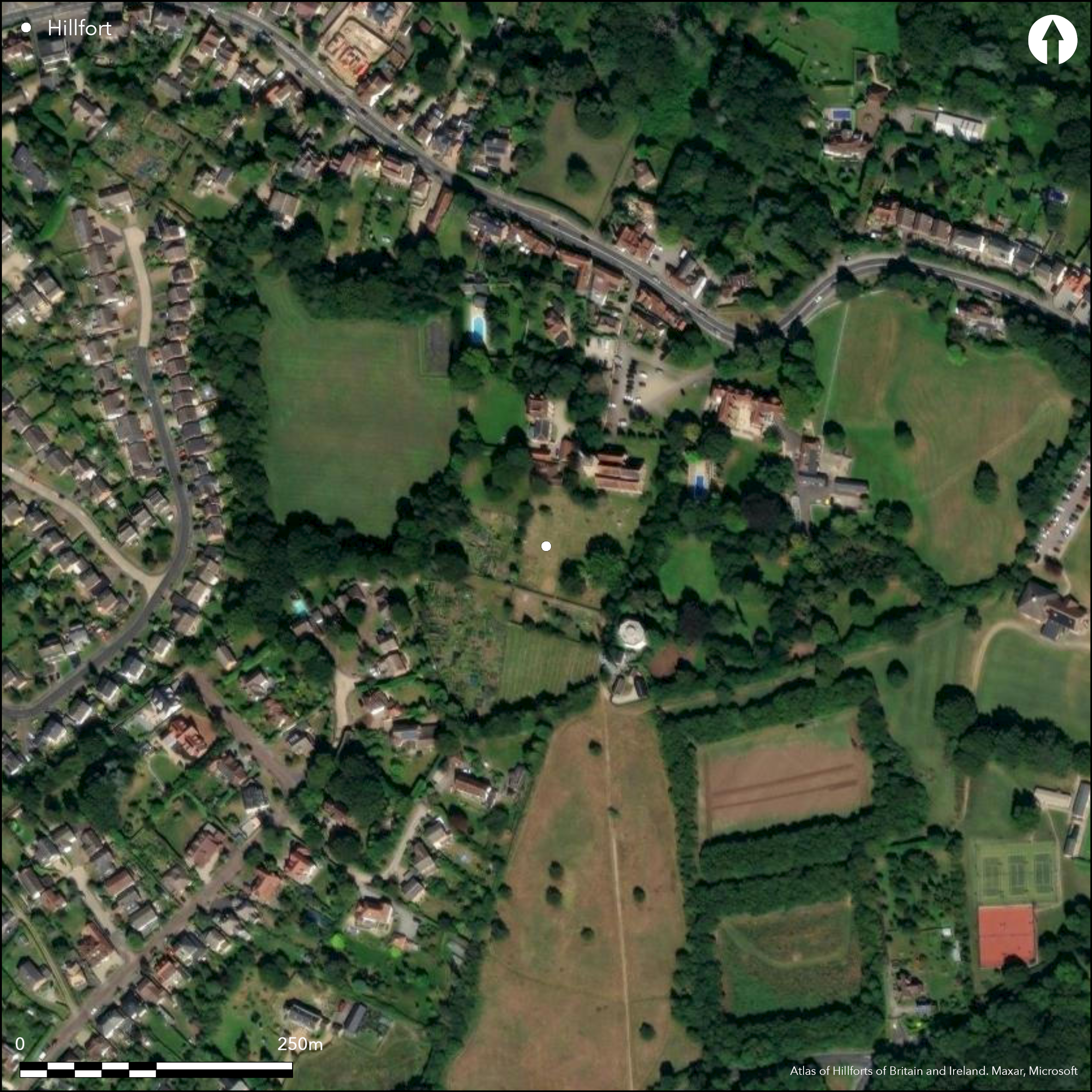
Satellite Imagery
LiDAR 1m DTM Hillshade
Satellite Imagery
Scroll left/right to view further images.
HER: Essex 5608 (None)
NMR: TL 70 NE 24 (378139)
SM: 1005571
NGR: TL 7789 0508
X: 577890 Y: 205080 (OSGB36)
Directly to the S of Main Road, Danbury and to the N of Penny Royal Road, the remains of a univallate hillfort. It is sited at 112m OD on the W end of a promontory on the highest point of the Danbury Ridge. Now badly denuded but still traceable on the ground except in the N where it lies under modern housing. It is approximately oval in plan, comprising a single rampart 2.5m high in places, and a ditch. A slight mound on the NW corner was dug into by the Home Guard in 1941 but nothing was found. A plan produced by Morant in 1768 stated the earthen rampart in the SW stood in the region of 10m from the bottom of the ditch at that time. Work by Spurrell (1890) identified traces of further earthworks to the W of the enclosure which connected to the hillfort at the northern corners and which he concluded were possible stock enclosures. These are now considered to be a terraced trackway and a former field boundary. The location of any original entrances is unknown. The 12th century church of St John the Baptist lies within the enclosed area in the N with the associated graveyard occupying the eastern sector Allotments lie in the W. Excavations were carried out in the 1970's prior to extensions to the Churchyard and the allotments (Morris and Buckley 1978). Fourteen postholes with no coherent pattern were recorded one of which produced a tile fragment. Three abraded Iron Age or Roman sherds were recovered from a further posthole. Sections through the bank produced small amounts of Iron Age and Roman sherds and metalwork, animal bone and burnt daub, in addition to finds of later periods. An abraded Roman sherd recovered from below the bank material provides very limited evidence that the investigated bank was post-Roman or reconstructed at a later date. Possible pits, postholes and ditches were also recorded which are undated, but finds of Iron Age and Roman pottery from newly dug graves, allotments and gardens suggest some form of settlement in the N of the interior. A rubbish pit containing oyster shells was exposed during grave digging in 1949. In the E the ramparts have been mutilated by post-1960's garden landscaping and a modern boundary bank surmounts the rampart in the S. Referred to in Domesday by the placename Danengeberiam, interpreted as 'the stronghold (burh) of the Daenningas.' The site is recorded on 1874, 1:2,500 OS mapping. Scheduled
Citizen Science: ✗
Reliability of Data: Confirmed
Reliability of Interpretation: Confirmed
X: 63869 Y: 6748970 (EPSG: 3857)
Longitude: 0.5737493842709951 Latitude: 51.7161846408409 (EPSG:4326)
Country: England
Current County or Unitary Authority: Essex
Historic County: Essex
Current Parish/Community/Council/Townland: Danebury
The northern arc of the ramparts has been totally subsumed under housing. Garden landscaping and associated housing has damaged the exterior face of the rampart in a number of places. Further damage caused by modern paths and allotment cultivation.
| Extant | ✓ |
| Cropmark | ✗ |
| Likely Destroyed | ✓ |
Graveyard, allotments, housing and gardens
| Woodland | ✗ |
| Commercial Forestry Plantation | ✗ |
| Parkland | ✗ |
| Pasture (Grazing) | ✗ |
| Arable | ✗ |
| Scrub/Bracken | ✗ |
| Bare Outcrop | ✗ |
| Heather/Moorland | ✗ |
| Heath | ✗ |
| Built-up | ✓ |
| Coastal Grassland | ✗ |
| Other | ✓ |
Sited at 112m OD on the W end of a promontory on the highest point of the Danbury Ridge.
| Contour Fort | ✗ |
| Partial Contour Fort | ✓ |
| Promontory Fort | ✗ |
| Hillslope Fort | ✗ |
| Level Terrain Fort | ✗ |
| Marsh Fort | ✗ |
| Multiple Enclosure Fort | ✗ |
| Hilltop | ✓ |
| Coastal Promontory | ✗ |
| Inland Promontory | ✓ |
| Valley Bottom | ✗ |
| Knoll/Hillock/Outcrop | ✗ |
| Ridge | ✓ |
| Cliff/Plateau-edge/Scarp | ✗ |
| Hillslope | ✗ |
| Lowland | ✗ |
| Spur | ✗ |
Dominant Topographic Feature: Danbury Ridge
| North | ✗ |
| Northeast | ✗ |
| East | ✗ |
| Southeast | ✗ |
| South | ✗ |
| Southwest | ✗ |
| West | ✗ |
| Northwest | ✗ |
| Level | ✓ |
Altitude: 112.0m
N/A
Iron Age and Roman finds have been recovered during excavation of the bank, and a Roman pot sherd from below the bank
Reliability: B - Medium
| Pre 1200BC | ✗ |
| 1200BC - 800BC | ✗ |
| 800BC - 400BC | ✓ |
| 400BC - AD50 | ✓ |
| AD50 - AD400 | ✗ |
| AD400 - AD 800 | ✗ |
| Post AD800 | ✗ |
| Unknown | ✗ |
| Pre Hillfort: | None |
| Post Hillfort: | None |
| Artefactual: | Iron Age and Roman sherds and metalwork, animal bone and burnt daub |
Referred to in Domesday (1086) in the placename Danengeberiam, interpreted as 'the stronghold (burh) of the Daenningas (Reaney 1935, 248) In Aubrey's Monumenta Britannica (1665-1693). Recorded on 1874, 1:2,500 OS mapping. Magnetometer survey in 1974. Excavated in 1974 and 1977 (Morris and Buckley 1978) and in 1992 (Medlycott 1993). Field investigations in 1949, 1962, 1975, 1987. Scheduled
| 1st Identified Written Reference (1086): | Domesday |
| Other (1768): | Plan (Morant (1768) |
| 1st Identified Map Depiction (1874): | None |
| Other (1949): | Field investigation |
| Other (1962): | Field investigation |
| Excavation (1974): | (Morris and Buckley 1978) |
| Geophysical Survey (1974): | AML |
| Other (1975): | Field investigation |
| Excavation (1977): | (Morris and Buckley 1978) |
| Other (1987): | Field investigation |
| Excavation (1992): | Trial trenching, nothing found (Medlycott, 1993) |
| Excavation (None): | None |
| Other (None): | Sheduled |
Church lies in the N of the interior. Graveyard occupies the eastern side, allotments the W. Pits, postholes and ditches from excavation, all undated, pottery metal and daub.
None
| None | ✓ |
| Spring | ✗ |
| Stream | ✗ |
| Pool | ✗ |
| Flush | ✗ |
| Well | ✗ |
| Other | ✗ |
None
| No Known Features | ✓ |
| Round Stone Structures | ✗ |
| Rectangular Stone Structures | ✗ |
| Curvilinear Platforms | ✗ |
| Other Roundhouse Evidence | ✗ |
| Pits | ✗ |
| Quarry Hollows | ✗ |
| Other | ✗ |
None
| No Known Excavation | ✗ |
| Pits | ✓ |
| Postholes | ✓ |
| Roundhouses | ✗ |
| Rectangular Structures | ✗ |
| Roads/Tracks | ✗ |
| Quarry Hollows | ✗ |
| Other | ✓ |
| Nothing Found | ✗ |
None
| No Known Geophysics | ✗ |
| Pits | ✗ |
| Roundhouses | ✗ |
| Rectangular Structures | ✗ |
| Roads/Tracks | ✗ |
| Quarry Hollows | ✗ |
| Other | ✗ |
| Nothing Found | ✓ |
Burnt daub
| No Known Finds | ✗ |
| Pottery | ✓ |
| Metal | ✓ |
| Metalworking | ✗ |
| Human Bones | ✗ |
| Animal Bones | ✗ |
| Lithics | ✗ |
| Environmental | ✗ |
| Other | ✓ |
Built-up
| APs Not Checked | ✓ |
| None | ✗ |
| Roundhouses | ✗ |
| Rectangular Structures | ✗ |
| Pits | ✗ |
| Postholes | ✗ |
| Roads/Tracks | ✗ |
| Other | ✗ |
The location of original entrances is unknown
| None: | None |
| 2: | None |
Guard Chambers: ✗
Chevaux de Frise: ✗
Univallate hillfort, now badly denuded. Approximately oval in plan, comprising a single rampart 2.5m high in places, and a ditch. A slight mound lies on the NW corner. A plan produced by Morant in 1768 stated the earthen rampart in the SW stood in the region of 10m from the bottom of the ditch at that time.
| Area 1: | 2.5ha. |
| Total: | 2.5ha. |
Total Footprint Area: Noneha.
None
| ✗ | None |
| ✗ | Absent or destroyed in the N |
| NE Quadrant: | None |
| SE Quadrant: | 1 |
| SW Quadrant: | 1 |
| NW Quadrant: | None |
| Total: | 1 |
| Partial Univallate | ✓ |
| Univallate | ✗ |
| Partial Bivallate | ✗ |
| Bivallate | ✗ |
| Partial Multivallate | ✗ |
| Multivallate | ✗ |
| Unknown | ✗ |
| Partial Univallate | ✗ |
| Univallate | ✗ |
| Partial Bivallate | ✗ |
| Bivallate | ✗ |
| Partial Multivallate | ✗ |
| Multivallate | ✗ |
None
| None | ✗ |
| Earthen Bank | ✓ |
| Stone Wall | ✗ |
| Rubble | ✗ |
| Wall-walk | ✗ |
| Evidence of Timber | ✗ |
| Vitrification | ✗ |
| Other Burning | ✗ |
| Palisade | ✗ |
| Counter Scarp Bank | ✗ |
| Berm | ✗ |
| Unfinished | ✗ |
| Other | ✗ |
None
| None | ✗ |
| Earthen Bank | ✓ |
| Stone Wall | ✗ |
| Murus Duplex | ✗ |
| Timber-framed | ✗ |
| Timber-laced | ✗ |
| Vitrification | ✗ |
| Other Burning | ✗ |
| Palisade | ✗ |
| Counter Scarp Bank | ✗ |
| Berm | ✗ |
| Unfinished | ✗ |
| No Known Excavation | ✗ |
| Other | ✗ |
| ✗ | None |
| ✓ | None |
Number of Ditches: 1
| ✗ | None |
Bartlett, A. D. 1974 Geophysics : Danbury Hillfort AML report (Old Series) 1693
Medleycott, M. 1993. Archaeology in Essex 1992: Danbury, Danbury Camp (TL779 052), Essex Archaeol Hist, 24, 205
Morant, P. 1768. History and Antiquities of Essex. London. II, 30
Morris, S. and Buckley, D.G. 1978. Excavations at Danbury Camp, Essex 1974 and 1977. Essex Archaeol Hist. 10, 1-28
Reaney, P.H. 1935. The Place Names of Essex, England. Place Names Soc. XII Cambridge
Spurrell, F.C. 1890. Danbury Camp, Essex. Essex Natur. IV 138-140
Atlas of Hillforts:
Wikidata:
This work is licensed under CC BY-SA 4.0

 and should be cited as:
Lock, Gary and Ralston, Ian. 2024. Atlas of Hillforts of Britain and Ireland. Available at: https://hillforts.arch.ox.ac.uk
Document Version 1.1