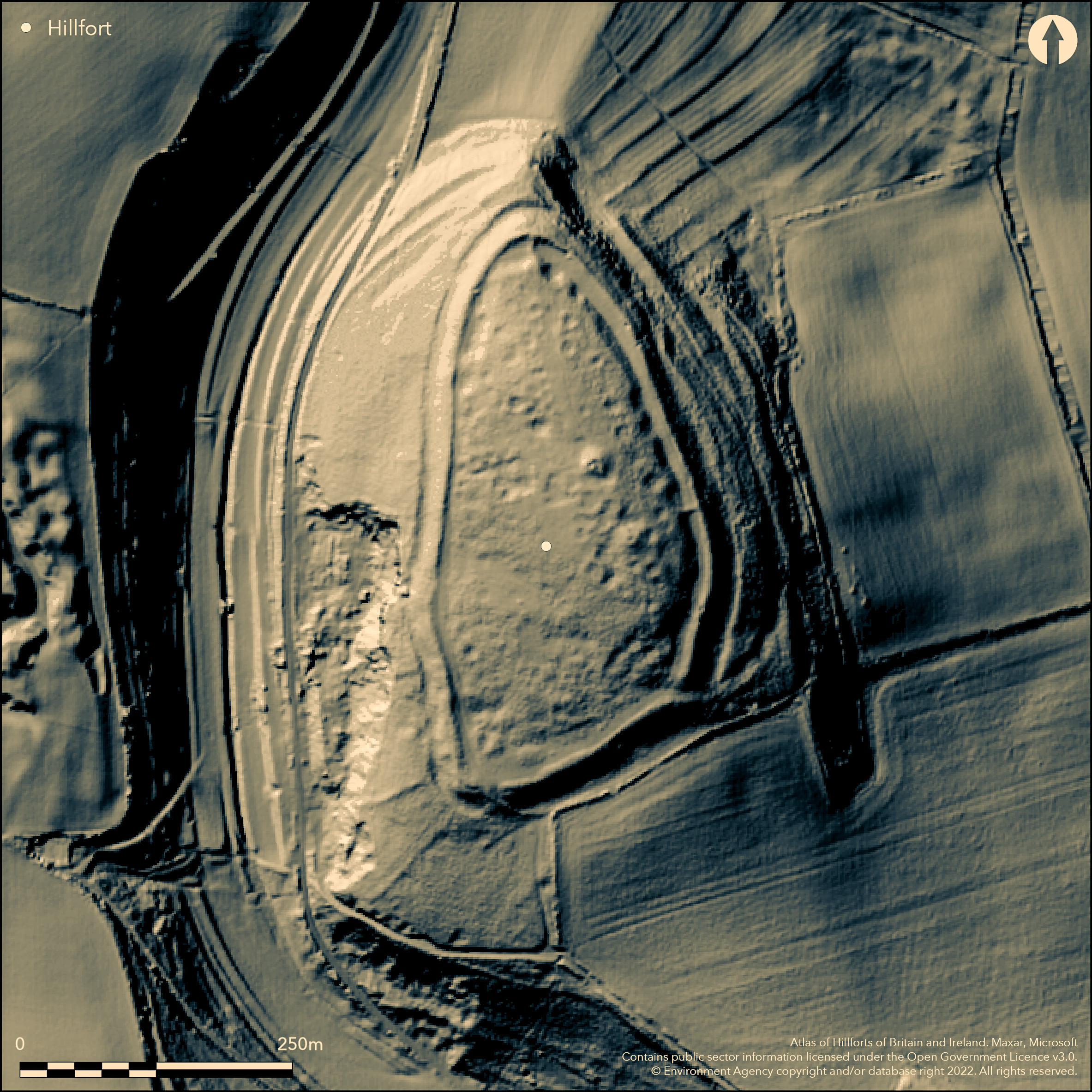
LiDAR 1m DTM Hillshade
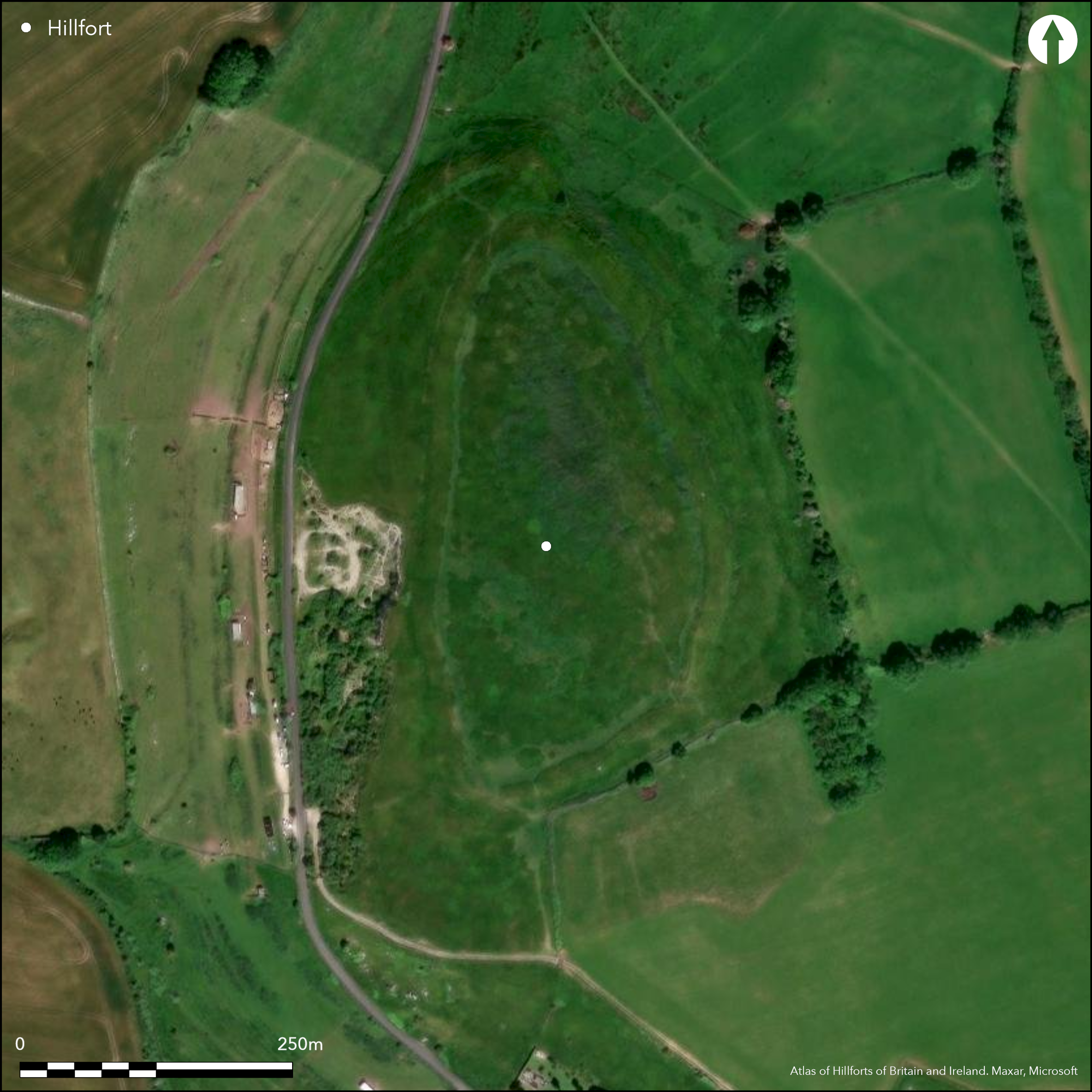
Satellite Imagery
LiDAR 1m DTM Hillshade
Satellite Imagery
Scroll left/right to view further images.
HER: Dorset MDO309 (None)
NMR: SY 68 SE 32 (452691)
SM: 102711
NGR: SY69408380
X: 369463 Y: 83845 (OSGB36)
Commanding, contour hillfort located on domed crest of prominent hill/knoll, composed partly of Lower Purbeck Limestone and partly Portland Sands, in strategic position at N end of the Rimbury ridge which divides valley inland from Weymouth Bay to S. To E is the bowl of Sutton Poyntz valley, rising towards Osmington. Narrow defile of Coombe Valley climbs from Preston up to Ridgeway immediately to W and is overlooked by hillfort. Steep surrounding slopes, slightly less to S. Domed interior with area c. 3.4ha. Defined by formerly, robust, single, dry-stone rampart and ditch, latter now little more than a terrace, around circuit, with line of quarry ditches, pits or hollows for much of length. Grassy rampart now less than 1m high above interior. Entrance simple gap on SE with slight hollowing, possibly partly cut, inside. Ramped, oblique, approach possibly original. Track climbing diagonally across rampart 107m SW of entrance modern. Possible evidence of occupation, but depressions and hollows in interior may also be later shallow quarrying. Excavations from 19th century to just before WWII, M. Whiteley in 1939 suggesting early Iron Age date. These showed limestone retaining walls back and front of rampart holding a soil and stone core with a berm to 2.7m wide and rock-cut flat-bottomed ditch. Finds included aNIMAL REMAINS, BEAD, BRACELET, HUMAN REMAINS, RING, SLING SHOT;, SPINDLE WHORL, pottery. Two Bronze Age barrows on summit of hill. Strip lynchets run into defences on N and lower down on NE and on E narrow cultivation terrace and late Iron Age burial in valley below fort. Improved pasture. Well-preserved though possible quarry damage to interior and large modern quarry to ditch on W side. On 1st Ed. OS map (1889).
Citizen Science: ✓
Reliability of Data: Confirmed
Reliability of Interpretation: Confirmed
X: -270880 Y: 6560214 (EPSG: 3857)
Longitude: -2.433358837429819 Latitude: 50.65341140881817 (EPSG:4326)
Country: England; None
Current County or Unitary Authority: Dorset
Historic County: Dorset
Current Parish/Community/Council/Townland: Bincombe; Weymouth
Well-preserved though possible quarry damage to interior and large modern quarry to ditch on W side.
| Extant | ✓ |
| Cropmark | ✗ |
| Likely Destroyed | ✗ |
Improved pasture.
| Woodland | ✗ |
| Commercial Forestry Plantation | ✗ |
| Parkland | ✗ |
| Pasture (Grazing) | ✓ |
| Arable | ✗ |
| Scrub/Bracken | ✗ |
| Bare Outcrop | ✗ |
| Heather/Moorland | ✗ |
| Heath | ✗ |
| Built-up | ✗ |
| Coastal Grassland | ✗ |
| Other | ✗ |
Commanding, contour hillfort located on domed crest of prominent hill/knoll, composed partly of Lower Purbeck Limestone and partly Portland Sands, in strategic position at N end of the Rimbury ridge which divides valley inland from Weymouth Bay. Steep surrounding slopes, slightly less to S.
| Contour Fort | ✓ |
| Partial Contour Fort | ✗ |
| Promontory Fort | ✗ |
| Hillslope Fort | ✗ |
| Level Terrain Fort | ✗ |
| Marsh Fort | ✗ |
| Multiple Enclosure Fort | ✗ |
| Hilltop | ✓ |
| Coastal Promontory | ✗ |
| Inland Promontory | ✗ |
| Valley Bottom | ✗ |
| Knoll/Hillock/Outcrop | ✗ |
| Ridge | ✗ |
| Cliff/Plateau-edge/Scarp | ✗ |
| Hillslope | ✗ |
| Lowland | ✗ |
| Spur | ✗ |
Dominant Topographic Feature: Hill top/Knoll
| North | ✗ |
| Northeast | ✗ |
| East | ✗ |
| Southeast | ✗ |
| South | ✗ |
| Southwest | ✗ |
| West | ✗ |
| Northwest | ✗ |
| Level | ✓ |
Altitude: 116.0m
Boundary Type: Parish/Townland
Excavation by M. Whitely 1939 suggested early Iron Age date. Late Iron Age burial in valley below fort.
Reliability: B - Medium
| Pre 1200BC | ✗ |
| 1200BC - 800BC | ✗ |
| 800BC - 400BC | ✓ |
| 400BC - AD50 | ✗ |
| AD50 - AD400 | ✗ |
| AD400 - AD 800 | ✗ |
| Post AD800 | ✗ |
| Unknown | ✗ |
| Pre Hillfort: | None |
| Post Hillfort: | None |
| Morphology/Earthwork/Typology: | Excavations. |
On 1st Ed. OS map (1889). Excavation 19th century C. Warne. Excavation E. Cunnington 1882. Excavation M. Whiteley 1939, but WWII intervened. Watching Brief 1994. LiDAR survey Citizen Science information 2015.
| Excavation (1882): | E. Cunnington. |
| 1st Identified Map Depiction (1889): | OS map. |
| Excavation (1939): | M. Whiteley. |
| Other (1966): | Visit by the Hillfort Study Group |
| Other (1994): | Watching Brief. |
| LiDAR Survey (2015): | Citizen Science information. |
| Other (2016): | Visit by the Hillfort Study Group |
| Excavation (None): | C. Warne. |
Quarry ditches for much of circuit. Possible evidence of occupation, but depressions, pits and hollows in interior may also be effects of later shallow quarrying. Finds included aNIMAL REMAINS, BEAD, BRACELET, HUMAN REMAINS, RING, SLING SHOT;, SPINDLE WHORL, pottery.
Spring c. 800m to S.
| None | ✓ |
| Spring | ✗ |
| Stream | ✗ |
| Pool | ✗ |
| Flush | ✗ |
| Well | ✗ |
| Other | ✗ |
Quarry ditches for much of circuit. Possible evidence of occupation, but depressions, pits and hollows in interior may also be effects of later shallow quarrying.
| No Known Features | ✗ |
| Round Stone Structures | ✗ |
| Rectangular Stone Structures | ✗ |
| Curvilinear Platforms | ✓ |
| Other Roundhouse Evidence | ✗ |
| Pits | ✗ |
| Quarry Hollows | ✓ |
| Other | ✓ |
None
| No Known Excavation | ✗ |
| Pits | ✗ |
| Postholes | ✗ |
| Roundhouses | ✗ |
| Rectangular Structures | ✗ |
| Roads/Tracks | ✗ |
| Quarry Hollows | ✗ |
| Other | ✗ |
| Nothing Found | ✓ |
None
| No Known Geophysics | ✓ |
| Pits | ✗ |
| Roundhouses | ✗ |
| Rectangular Structures | ✗ |
| Roads/Tracks | ✗ |
| Quarry Hollows | ✗ |
| Other | ✗ |
| Nothing Found | ✗ |
ANIMAL REMAINS, BEAD, BRACELET, HUMAN REMAINS, RING, SLING SHOT, SPINDLE WHORL, pottery.
| No Known Finds | ✗ |
| Pottery | ✓ |
| Metal | ✓ |
| Metalworking | ✗ |
| Human Bones | ✓ |
| Animal Bones | ✓ |
| Lithics | ✓ |
| Environmental | ✗ |
| Other | ✓ |
None
| APs Not Checked | ✓ |
| None | ✗ |
| Roundhouses | ✗ |
| Rectangular Structures | ✗ |
| Pits | ✗ |
| Postholes | ✗ |
| Roads/Tracks | ✗ |
| Other | ✗ |
Entrance simple gap on SE with slight hollowing, possibly partly cut, inside. Ramped, oblique, approach possibly original. The track climbing diagonally across rampart 107m SW of entrance modern.
| 1: | None |
| 2: | None |
Guard Chambers: ✗
Chevaux de Frise: ✗
| 1. Simple Gap (South east): | Simple gap on SE with slight hollowing, possibly partly cut, inside. Ramped, oblique, approach possibly original. |
| 1. Oblique (South east): | Ramped, oblique appraoch. |
Defined by single rampart and ditch, now little more than a terrace, around circuit, with line of quarry ditches, pits or hollows for much of length. Rampart less than 1m high above interior. Excavations showed limestone retaining walls back and front of rampart holding a soil and stone core. Internally on SE stone kerb at tail of rampart. Externally, stone out crops used in wall and berm to 2.7m wide. Flat-bottomed ditch cut into bed-rock. Ditch now little more than terrace, especially to N of entrance where seems to have been converted to a cultivation terrace.
| Area 1: | 3.4ha. |
| Total: | 3.4ha. |
Total Footprint Area: Noneha.
None
| ✓ | Possibly two phases. |
| ✓ | None |
| NE Quadrant: | 1 |
| SE Quadrant: | 1 |
| SW Quadrant: | 1 |
| NW Quadrant: | 1 |
| Total: | 1 |
| Partial Univallate | ✗ |
| Univallate | ✓ |
| Partial Bivallate | ✗ |
| Bivallate | ✗ |
| Partial Multivallate | ✗ |
| Multivallate | ✗ |
| Unknown | ✗ |
| Partial Univallate | ✗ |
| Univallate | ✗ |
| Partial Bivallate | ✗ |
| Bivallate | ✗ |
| Partial Multivallate | ✗ |
| Multivallate | ✗ |
Robust stone ramparts. Ditch now little more than terrace.
| None | ✗ |
| Earthen Bank | ✓ |
| Stone Wall | ✓ |
| Rubble | ✗ |
| Wall-walk | ✗ |
| Evidence of Timber | ✗ |
| Vitrification | ✗ |
| Other Burning | ✗ |
| Palisade | ✗ |
| Counter Scarp Bank | ✗ |
| Berm | ✗ |
| Unfinished | ✗ |
| Other | ✓ |
Excavations showed limestone retaining walls back and front of rampart holding a soil and stone core. Internally on SE stone kerb at tail of rampart. Externally, stone out crops used in wall and berm to 2.7m wide. Flat-bottomed ditch cut into bed-rock at variable distance below this.
| None | ✗ |
| Earthen Bank | ✓ |
| Stone Wall | ✓ |
| Murus Duplex | ✗ |
| Timber-framed | ✗ |
| Timber-laced | ✗ |
| Vitrification | ✗ |
| Other Burning | ✗ |
| Palisade | ✗ |
| Counter Scarp Bank | ✗ |
| Berm | ✗ |
| Unfinished | ✗ |
| No Known Excavation | ✗ |
| Other | ✓ |
| ✗ | None |
| ✓ | Flat-bottomed ditch cut into bed-rock. Ditch now little more than terrace, especially to N of entrance where seems to have been converted to a cultivation terrace. |
Number of Ditches: 1
| ✗ | None |
Gale, J. 2003. Prehistoric Dorset, Stroud: Tempus Publishing.
RCHME 1970. An inventory of historical monuments in the County of Dorset, Vol 3, Central Dorset, 486-87, London: RCHME.
Whiteley, M .1943. Excavations at Chalbury Camp, Dorset 1939, Arch J, 23, 98-121.
Atlas of Hillforts:
Wikidata:
This work is licensed under CC BY-SA 4.0

 and should be cited as:
Lock, Gary and Ralston, Ian. 2024. Atlas of Hillforts of Britain and Ireland. Available at: https://hillforts.arch.ox.ac.uk
Document Version 1.1