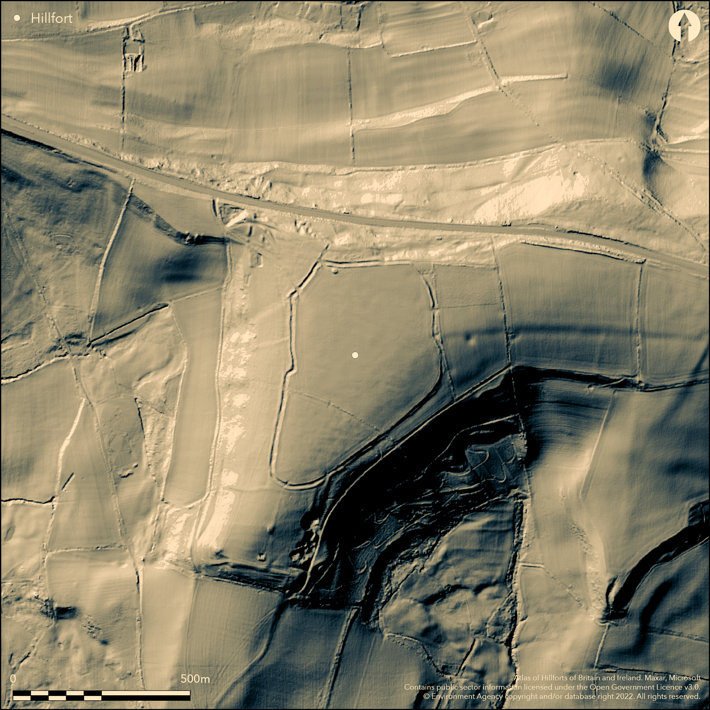
LiDAR 1m DTM Hillshade
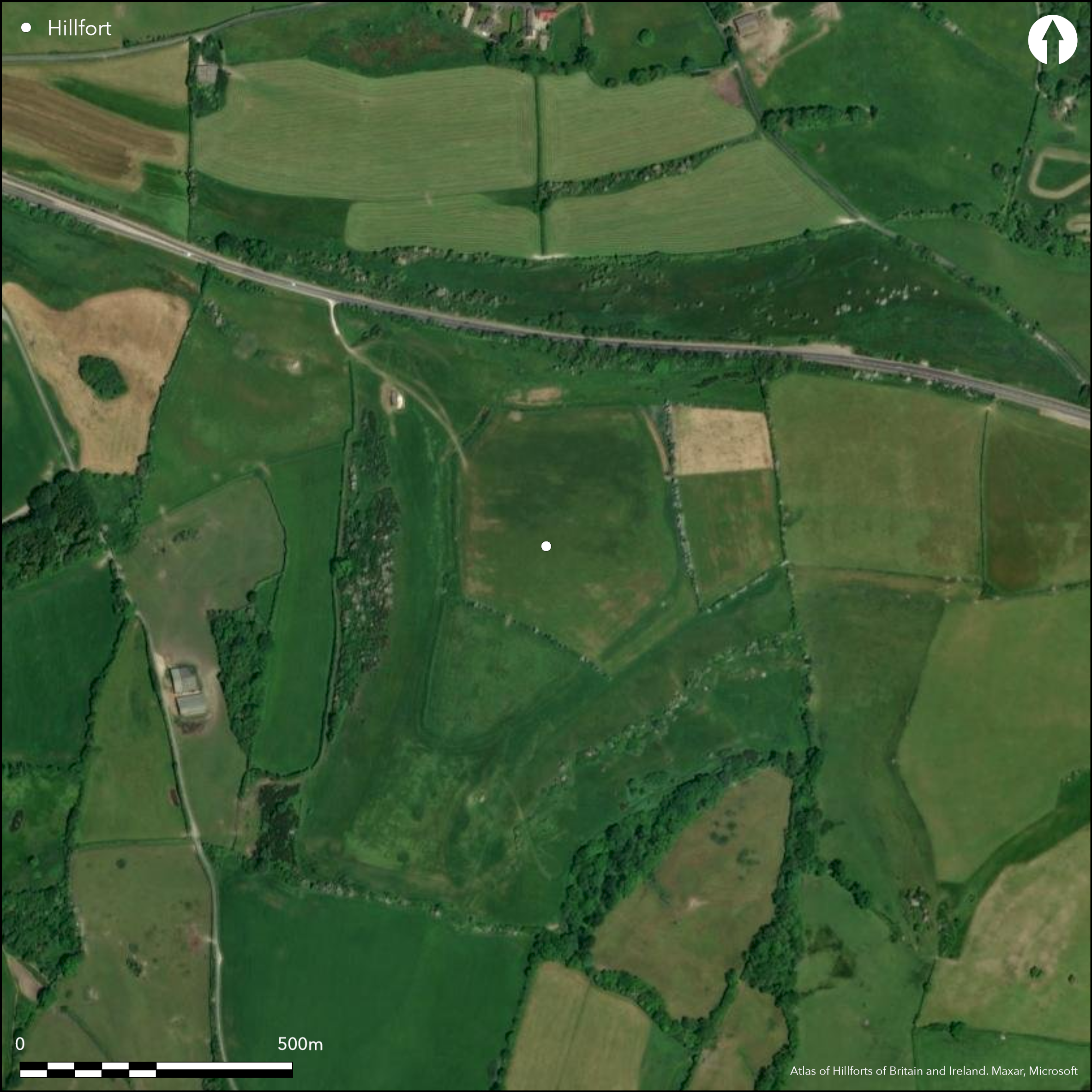
Satellite Imagery
LiDAR 1m DTM Hillshade
Satellite Imagery
Scroll left/right to view further images.
HER: Dorset MDO907 (None)
NMR: SY 59 SW 14 (451361)
SM: 1002777
NGR: SY53029195
X: 353011 Y: 91948 (OSGB36)
Contour bivallate hillfort sited at end of chalk ridge of Chilcombe Hill. Fairly flat, slightly domed interior with land along ridge to E rising gently. To N, S and W ground falls steeply to Bride Valley and Askerswell, at 30m and 90m OD respectively. Within sight of sea to SW. Irregular pear-shaped with internal area c. 7.5ha. Defined by two very slight ramparts with medial and outer ditch. On SE, banks possibly eroded to give scarps and narrow ledge or berm between. Best on N. Three possible entrance gaps, to E, S and NW, that on S a possible postern with date unclear, the others with passageways into interior. Modern gap at NW angle. Traces of round barrow near NW entrance. Iron Age sherds from gas trench across N end of fort (no details). Improved pasture. Ploughed-down with quarrying damage. On 1st Ed. OS map (1888-89).
Citizen Science: ✓
Reliability of Data: Confirmed
Reliability of Interpretation: Confirmed
X: -296901 Y: 6572824 (EPSG: 3857)
Longitude: -2.6671069314479876 Latitude: 50.725178277116385 (EPSG:4326)
Country: England; None
Current County or Unitary Authority: Dorset
Historic County: Dorset
Current Parish/Community/Council/Townland: Chilcombe; Askerswell; Litton Cheney; Shipton Gorge
Ploughed-down. Outer bank part-destroyed on N by quarrying.
| Extant | ✓ |
| Cropmark | ✗ |
| Likely Destroyed | ✗ |
Improved pasture. Quarrying.
| Woodland | ✗ |
| Commercial Forestry Plantation | ✗ |
| Parkland | ✗ |
| Pasture (Grazing) | ✓ |
| Arable | ✗ |
| Scrub/Bracken | ✗ |
| Bare Outcrop | ✗ |
| Heather/Moorland | ✗ |
| Heath | ✗ |
| Built-up | ✗ |
| Coastal Grassland | ✗ |
| Other | ✓ |
Contour bivallate hillfort sited at end of chalk ridge of Chilcombe Hill. Fairly flat, slightly domed interior. with land along ridge to E rising gently. To N, S and W ground falls steeply to Bride Valley and Askerswell, at 30m and 90m OD respectively. Within
| Contour Fort | ✓ |
| Partial Contour Fort | ✗ |
| Promontory Fort | ✗ |
| Hillslope Fort | ✗ |
| Level Terrain Fort | ✗ |
| Marsh Fort | ✗ |
| Multiple Enclosure Fort | ✗ |
| Hilltop | ✗ |
| Coastal Promontory | ✗ |
| Inland Promontory | ✗ |
| Valley Bottom | ✗ |
| Knoll/Hillock/Outcrop | ✗ |
| Ridge | ✓ |
| Cliff/Plateau-edge/Scarp | ✗ |
| Hillslope | ✗ |
| Lowland | ✗ |
| Spur | ✗ |
Dominant Topographic Feature: Ridge
| North | ✗ |
| Northeast | ✗ |
| East | ✗ |
| Southeast | ✗ |
| South | ✗ |
| Southwest | ✗ |
| West | ✗ |
| Northwest | ✗ |
| Level | ✓ |
Altitude: 190.0m
Boundary Type: Parish/Townland
Iron Age sherds from gas trench across N end of fort.
Reliability: B - Medium
| Pre 1200BC | ✗ |
| 1200BC - 800BC | ✗ |
| 800BC - 400BC | ✗ |
| 400BC - AD50 | ✓ |
| AD50 - AD400 | ✗ |
| AD400 - AD 800 | ✗ |
| Post AD800 | ✗ |
| Unknown | ✗ |
| Pre Hillfort: | None |
| Post Hillfort: | None |
| Artefactual: | Iron Age sherds. |
On 1st Ed. OS map (1888-89). Gas trench at N end - no date.
| 1st Identified Map Depiction (None): | OS map. |
| Other (None): | Gas trench at N end. |
Possible hut sites shown as dark patches. Burnt flints and pottery recovered from possible hut sites.
Good water supply adjacent.
| None | ✓ |
| Spring | ✗ |
| Stream | ✗ |
| Pool | ✗ |
| Flush | ✗ |
| Well | ✗ |
| Other | ✗ |
Possible hut sites shown as dark patches.
| No Known Features | ✗ |
| Round Stone Structures | ✗ |
| Rectangular Stone Structures | ✗ |
| Curvilinear Platforms | ✓ |
| Other Roundhouse Evidence | ✗ |
| Pits | ✗ |
| Quarry Hollows | ✗ |
| Other | ✗ |
None
| No Known Excavation | ✓ |
| Pits | ✗ |
| Postholes | ✗ |
| Roundhouses | ✗ |
| Rectangular Structures | ✗ |
| Roads/Tracks | ✗ |
| Quarry Hollows | ✗ |
| Other | ✗ |
| Nothing Found | ✗ |
None
| No Known Geophysics | ✓ |
| Pits | ✗ |
| Roundhouses | ✗ |
| Rectangular Structures | ✗ |
| Roads/Tracks | ✗ |
| Quarry Hollows | ✗ |
| Other | ✗ |
| Nothing Found | ✗ |
Burnt flints and pottery recovered from possible hut sites.
| No Known Finds | ✗ |
| Pottery | ✓ |
| Metal | ✗ |
| Metalworking | ✗ |
| Human Bones | ✗ |
| Animal Bones | ✗ |
| Lithics | ✓ |
| Environmental | ✗ |
| Other | ✗ |
None
| APs Not Checked | ✓ |
| None | ✗ |
| Roundhouses | ✗ |
| Rectangular Structures | ✗ |
| Pits | ✗ |
| Postholes | ✗ |
| Roads/Tracks | ✗ |
| Other | ✗ |
Three possible entrance gaps, to E, S and NW. That on S a possible postern date unclear the others with passageways into interior probably original. Probable modern break at NW angle.
| 4: | Probable modern break at NW angle. |
| 2: | None |
Guard Chambers: ✗
Chevaux de Frise: ✗
| 1. Passage-way/Corridor (East): | None |
| 2. Postern Gate (South): | Date unclear. |
| 3. Passage-way/Corridor (North west): | None |
Defined by two very slight ramparts with medial and outer ditch. On SE, banks possibly eroded to give scarps and narrow ledge or berm between. Best on N.
| Area 1: | 7.5ha. |
| Total: | 7.5ha. |
Total Footprint Area: Noneha.
None
| ✗ | None |
| ✓ | None |
| NE Quadrant: | 2 |
| SE Quadrant: | 2 |
| SW Quadrant: | 2 |
| NW Quadrant: | 2 |
| Total: | 2 |
| Partial Univallate | ✗ |
| Univallate | ✗ |
| Partial Bivallate | ✗ |
| Bivallate | ✓ |
| Partial Multivallate | ✗ |
| Multivallate | ✗ |
| Unknown | ✗ |
| Partial Univallate | ✗ |
| Univallate | ✗ |
| Partial Bivallate | ✗ |
| Bivallate | ✗ |
| Partial Multivallate | ✗ |
| Multivallate | ✗ |
Berm on SE between eroded/slipped banks.
| None | ✗ |
| Earthen Bank | ✓ |
| Stone Wall | ✗ |
| Rubble | ✗ |
| Wall-walk | ✗ |
| Evidence of Timber | ✗ |
| Vitrification | ✗ |
| Other Burning | ✗ |
| Palisade | ✗ |
| Counter Scarp Bank | ✗ |
| Berm | ✓ |
| Unfinished | ✗ |
| Other | ✗ |
None
| None | ✗ |
| Earthen Bank | ✗ |
| Stone Wall | ✗ |
| Murus Duplex | ✗ |
| Timber-framed | ✗ |
| Timber-laced | ✗ |
| Vitrification | ✗ |
| Other Burning | ✗ |
| Palisade | ✗ |
| Counter Scarp Bank | ✗ |
| Berm | ✗ |
| Unfinished | ✗ |
| No Known Excavation | ✓ |
| Other | ✗ |
| ✗ | None |
| ✓ | Much eroded and infilled. |
Number of Ditches: 2
| ✗ | None |
Gale, J. 2003. Prehistoric Dorset, Stroud: Tempus Publishing.
RCHME 1952. An inventory of the historical monuments in Dorset, Vol 1, West Dorset, 97, London: RCHM.
Warne, C. 1872. Ancient Dorset. The Celtic, Roman, Saxon and Danish Antiquities of the County, Bournemouth: For the author, 148-49.
Atlas of Hillforts:
Wikidata:
This work is licensed under CC BY-SA 4.0

 and should be cited as:
Lock, Gary and Ralston, Ian. 2024. Atlas of Hillforts of Britain and Ireland. Available at: https://hillforts.arch.ox.ac.uk
Document Version 1.1