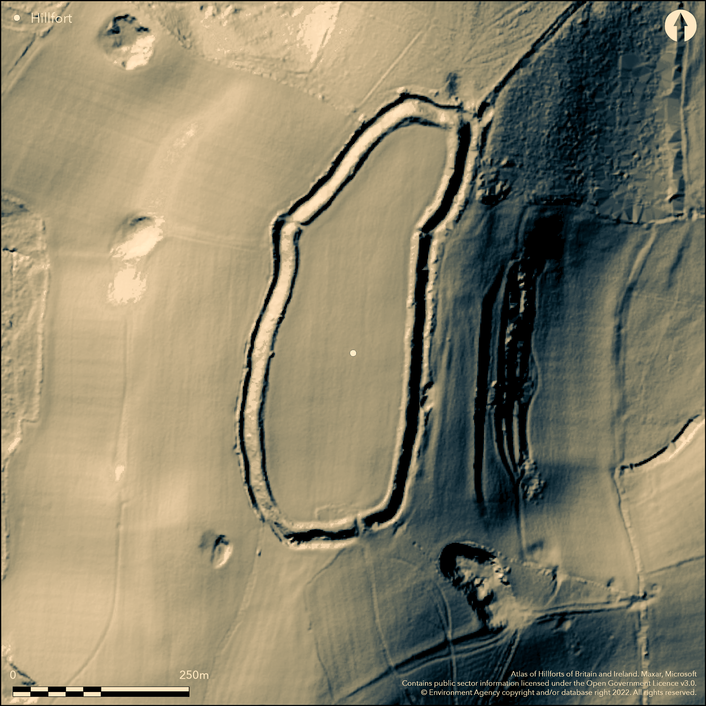
LiDAR 1m DTM Hillshade
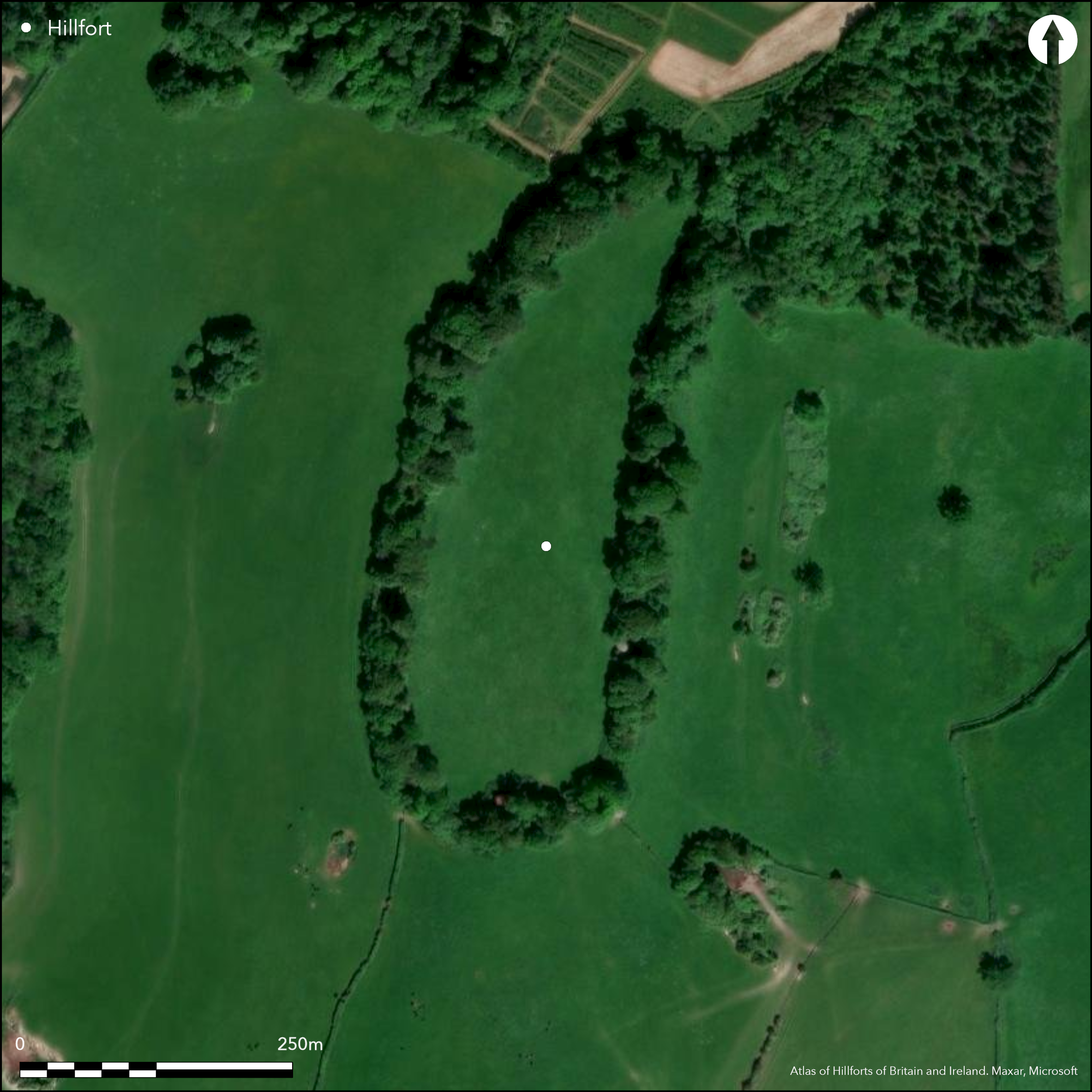
Satellite Imagery
LiDAR 1m DTM Hillshade
Satellite Imagery
Scroll left/right to view further images.
HER: Dorset MDO567 (None)
NMR: ST 60 NE 9 (198773)
SM: 1016895
NGR: ST68990741
X: 368995 Y: 107412 (OSGB36)
Prominent, partial contour hillfort located on N part of summit of the low, but prominent, Dungeon Hill, a chalk outlier just to N of downs in the Blackmore Vale. Steep surrounding slopes. Site oval in plan and tipped to NNE encloses 3.6ha. Defined by bank around circuit, 7m wide and 1.5m high, rising to c. 2.4m high at SW apex and N end, with ditch 13m wide and 2m deep, and up to 6m from bottom of ditch to crest of bank. Very slight traces of additional outer bank on E side, 7m wide and 0.8m high, possibly all encompassing bank around all the circuit. Disturbed simple causewayed entrance on S, with significant modern breaches on NE and NW. Excavation by E. Cunnington 1881 uncovered finds of pottery, quern fragments, tiles and stone building debris indicated late Roman occupation or re-use. Medieval strip lynchets as four parallel terraces on hillside below E rampart. Interior improved pasture, wooded and overgrown banks and ditch. Well-preserved, but badly affected by the two modern breaches, with, now dilapidated, brick arches constructed through ramparts on NE and NW. On 1st Ed. OS map (1888).
Citizen Science: ✓
Reliability of Data: Confirmed
Reliability of Interpretation: Confirmed
X: -271839 Y: 6597504 (EPSG: 3857)
Longitude: -2.441970614156134 Latitude: 50.86531354290527 (EPSG:4326)
Country: England; None
Current County or Unitary Authority: Dorset
Historic County: Dorset
Current Parish/Community/Council/Townland: Buckland Newton; Glanvilles Wootton
Well-preserved, but badly affected by the two modern breaches, with brick arches constructed through ramparts (now dilapidated) on NE and NW. Small chalk pit damage to E ditch.
| Extant | ✓ |
| Cropmark | ✗ |
| Likely Destroyed | ✓ |
Interior improved pasture, wooded and overgrown banks and ditch. Brick arches constructed through ramparts (now dilapidated) on NE and NW.
| Woodland | ✓ |
| Commercial Forestry Plantation | ✗ |
| Parkland | ✗ |
| Pasture (Grazing) | ✓ |
| Arable | ✗ |
| Scrub/Bracken | ✗ |
| Bare Outcrop | ✗ |
| Heather/Moorland | ✗ |
| Heath | ✗ |
| Built-up | ✗ |
| Coastal Grassland | ✗ |
| Other | ✓ |
Prominent, partial contour hillfort located on N part of summit of the low, but prominent, Dungeon Hill, a chalk outlier just to N of downs in the Blackmore Vale. Steep surrounding slopes.
| Contour Fort | ✗ |
| Partial Contour Fort | ✓ |
| Promontory Fort | ✗ |
| Hillslope Fort | ✗ |
| Level Terrain Fort | ✗ |
| Marsh Fort | ✗ |
| Multiple Enclosure Fort | ✗ |
| Hilltop | ✓ |
| Coastal Promontory | ✗ |
| Inland Promontory | ✗ |
| Valley Bottom | ✗ |
| Knoll/Hillock/Outcrop | ✗ |
| Ridge | ✗ |
| Cliff/Plateau-edge/Scarp | ✗ |
| Hillslope | ✗ |
| Lowland | ✗ |
| Spur | ✗ |
Dominant Topographic Feature: Hill top
| North | ✗ |
| Northeast | ✓ |
| East | ✗ |
| Southeast | ✗ |
| South | ✗ |
| Southwest | ✗ |
| West | ✗ |
| Northwest | ✗ |
| Level | ✗ |
Altitude: 185.0m
Boundary Type: Parish/Townland
Probably Iron Age in origin, but excavation found finds of pottery and building debris of late Roman occupation or re-use of the site.
Reliability: B - Medium
| Pre 1200BC | ✗ |
| 1200BC - 800BC | ✗ |
| 800BC - 400BC | ✓ |
| 400BC - AD50 | ✓ |
| AD50 - AD400 | ✓ |
| AD400 - AD 800 | ✗ |
| Post AD800 | ✗ |
| Unknown | ✗ |
| Pre Hillfort: | None |
| Post Hillfort: | None |
| Artefactual: | Late Roman pottery and building debris. |
In late 18th century owner, Mr Foy, cleared the woodland on the site and found, among other remains, human bones, sword blades and Roman coins. Excavation E. Cunnington 1881. On 1st Ed. OS map (1888).
| Excavation (1881): | E. Cunnington. |
| 1st Identified Map Depiction (1888): | OS map. |
| Other (None): | Chance finds. |
In late 18th century owner, Mr Foy, cleared the woodland on the site and found, among other remains, human bones, sword blades and Roman coins. Excavation 1881 found late Roman pottery, quern fragments and stone building debris and Roman tiles in interior.
None
| None | ✓ |
| Spring | ✗ |
| Stream | ✗ |
| Pool | ✗ |
| Flush | ✗ |
| Well | ✗ |
| Other | ✗ |
None
| No Known Features | ✓ |
| Round Stone Structures | ✗ |
| Rectangular Stone Structures | ✗ |
| Curvilinear Platforms | ✗ |
| Other Roundhouse Evidence | ✗ |
| Pits | ✗ |
| Quarry Hollows | ✗ |
| Other | ✗ |
No details.
| No Known Excavation | ✗ |
| Pits | ✗ |
| Postholes | ✗ |
| Roundhouses | ✗ |
| Rectangular Structures | ✗ |
| Roads/Tracks | ✗ |
| Quarry Hollows | ✗ |
| Other | ✗ |
| Nothing Found | ✓ |
None
| No Known Geophysics | ✓ |
| Pits | ✗ |
| Roundhouses | ✗ |
| Rectangular Structures | ✗ |
| Roads/Tracks | ✗ |
| Quarry Hollows | ✗ |
| Other | ✗ |
| Nothing Found | ✗ |
In late 18th century owner, Mr Foy, cleared the woodland on the site and found, among other remains, human bones, sword blades and Roman coins. Excavation 1881 found late Roman pottery, quern fragments and stone building debris and Roman tiles in interior.
| No Known Finds | ✗ |
| Pottery | ✓ |
| Metal | ✓ |
| Metalworking | ✗ |
| Human Bones | ✓ |
| Animal Bones | ✗ |
| Lithics | ✗ |
| Environmental | ✗ |
| Other | ✓ |
None
| APs Not Checked | ✓ |
| None | ✗ |
| Roundhouses | ✗ |
| Rectangular Structures | ✗ |
| Pits | ✗ |
| Postholes | ✗ |
| Roads/Tracks | ✗ |
| Other | ✗ |
Simple causewayed entrance on S, widened for access in modern times with modern field gate. Two opposing modern entrances over causeways across ditch on NE and NW, with now dilapidated brick arches constructed through the rampart for access into interior.
| 3: | Two opposing modern entrances over causeways across ditch on NE and NW, with now dilapidated brick arches constructed through the rampart for access into interior. |
| 2: | None |
Guard Chambers: ✗
Chevaux de Frise: ✗
| 1. Simple Gap (South): | Simple causewayed entrance. |
Defined by bank around circuit, 7m wide and 1.5m high, rising to c. 2.4m high at SW apex and N end, with ditch 13m wide and 2m deep. Very slight traces of additional outer bank on E side, 7m wide and 0.8m high. Was this an all encompassing bank around all the circuit? Unclear.
| Area 1: | 3.6ha. |
| Total: | 3.6ha. |
Total Footprint Area: Noneha.
None
| ✗ | None |
| ✓ | Very slight traces of additional outer bank on E side, but exact quadrant location unclear and estimated. |
| NE Quadrant: | 2 |
| SE Quadrant: | 2 |
| SW Quadrant: | 1 |
| NW Quadrant: | 1 |
| Total: | 2 |
| Partial Univallate | ✓ |
| Univallate | ✗ |
| Partial Bivallate | ✓ |
| Bivallate | ✗ |
| Partial Multivallate | ✗ |
| Multivallate | ✗ |
| Unknown | ✗ |
| Partial Univallate | ✗ |
| Univallate | ✗ |
| Partial Bivallate | ✗ |
| Bivallate | ✗ |
| Partial Multivallate | ✗ |
| Multivallate | ✗ |
None
| None | ✗ |
| Earthen Bank | ✓ |
| Stone Wall | ✗ |
| Rubble | ✗ |
| Wall-walk | ✗ |
| Evidence of Timber | ✗ |
| Vitrification | ✗ |
| Other Burning | ✗ |
| Palisade | ✗ |
| Counter Scarp Bank | ✗ |
| Berm | ✗ |
| Unfinished | ✗ |
| Other | ✗ |
Some construction evidence found.
| None | ✗ |
| Earthen Bank | ✓ |
| Stone Wall | ✗ |
| Murus Duplex | ✗ |
| Timber-framed | ✗ |
| Timber-laced | ✗ |
| Vitrification | ✗ |
| Other Burning | ✗ |
| Palisade | ✗ |
| Counter Scarp Bank | ✗ |
| Berm | ✗ |
| Unfinished | ✗ |
| No Known Excavation | ✗ |
| Other | ✗ |
| ✗ | None |
| ✓ | None |
Number of Ditches: 1
| ✗ | None |
Cunnington, E. 1901. Dungeon or Dunset Camp, Proc. Dorset Natur. Hist. Antiq. Fld. Clb, 21, 203-204.
Gale, J. 2003. Prehistoric Dorset, Stroud: Tempus Publishing.
Hutchins, Rev. J. 1868. The history and antiquities of the County of Dorset, 3, 3rd Edn, Westminster, 708.
RCHME 1952. An inventory of the historical monuments in Dorset, Vol 1, West Dorset, 169, London: RCHM.
Atlas of Hillforts:
Wikidata:
This work is licensed under CC BY-SA 4.0

 and should be cited as:
Lock, Gary and Ralston, Ian. 2024. Atlas of Hillforts of Britain and Ireland. Available at: https://hillforts.arch.ox.ac.uk
Document Version 1.1