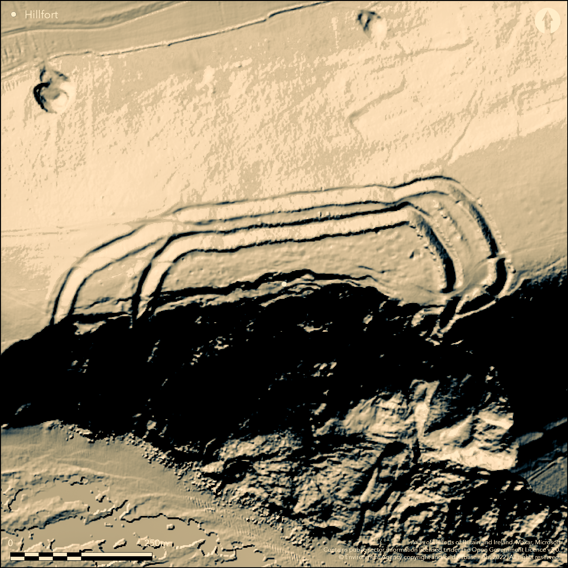
LiDAR 1m DTM Hillshade
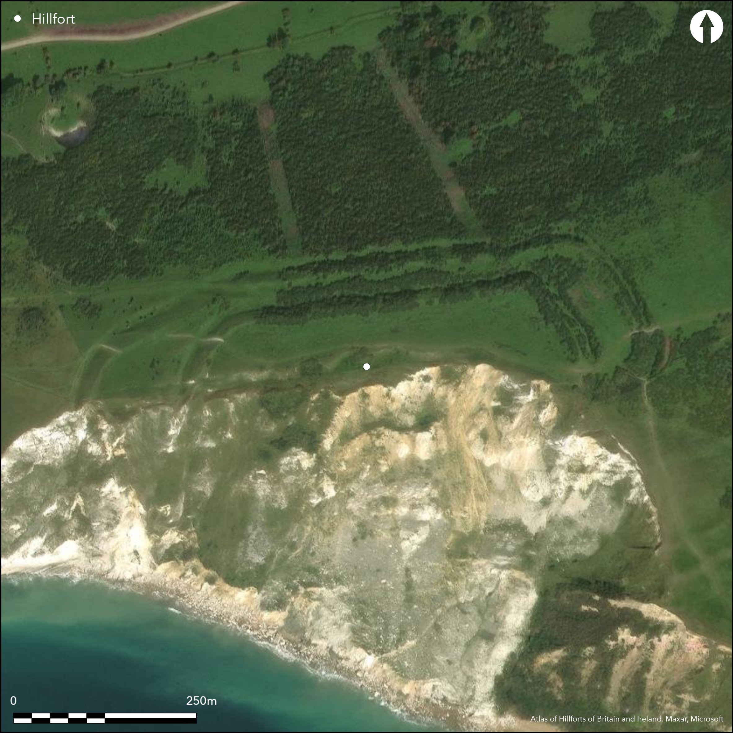
Satellite Imagery
LiDAR 1m DTM Hillshade
Satellite Imagery
Scroll left/right to view further images.
HER: Dorset MDO7654 (None)
NMR: SY 88 SE 1 (455375)
SM: 1008141
NGR: SY864805
X: 386366 Y: 80555 (OSGB36)
Remains of coastal partial contour fort located on Upper Chalk with out-cropping sands and clays of the Corallian Beds cliff edge of Rings Hill directly above Worbarrow Bay to S at extreme edge of Purbeck Hills. Interior rises gently to E and S. Precipitous, eroded sea cliffs to SE, very steep slopes on N and W, but only very gently along ridge to E. Altitude of site 140m-173m OD. Spectacular coastal erosion has reduced site by at least one half and formerly a distance inland (Brown 2009, 186), and noted as early as 1744 by antiquarian Edward Weld. Two principal banks and ditches now on three sides, N. E and W, now c. 6.76ha in total area. Site shows at least two phases of construction, with an inner enclosure of c. 2.64ha with bank c. 9m wide and 9m high above ditch bottom, with broad quarry ditch not extending S of entrance. Counterscarp bank on N and E, but not on W. At NW apex of this inner enclosure counterscarp met by main outer rampart, but a later broad track has cut through at this point. The outer rampart is separated from the inner counterscarp by a berm of varying width to 6m wide, less on NE corner. Space between rampart increases to 30m on W. On E mid-way between inner ditch and outer rampart low bank with no ditch for c. 60m of uncertain origin. To NW outer rampart now little more than a scarp c. 10m above ditch bottom. SE entrance to inner and outer banks. Occupation platforms visible along N-facing slope of interior. Pit excavated 1939 near entrance c. 0.9m deep yielding some slingstones, bone refuse and Iron Age pottery (Calkin 1948). In early 19th century a skeleton, said to be of abnormal length, found just beneath surface of inner rampart of uncertain date. Dyke 165m away on E spans three-quarters of the ridge top. Coastal grassland and bare chalk. Much eroded. On 1st Ed. OS map (1889).
Citizen Science: ✗
Reliability of Data: Confirmed
Reliability of Interpretation: Confirmed
X: -244249 Y: 6555133 (EPSG: 3857)
Longitude: -2.194130068862661 Latitude: 50.62446848616349 (EPSG:4326)
Country: England; None
Current County or Unitary Authority: Dorset
Historic County: Dorset
Current Parish/Community/Council/Townland: East Lulworth; Tyneham
South West Coast Path through site E-W. Spectacular coastal erosion has reduced site by at least one half and formerly a distance inland (Brown 2009, 186), and noted as early as 1744 by antiquarian Edward Weld. On Heritage at Risk Register (2015).
| Extant | ✓ |
| Cropmark | ✗ |
| Likely Destroyed | ✓ |
Coastal grassland and bare chalk.
| Woodland | ✗ |
| Commercial Forestry Plantation | ✗ |
| Parkland | ✗ |
| Pasture (Grazing) | ✗ |
| Arable | ✗ |
| Scrub/Bracken | ✗ |
| Bare Outcrop | ✗ |
| Heather/Moorland | ✗ |
| Heath | ✗ |
| Built-up | ✗ |
| Coastal Grassland | ✓ |
| Other | ✗ |
Remains of coastal partial contour fort located on Upper Chalk with out-cropping sands and clays of the Corallian Beds cliff edge of Rings Hill directly above Worbarrow Bay to S at extreme edge of Purbeck Hills. Precipitous, eroded sea cliffs to SE, very steep slopes on N and W, but only very gently along ridge to E. Altitude of site 140m-173m OD. Interior rises gently to E and S and therefore site classified as hillslope rather than level terrain fort.
| Contour Fort | ✗ |
| Partial Contour Fort | ✓ |
| Promontory Fort | ✗ |
| Hillslope Fort | ✗ |
| Level Terrain Fort | ✗ |
| Marsh Fort | ✗ |
| Multiple Enclosure Fort | ✗ |
| Hilltop | ✗ |
| Coastal Promontory | ✗ |
| Inland Promontory | ✗ |
| Valley Bottom | ✗ |
| Knoll/Hillock/Outcrop | ✗ |
| Ridge | ✗ |
| Cliff/Plateau-edge/Scarp | ✓ |
| Hillslope | ✗ |
| Lowland | ✗ |
| Spur | ✗ |
Dominant Topographic Feature: Sloping coastal cliff edge
| North | ✗ |
| Northeast | ✗ |
| East | ✗ |
| Southeast | ✗ |
| South | ✓ |
| Southwest | ✗ |
| West | ✗ |
| Northwest | ✗ |
| Level | ✗ |
Altitude: 173.0m
Boundary Type: Parish/Townland
Possibly late Iron Age pottery. Chance finds of silver Durotrigian stater and early Iron Age pottery.
Reliability: B - Medium
| Pre 1200BC | ✗ |
| 1200BC - 800BC | ✗ |
| 800BC - 400BC | ✓ |
| 400BC - AD50 | ✓ |
| AD50 - AD400 | ✗ |
| AD400 - AD 800 | ✗ |
| Post AD800 | ✗ |
| Unknown | ✗ |
| Pre Hillfort: | None |
| Post Hillfort: | None |
| Artefactual: | Iron Age pottery. |
In Aubrey's Monumenta Britannica (1665-1693). Erosion noted by Edward Weld 1744. Reference F. Pennie 1827. Note in Dorset County Record Office. Early 19th century skeleton find. Excavation C. Warne 1842. Excavation W.H.C. Frend 1937. Excavation J.B. Calkin 1939. On 1st Ed. OS map (1889).
| Other (1827): | Reference F. Pennie. |
| Excavation (1842): | C. Warne. |
| 1st Identified Map Depiction (1889): | OS map. |
| Excavation (1937): | W.H.C. Frend. |
| Excavation (1939): | J.B. Calkin. |
| 1st Identified Written Reference (None): | None |
| Other (None): | Skeleton find. |
At least dozen occupation platforms levelled into slope and visible along N-facing slope of interior concentrated to E. Pit excavated 1939 near entrance c. 0.9m deep yielding some slingstones, bone refuse (animal?) and (late?) Iron Age pottery. Possible hearth. In early 19th century a skeleton, said to be of abnormal length, found just beneath surface of inner rampart of uncertain date. Chance find of silver Durotrigian stater and early Iron Age pottery.
None
| None | ✓ |
| Spring | ✗ |
| Stream | ✗ |
| Pool | ✗ |
| Flush | ✗ |
| Well | ✗ |
| Other | ✗ |
At least dozen occupation platforms levelled into slope and visible along N-facing slope of interior concentrated to E.
| No Known Features | ✗ |
| Round Stone Structures | ✗ |
| Rectangular Stone Structures | ✗ |
| Curvilinear Platforms | ✓ |
| Other Roundhouse Evidence | ✗ |
| Pits | ✗ |
| Quarry Hollows | ✗ |
| Other | ✗ |
Pit excavated near entrance. Possible hearth.
| No Known Excavation | ✗ |
| Pits | ✓ |
| Postholes | ✗ |
| Roundhouses | ✗ |
| Rectangular Structures | ✗ |
| Roads/Tracks | ✗ |
| Quarry Hollows | ✗ |
| Other | ✓ |
| Nothing Found | ✗ |
None
| No Known Geophysics | ✓ |
| Pits | ✗ |
| Roundhouses | ✗ |
| Rectangular Structures | ✗ |
| Roads/Tracks | ✗ |
| Quarry Hollows | ✗ |
| Other | ✗ |
| Nothing Found | ✗ |
Pit excavated 1939 near entrance c. 0.9m deep yielding some slingstones, bone refuse (animal?) and (late?) Iron Age pottery. In early 19th century a skeleton, said to be of abnormal length, found just beneath surface of inner rampart of uncertain date. Chance find of silver Durotrigian stater and early Iron Age pottery.
| No Known Finds | ✗ |
| Pottery | ✓ |
| Metal | ✗ |
| Metalworking | ✗ |
| Human Bones | ✓ |
| Animal Bones | ✓ |
| Lithics | ✓ |
| Environmental | ✗ |
| Other | ✓ |
None
| APs Not Checked | ✓ |
| None | ✗ |
| Roundhouses | ✗ |
| Rectangular Structures | ✗ |
| Pits | ✗ |
| Postholes | ✗ |
| Roads/Tracks | ✗ |
| Other | ✗ |
SE entrance through inner rampart slightly inturned to N. Opposite it through outer bank is possible mutilated entrance gap.
| 2: | None |
| 2: | None |
Guard Chambers: ✗
Chevaux de Frise: ✗
| 1. In-turned (South east): | Through inner rampart slightly inturned to N. |
| 2. Simple Gap (South east): | Possible mutilated entrance gap through outer rampart. |
Two principal banks and ditches now on three sides, N. E and W. Site shows at least two phases of construction, with an inner enclosure of c. 2.64ha with bank c. 9m wide and 9m high above ditch bottom, with broad quarry ditch not extending S of entrance. Counterscarp bank on N and E, but not on W. At NW apex of this inner enclosure counterscarp met by main outer rampart, but a later broad track has cut through at this point. The outer rampart is separated from the inner counterscarp by a berm of varying width to 6m wide, less on NE corner. Space between rampart increases to 30m on W. On E wid-way between inner ditch and outer rampart low bank with no ditch for c. 60m of uncertain origin. To NW outer rampart now little more than a scarp c. 10m above ditch bottom.
| Area 1: | 2.64ha. |
| Total: | 2.64ha. |
Total Footprint Area: 6.76ha.
None
| ✓ | Morphology suggests at least two phases of construction, but no details. |
| ✗ | Much of site lost to sea. |
| NE Quadrant: | 2 |
| SE Quadrant: | 0 |
| SW Quadrant: | 2 |
| NW Quadrant: | 2 |
| Total: | 2 |
| Partial Univallate | ✗ |
| Univallate | ✗ |
| Partial Bivallate | ✓ |
| Bivallate | ✗ |
| Partial Multivallate | ✗ |
| Multivallate | ✗ |
| Unknown | ✗ |
| Partial Univallate | ✗ |
| Univallate | ✓ |
| Partial Bivallate | ✗ |
| Bivallate | ✗ |
| Partial Multivallate | ✗ |
| Multivallate | ✗ |
Counterscarp bank on N and E, but not on W.
| None | ✗ |
| Earthen Bank | ✓ |
| Stone Wall | ✗ |
| Rubble | ✗ |
| Wall-walk | ✗ |
| Evidence of Timber | ✗ |
| Vitrification | ✗ |
| Other Burning | ✗ |
| Palisade | ✗ |
| Counter Scarp Bank | ✓ |
| Berm | ✗ |
| Unfinished | ✗ |
| Other | ✗ |
None
| None | ✓ |
| Earthen Bank | ✗ |
| Stone Wall | ✗ |
| Murus Duplex | ✗ |
| Timber-framed | ✗ |
| Timber-laced | ✗ |
| Vitrification | ✗ |
| Other Burning | ✗ |
| Palisade | ✗ |
| Counter Scarp Bank | ✗ |
| Berm | ✗ |
| Unfinished | ✗ |
| No Known Excavation | ✗ |
| Other | ✗ |
| ✗ | None |
| ✓ | None |
Number of Ditches: 1
| ✗ | None |
Brown, I. 2009. Beacons in the landscape. The hillforts of England and Wales. Oxford: Windgather Press/ Oxbow Books.
Calkin, J.B. 1948. The Isle of Purbeck in the Iron Age, Proc Dorset Natur Hist Archaeol Soc, 70, 29-59.
Frend, W.H.C. 1949. Some Further Iron Age and Roman Sites in the Isle of Purbeck, Proc Dorset Natur Hist Archaeol Soc, 71, 51-53.
Gale, J. 2003. Prehistoric Dorset, Stroud: Tempus Publishing.
Pennie, F. 1827. The Tale of a Modern Genius, II, 85.
RCHME 1970. An inventory of historical monuments in the County of Dorset, Vol 2, pt 3: south-east, No 40, 489-90,London: RCHME.
Atlas of Hillforts:
Wikidata:
This work is licensed under CC BY-SA 4.0

 and should be cited as:
Lock, Gary and Ralston, Ian. 2024. Atlas of Hillforts of Britain and Ireland. Available at: https://hillforts.arch.ox.ac.uk
Document Version 1.1