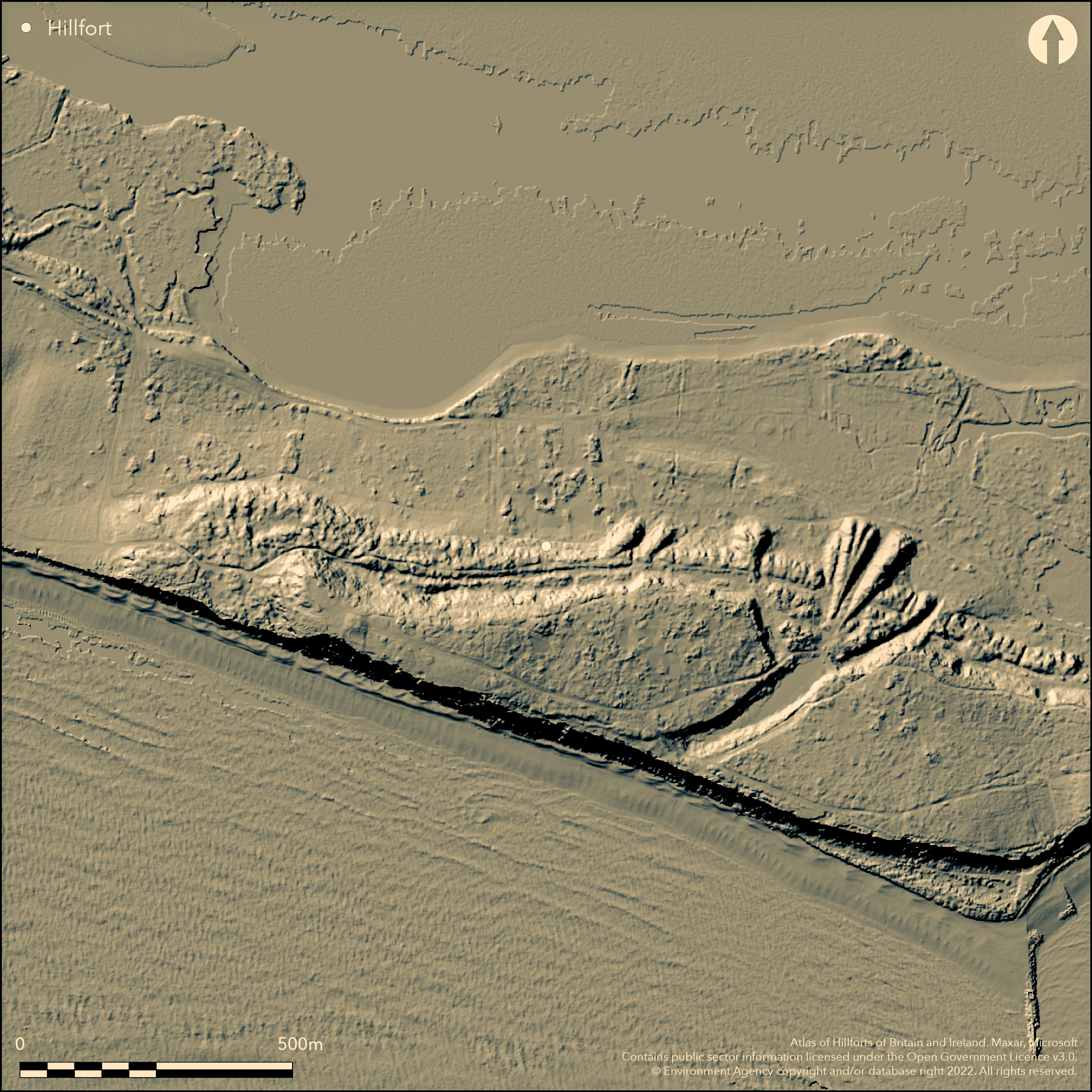
LiDAR 1m DTM Hillshade
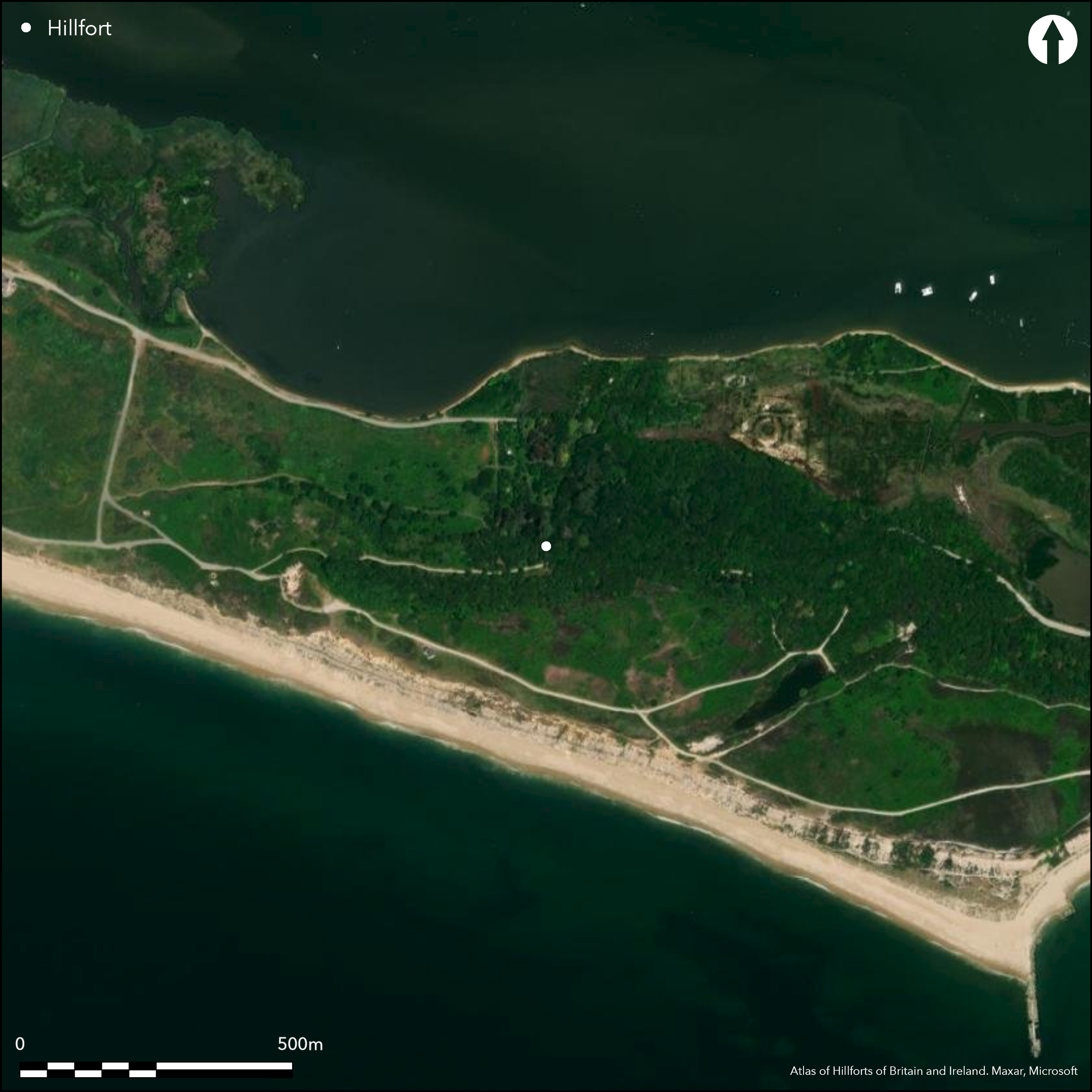
Satellite Imagery
LiDAR 1m DTM Hillshade
Satellite Imagery
Scroll left/right to view further images.
HER: Dorset MDO8633 (None)
NMR: SZ 19 SE 84 (458767)
SM: 1002367
NGR: SZ172907
X: 417263 Y: 90784 (OSGB36)
An Iron Age/Romano-British trading settlement on Hengistbury Head, centred on the low land lying under the shelter of Warren Hill and bordering Christchurch harbour, the peninsula of the Head jutting out into the English Channel NW-SE creating a natural harbour behind. Probably started as a coastal promontory fort on Hengistbury Head and cut off from the mainland by the 'Double Dykes', erected c. 700 BC, comprising two parallel linear earthworks of bank and ditch, c. 40m wide, the inner most massive at c. 3m above surrounding ground surface and c. 7m above base of ditch. Area enclosed c. 80ha+. Although thought to be of Iron Age date, the small rescue excavation of J.P. Bushe-Fox 1911-12 and those of Barry Cunliffe 1970-71 and 1979-1984, failed to uncover entirely unambiguous dating evidence for their construction. Evidence of occupation of promontory from Upper Palaeolithic onwards and in Bronze Age site of later hillfort used for funerary purposes, with none recorded round barrows on site, one with rich Wessex II cremation, suggesting already trading network to Wessex. Subsequently developed, there is plenty of evidence to confirm the settlement as a whole as a major trading centre and port from c. 150 BC during the Iron Age and extending to end of Roman period. Much evidence of occupation, including postholes, pits, trackways, timber buildings and rectangular or square structures and many more features. Existing gaps visible to N and S and central through banks, either that to N or central gap original, possibly latter favoured. No significant gap in occupation of hillfort from late Iron Age c. 500 BC through to Roman period, with two phases of late Iron Age occupation (100-50 BC and 50 BC to AD 43). Industrial activities within settlement included bronze working, glass working, shale working, iron working, extraction of silver, minting coins, and possible salt production with many relevant finds, including amphorae from Mediterranean, glass fine pottery, jewellery, coins, iron brooch, bronze work, glass beads and quern. On 1st Ed. OS map (1893).
Citizen Science: ✓
Reliability of Data: Confirmed
Reliability of Interpretation: Confirmed
X: -195572 Y: 6571275 (EPSG: 3857)
Longitude: -1.756856984399864 Latitude: 50.71636540295246 (EPSG:4326)
Country: England
Current County or Unitary Authority: Dorset
Historic County: Dorset
Current Parish/Community/Council/Townland: Hengistbury
Well-preserved bank.
| Extant | ✓ |
| Cropmark | ✗ |
| Likely Destroyed | ✗ |
Rough coastal grassland and scrub.
| Woodland | ✗ |
| Commercial Forestry Plantation | ✗ |
| Parkland | ✗ |
| Pasture (Grazing) | ✗ |
| Arable | ✗ |
| Scrub/Bracken | ✓ |
| Bare Outcrop | ✗ |
| Heather/Moorland | ✗ |
| Heath | ✗ |
| Built-up | ✗ |
| Coastal Grassland | ✓ |
| Other | ✗ |
The important trading Iron Age/Romano-British settlement on Hengistbury Head, centered on the low land lying under the shelter of Warren Hill and bordering Christchurch harbour, the Head jutting out into the English Channel NW-SE creating a natural harbour behind.
| Contour Fort | ✗ |
| Partial Contour Fort | ✗ |
| Promontory Fort | ✓ |
| Hillslope Fort | ✗ |
| Level Terrain Fort | ✗ |
| Marsh Fort | ✗ |
| Multiple Enclosure Fort | ✗ |
| Hilltop | ✗ |
| Coastal Promontory | ✓ |
| Inland Promontory | ✗ |
| Valley Bottom | ✗ |
| Knoll/Hillock/Outcrop | ✗ |
| Ridge | ✗ |
| Cliff/Plateau-edge/Scarp | ✗ |
| Hillslope | ✗ |
| Lowland | ✗ |
| Spur | ✗ |
Dominant Topographic Feature: Coastal headland
| North | ✗ |
| Northeast | ✗ |
| East | ✗ |
| Southeast | ✗ |
| South | ✗ |
| Southwest | ✗ |
| West | ✗ |
| Northwest | ✗ |
| Level | ✓ |
Altitude: 10.0m
N/A
Ramparts erected c. 700 BC, with no significant gap in occupation of hillfort from late Iron Age c. 500 BC through to Roman period, with two phases of late Iron Age occupation (100-50 BC and 50 BC to AD 43).
Reliability: B - Medium
| Pre 1200BC | ✗ |
| 1200BC - 800BC | ✗ |
| 800BC - 400BC | ✓ |
| 400BC - AD50 | ✓ |
| AD50 - AD400 | ✓ |
| AD400 - AD 800 | ✗ |
| Post AD800 | ✗ |
| Unknown | ✗ |
| Pre Hillfort: | None |
| Post Hillfort: | None |
| Artefactual: | Many dateable finds. |
On 1st Ed. OS map (1893). Small rescue excavation prior to sea defence works J.P. Bushe-Fox 1911-12. Excavations B. Cunliffe 1970-71 and 1979-1984.
| 1st Identified Map Depiction (1893): | OS map. |
| Excavation (None): | J.P. Bushe-Fox. |
| Excavation (None): | B.Cunliffe. |
Much evidence of occupation, including postholes, pits, trackways, timber buildings and rectangular or square structures and many more features. Iron Age to Roman period pottery and evidence of Industrial activities within settlement included bronze working, glass working, shale working, iron working, extraction of silver, minting coins and possible salt production with many relevant finds indicating overseas trade especially, including amphorae from Mediterranean, glass, fine Armorican pottery, jewellery, coins, iron brooch, bronze work, glass beads and quern.
None
| None | ✓ |
| Spring | ✗ |
| Stream | ✗ |
| Pool | ✗ |
| Flush | ✗ |
| Well | ✗ |
| Other | ✗ |
None
| No Known Features | ✓ |
| Round Stone Structures | ✗ |
| Rectangular Stone Structures | ✗ |
| Curvilinear Platforms | ✗ |
| Other Roundhouse Evidence | ✗ |
| Pits | ✗ |
| Quarry Hollows | ✗ |
| Other | ✗ |
Much evidence of occupation, including postholes, pits, trackways, timber buildings and rectangular or square structures and many more features.
| No Known Excavation | ✗ |
| Pits | ✓ |
| Postholes | ✓ |
| Roundhouses | ✗ |
| Rectangular Structures | ✓ |
| Roads/Tracks | ✓ |
| Quarry Hollows | ✗ |
| Other | ✓ |
| Nothing Found | ✗ |
None
| No Known Geophysics | ✓ |
| Pits | ✗ |
| Roundhouses | ✗ |
| Rectangular Structures | ✗ |
| Roads/Tracks | ✗ |
| Quarry Hollows | ✗ |
| Other | ✗ |
| Nothing Found | ✗ |
Iron Age to Roman period pottery and evidence of Industrial activities within settlement included bronze working, glass working, shale working, iron working, extraction of silver, minting coins and possible salt production with many relevant finds indicating overseas trade especially, including amphorae from Mediterranean, glass, fine Armorican pottery, jewellery, coins, iron brooch, bronze work, glass beads and quern.
| No Known Finds | ✗ |
| Pottery | ✓ |
| Metal | ✓ |
| Metalworking | ✓ |
| Human Bones | ✓ |
| Animal Bones | ✓ |
| Lithics | ✓ |
| Environmental | ✓ |
| Other | ✓ |
None
| APs Not Checked | ✓ |
| None | ✗ |
| Roundhouses | ✗ |
| Rectangular Structures | ✗ |
| Pits | ✗ |
| Postholes | ✗ |
| Roads/Tracks | ✗ |
| Other | ✗ |
Existing gaps visible to N and S and central through banks on W, either that to N or central gap original, possibly latter favoured.
| 3: | None |
| 2: | Possibly centre gap favoured. |
Guard Chambers: ✗
Chevaux de Frise: ✗
| 1. Simple Gap (West): | To N possible. |
| 2. Simple Gap (West): | Central gap possibly favoured. |
Site cut off from the mainland by the 'Double Dykes', comprising two parallel linear earthworks of bank and ditch, the inner most massive at c. 3m above surrounding ground surface.
| Area 1: | 80.0ha. |
| Total: | 80.0ha. |
Total Footprint Area: Noneha.
None
| ✓ | Phased construction. |
| ✗ | None |
| NE Quadrant: | 0 |
| SE Quadrant: | 0 |
| SW Quadrant: | 2 |
| NW Quadrant: | 2 |
| Total: | 2 |
| Partial Univallate | ✗ |
| Univallate | ✗ |
| Partial Bivallate | ✓ |
| Bivallate | ✗ |
| Partial Multivallate | ✗ |
| Multivallate | ✗ |
| Unknown | ✗ |
| Partial Univallate | ✗ |
| Univallate | ✗ |
| Partial Bivallate | ✗ |
| Bivallate | ✗ |
| Partial Multivallate | ✗ |
| Multivallate | ✗ |
None
| None | ✗ |
| Earthen Bank | ✓ |
| Stone Wall | ✗ |
| Rubble | ✗ |
| Wall-walk | ✗ |
| Evidence of Timber | ✗ |
| Vitrification | ✗ |
| Other Burning | ✗ |
| Palisade | ✗ |
| Counter Scarp Bank | ✗ |
| Berm | ✗ |
| Unfinished | ✗ |
| Other | ✗ |
Evidence of palisaded encloures in late Iron Age on promontory.
| None | ✗ |
| Earthen Bank | ✓ |
| Stone Wall | ✗ |
| Murus Duplex | ✗ |
| Timber-framed | ✗ |
| Timber-laced | ✗ |
| Vitrification | ✗ |
| Other Burning | ✗ |
| Palisade | ✓ |
| Counter Scarp Bank | ✗ |
| Berm | ✗ |
| Unfinished | ✗ |
| No Known Excavation | ✗ |
| Other | ✗ |
| ✗ | None |
| ✓ | None |
Number of Ditches: 2
| ✗ | None |
Brown, I. 2009. Beacons in the landscape. The hillforts of England and Wales, Oxford: Wingather Press/Oxbow Books.
Bushe-Fox , J.P 1915. Excavations at Hengistbury Head, Hampshire in 1911-12, Rept Res Comm Soc Antiq London, No.1 (1913) - no.3, 20-30.
Collis, J (ed). 1975. Defended Sites of the Late La Tene in Central and Western Europe, BAR Supplementary Series 2, 213-5.
Cunliffe, B. 1978. Hengistbury Head. London: Elek.
Cunliffe, B. 1987. Hengistbury Head, Dorset, Vol I: The prehistoric and Roman settlement, 3500 BC-AD 50, Oxford University Committee for Archaeology Monograph 13, Oxford: Oxford University Committee for Archaeology.
Darvill, T., Stamper, P. and Timby, J. 2002. England an archaeological guide, Oxford: Oxford University Press, 393.
Gale, J. 2003. Prehistoric Dorset, Stroud: Tempus Publishing.
Atlas of Hillforts:
Wikidata:
This work is licensed under CC BY-SA 4.0

 and should be cited as:
Lock, Gary and Ralston, Ian. 2024. Atlas of Hillforts of Britain and Ireland. Available at: https://hillforts.arch.ox.ac.uk
Document Version 1.1