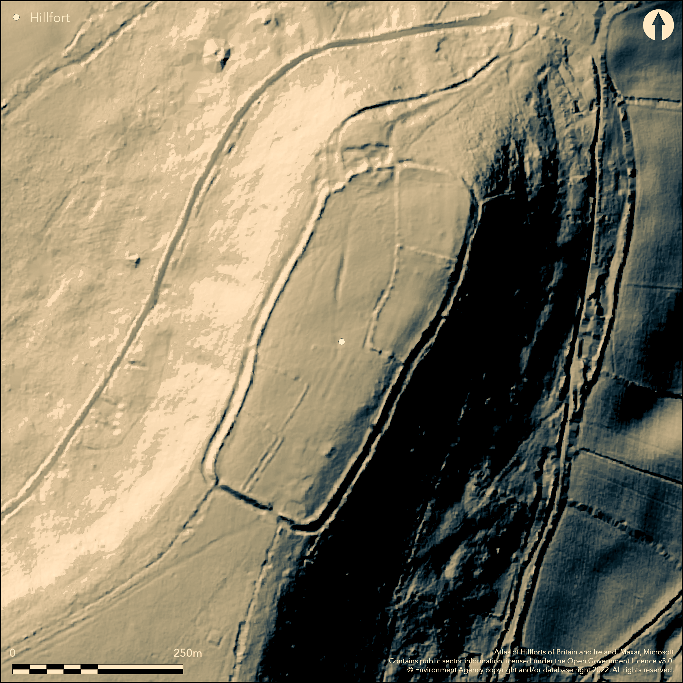
LiDAR 1m DTM Hillshade
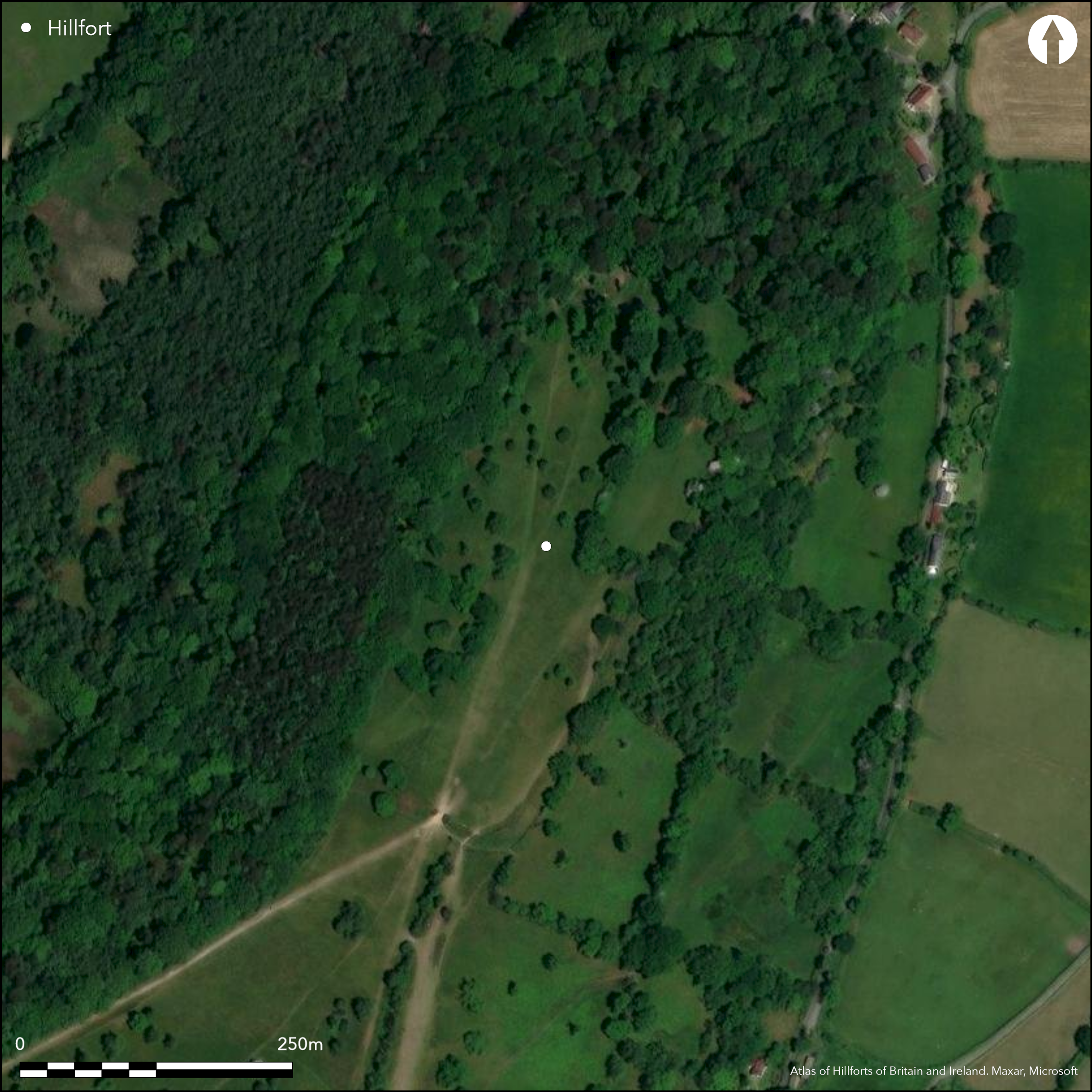
Satellite Imagery
LiDAR 1m DTM Hillshade
Satellite Imagery
Scroll left/right to view further images.
HER: Dorset MDO1636 (None)
NMR: SY 39 NE 2 (449717)
SM: 1017035
NGR: SY37159905
X: 337179 Y: 99076 (OSGB36)
Univallate, contour hillfort located at N end of sharp Greensand NE-facing spur 425m W of Nash Farm and overlooking the Marshwood Vale at E extremity of county. Steep to very steep surrounding slopes except along spur to SW where moderate. Roughly rectangular area encloses c. 4.7ha. Little known about site and disturbed by 19th century field walls. Defined by rampart 8m wide and to 3m above base of external ditch c. 4m wide and 1.5m, built along escarpment and across level ridge at S end. Intermittent counterscarp bank on outside of ditch, c. 2m wide and 0.3 metres high. Possible two original entrances. That on S side a, possibly disturbed, 12m wide gap in ramparts corresponding causeway across ditch gives access across level neck of the spur. Bank here more substantial. Second entrance on N side also causeway across ditch with hollow way continuing into interior. Following storm damage January 1990, section across rampart in NW corner recorded by National Trust before reinstatement (Lester 1990). Three phases of construction found, earliest box rampart of dump construction, built on old land surface, with timber palisades lining inner and outer faces, with possible stone facing on outside. No dateable finds were recovered. Rough grass, scrub and trees, latter especially on banks. National Trust site. Wessex Way passes through site. On 1st Ed. OS map (1889).
Citizen Science: ✗
Reliability of Data: Confirmed
Reliability of Interpretation: Confirmed
X: -322003 Y: 6583839 (EPSG: 3857)
Longitude: -2.8926013351783615 Latitude: 50.787772294173784 (EPSG:4326)
Country: England; None
Current County or Unitary Authority: Dorset
Historic County: Dorset
Current Parish/Community/Council/Townland: Hawkchurch; Marshwood
National Trust site. Wessex Way passes through site. Disturbed by 19th century field walls. On Heritage at Risk Register (2015).
| Extant | ✓ |
| Cropmark | ✗ |
| Likely Destroyed | ✗ |
Rough grass, scrub and trees, latter especially on banks. Telegraph station. SSSI.
| Woodland | ✓ |
| Commercial Forestry Plantation | ✗ |
| Parkland | ✗ |
| Pasture (Grazing) | ✓ |
| Arable | ✗ |
| Scrub/Bracken | ✓ |
| Bare Outcrop | ✗ |
| Heather/Moorland | ✗ |
| Heath | ✗ |
| Built-up | ✗ |
| Coastal Grassland | ✗ |
| Other | ✓ |
Univallate, contour hillfort located at N end of sharp Greensand NE-facing spur 425m W of Nash Farm and overlooking the Marshwood Vale at E extremity of county. Steep to very steep surrounding slopes except along spur to SW where moderate.
| Contour Fort | ✓ |
| Partial Contour Fort | ✗ |
| Promontory Fort | ✗ |
| Hillslope Fort | ✗ |
| Level Terrain Fort | ✗ |
| Marsh Fort | ✗ |
| Multiple Enclosure Fort | ✗ |
| Hilltop | ✗ |
| Coastal Promontory | ✗ |
| Inland Promontory | ✗ |
| Valley Bottom | ✗ |
| Knoll/Hillock/Outcrop | ✗ |
| Ridge | ✗ |
| Cliff/Plateau-edge/Scarp | ✗ |
| Hillslope | ✗ |
| Lowland | ✗ |
| Spur | ✓ |
Dominant Topographic Feature: Spur
| North | ✗ |
| Northeast | ✗ |
| East | ✗ |
| Southeast | ✗ |
| South | ✗ |
| Southwest | ✗ |
| West | ✗ |
| Northwest | ✓ |
| Level | ✗ |
Altitude: 257.4m
Boundary Type: Parish/Townland
None.
Reliability: D - None
| Pre 1200BC | ✗ |
| 1200BC - 800BC | ✗ |
| 800BC - 400BC | ✗ |
| 400BC - AD50 | ✗ |
| AD50 - AD400 | ✗ |
| AD400 - AD 800 | ✗ |
| Post AD800 | ✗ |
| Unknown | ✓ |
| Pre Hillfort: | Bowl barrow on site. |
| Post Hillfort: | Site of post-medieval fairs and telegraph station. |
On 1st Ed. Os map (1889). Excavation M.J. Lester, auspices of National Trust 1990. RCHME aerial photograph interpretation Primary Recording Project 1992-96.
| 1st Identified Map Depiction (1889): | OS map. |
| Excavation (1990): | M.J. Lester auspices of National Trust. |
| Other (None): | RCHME aerial photograph interpretation Primary Recording Project. |
None.
None
| None | ✓ |
| Spring | ✗ |
| Stream | ✗ |
| Pool | ✗ |
| Flush | ✗ |
| Well | ✗ |
| Other | ✗ |
None
| No Known Features | ✓ |
| Round Stone Structures | ✗ |
| Rectangular Stone Structures | ✗ |
| Curvilinear Platforms | ✗ |
| Other Roundhouse Evidence | ✗ |
| Pits | ✗ |
| Quarry Hollows | ✗ |
| Other | ✗ |
No interior excavation.
| No Known Excavation | ✓ |
| Pits | ✗ |
| Postholes | ✗ |
| Roundhouses | ✗ |
| Rectangular Structures | ✗ |
| Roads/Tracks | ✗ |
| Quarry Hollows | ✗ |
| Other | ✗ |
| Nothing Found | ✗ |
None
| No Known Geophysics | ✓ |
| Pits | ✗ |
| Roundhouses | ✗ |
| Rectangular Structures | ✗ |
| Roads/Tracks | ✗ |
| Quarry Hollows | ✗ |
| Other | ✗ |
| Nothing Found | ✗ |
No dateable finds from excavation.
| No Known Finds | ✓ |
| Pottery | ✗ |
| Metal | ✗ |
| Metalworking | ✗ |
| Human Bones | ✗ |
| Animal Bones | ✗ |
| Lithics | ✗ |
| Environmental | ✗ |
| Other | ✗ |
None
| APs Not Checked | ✓ |
| None | ✗ |
| Roundhouses | ✗ |
| Rectangular Structures | ✗ |
| Pits | ✗ |
| Postholes | ✗ |
| Roads/Tracks | ✗ |
| Other | ✗ |
Possible two original entrances. That on S side a, possibly disturbed, 12m wide gap in ramparts corresponding causeway across ditch gives access across level neck of the spur. Bank here more substantial. Second entrance on N side also causeway across ditch with hollow way continuing into interior.
| 2: | None |
| 2: | None |
Guard Chambers: ✗
Chevaux de Frise: ✗
| 1. Simple Gap (South): | Causeway across ditch. |
| 2. Hollow Way (North): | Causeway across ditch and hollow way into interior. |
Defined by rampart 8m wide and to 3m above base of external ditch c. 4 wide and 1.5m, built along escarpment and across level ridge at S end. Intermittent counterscarp bank on outside of ditch, c. 2m wide and 0.3 metres high.
| Area 1: | 4.7ha. |
| Total: | 4.7ha. |
Total Footprint Area: Noneha.
None
| ✓ | Following storm damage January 1990, section across rampart in NW corner recorded by National Trust before reinstatement. Three phases of construction found, earliest box rampart of dump construction, built on old land surface, with timber palisades lining inner and outer faces, with possible stone facing on outside. |
| ✓ | None |
| NE Quadrant: | 1 |
| SE Quadrant: | 1 |
| SW Quadrant: | 1 |
| NW Quadrant: | 1 |
| Total: | 1 |
| Partial Univallate | ✗ |
| Univallate | ✓ |
| Partial Bivallate | ✗ |
| Bivallate | ✗ |
| Partial Multivallate | ✗ |
| Multivallate | ✗ |
| Unknown | ✗ |
| Partial Univallate | ✗ |
| Univallate | ✗ |
| Partial Bivallate | ✗ |
| Bivallate | ✗ |
| Partial Multivallate | ✗ |
| Multivallate | ✗ |
Intermittent counterscarp around circuit.
| None | ✗ |
| Earthen Bank | ✓ |
| Stone Wall | ✗ |
| Rubble | ✗ |
| Wall-walk | ✗ |
| Evidence of Timber | ✗ |
| Vitrification | ✗ |
| Other Burning | ✗ |
| Palisade | ✗ |
| Counter Scarp Bank | ✓ |
| Berm | ✗ |
| Unfinished | ✗ |
| Other | ✗ |
Following storm damage January 1990, section across rampart in NW corner recorded by National Trust before reinstatement. Three phases of construction found, earliest box rampart of dump construction, built on old land surface, with timber palisades lining inner and outer faces, with possible stone facing on outside.
| None | ✗ |
| Earthen Bank | ✓ |
| Stone Wall | ✓ |
| Murus Duplex | ✗ |
| Timber-framed | ✓ |
| Timber-laced | ✗ |
| Vitrification | ✗ |
| Other Burning | ✗ |
| Palisade | ✓ |
| Counter Scarp Bank | ✗ |
| Berm | ✗ |
| Unfinished | ✗ |
| No Known Excavation | ✗ |
| Other | ✓ |
| ✗ | None |
| ✓ | External ditch around circuit. |
Number of Ditches: 1
| ✗ | None |
Gale, J. 2003. Prehistoric Dorset, Stroud: Tempus Publishing.
Lester, M.J. 1990. Lambert's Castle, Marshwood, West Dorset, Proc Dorset Natur Hist Archaeol Soc, 112, 115.
Atlas of Hillforts:
Wikidata:
This work is licensed under CC BY-SA 4.0

 and should be cited as:
Lock, Gary and Ralston, Ian. 2024. Atlas of Hillforts of Britain and Ireland. Available at: https://hillforts.arch.ox.ac.uk
Document Version 1.1