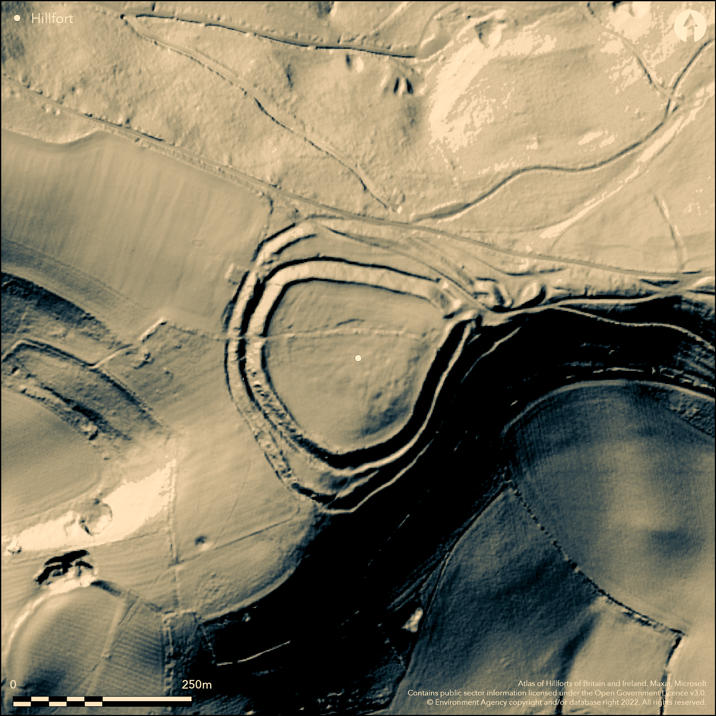
LiDAR 1m DTM Hillshade
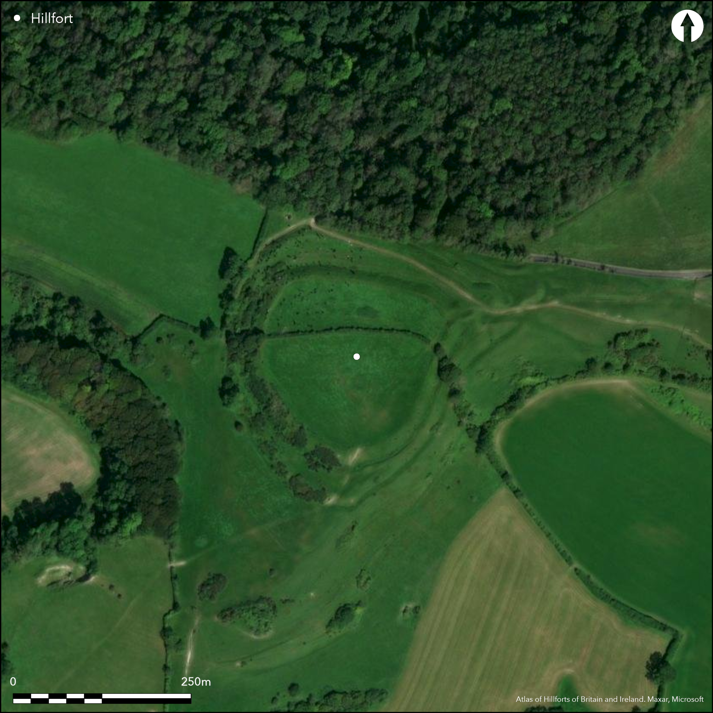
Satellite Imagery
LiDAR 1m DTM Hillshade
Satellite Imagery
Scroll left/right to view further images.
HER: Dorset MDO4766 (None)
NMR: ST 70 NE 12 (201750)
SM: 1003207
NGR: ST76800580
X: 376748 Y: 105813 (OSGB36)
Commanding bivallate partial contour hillfort sited high on end of prominent spur extending NW from chalk escarpment of Bulbarrow Hill, nr. Stoke Wake, W of Blandford. Blackmoor Vale to N and upper Piddle valley to S. Very steep slopes from N to SE, steep on SW, less on NW. Narrow ridge leads to hillfort from E. Roughly pear-shaped in plan enclosing c. 4.5ha in total. Defined by two banks, each with ditch, and separated by berm. Possible at least two phases of construction, with slight univallate enclosure of 1.8ha later added to by outer bank and ditch. Inner rampart to 1.5m high above interior and 5.7m above ditch. Inner ditch to 9m wide in places. Outer rampart to 1.2m high internally and 6m high above ditch. Outer ditch, where best, to 7m wide and 1.2m deep. To S faint traces of slight counterscarp bank. Single E entrance facing up the spur, with elaborate out-turn and possible barbican or outwork apparently added to the outer rampart and now badly damaged by tracks and digging. Cross-dyke, c. 152 E of fort possibly related to it. In S half of interior slight depressions may be sign of occupation, but no details. Iron Age sherds chance finds from army manoeuvres 1951. Crossed by hedge, pasture interior, scrub and few trees on banks. Parts of site generally well-preserved despite disturbance by trackways and N side cut by road and woodland. On 1st Ed. OS map (1888). Minimal investigations, undated.
Citizen Science: ✓
Reliability of Data: Confirmed
Reliability of Interpretation: Confirmed
X: -259564 Y: 6595032 (EPSG: 3857)
Longitude: -2.3317008284023166 Latitude: 50.851299712183646 (EPSG:4326)
Country: England; None
Current County or Unitary Authority: Dorset
Historic County: Dorset
Current Parish/Community/Council/Townland: Hilton; Stoke Wake
Parts generally well-preserved despite disturbance by trackways and N side cut by road and impinged woodland. Crossed by hedge which marks parish boundary.
| Extant | ✓ |
| Cropmark | ✗ |
| Likely Destroyed | ✗ |
Pasture interior, scrub and few trees on banks. N side impinged by wood. Cut by road.
| Woodland | ✓ |
| Commercial Forestry Plantation | ✗ |
| Parkland | ✗ |
| Pasture (Grazing) | ✓ |
| Arable | ✗ |
| Scrub/Bracken | ✓ |
| Bare Outcrop | ✗ |
| Heather/Moorland | ✗ |
| Heath | ✗ |
| Built-up | ✗ |
| Coastal Grassland | ✗ |
| Other | ✓ |
Multivallate partial contour hillfort sited high on summit of prominent spur extending NW from chalk escarpment of Bulbarrow Hill. Blackmoor Vale to N and upper Piddle valley to S. Narrow ridge leads to hillfort from E. Very steep N to SE, steep on SW, less on NW. Ridge rises a little to E.
| Contour Fort | ✗ |
| Partial Contour Fort | ✓ |
| Promontory Fort | ✗ |
| Hillslope Fort | ✗ |
| Level Terrain Fort | ✗ |
| Marsh Fort | ✗ |
| Multiple Enclosure Fort | ✗ |
| Hilltop | ✗ |
| Coastal Promontory | ✗ |
| Inland Promontory | ✗ |
| Valley Bottom | ✗ |
| Knoll/Hillock/Outcrop | ✗ |
| Ridge | ✗ |
| Cliff/Plateau-edge/Scarp | ✗ |
| Hillslope | ✗ |
| Lowland | ✗ |
| Spur | ✓ |
Dominant Topographic Feature: Spur
| North | ✗ |
| Northeast | ✗ |
| East | ✓ |
| Southeast | ✗ |
| South | ✗ |
| Southwest | ✗ |
| West | ✗ |
| Northwest | ✗ |
| Level | ✗ |
Altitude: 274.0m
Hedgeline follows parish boundary with Stoke Wake in N half and Hilton in greater S.
Boundary Type: Parish/Townland
Chance finds of early and late Iron Age sherds. Extensive later prehistoric field system on Bulbarrow.
Reliability: C - Low
| Pre 1200BC | ✗ |
| 1200BC - 800BC | ✗ |
| 800BC - 400BC | ✓ |
| 400BC - AD50 | ✓ |
| AD50 - AD400 | ✗ |
| AD400 - AD 800 | ✗ |
| Post AD800 | ✗ |
| Unknown | ✗ |
| Pre Hillfort: | None |
| Post Hillfort: | None |
| Artefactual: | Chance early and late Iron Age sherds. |
On 1st Ed. OS map (1888). Visits by Hillfort Study Group 1966, 2016.
| 1st Identified Map Depiction (1888): | OS map. |
| Other (1966): | Visit by the Hillfort Study Group |
| Other (2016): | Visit by the Hillfort Study Group |
In S half of interior slight depressions may be sign of occupation, but no details. Iron Age pottery, Roman coins and pottery.
None
| None | ✓ |
| Spring | ✗ |
| Stream | ✗ |
| Pool | ✗ |
| Flush | ✗ |
| Well | ✗ |
| Other | ✗ |
In S half of interior slight depressions may be sign of occupation, but no details.
| No Known Features | ✗ |
| Round Stone Structures | ✗ |
| Rectangular Stone Structures | ✗ |
| Curvilinear Platforms | ✓ |
| Other Roundhouse Evidence | ✗ |
| Pits | ✗ |
| Quarry Hollows | ✗ |
| Other | ✗ |
None
| No Known Excavation | ✓ |
| Pits | ✗ |
| Postholes | ✗ |
| Roundhouses | ✗ |
| Rectangular Structures | ✗ |
| Roads/Tracks | ✗ |
| Quarry Hollows | ✗ |
| Other | ✗ |
| Nothing Found | ✗ |
None
| No Known Geophysics | ✓ |
| Pits | ✗ |
| Roundhouses | ✗ |
| Rectangular Structures | ✗ |
| Roads/Tracks | ✗ |
| Quarry Hollows | ✗ |
| Other | ✗ |
| Nothing Found | ✗ |
Chance finds of Iron Age pottery from army manoeuvres trenches 1951, Roman coins and pottery.
| No Known Finds | ✗ |
| Pottery | ✓ |
| Metal | ✗ |
| Metalworking | ✗ |
| Human Bones | ✗ |
| Animal Bones | ✗ |
| Lithics | ✓ |
| Environmental | ✗ |
| Other | ✗ |
None
| APs Not Checked | ✓ |
| None | ✗ |
| Roundhouses | ✗ |
| Rectangular Structures | ✗ |
| Pits | ✗ |
| Postholes | ✗ |
| Roads/Tracks | ✗ |
| Other | ✗ |
Fine, single E entrance facing up the spur, with elaborate out-turn and possible barbican or outwork apparently added to the outer rampart and now badly damaged by tracks and digging.
| 1: | None |
| 2: | None |
Guard Chambers: ✗
Chevaux de Frise: ✗
| 1. Outworks (East): | With possible barbican or outwork formed by the outer rampart. |
| 1. Barbican (East): | Possible barbican. |
| 1. Out-turned (East): | Elaborate out-turn. |
Inner rampart to 1.5m high above interior and 5.7m above ditch. Inner ditch to 9m wide in places. Outer rampart to 1.2m high internally and 6m high above ditch. Outer ditch, where best, to 7m wide and 1.2m deep. To S faint traces of slight counterscarp bank.
| Area 1: | 1.6ha. |
| Total: | 1.6ha. |
Total Footprint Area: Noneha.
None
| ✓ | At least two phases of construction, probably univallate originally. |
| ✓ | None |
| NE Quadrant: | 2 |
| SE Quadrant: | 2 |
| SW Quadrant: | 2 |
| NW Quadrant: | 2 |
| Total: | 2 |
| Partial Univallate | ✗ |
| Univallate | ✗ |
| Partial Bivallate | ✗ |
| Bivallate | ✓ |
| Partial Multivallate | ✗ |
| Multivallate | ✗ |
| Unknown | ✗ |
| Partial Univallate | ✗ |
| Univallate | ✓ |
| Partial Bivallate | ✗ |
| Bivallate | ✗ |
| Partial Multivallate | ✗ |
| Multivallate | ✗ |
Medial ditch with berm. To S faint traces of slight counterscarp bank.
| None | ✗ |
| Earthen Bank | ✓ |
| Stone Wall | ✗ |
| Rubble | ✗ |
| Wall-walk | ✗ |
| Evidence of Timber | ✗ |
| Vitrification | ✗ |
| Other Burning | ✗ |
| Palisade | ✗ |
| Counter Scarp Bank | ✓ |
| Berm | ✓ |
| Unfinished | ✗ |
| Other | ✗ |
None
| None | ✗ |
| Earthen Bank | ✗ |
| Stone Wall | ✗ |
| Murus Duplex | ✗ |
| Timber-framed | ✗ |
| Timber-laced | ✗ |
| Vitrification | ✗ |
| Other Burning | ✗ |
| Palisade | ✗ |
| Counter Scarp Bank | ✗ |
| Berm | ✗ |
| Unfinished | ✗ |
| No Known Excavation | ✓ |
| Other | ✗ |
| ✗ | None |
| ✓ | Ditches variable in depth throughout circuit with silting and damage in places. |
Number of Ditches: 2
| ✗ | None |
Gale, J. 2003. Prehistoric Dorset, Stroud: Tempus Publishing.
Hutchins, Rev. J. 1868. The history and antiquities of the County of Dorset, 4, 3rd Edn, Westminster, 356-57.
RCHME 1970. An inventory of historical monuments in the County of Dorset, Vol 3, Central Dorset, 258-59, London: RCHME.
Warne, C. 1872. Ancient Dorset. The Celtic, Roman, Saxon and Danish Antiquities of the County, Bournemouth: For the author, 94-5.
Atlas of Hillforts:
Wikidata:
This work is licensed under CC BY-SA 4.0

 and should be cited as:
Lock, Gary and Ralston, Ian. 2024. Atlas of Hillforts of Britain and Ireland. Available at: https://hillforts.arch.ox.ac.uk
Document Version 1.1