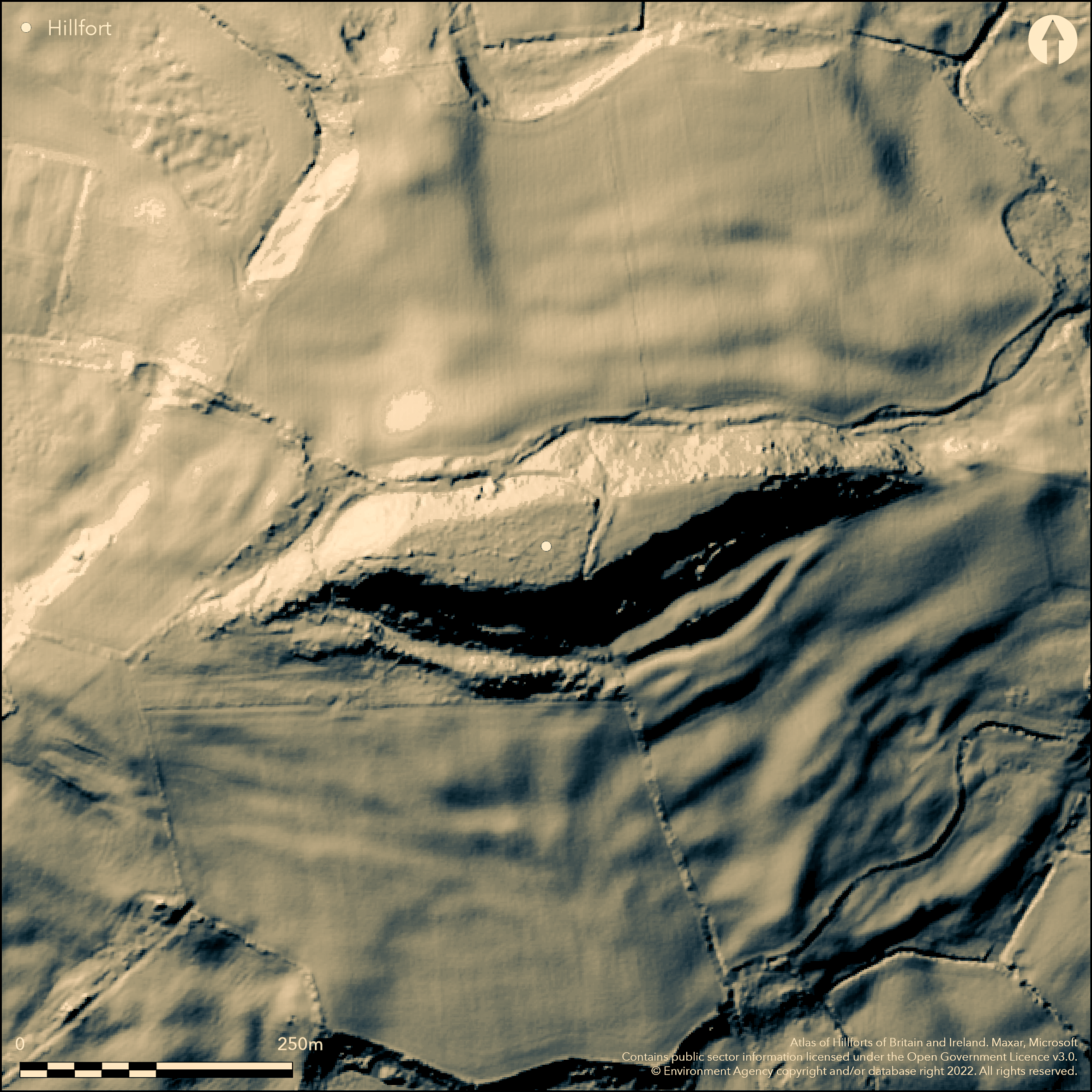
LiDAR 1m DTM Hillshade
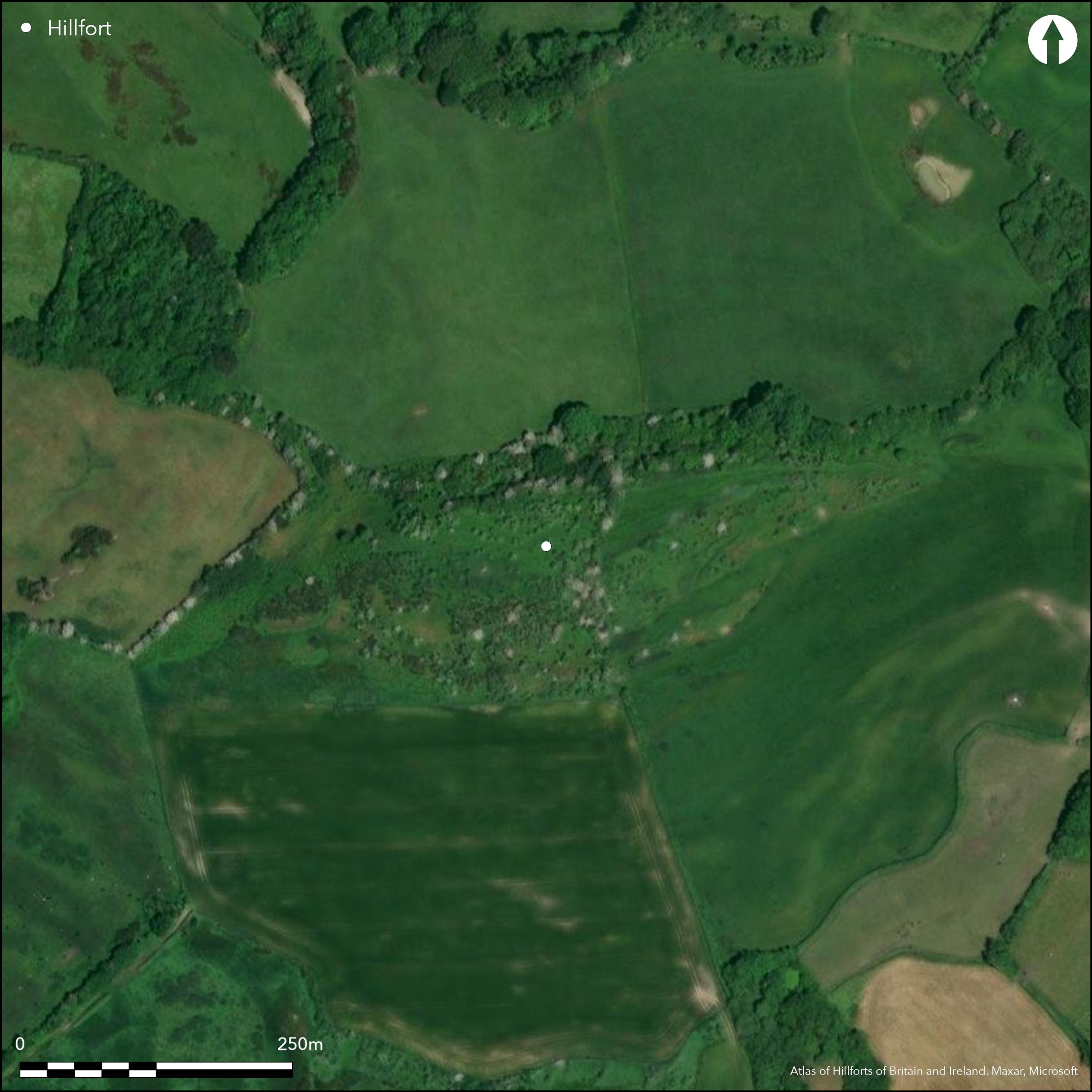
Satellite Imagery
LiDAR 1m DTM Hillshade
Satellite Imagery
Scroll left/right to view further images.
HER: Dorset MDO2432 (None)
NMR: SY 59 SW (451331)
SM: 1002779
NGR: SY50709210
X: 350757 Y: 92151 (OSGB36)
Possible remains of unfinished, contour hillfort, located on summit of Shipton Hill above tributaries of River Brit to N and River Bride to S. Steep surrounding slopes. Very little definite can be said about this enigmatic site. There is possibly some scarping on N and S sides of hill, and at base of hill, on both N and S sides, ditch with outer rampart, destroyed in places, but not going round the ends of the hill. Near middle of summit is transverse hedge bank seemingly formed along the E scarp of a ditch to an earlier bank. Excavation in 1954 found Iron Age pottery, slingstone hoard, hammer stones, flint flakes and scrapers, spindle whorls (pottery) fragments of corn querns, bronze sword or spear tip and Kimmeridge shale ring, which tend to suggest interest in the hill as some sort of hillfort (Butcher 1955). Rough grass, scrub and trees. It is possible the site is unfinished as the top of the hill appears to have been been strengthened in part, but, in view of fact that it would not have been difficult to completely enclose the summit of hill, the questionable nature of the scarping itself and the possible ditch and rampart at foot of hill, its status of a hillfort must be questioned. On 1st Ed. OS map (1885-1900). No further details.
Citizen Science: ✗
Reliability of Data: Unconfirmed
Reliability of Interpretation: Unconfirmed
X: -300459 Y: 6573112 (EPSG: 3857)
Longitude: -2.6990653807244533 Latitude: 50.72681662593855 (EPSG:4326)
Country: England; None
Current County or Unitary Authority: Dorset
Historic County: Dorset
Current Parish/Community/Council/Townland: Shipton Gorge; Loders
Enigmatic site difficult to interpret.
| Extant | ✓ |
| Cropmark | ✗ |
| Likely Destroyed | ✗ |
Rough grass, scrub and trees.
| Woodland | ✗ |
| Commercial Forestry Plantation | ✗ |
| Parkland | ✗ |
| Pasture (Grazing) | ✗ |
| Arable | ✗ |
| Scrub/Bracken | ✓ |
| Bare Outcrop | ✗ |
| Heather/Moorland | ✗ |
| Heath | ✗ |
| Built-up | ✗ |
| Coastal Grassland | ✗ |
| Other | ✗ |
Remains of possible, unfinished, contour hillfort, located on summit of Shipton Hill above tributaries of River Brit to N and River Bride to S. Steep surrounding slopes.
| Contour Fort | ✓ |
| Partial Contour Fort | ✗ |
| Promontory Fort | ✗ |
| Hillslope Fort | ✗ |
| Level Terrain Fort | ✗ |
| Marsh Fort | ✗ |
| Multiple Enclosure Fort | ✗ |
| Hilltop | ✓ |
| Coastal Promontory | ✗ |
| Inland Promontory | ✗ |
| Valley Bottom | ✗ |
| Knoll/Hillock/Outcrop | ✗ |
| Ridge | ✗ |
| Cliff/Plateau-edge/Scarp | ✗ |
| Hillslope | ✗ |
| Lowland | ✗ |
| Spur | ✗ |
Dominant Topographic Feature: Hill top
| North | ✗ |
| Northeast | ✗ |
| East | ✗ |
| Southeast | ✗ |
| South | ✗ |
| Southwest | ✗ |
| West | ✗ |
| Northwest | ✗ |
| Level | ✓ |
Altitude: 170.0m
Boundary Type: Parish/Townland
Iron Age pottery excavated, possible early rather than later Iron Age.
Reliability: B - Medium
| Pre 1200BC | ✗ |
| 1200BC - 800BC | ✗ |
| 800BC - 400BC | ✓ |
| 400BC - AD50 | ✗ |
| AD50 - AD400 | ✗ |
| AD400 - AD 800 | ✗ |
| Post AD800 | ✗ |
| Unknown | ✗ |
| Pre Hillfort: | None |
| Post Hillfort: | None |
| Artefactual: | Iron Age pottery. |
On 1st Ed. OS map (1885-1900). Excavation W.A. Butcher 1954.
| Excavation (1954): | W.A. Butcher. |
| 1st Identified Map Depiction (None): | None |
Excavation in 1954 found Iron Age pottery, slingstone hoard, hammer stones, flint flakes and scrapers, spindle whorls (pottery) fragments of corn querns, bronze sword or spear tip and Kimmeridge shale ring.
None
| None | ✓ |
| Spring | ✗ |
| Stream | ✗ |
| Pool | ✗ |
| Flush | ✗ |
| Well | ✗ |
| Other | ✗ |
None
| No Known Features | ✓ |
| Round Stone Structures | ✗ |
| Rectangular Stone Structures | ✗ |
| Curvilinear Platforms | ✗ |
| Other Roundhouse Evidence | ✗ |
| Pits | ✗ |
| Quarry Hollows | ✗ |
| Other | ✗ |
None
| No Known Excavation | ✗ |
| Pits | ✗ |
| Postholes | ✗ |
| Roundhouses | ✗ |
| Rectangular Structures | ✗ |
| Roads/Tracks | ✗ |
| Quarry Hollows | ✗ |
| Other | ✗ |
| Nothing Found | ✓ |
None
| No Known Geophysics | ✓ |
| Pits | ✗ |
| Roundhouses | ✗ |
| Rectangular Structures | ✗ |
| Roads/Tracks | ✗ |
| Quarry Hollows | ✗ |
| Other | ✗ |
| Nothing Found | ✗ |
Excavation in 1954 found Iron Age pottery, slingstone hoard. hammer stones, flint flakes and scrapers, spindle whorls (pottery) fragments of corn querns, bronze sword or spear tip and Kimmeridge shale ring.
| No Known Finds | ✗ |
| Pottery | ✓ |
| Metal | ✓ |
| Metalworking | ✗ |
| Human Bones | ✗ |
| Animal Bones | ✗ |
| Lithics | ✓ |
| Environmental | ✗ |
| Other | ✗ |
None
| APs Not Checked | ✓ |
| None | ✗ |
| Roundhouses | ✗ |
| Rectangular Structures | ✗ |
| Pits | ✗ |
| Postholes | ✗ |
| Roads/Tracks | ✗ |
| Other | ✗ |
None defined.
| 0: | None |
| 2: | None |
Guard Chambers: ✗
Chevaux de Frise: ✗
None.
| Area 1: | Noneha. |
| Total: | Noneha. |
Total Footprint Area: Noneha.
None
| ✗ | Area not defined. |
| ✗ | Quadrants not defined. |
| NE Quadrant: | None |
| SE Quadrant: | None |
| SW Quadrant: | None |
| NW Quadrant: | None |
| Total: | None |
| Partial Univallate | ✗ |
| Univallate | ✗ |
| Partial Bivallate | ✗ |
| Bivallate | ✗ |
| Partial Multivallate | ✗ |
| Multivallate | ✗ |
| Unknown | ✓ |
| Partial Univallate | ✗ |
| Univallate | ✗ |
| Partial Bivallate | ✗ |
| Bivallate | ✗ |
| Partial Multivallate | ✗ |
| Multivallate | ✗ |
Possibly unfinished site.
| None | ✗ |
| Earthen Bank | ✓ |
| Stone Wall | ✗ |
| Rubble | ✗ |
| Wall-walk | ✗ |
| Evidence of Timber | ✗ |
| Vitrification | ✗ |
| Other Burning | ✗ |
| Palisade | ✗ |
| Counter Scarp Bank | ✗ |
| Berm | ✗ |
| Unfinished | ✓ |
| Other | ✗ |
None
| None | ✓ |
| Earthen Bank | ✗ |
| Stone Wall | ✗ |
| Murus Duplex | ✗ |
| Timber-framed | ✗ |
| Timber-laced | ✗ |
| Vitrification | ✗ |
| Other Burning | ✗ |
| Palisade | ✗ |
| Counter Scarp Bank | ✗ |
| Berm | ✗ |
| Unfinished | ✗ |
| No Known Excavation | ✗ |
| Other | ✗ |
| ✗ | None |
| ✓ | Possible ditch visible. |
Number of Ditches: 1
| ✗ | None |
Butcher, Mr and Mrs W. 1955. An early Iron Age fort on Shipton Hill, Shipton Gorge, Proc Dorset Natur Hist Archaeol Soc, 77, 135-136.
Gale, J. 2003. Prehistoric Dorset, Stroud: Tempus Publishing.
RCHME 1952. An inventory of the historical monuments in Dorset, Vol 1, West Dorset, 223, London: RCHM.
Warne, C. 1872. Ancient Dorset. The Celtic, Roman, Saxon and Danish Antiquities of the County, Bournemouth: For the author, 96-7.
Atlas of Hillforts:
Wikidata:
This work is licensed under CC BY-SA 4.0

 and should be cited as:
Lock, Gary and Ralston, Ian. 2024. Atlas of Hillforts of Britain and Ireland. Available at: https://hillforts.arch.ox.ac.uk
Document Version 1.1