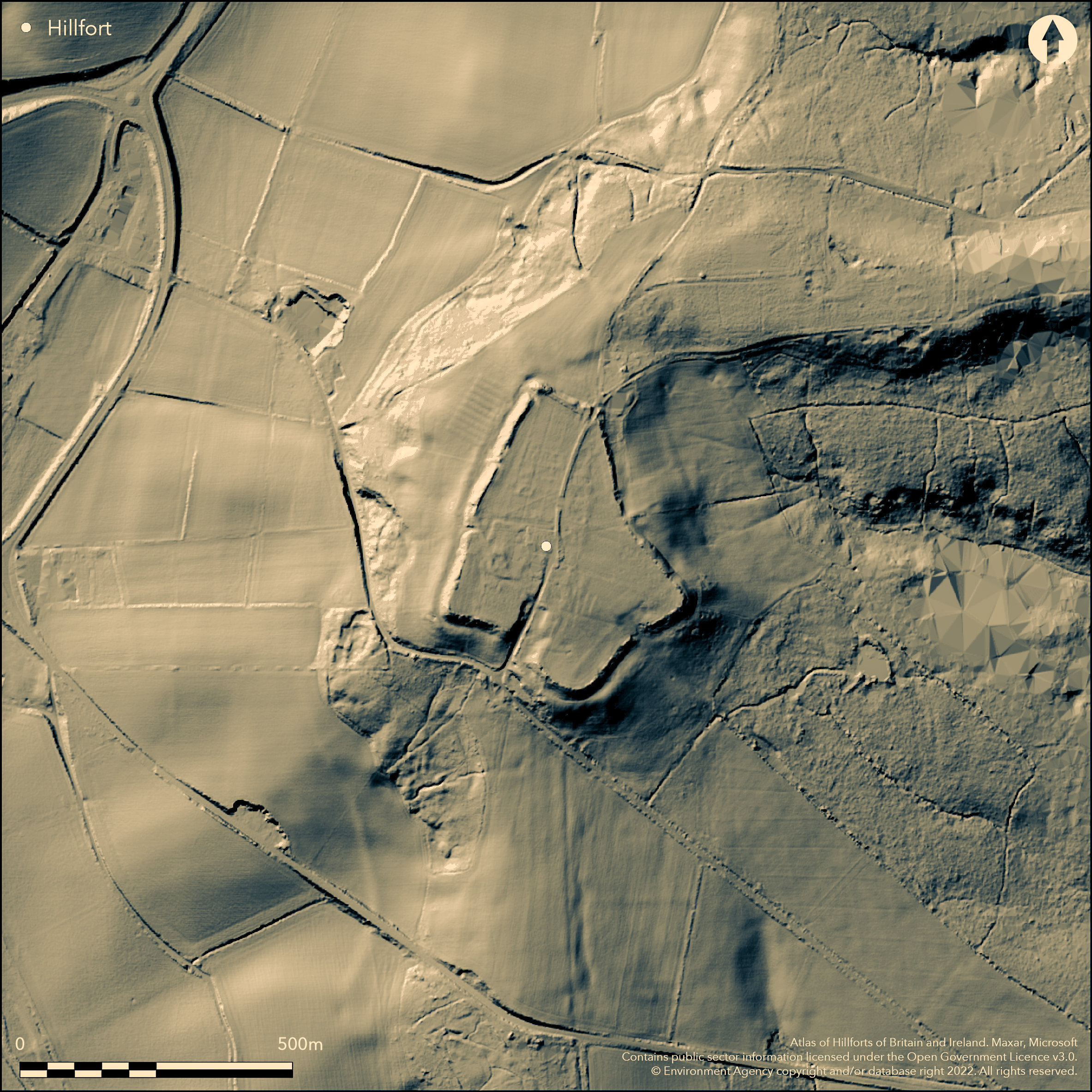
LiDAR 1m DTM Hillshade
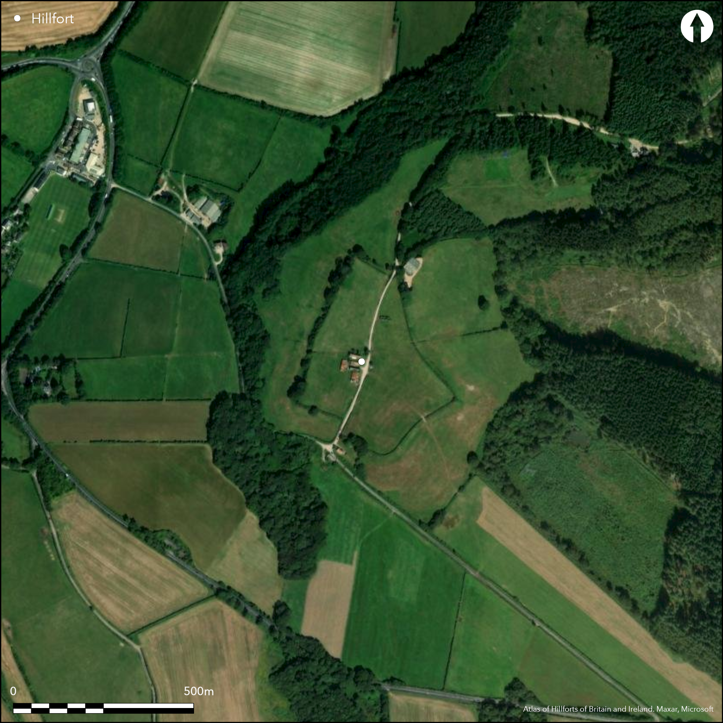
Satellite Imagery
LiDAR 1m DTM Hillshade
Satellite Imagery
Scroll left/right to view further images.
HER: Dorset MDO7148 (None)
NMR: SY 89 SE 2 (456110)
SM: 1016042
NGR: SY85639480
X: 385637 Y: 94784 (OSGB36)
Slight, part bivallate, contour hillfort located on prominent ridge of Woodbury Hill overlooking the Piddle Valley to S, the Bere Valley to W and the Winterborne Valley to N. Steep surrounding slopes, moderate along ridge to NNE. Adjoining area of ridge and furrow, and, within the hillfort, farm buildings, footings of medieval chapel and associated holy well. Irregular shaped enclosure measuring c. 272m E-W max by 410m N-S with total area of c. 11ha and area enclosed c. 5.5ha. Defined by single rampart 6m-12m wide and c .0.5m-5m high and outer ditch 9m wide and c.1.5m deep. Now degraded counterscarp above the steep natural slopes along E, S and SW sides, bank reduced and partly spread across the ditch, creating appearance of a terrace c. 25m wide. To N where hilltop linked to a N ridge by narrow strip of gently sloping ground is second rampart with possible, but unconfirmed, ditch, sited 60m to N of main rampart and enclosing additional c. 0.5ha, thus strengthening at a vulnerable point. Five gaps in ramparts, to NNE and SSW probably original but cut through and damaged by track to farm in interior. Chance finds of two Roman coins from N rampart. Sherds of post-medieval pottery recovered from a stanchion hole during Watching Brief in interior in 1995. Tithe map of 1844 shows many structures in interior 24 of which subsequently removed leaving much modern debris on hilltop. Central farm interior may have early origins. Site of medieval chapel in SW interior, present in 15th century, demolished by 18th century. Holy well, situated 25m to SE of the chapel, probably associated with it. Two houses situated on W side of hillfort, within the ditch, demolished in 1981. Hilltop mentioned by Thomas Hardy as `Green Hill' traditional for annual sheep-fair to be held. Annual fairs continued into early 20th century. Site now much damaged and under improved pasture. On 1st Ed. OS map (1888). Undated.
Citizen Science: ✓
Reliability of Data: Confirmed
Reliability of Interpretation: Confirmed
X: -245459 Y: 6577614 (EPSG: 3857)
Longitude: -2.204992902418418 Latitude: 50.75241010186885 (EPSG:4326)
Country: England
Current County or Unitary Authority: Dorset
Historic County: Dorset
Current Parish/Community/Council/Townland: Bere Regis
Generally much degraded and interior ploughed and developed. Track NE-SW through interior to farm buildings possibly uses original entrances and now much damaged. Tithe map of 1844 shows many structures in interior 24 with garden plots, of which subsequently removed in 19th century, leaving much modern debris on hilltop. Central farm interior may have early origins. Site of medieval chapel in SW interior, present in 15th century, demolished by 18th century. Holy well, situated 25m to SE of the chapel, probably associated with it. Two houses situated on W side of hillfort, within the ditch, demolished in 1981. Hilltop mentioned by Thomas Hardy as `Green Hill' traditional for annual sheep-fair to be held. Annual fairs continued into early 20th century. Despite this development within survives well.
| Extant | ✓ |
| Cropmark | ✗ |
| Likely Destroyed | ✓ |
Improved pasture. Some trees and scrub on banks. Buildings in interior.
| Woodland | ✗ |
| Commercial Forestry Plantation | ✗ |
| Parkland | ✗ |
| Pasture (Grazing) | ✓ |
| Arable | ✗ |
| Scrub/Bracken | ✓ |
| Bare Outcrop | ✗ |
| Heather/Moorland | ✗ |
| Heath | ✗ |
| Built-up | ✓ |
| Coastal Grassland | ✗ |
| Other | ✗ |
Slight, univallate, contour hillfort located on prominent ridge of Woodbury Hill, a prominent ridge overlooking the Piddle Valley to S, the Bere Valley to W and the Winterborne Valley to N. Steep surrounding slopes, moderate along ridge to NE.
| Contour Fort | ✓ |
| Partial Contour Fort | ✗ |
| Promontory Fort | ✗ |
| Hillslope Fort | ✗ |
| Level Terrain Fort | ✗ |
| Marsh Fort | ✗ |
| Multiple Enclosure Fort | ✗ |
| Hilltop | ✗ |
| Coastal Promontory | ✗ |
| Inland Promontory | ✗ |
| Valley Bottom | ✗ |
| Knoll/Hillock/Outcrop | ✗ |
| Ridge | ✓ |
| Cliff/Plateau-edge/Scarp | ✗ |
| Hillslope | ✗ |
| Lowland | ✗ |
| Spur | ✗ |
Dominant Topographic Feature: Ridge
| North | ✗ |
| Northeast | ✗ |
| East | ✗ |
| Southeast | ✗ |
| South | ✗ |
| Southwest | ✗ |
| West | ✗ |
| Northwest | ✗ |
| Level | ✓ |
Altitude: 110.0m
N/A
None.
Reliability: D - None
| Pre 1200BC | ✗ |
| 1200BC - 800BC | ✗ |
| 800BC - 400BC | ✗ |
| 400BC - AD50 | ✗ |
| AD50 - AD400 | ✗ |
| AD400 - AD 800 | ✗ |
| Post AD800 | ✗ |
| Unknown | ✓ |
| Pre Hillfort: | None |
| Post Hillfort: | Adjoining area of ridge and furrow, and, within the hillfort, a holy well and medieval chapel. Chance finds of two Roman coins from N rampart. Sherds of post-medieval pottery recovered from a stanchion hole during Watching Brief in interior in 1995. Site used for annual fairs till early 20th century. |
Mention on Tithe map (1844). On 1st Ed. OS map (1888). Watching brief (1995), no details.
| 1st Identified Written Reference (1844): | Mention on tithe map. |
| 1st Identified Map Depiction (1888): | OS map. |
| Other (1995): | Watching Brief |
Chance finds of two Roman coins from N rampart. Sherds of post-medieval pottery recovered from a stanchion hole during Watching Brief in interior in 1995.
None
| None | ✓ |
| Spring | ✗ |
| Stream | ✗ |
| Pool | ✗ |
| Flush | ✗ |
| Well | ✗ |
| Other | ✗ |
None
| No Known Features | ✓ |
| Round Stone Structures | ✗ |
| Rectangular Stone Structures | ✗ |
| Curvilinear Platforms | ✗ |
| Other Roundhouse Evidence | ✗ |
| Pits | ✗ |
| Quarry Hollows | ✗ |
| Other | ✗ |
Watching Brief during groundworks for building 1995.
| No Known Excavation | ✗ |
| Pits | ✗ |
| Postholes | ✗ |
| Roundhouses | ✗ |
| Rectangular Structures | ✗ |
| Roads/Tracks | ✗ |
| Quarry Hollows | ✗ |
| Other | ✗ |
| Nothing Found | ✓ |
None
| No Known Geophysics | ✓ |
| Pits | ✗ |
| Roundhouses | ✗ |
| Rectangular Structures | ✗ |
| Roads/Tracks | ✗ |
| Quarry Hollows | ✗ |
| Other | ✗ |
| Nothing Found | ✗ |
Chance finds of two Roman coins from N rampart (Domitian and Septimius Severus). Sherds of post-medieval pottery recovered from a stanchion hole during Watching Brief for barn construction groundworks in area of NE ramparts in 1995.
| No Known Finds | ✗ |
| Pottery | ✓ |
| Metal | ✗ |
| Metalworking | ✗ |
| Human Bones | ✗ |
| Animal Bones | ✗ |
| Lithics | ✗ |
| Environmental | ✗ |
| Other | ✓ |
None
| APs Not Checked | ✓ |
| None | ✗ |
| Roundhouses | ✗ |
| Rectangular Structures | ✗ |
| Pits | ✗ |
| Postholes | ✗ |
| Roads/Tracks | ✗ |
| Other | ✗ |
Five gaps in ramparts, to NNE and SSW probably original, but cut through and damaged by track to farm in interior.
| 5: | None |
| 2: | None |
Guard Chambers: ✗
Chevaux de Frise: ✗
| 1. Simple Gap (North east): | Damaged. |
| 2. Simple Gap (South west): | Damaged. |
Defined by single rampart 6m-12m wide and c .0.5m-5m high and outer ditch 9m wide and c.1.5m deep. Counterscarp above the steep natural slopes along E, S and SW sides, bank reduced and partly spread across the ditch, creating appearance of a terrace c. 25m wide. To N where hilltop linked to a N ridge by narrow strip of gently sloping ground is second rampart, sited 60m to N of main rampart and enclosing additional c. 0.5ha, thus strengthening the defences at a vulnerable point.
| Area 1: | 5.5ha. |
| Total: | 5.5ha. |
Total Footprint Area: 11.0ha.
None
| ✗ | Areas estimated. |
| ✓ | None |
| NE Quadrant: | 2 |
| SE Quadrant: | 1 |
| SW Quadrant: | 1 |
| NW Quadrant: | 1 |
| Total: | 2 |
| Partial Univallate | ✓ |
| Univallate | ✗ |
| Partial Bivallate | ✓ |
| Bivallate | ✗ |
| Partial Multivallate | ✗ |
| Multivallate | ✗ |
| Unknown | ✗ |
| Partial Univallate | ✗ |
| Univallate | ✗ |
| Partial Bivallate | ✗ |
| Bivallate | ✗ |
| Partial Multivallate | ✗ |
| Multivallate | ✗ |
None
| None | ✗ |
| Earthen Bank | ✓ |
| Stone Wall | ✗ |
| Rubble | ✗ |
| Wall-walk | ✗ |
| Evidence of Timber | ✗ |
| Vitrification | ✗ |
| Other Burning | ✗ |
| Palisade | ✗ |
| Counter Scarp Bank | ✓ |
| Berm | ✗ |
| Unfinished | ✗ |
| Other | ✗ |
Watching Brief 1995 for barn groundworks only.
| None | ✓ |
| Earthen Bank | ✗ |
| Stone Wall | ✗ |
| Murus Duplex | ✗ |
| Timber-framed | ✗ |
| Timber-laced | ✗ |
| Vitrification | ✗ |
| Other Burning | ✗ |
| Palisade | ✗ |
| Counter Scarp Bank | ✗ |
| Berm | ✗ |
| Unfinished | ✗ |
| No Known Excavation | ✗ |
| Other | ✗ |
| ✗ | None |
| ✓ | Ditch to second rampart to N not confirmed but possible. |
Number of Ditches: 2
| ✗ | None |
Gale, J. 2003. Prehistoric Dorset, Stroud: Tempus Publishing.
Hutchins, Rev. J. 1868. The history and antiquities of the County of Dorset, 4, 3rd Edn, Westminster, 135.
RCHME 1970. An inventory of historical monuments in the County of Dorset, Vol 2, pt 3: south-east, No 40, 484-86, 594, London: RCHME.
Wallis, S. 1995. Woodbury Hill, Bere Regis. No details.
Atlas of Hillforts:
Wikidata:
This work is licensed under CC BY-SA 4.0

 and should be cited as:
Lock, Gary and Ralston, Ian. 2024. Atlas of Hillforts of Britain and Ireland. Available at: https://hillforts.arch.ox.ac.uk
Document Version 1.1