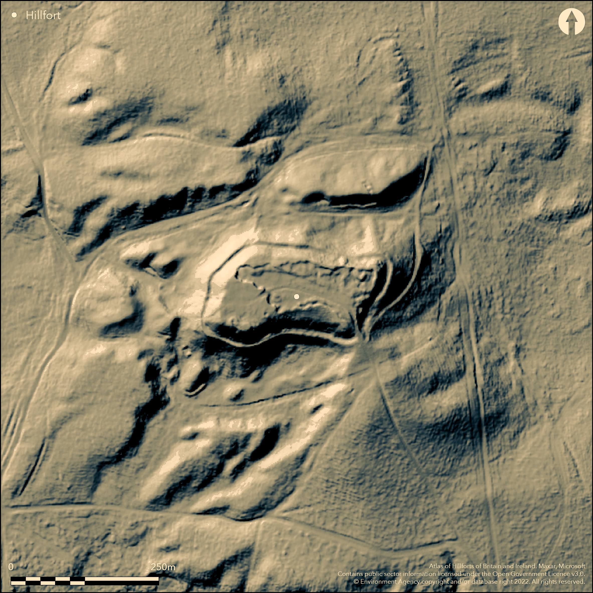
LiDAR 1m DTM Hillshade
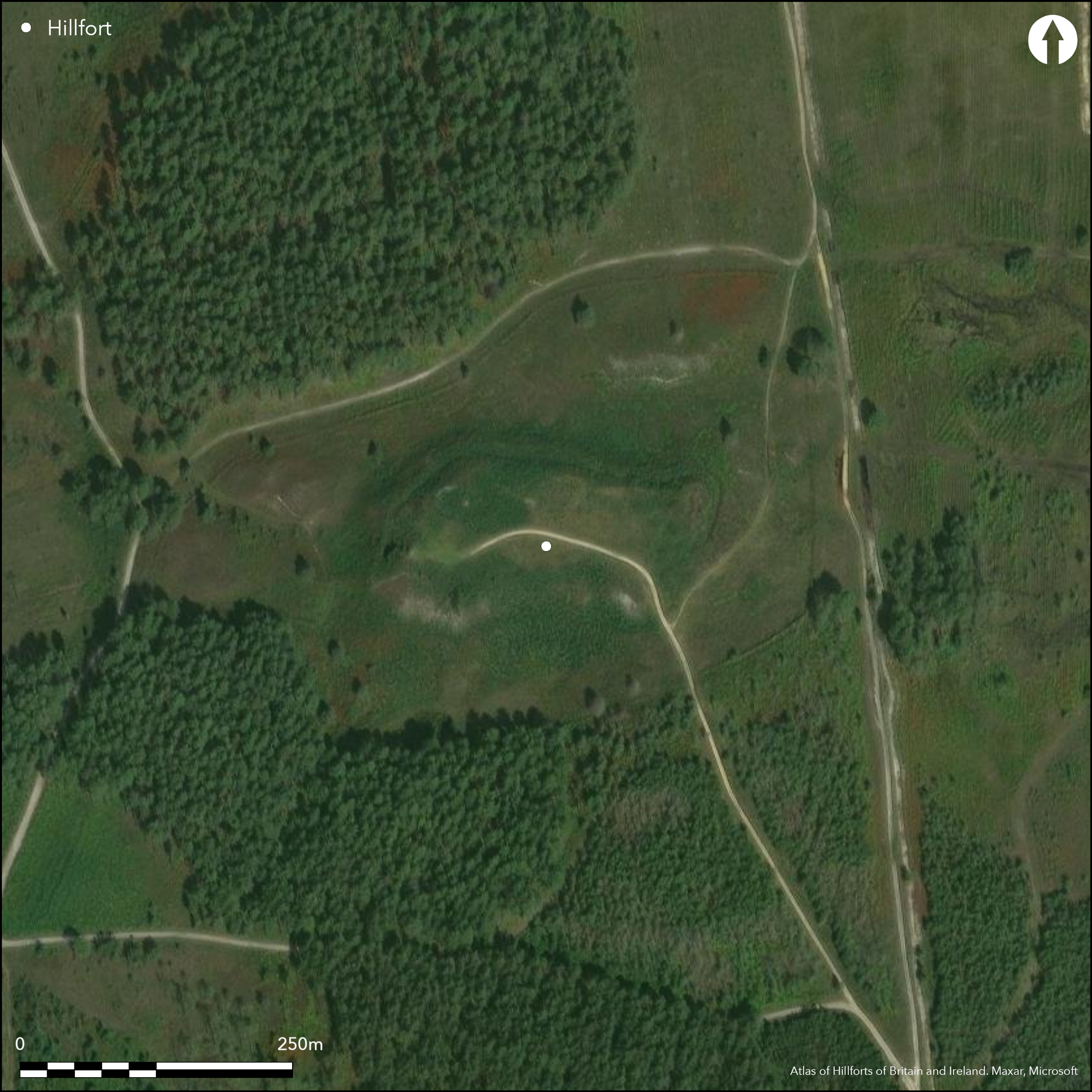
Satellite Imagery
LiDAR 1m DTM Hillshade
Satellite Imagery
Scroll left/right to view further images.
HER: Dorset MDO7215 (None)
NMR: SY 89 SE 11 (456149)
SM: 1018437
NGR: SY89319254
X: 389311 Y: 92552 (OSGB36)
Slight univallate contour hillfort located on flat-topped gravel knoll on Bloxworth Heath, a plateau separating the River Sherford to E and River Piddle to W. Smallest hillfort in SE Dorset. Ground falls sharply on all sides except on SE, where a natural saddle connects the hilltop to a lower spur. Badly damaged by sand and gravel working which has destroyed interior on E which is now c. 1.2m lower than W and NW areas. Area enclosed c. 0.63ha. Mounds within interior either spoil from the gravel working or natural features. Single surrounding bank, reasonably intact, with an inner ditch providing material, and located c. 7m below hill summit. Ditch now partly infilled and c. 3.2m wide and 0.5m deep, with intermittent counterscarp 5m-6m wide and c. 0.5m high, reduced in places to terrace c. 10m wide. Antiquarian 'excavation' by Mr Groves of Wareham of possible burial mound in interior produced negative results. Simple gap entrance at SE corner leads to the natural saddle, mentioned above, which connects the hilltop to a lower spur, and now damaged by modern track. On 1st Ed. OS map (1888). Undated.
Citizen Science: ✗
Reliability of Data: Confirmed
Reliability of Interpretation: Confirmed
X: -239654 Y: 6574097 (EPSG: 3857)
Longitude: -2.1528460388401527 Latitude: 50.7324181077859 (EPSG:4326)
Country: England; None
Current County or Unitary Authority: Dorset
Historic County: Dorset
Current Parish/Community/Council/Townland: Bloxworth; Morden
Badly damaged by sand and gravel working which has destroyed interior on E. Path passes through interior c. E-W. Cleared area within State forest.
| Extant | ✓ |
| Cropmark | ✗ |
| Likely Destroyed | ✓ |
Clear but scrub and bracken.
| Woodland | ✗ |
| Commercial Forestry Plantation | ✗ |
| Parkland | ✗ |
| Pasture (Grazing) | ✗ |
| Arable | ✗ |
| Scrub/Bracken | ✓ |
| Bare Outcrop | ✗ |
| Heather/Moorland | ✗ |
| Heath | ✗ |
| Built-up | ✗ |
| Coastal Grassland | ✗ |
| Other | ✗ |
Slight univallate contour hillfort located on flat-topped gravel knoll on Bloxworth Heath, a plateau separating the River Sherford to E and River Piddle to W. Smallest hillfort in SE Dorset. Ground falls sharply on all sides except on SE, where a natural saddle connects the hilltop to a lower spur.
| Contour Fort | ✓ |
| Partial Contour Fort | ✗ |
| Promontory Fort | ✗ |
| Hillslope Fort | ✗ |
| Level Terrain Fort | ✗ |
| Marsh Fort | ✗ |
| Multiple Enclosure Fort | ✗ |
| Hilltop | ✗ |
| Coastal Promontory | ✗ |
| Inland Promontory | ✗ |
| Valley Bottom | ✗ |
| Knoll/Hillock/Outcrop | ✓ |
| Ridge | ✗ |
| Cliff/Plateau-edge/Scarp | ✗ |
| Hillslope | ✗ |
| Lowland | ✗ |
| Spur | ✗ |
Dominant Topographic Feature: Gravel knoll
| North | ✗ |
| Northeast | ✗ |
| East | ✗ |
| Southeast | ✗ |
| South | ✗ |
| Southwest | ✗ |
| West | ✗ |
| Northwest | ✗ |
| Level | ✓ |
Altitude: 67.0m
Boundary Type: Parish/Townland
None.
Reliability: D - None
| Pre 1200BC | ✗ |
| 1200BC - 800BC | ✗ |
| 800BC - 400BC | ✗ |
| 400BC - AD50 | ✗ |
| AD50 - AD400 | ✗ |
| AD400 - AD 800 | ✗ |
| Post AD800 | ✗ |
| Unknown | ✓ |
| Pre Hillfort: | None |
| Post Hillfort: | None |
Antiquarian 'excavation' by Mr Groves of Wareham of possible burial mound in interior. On 1st Ed. OS map (1888).
| 1st Identified Map Depiction (1888): | OS map. |
| Excavation (None): | Antiquarian 'excavation' by Mr Groves of Wareham. |
Mounds within interior either spoil from the gravel working or natural features.
None
| None | ✓ |
| Spring | ✗ |
| Stream | ✗ |
| Pool | ✗ |
| Flush | ✗ |
| Well | ✗ |
| Other | ✗ |
Mounds within interior either spoil from the gravel working or natural features.
| No Known Features | ✓ |
| Round Stone Structures | ✗ |
| Rectangular Stone Structures | ✗ |
| Curvilinear Platforms | ✗ |
| Other Roundhouse Evidence | ✗ |
| Pits | ✗ |
| Quarry Hollows | ✗ |
| Other | ✗ |
Antiquarian 'excavation' of possible burial mound in interior produced negative results.
| No Known Excavation | ✗ |
| Pits | ✗ |
| Postholes | ✗ |
| Roundhouses | ✗ |
| Rectangular Structures | ✗ |
| Roads/Tracks | ✗ |
| Quarry Hollows | ✗ |
| Other | ✗ |
| Nothing Found | ✓ |
None
| No Known Geophysics | ✓ |
| Pits | ✗ |
| Roundhouses | ✗ |
| Rectangular Structures | ✗ |
| Roads/Tracks | ✗ |
| Quarry Hollows | ✗ |
| Other | ✗ |
| Nothing Found | ✗ |
None
| No Known Finds | ✓ |
| Pottery | ✗ |
| Metal | ✗ |
| Metalworking | ✗ |
| Human Bones | ✗ |
| Animal Bones | ✗ |
| Lithics | ✗ |
| Environmental | ✗ |
| Other | ✗ |
None
| APs Not Checked | ✓ |
| None | ✗ |
| Roundhouses | ✗ |
| Rectangular Structures | ✗ |
| Pits | ✗ |
| Postholes | ✗ |
| Roads/Tracks | ✗ |
| Other | ✗ |
Simple gap entrance at SE corner leads to a natural saddle connecting the hilltop to a lower spur, and now damaged by modern track.
| 1: | None |
| 2: | None |
Guard Chambers: ✗
Chevaux de Frise: ✗
| 1. Simple Gap (South east): | At SE corner. Damaged. |
Single surrounding bank, reasonably intact, with an inner ditch providing material, and located c. 7m below hill summit. Ditch now partly infilled and c. 3.2m wide and 0.5m deep, with intermittent counterscarp 5m-6m wide and c. 0.5m high, reduced in places to terrace c. 10m wide.
| Area 1: | 0.63ha. |
| Total: | 0.63ha. |
Total Footprint Area: Noneha.
None
| ✗ | None |
| ✗ | None |
| NE Quadrant: | 1 |
| SE Quadrant: | 1 |
| SW Quadrant: | 1 |
| NW Quadrant: | 1 |
| Total: | 1 |
| Partial Univallate | ✗ |
| Univallate | ✓ |
| Partial Bivallate | ✗ |
| Bivallate | ✗ |
| Partial Multivallate | ✗ |
| Multivallate | ✗ |
| Unknown | ✗ |
| Partial Univallate | ✗ |
| Univallate | ✗ |
| Partial Bivallate | ✗ |
| Bivallate | ✗ |
| Partial Multivallate | ✗ |
| Multivallate | ✗ |
Intermittent counterscarp.
| None | ✗ |
| Earthen Bank | ✓ |
| Stone Wall | ✗ |
| Rubble | ✗ |
| Wall-walk | ✗ |
| Evidence of Timber | ✗ |
| Vitrification | ✗ |
| Other Burning | ✗ |
| Palisade | ✗ |
| Counter Scarp Bank | ✓ |
| Berm | ✗ |
| Unfinished | ✗ |
| Other | ✗ |
No known excavation of ramparts and ditch.
| None | ✗ |
| Earthen Bank | ✗ |
| Stone Wall | ✗ |
| Murus Duplex | ✗ |
| Timber-framed | ✗ |
| Timber-laced | ✗ |
| Vitrification | ✗ |
| Other Burning | ✗ |
| Palisade | ✗ |
| Counter Scarp Bank | ✗ |
| Berm | ✗ |
| Unfinished | ✗ |
| No Known Excavation | ✓ |
| Other | ✗ |
| ✗ | None |
| ✓ | Inner ditch. |
Number of Ditches: 1
| ✗ | None |
Gale, J. 2003. Prehistoric Dorset, Stroud: Tempus Publishing.
RCHME 1970. An inventory of historical monuments in the County of Dorset, Vol 3, Central Dorset, 487, London: RCHME.
Warne, C. 1872. Ancient Dorset. The Celtic, Roman, Saxon and Danish Antiquities of the County, Bournemouth: For the author, 88.
Atlas of Hillforts:
Wikidata:
This work is licensed under CC BY-SA 4.0

 and should be cited as:
Lock, Gary and Ralston, Ian. 2024. Atlas of Hillforts of Britain and Ireland. Available at: https://hillforts.arch.ox.ac.uk
Document Version 1.1