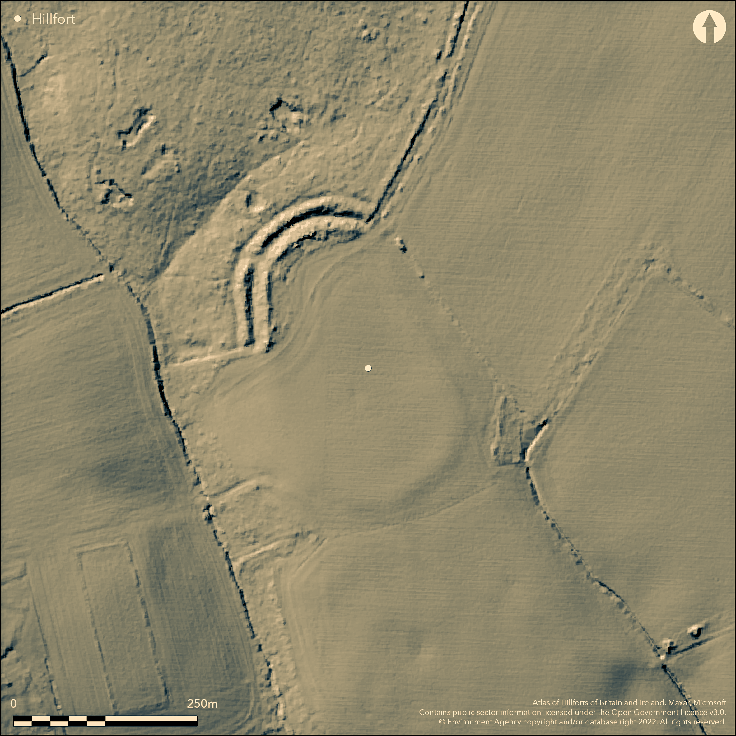
LiDAR 1m DTM Hillshade
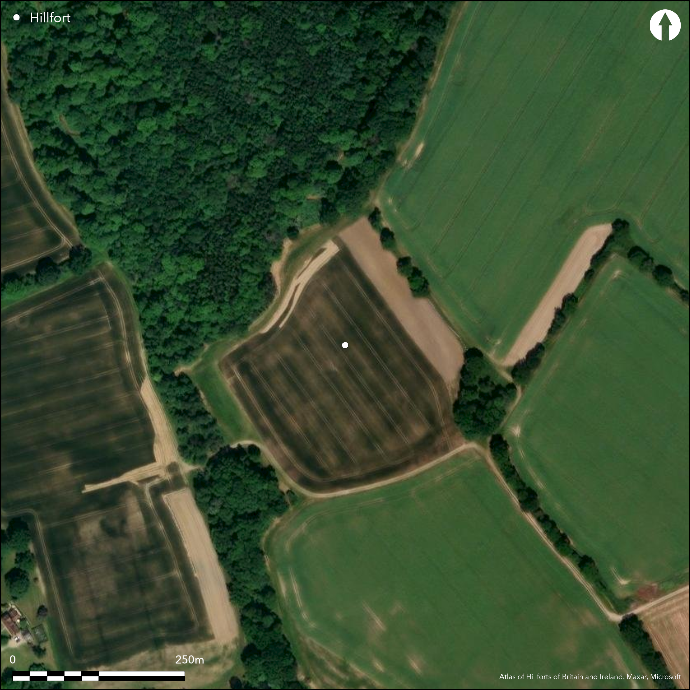
Satellite Imagery
LiDAR 1m DTM Hillshade
Satellite Imagery
Scroll left/right to view further images.
HER: Essex 11654 (None)
NMR: TL 92 NE 23 (383781)
SM: 1019959
NGR: TL 96642 28982
X: 596642 Y: 228982 (OSGB36)
Lying to the S of Pitchbury Woods, the remains of a bivallate hillfort located on a gravel spur. The enclosure was oval in plan measuring 300m N-S by 190m transversely enclosing 1.9ha. Possibly originally univallate with a further outer rampart or counterscarp, and a ditch which was added later. The majority of the ramparts were levelled for arable by 1844 with the NW arc surviving where the ramparts now define the south-eastern extent of Pitchbury Wood. In this region the banks stand approximately 3m high and 18m from crest to crest. An excavation in 1933 was not fully published, but a paper given by the excavator in 1933 is included in a report by Crummy (1995) following a rescue excavation in 1973. The 1933 excavations across a section of the extant rampart in the N, the remains of the ramparts in the E and W, the causeway, and part of the interior, showed the ramparts had been constructed as simple dumps of gravel with no evidence of revetment. Traces of an outer, flat-bottomed ditch was discovered in the E, possibly unfinished. The ditches cut into the London Clay and retained water. The causewayed entrance, approximately 11m wide in the NE, was floored with gravel and showed little sign of use. Two pits and two hearths were identified within the interior. The 1973 excavations ahead of the installation of a gas pipeline showed the inner ditch measured 8.5m wide and 2.6m deep at the E end and 10m wide and 2.3m deep at the W. The outer ditch, confirmed as present only in the E, measured 4.3m wide and 1.5m deep. Mesolithic and late Neolithic worked flint and earlier prehistoric pottery was recovered from the interior and beneath the ramparts. A number of shallow pits of unknown function were recorded within the interior. It was concluded that the site was unfinished owing to the incomplete nature of the outer ditch and the scarcity of material culture, with the site seeing only occasional use, possibly as a place of refuge (Crummy and Cruso 1995). Burnt wood recovered from towards the bottom of the inner ditch was radiocarbon dated 10BC+/-80. It was concluded that the site saw some occupation in the eighth to fourth centuries BC based on pottery, but the form of the hillfort and small sherds of pottery suggest it was constructed in the late Iron Age c. 50AD to AD10. Recorded as an incomplete earthwork on 1876, 1:2,500 OS mapping. Scheduled.
Citizen Science: ✗
Reliability of Data: Confirmed
Reliability of Interpretation: Confirmed
X: 95559 Y: 6786498 (EPSG: 3857)
Longitude: 0.8584230220515374 Latitude: 51.924569401221554 (EPSG:4326)
Country: England; None
Current County or Unitary Authority: Essex
Historic County: Essex
Current Parish/Community/Council/Townland: Great Horkesley; West Bergholt
On Heritage at Risk Register (2015). Extensive plough damage to the interior recorded during 1973 excavations. Well-defined cropmark on 2005 Google earth satellite imagery
| Extant | ✓ |
| Cropmark | ✗ |
| Likely Destroyed | ✗ |
Northern arc of the ramparts survive in woodland
| Woodland | ✓ |
| Commercial Forestry Plantation | ✗ |
| Parkland | ✗ |
| Pasture (Grazing) | ✗ |
| Arable | ✓ |
| Scrub/Bracken | ✗ |
| Bare Outcrop | ✗ |
| Heather/Moorland | ✗ |
| Heath | ✗ |
| Built-up | ✗ |
| Coastal Grassland | ✗ |
| Other | ✗ |
A lowland site lying on level ground on a gravel spur at 53m OD
| Contour Fort | ✗ |
| Partial Contour Fort | ✗ |
| Promontory Fort | ✗ |
| Hillslope Fort | ✗ |
| Level Terrain Fort | ✓ |
| Marsh Fort | ✗ |
| Multiple Enclosure Fort | ✗ |
| Hilltop | ✗ |
| Coastal Promontory | ✗ |
| Inland Promontory | ✗ |
| Valley Bottom | ✗ |
| Knoll/Hillock/Outcrop | ✗ |
| Ridge | ✗ |
| Cliff/Plateau-edge/Scarp | ✗ |
| Hillslope | ✗ |
| Lowland | ✓ |
| Spur | ✓ |
Dominant Topographic Feature: Gravel spur
| North | ✗ |
| Northeast | ✗ |
| East | ✗ |
| Southeast | ✗ |
| South | ✗ |
| Southwest | ✗ |
| West | ✗ |
| Northwest | ✗ |
| Level | ✓ |
Altitude: 53.0m
The parish boundary between Great Horkesley and West Bergholt lies 60m to the W, following the line of a brook
Boundary Type: Parish/Townland
Burnt wood recovered from towards the bottom of the inner ditch was radiocarbon dated 10BC+/-80. It was concluded that the site saw some occupation in the eighth to fourth centuries BC based on pottery, but the form of the hillfort and small sherds of pottery suggest it was constructed in the late Iron Age c. 50AD to AD10.
Reliability: B - Medium
| Pre 1200BC | ✗ |
| 1200BC - 800BC | ✗ |
| 800BC - 400BC | ✓ |
| 400BC - AD50 | ✓ |
| AD50 - AD400 | ✓ |
| AD400 - AD 800 | ✗ |
| Post AD800 | ✗ |
| Unknown | ✗ |
| Pre Hillfort: | None |
| Post Hillfort: | None |
| Artefactual: | Iron Age pottery |
| Artefactual: | Mesolithic and Neolithic flint |
| C14: | Single radiocarbon date |
Shown by Stukeley as Horksley Heath on a map of 1759 of the earthworks on Lexden Heath (Crummy and Cruso 1995, 16. Fig 2.7). RCHM plan drawn in 1922. Excavated in 1924 (unpublished) 1933 and 1973 (Crummy and Cruso 1995). Geophysical survey 1973, AML. Scheduled
| 1st Identified Map Depiction (1759): | Map of 1759 by William Stukeley of the earthworks on Lexden Heath |
| 1st Identified Written Reference (1759): | Stukeley |
| Excavation (1924): | Unpublished |
| Excavation (1933): | None |
| Excavation (1973): | None |
| Geophysical Survey (1973): | Location of magnetometer survey shown on site plan (Crummy and Cruso 1975) |
| Other (1973): | Scheduled |
Two pits and two hearths identified during 1933 excavations, with a further 47 shallow pits of unknown purpose partially excavated in 1973, pottery and lithics recovered.
Brook to the E
| None | ✓ |
| Spring | ✗ |
| Stream | ✗ |
| Pool | ✗ |
| Flush | ✗ |
| Well | ✗ |
| Other | ✗ |
None
| No Known Features | ✓ |
| Round Stone Structures | ✗ |
| Rectangular Stone Structures | ✗ |
| Curvilinear Platforms | ✗ |
| Other Roundhouse Evidence | ✗ |
| Pits | ✗ |
| Quarry Hollows | ✗ |
| Other | ✗ |
Hearths
| No Known Excavation | ✗ |
| Pits | ✓ |
| Postholes | ✗ |
| Roundhouses | ✗ |
| Rectangular Structures | ✗ |
| Roads/Tracks | ✗ |
| Quarry Hollows | ✗ |
| Other | ✓ |
| Nothing Found | ✗ |
Unidentified anomaly, possibly a medieval pottery kiln
| No Known Geophysics | ✗ |
| Pits | ✗ |
| Roundhouses | ✗ |
| Rectangular Structures | ✗ |
| Roads/Tracks | ✗ |
| Quarry Hollows | ✗ |
| Other | ✓ |
| Nothing Found | ✗ |
None
| No Known Finds | ✗ |
| Pottery | ✓ |
| Metal | ✗ |
| Metalworking | ✗ |
| Human Bones | ✗ |
| Animal Bones | ✗ |
| Lithics | ✓ |
| Environmental | ✗ |
| Other | ✗ |
None
| APs Not Checked | ✓ |
| None | ✗ |
| Roundhouses | ✗ |
| Rectangular Structures | ✗ |
| Pits | ✗ |
| Postholes | ✗ |
| Roads/Tracks | ✗ |
| Other | ✗ |
Causewayed entrance, approximately 11m wide in the NE, floored with gravel
| 2: | Through both ramparts |
| 2: | None |
Guard Chambers: ✗
Chevaux de Frise: ✗
| 1. Simple Gap (North east): | None |
Oval, bivallate hillfort measuring 300m N-S by 190m transversely enclosing 1.9ha. Possibly originally univallate with a further outer rampart or counterscarp and a ditch which was added later. Only the NW arc remains extant in woodland. In this region the banks stand approximately 3m high and 18m from crest to crest. The ramparts were constructed as simple dumps of gravel with no evidence of revetment. Traces of an outer, flat-bottomed ditch was discovered in the E, possibly unfinished. The ditches cut into the London Clay and retained water. Excavations in 1973 showed the inner ditch measured 8.5m wide and 2.6m deep at the E end and 10m wide and 2.3m deep at the W. The outer ditch, confirmed as present only in the E, measured 4.3m wide and 1.5m deep.
| Area 1: | 1.9ha. |
| Total: | 1.9ha. |
Total Footprint Area: Noneha.
None
| ✓ | None |
| ✓ | Cropmark evidence shows it was once a complete circuit, second bank possibly a counterscarp. |
| NE Quadrant: | 2 |
| SE Quadrant: | 2 |
| SW Quadrant: | 2 |
| NW Quadrant: | 1 |
| Total: | 2 |
| Partial Univallate | ✓ |
| Univallate | ✗ |
| Partial Bivallate | ✓ |
| Bivallate | ✗ |
| Partial Multivallate | ✗ |
| Multivallate | ✗ |
| Unknown | ✗ |
| Partial Univallate | ✗ |
| Univallate | ✓ |
| Partial Bivallate | ✗ |
| Bivallate | ✗ |
| Partial Multivallate | ✗ |
| Multivallate | ✗ |
None
| None | ✗ |
| Earthen Bank | ✓ |
| Stone Wall | ✗ |
| Rubble | ✗ |
| Wall-walk | ✗ |
| Evidence of Timber | ✗ |
| Vitrification | ✗ |
| Other Burning | ✗ |
| Palisade | ✗ |
| Counter Scarp Bank | ✓ |
| Berm | ✗ |
| Unfinished | ✓ |
| Other | ✗ |
Gravel, dump rampart
| None | ✗ |
| Earthen Bank | ✓ |
| Stone Wall | ✗ |
| Murus Duplex | ✗ |
| Timber-framed | ✗ |
| Timber-laced | ✗ |
| Vitrification | ✗ |
| Other Burning | ✗ |
| Palisade | ✗ |
| Counter Scarp Bank | ✗ |
| Berm | ✗ |
| Unfinished | ✗ |
| No Known Excavation | ✗ |
| Other | ✗ |
| ✗ | None |
| ✓ | None |
Number of Ditches: 2
| ✗ | None |
Clark , A. 1973. Geophysics: Pitchbury Camp, Essex, AML Report (Old Series) 1608
Crummy, P. and Cruso T. Pitchbury Ramparts Excavations 1933 and 1973, in Hawkes, C. F. C. and Crummy, P. 1995. Colchester Archaeological Report 11: Camulodunum 2. Colchester Archaeological Trust Ltd. 138-154. https://cat.essex.ac.uk/reports/CAR-report-0011.pdf. Accessed November 2015
Atlas of Hillforts:
Wikidata:
This work is licensed under CC BY-SA 4.0

 and should be cited as:
Lock, Gary and Ralston, Ian. 2024. Atlas of Hillforts of Britain and Ireland. Available at: https://hillforts.arch.ox.ac.uk
Document Version 1.1