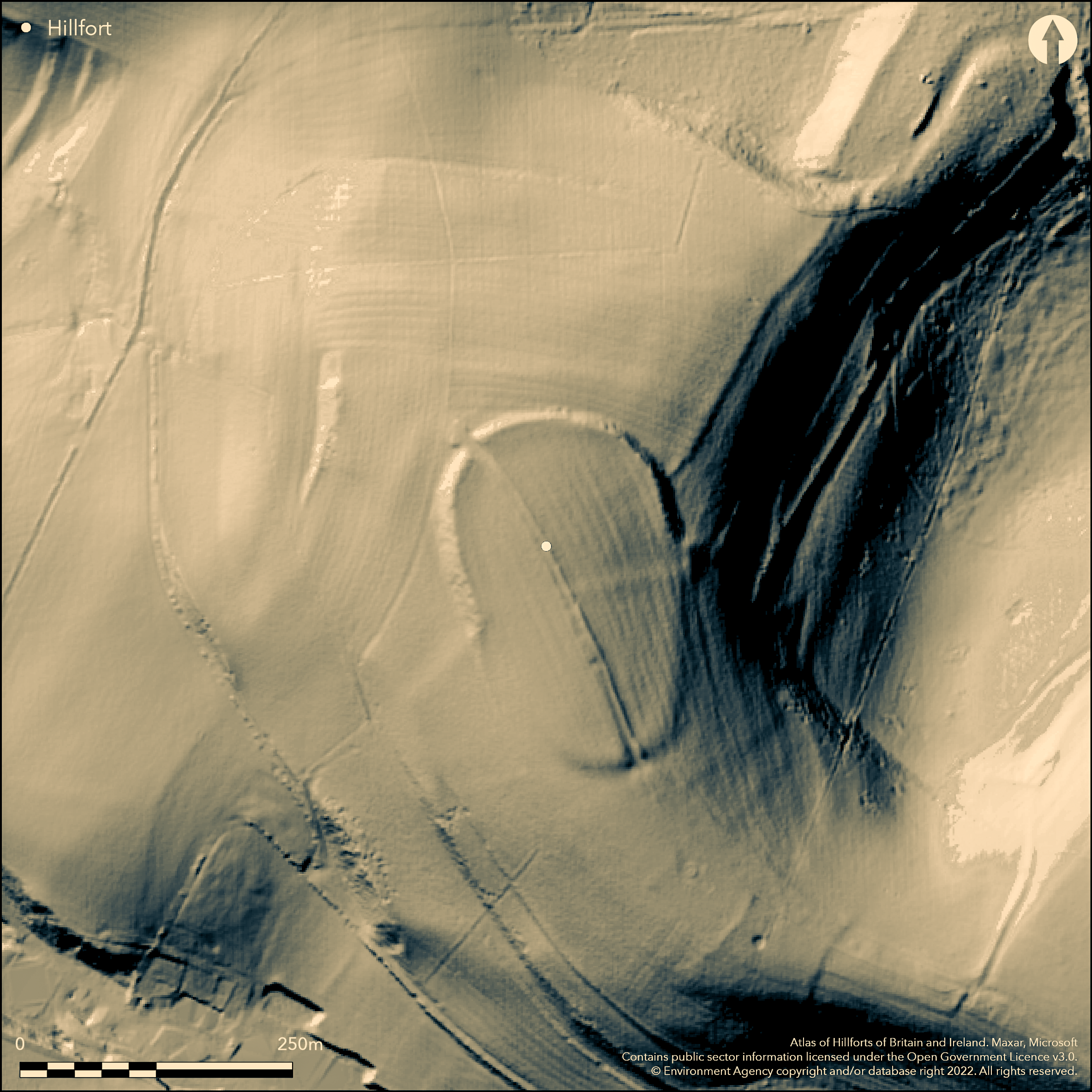
LiDAR 1m DTM Hillshade
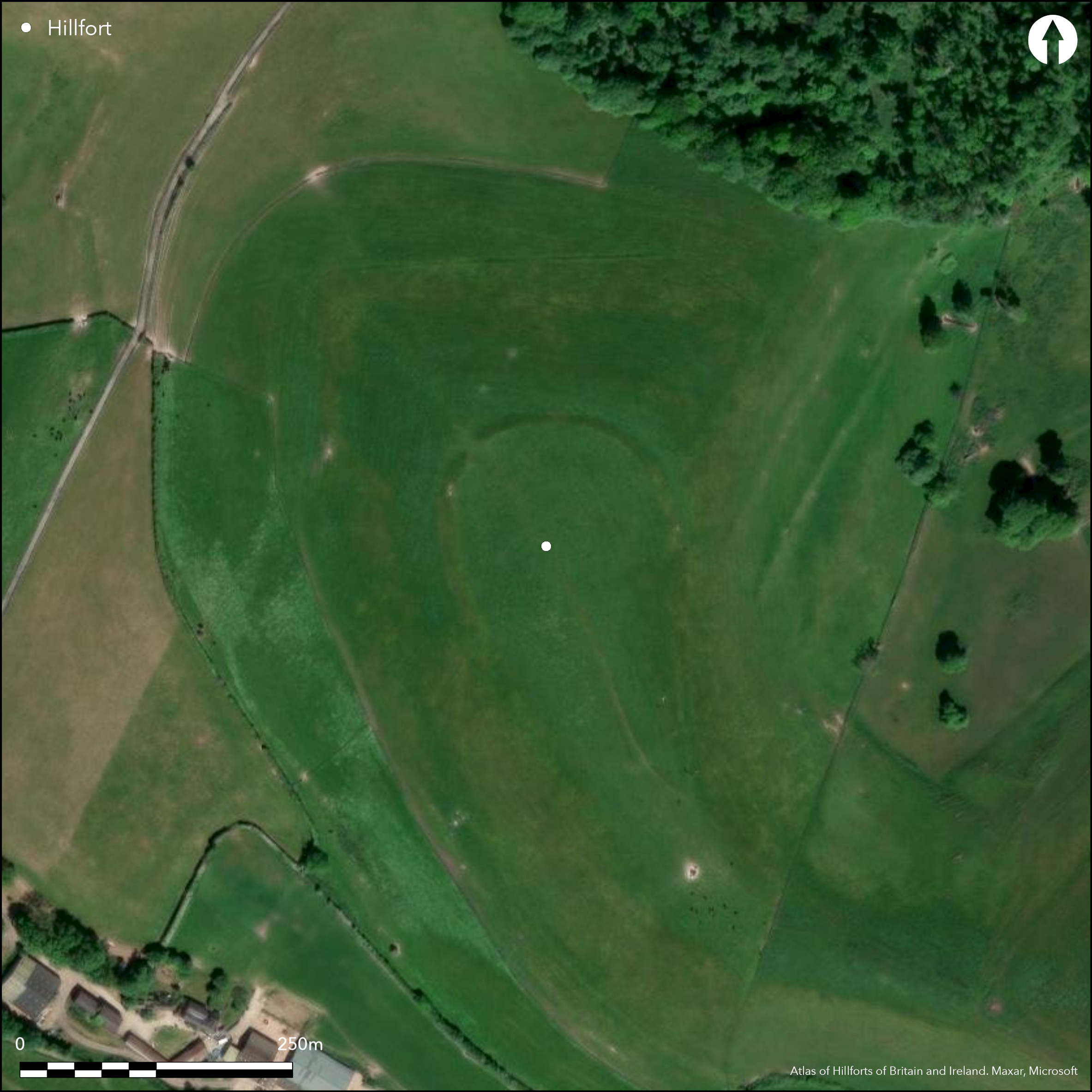
Satellite Imagery
LiDAR 1m DTM Hillshade
Satellite Imagery
Scroll left/right to view further images.
HER: Dorset MDO1364 (None)
NMR: SY 58 NE (None)
SM: 1002749
NGR: SY58428850
X: 358418 Y: 88518 (OSGB36)
Possible univallate contour hillfort located at N end of NW-facing spur between steep valleys to NE and SW in downs above sea to SW. Steep or very steep surrounding slopes, moderate along ridge to SE. Unusual site in having single rampart but none on neck of spur. Scarp c. 2-4m to 3m high with broad outer berm extends around the N oval end of the spur, turning slightly where crossed by trackway which continues along spur to S. Traces of bank on its NE side. S of N scarp slight traces of additional bank W of track curving to possibly join main scarp on W, thus central trackway consists of two mutilated banks c.10m apart and c. 0.2m high, with the track between them. Traces of 13th and 18th century plough ridges in interior. On the basis of the name `Brydian' used in a grant from Littlebredy to Cerne Abbey of 987, possible that site was adapted as a burh in 9th-10th centuries, and is the Brydian mentioned between Exeter and Wareham in the Burghal Hidage, and this earthwork may be remains of one of Alfred's burhs set up between Wareham and Exeter, perhaps never completed. However, Bridport could be the site of the burh. Rough upland moorland. On 1st Ed OS map (1885-1900). Minimal investigations, undated.
Citizen Science: ✗
Reliability of Data: Confirmed
Reliability of Interpretation: Unconfirmed
X: -288331 Y: 6567475 (EPSG: 3857)
Longitude: -2.590119991973775 Latitude: 50.69474745521242 (EPSG:4326)
Country: England; None
Current County or Unitary Authority: Dorset
Historic County: Dorset
Current Parish/Community/Council/Townland: Littlebredy; Kingston Russell
Mutilated site.
| Extant | ✓ |
| Cropmark | ✗ |
| Likely Destroyed | ✓ |
Rough upland moorland.
| Woodland | ✗ |
| Commercial Forestry Plantation | ✗ |
| Parkland | ✗ |
| Pasture (Grazing) | ✗ |
| Arable | ✗ |
| Scrub/Bracken | ✓ |
| Bare Outcrop | ✗ |
| Heather/Moorland | ✓ |
| Heath | ✗ |
| Built-up | ✗ |
| Coastal Grassland | ✗ |
| Other | ✗ |
Possible univallate contour hillfort located at N end of NW-facing spur between steep valleys to NE and SW in downs above sea to SW. Steep or very steep surrounding slopes, moderate along ridge to SE.
| Contour Fort | ✓ |
| Partial Contour Fort | ✗ |
| Promontory Fort | ✗ |
| Hillslope Fort | ✗ |
| Level Terrain Fort | ✗ |
| Marsh Fort | ✗ |
| Multiple Enclosure Fort | ✗ |
| Hilltop | ✗ |
| Coastal Promontory | ✗ |
| Inland Promontory | ✗ |
| Valley Bottom | ✗ |
| Knoll/Hillock/Outcrop | ✗ |
| Ridge | ✗ |
| Cliff/Plateau-edge/Scarp | ✗ |
| Hillslope | ✗ |
| Lowland | ✗ |
| Spur | ✓ |
Dominant Topographic Feature: Spur
| North | ✗ |
| Northeast | ✗ |
| East | ✗ |
| Southeast | ✗ |
| South | ✗ |
| Southwest | ✗ |
| West | ✗ |
| Northwest | ✗ |
| Level | ✓ |
Altitude: 178.0m
Boundary Type: Parish/Townland
None.
Reliability: D - None
| Pre 1200BC | ✗ |
| 1200BC - 800BC | ✗ |
| 800BC - 400BC | ✗ |
| 400BC - AD50 | ✗ |
| AD50 - AD400 | ✗ |
| AD400 - AD 800 | ✗ |
| Post AD800 | ✗ |
| Unknown | ✓ |
| Pre Hillfort: | None |
| Post Hillfort: | Traces of 13th and 18th century plough ridges in interior. Earthwork may be the remains of one of Alfred's burhs set up between Wareham and Exeter, perhaps never completed. However, Bridport could be the site of the burh. |
On the basis of the name `Brydian' used in a grant from Littlebredy to Cerne Abbey of 987, possible that site was adapted as a burh in 9th-10th centuries, and is the Brydian mentioned between Exeter and Wareham in the Burghal Hidage, and this earthwork may be remains of one of Alfred's burhs set up between Wareham and Exeter, perhaps never completed. However, Bridport could be the site of the burh. On 1st Ed OS map (1885-1900).
| 1st Identified Map Depiction (None): | None |
| 1st Identified Written Reference (None): | Possibly adapted as burgh. |
No evidence
None
| None | ✓ |
| Spring | ✗ |
| Stream | ✗ |
| Pool | ✗ |
| Flush | ✗ |
| Well | ✗ |
| Other | ✗ |
None
| No Known Features | ✓ |
| Round Stone Structures | ✗ |
| Rectangular Stone Structures | ✗ |
| Curvilinear Platforms | ✗ |
| Other Roundhouse Evidence | ✗ |
| Pits | ✗ |
| Quarry Hollows | ✗ |
| Other | ✗ |
None
| No Known Excavation | ✓ |
| Pits | ✗ |
| Postholes | ✗ |
| Roundhouses | ✗ |
| Rectangular Structures | ✗ |
| Roads/Tracks | ✗ |
| Quarry Hollows | ✗ |
| Other | ✗ |
| Nothing Found | ✗ |
None
| No Known Geophysics | ✓ |
| Pits | ✗ |
| Roundhouses | ✗ |
| Rectangular Structures | ✗ |
| Roads/Tracks | ✗ |
| Quarry Hollows | ✗ |
| Other | ✗ |
| Nothing Found | ✗ |
None
| No Known Finds | ✓ |
| Pottery | ✗ |
| Metal | ✗ |
| Metalworking | ✗ |
| Human Bones | ✗ |
| Animal Bones | ✗ |
| Lithics | ✗ |
| Environmental | ✗ |
| Other | ✗ |
None
| APs Not Checked | ✓ |
| None | ✗ |
| Roundhouses | ✗ |
| Rectangular Structures | ✗ |
| Pits | ✗ |
| Postholes | ✗ |
| Roads/Tracks | ✗ |
| Other | ✗ |
No evidence
| 0: | None |
| 2: | None |
Guard Chambers: ✗
Chevaux de Frise: ✗
Unusual site in having single defence but none on neck of spur, with scarp c. 2-4m to 3m high with broad outer berm around the N oval end of the spur, turning slightly where crossed by trackway which continues along spur to S. Traces of bank on its NE side. S of N scarp slight traces of additional bank W of track curving to possibly join main scarp on W, thus central trackway consists of two mutilated banks c.10m apart and c. 0.2m high, with the track between them.
| Area 1: | Noneha. |
| Total: | Noneha. |
Total Footprint Area: Noneha.
None
| ✗ | Area not defined. |
| ✗ | Actual quadrants cannot be defined and thus estimated. |
| NE Quadrant: | 1 |
| SE Quadrant: | 0 |
| SW Quadrant: | 0 |
| NW Quadrant: | 1 |
| Total: | 1 |
| Partial Univallate | ✓ |
| Univallate | ✗ |
| Partial Bivallate | ✗ |
| Bivallate | ✗ |
| Partial Multivallate | ✗ |
| Multivallate | ✗ |
| Unknown | ✗ |
| Partial Univallate | ✗ |
| Univallate | ✗ |
| Partial Bivallate | ✗ |
| Bivallate | ✗ |
| Partial Multivallate | ✗ |
| Multivallate | ✗ |
Banks flinty and possibly revetted. Possibly unfinished.
| None | ✗ |
| Earthen Bank | ✓ |
| Stone Wall | ✓ |
| Rubble | ✓ |
| Wall-walk | ✗ |
| Evidence of Timber | ✗ |
| Vitrification | ✗ |
| Other Burning | ✗ |
| Palisade | ✗ |
| Counter Scarp Bank | ✗ |
| Berm | ✗ |
| Unfinished | ✓ |
| Other | ✗ |
None
| None | ✗ |
| Earthen Bank | ✗ |
| Stone Wall | ✗ |
| Murus Duplex | ✗ |
| Timber-framed | ✗ |
| Timber-laced | ✗ |
| Vitrification | ✗ |
| Other Burning | ✗ |
| Palisade | ✗ |
| Counter Scarp Bank | ✗ |
| Berm | ✗ |
| Unfinished | ✗ |
| No Known Excavation | ✓ |
| Other | ✗ |
| ✗ | None |
| ✗ | None defined. |
Number of Ditches: 0
| ✗ | None |
RCHME 1952. An inventory of the historical monuments in Dorset, Vol 1, West Dorset, 38, London: RCHM.
Atlas of Hillforts:
Wikidata:
This work is licensed under CC BY-SA 4.0

 and should be cited as:
Lock, Gary and Ralston, Ian. 2024. Atlas of Hillforts of Britain and Ireland. Available at: https://hillforts.arch.ox.ac.uk
Document Version 1.1