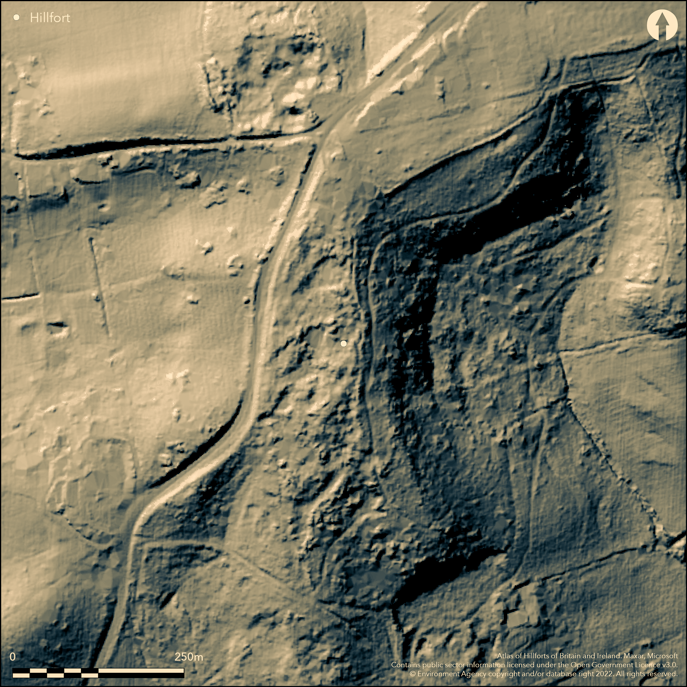
LiDAR 1m DTM Hillshade
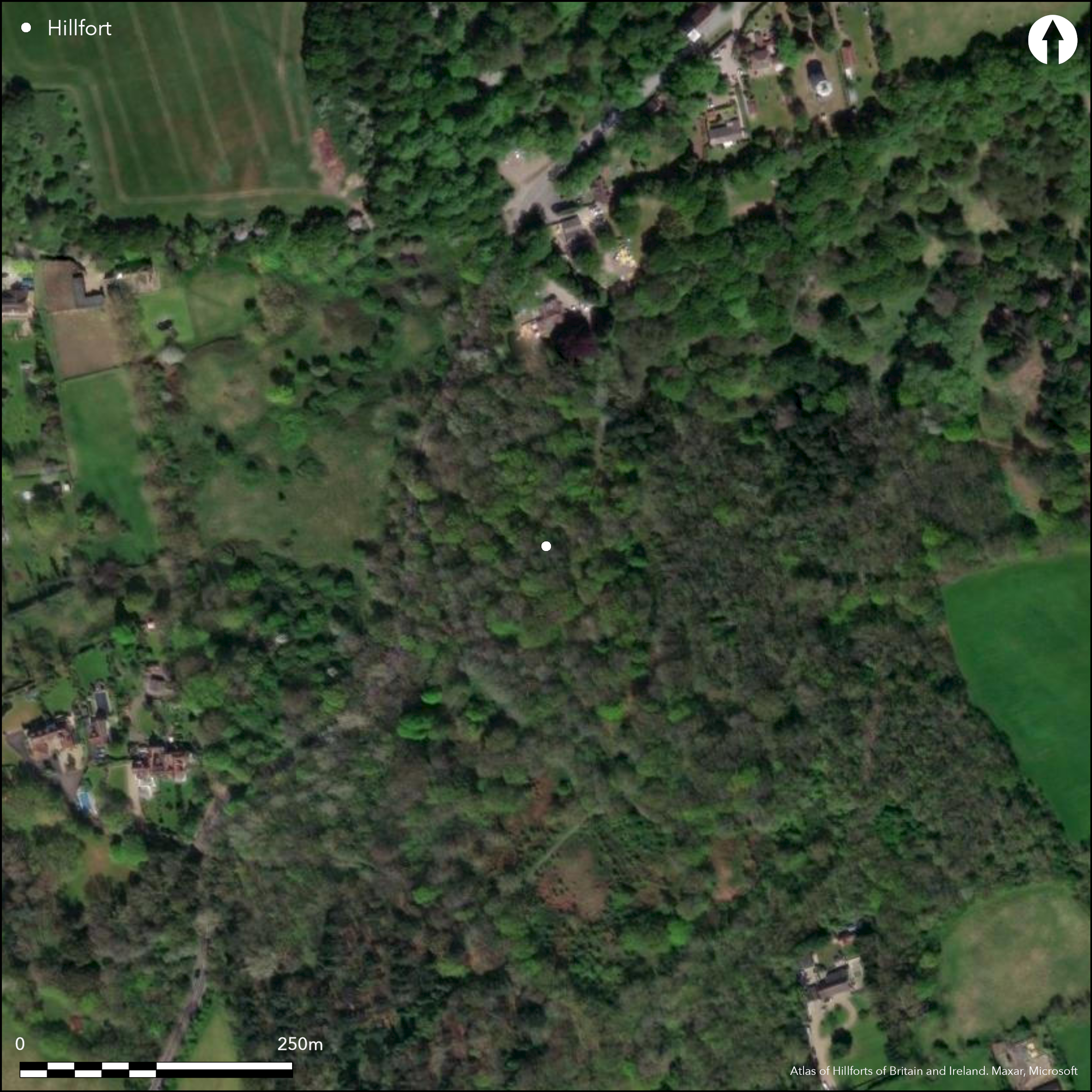
Satellite Imagery
LiDAR 1m DTM Hillshade
Satellite Imagery
Scroll left/right to view further images.
HER: Essex 5173 (None)
NMR: TQ 68 NE 10 (414066)
SM: None
NGR: TQ 6777 8616
X: 567770 Y: 186160 (OSGB36)
Within Langdon Hills Country Park the site of a settlement or possible hillfort discovered in 1966 (Hoares 1971). The site lies within woodland on a gravel knoll and offers uninterrupted views of the Thames Estuary and into Kent. Gravel quarrying has left the ground uneven but the site retains 'an impression of remaining lengths of banks and ditches' (Couchman 1976, 152) A limited excavation of two mounds within the interior by Hoares and the Wickford and Thurrock Archaeological Societies revealed in the first mound a large shallow pit lined with clay 4m long and surviving to a depth of 53cm, from which animal bone, charcoal and large amounts of pot sherds, both fine and coursewares were recovered (Hoares 1971, 57). A second mound was also investigated which produce further pottery and stones with evidence of heating. Surface finds of pottery have also been made. The pottery originally thought to be Iron Age has now been dated to the late Bronze Age, c.7th century (Brown and Buckley 1984-5). It is speculated that this is the site of a hillfort owing to strategic position and the 'dun' placename element indicating defences (Gelling 1978, 122; Rivet and Smith 1979, 275). Possibly naturally delineated in the W by a steep slope as it lacks ramparts in this area. The Interior slopes E-W with a 10m difference between the highest and lowest ground. The site is not recorded on OS mapping.
Citizen Science: ✗
Reliability of Data: Unconfirmed
Reliability of Interpretation: Unconfirmed
X: 46569 Y: 6719046 (EPSG: 3857)
Longitude: 0.41833538285295074 Latitude: 51.54933503697691 (EPSG:4326)
Country: England; None
Current County or Unitary Authority: Essex
Historic County: Essex
Current Parish/Community/Council/Townland: Basildon; Thurrock
Land owned by Essex County Council. Destroyed by quarrying
| Extant | ✓ |
| Cropmark | ✗ |
| Likely Destroyed | ✓ |
None
| Woodland | ✓ |
| Commercial Forestry Plantation | ✗ |
| Parkland | ✗ |
| Pasture (Grazing) | ✗ |
| Arable | ✗ |
| Scrub/Bracken | ✗ |
| Bare Outcrop | ✗ |
| Heather/Moorland | ✗ |
| Heath | ✗ |
| Built-up | ✗ |
| Coastal Grassland | ✗ |
| Other | ✗ |
No enclosure shown on OS mapping but the location suggests the site was located on the summit of a hill at 115m OD, with the defences possibly following the contours of the hill. The interior sloped E-W with a 10m difference between the highest and lowest ground
| Contour Fort | ✓ |
| Partial Contour Fort | ✗ |
| Promontory Fort | ✗ |
| Hillslope Fort | ✗ |
| Level Terrain Fort | ✗ |
| Marsh Fort | ✗ |
| Multiple Enclosure Fort | ✗ |
| Hilltop | ✓ |
| Coastal Promontory | ✗ |
| Inland Promontory | ✓ |
| Valley Bottom | ✗ |
| Knoll/Hillock/Outcrop | ✗ |
| Ridge | ✗ |
| Cliff/Plateau-edge/Scarp | ✗ |
| Hillslope | ✗ |
| Lowland | ✗ |
| Spur | ✗ |
Dominant Topographic Feature: Inland promontory
| North | ✗ |
| Northeast | ✗ |
| East | ✗ |
| Southeast | ✗ |
| South | ✗ |
| Southwest | ✗ |
| West | ✓ |
| Northwest | ✗ |
| Level | ✗ |
Altitude: 115.0m
The boundary between Essex County and Thurrock runs to the N and E
Boundary Type: Parish/Townland
'Iron Age' pottery recovered from the site has since been dated to the late Bronze Age, c. 7th century.
Reliability: B - Medium
| Pre 1200BC | ✗ |
| 1200BC - 800BC | ✗ |
| 800BC - 400BC | ✓ |
| 400BC - AD50 | ✗ |
| AD50 - AD400 | ✗ |
| AD400 - AD 800 | ✗ |
| Post AD800 | ✗ |
| Unknown | ✗ |
| Pre Hillfort: | None |
| Post Hillfort: | None |
| Artefactual: | Pottery |
The site was discovered in 1966 (Hoares, 1971). Mounds excavated in 1966 from which Bronze Age pottery was recovered. Field survey in 1995.
| Excavation (1966): | None |
| 1st Identified Written Reference (1971): | (Hoares 1971) |
| Earthwork Survey (1995): | None |
Mounds lie within the interior. Pottery and animal bones from excavation.
None
| None | ✓ |
| Spring | ✗ |
| Stream | ✗ |
| Pool | ✗ |
| Flush | ✗ |
| Well | ✗ |
| Other | ✗ |
Mound
| No Known Features | ✗ |
| Round Stone Structures | ✗ |
| Rectangular Stone Structures | ✗ |
| Curvilinear Platforms | ✗ |
| Other Roundhouse Evidence | ✗ |
| Pits | ✗ |
| Quarry Hollows | ✗ |
| Other | ✓ |
None
| No Known Excavation | ✗ |
| Pits | ✓ |
| Postholes | ✗ |
| Roundhouses | ✗ |
| Rectangular Structures | ✗ |
| Roads/Tracks | ✗ |
| Quarry Hollows | ✗ |
| Other | ✗ |
| Nothing Found | ✗ |
None
| No Known Geophysics | ✓ |
| Pits | ✗ |
| Roundhouses | ✗ |
| Rectangular Structures | ✗ |
| Roads/Tracks | ✗ |
| Quarry Hollows | ✗ |
| Other | ✗ |
| Nothing Found | ✗ |
None
| No Known Finds | ✗ |
| Pottery | ✓ |
| Metal | ✗ |
| Metalworking | ✗ |
| Human Bones | ✗ |
| Animal Bones | ✓ |
| Lithics | ✗ |
| Environmental | ✓ |
| Other | ✗ |
Wooded
| APs Not Checked | ✓ |
| None | ✗ |
| Roundhouses | ✗ |
| Rectangular Structures | ✗ |
| Pits | ✗ |
| Postholes | ✗ |
| Roads/Tracks | ✗ |
| Other | ✗ |
The location of entrances is unknown
| None: | None |
| 2: | None |
Guard Chambers: ✗
Chevaux de Frise: ✗
Retains 'an impression of remaining lengths of banks and ditches'.
| Area 1: | Noneha. |
| Total: | Noneha. |
Total Footprint Area: Noneha.
None
| ✗ | None |
| ✗ | None |
| NE Quadrant: | None |
| SE Quadrant: | None |
| SW Quadrant: | None |
| NW Quadrant: | None |
| Total: | None |
| Partial Univallate | ✗ |
| Univallate | ✗ |
| Partial Bivallate | ✗ |
| Bivallate | ✗ |
| Partial Multivallate | ✗ |
| Multivallate | ✗ |
| Unknown | ✓ |
| Partial Univallate | ✗ |
| Univallate | ✗ |
| Partial Bivallate | ✗ |
| Bivallate | ✗ |
| Partial Multivallate | ✗ |
| Multivallate | ✗ |
None
| None | ✓ |
| Earthen Bank | ✗ |
| Stone Wall | ✗ |
| Rubble | ✗ |
| Wall-walk | ✗ |
| Evidence of Timber | ✗ |
| Vitrification | ✗ |
| Other Burning | ✗ |
| Palisade | ✗ |
| Counter Scarp Bank | ✗ |
| Berm | ✗ |
| Unfinished | ✗ |
| Other | ✗ |
No excavation of the ramparts
| None | ✗ |
| Earthen Bank | ✗ |
| Stone Wall | ✗ |
| Murus Duplex | ✗ |
| Timber-framed | ✗ |
| Timber-laced | ✗ |
| Vitrification | ✗ |
| Other Burning | ✗ |
| Palisade | ✗ |
| Counter Scarp Bank | ✗ |
| Berm | ✗ |
| Unfinished | ✗ |
| No Known Excavation | ✓ |
| Other | ✗ |
| ✗ | None |
| ✗ | 'Impression' of ditches only |
Number of Ditches: None
| ✗ | None |
Brown, N. and Buckley, D. 1984-5. Langdon Hills. Essex Archaeol Hist,105-8
Couchman, C.R. 1976. Work Undertaken by Essex County Council Archaeology Section, 1974-76, Essex Archaeol Hist, 8, 149-152
Gelling, M. 1978. Signposts to the Past: Placenames and the History of England. London
Hoares, R.E. 1971. Langdon Hills - "The Park". Panorama. Jnl Thurrock Local Hist Soc. 14, 57-8
Isserlin, R. 1995. Analytical field survey at two Essex 'hill forts': South Weald Camp and Langdon Hill. Essex Archaeol Hist, 26, 40-52
Isserlin, R. 1995. South Weald Camp, Brentwood and Langdon Hills, Basildon. Analytical Earthwork Survey. Essex County Council Field Archaeology Group. Unpublished
Rivet, A.L.F. and Smith, C. 1979.The place-names of Roman Britain. London, (reprinted by Book Club Associates, 1981)
Atlas of Hillforts:
Wikidata:
This work is licensed under CC BY-SA 4.0

 and should be cited as:
Lock, Gary and Ralston, Ian. 2024. Atlas of Hillforts of Britain and Ireland. Available at: https://hillforts.arch.ox.ac.uk
Document Version 1.1