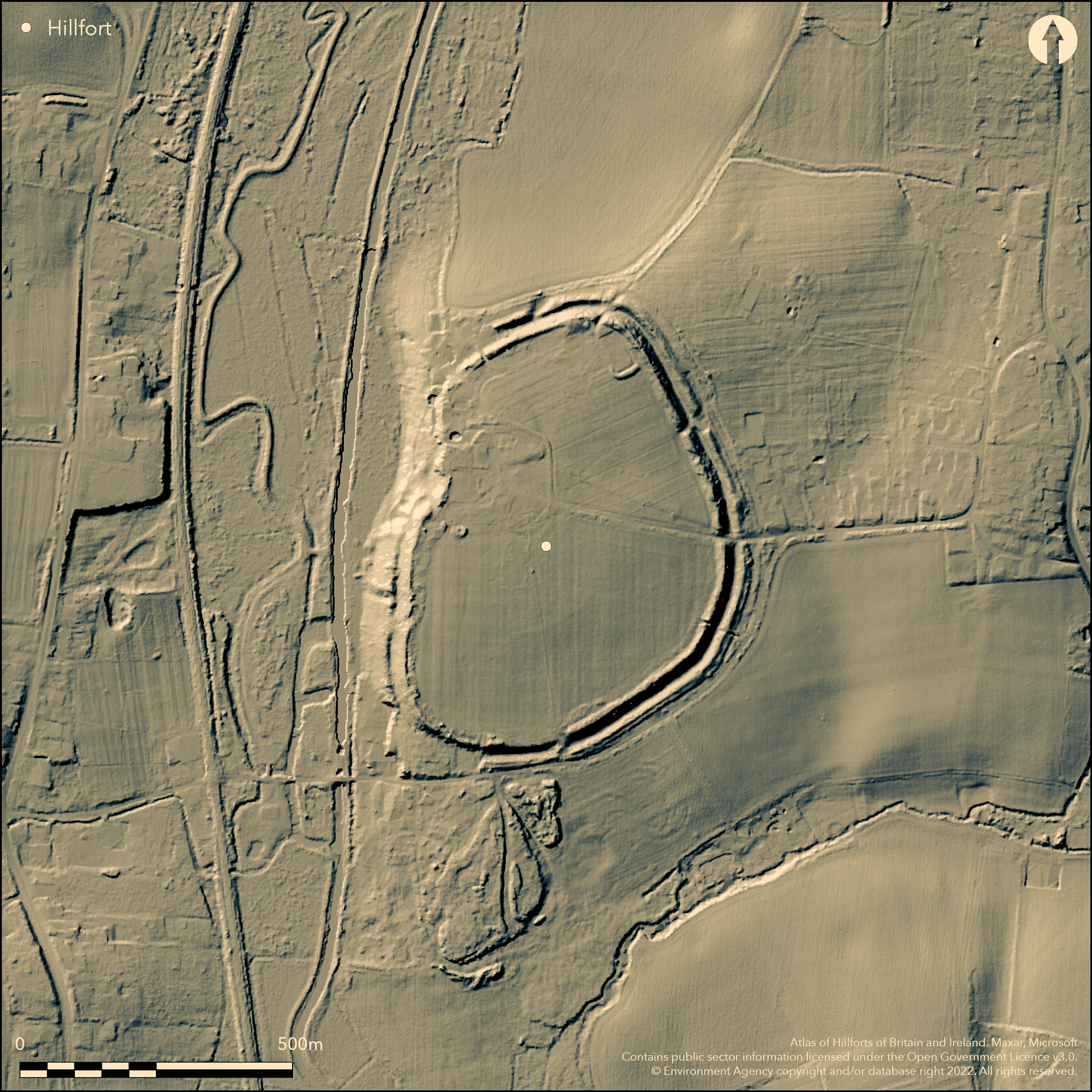
LiDAR 1m DTM Hillshade
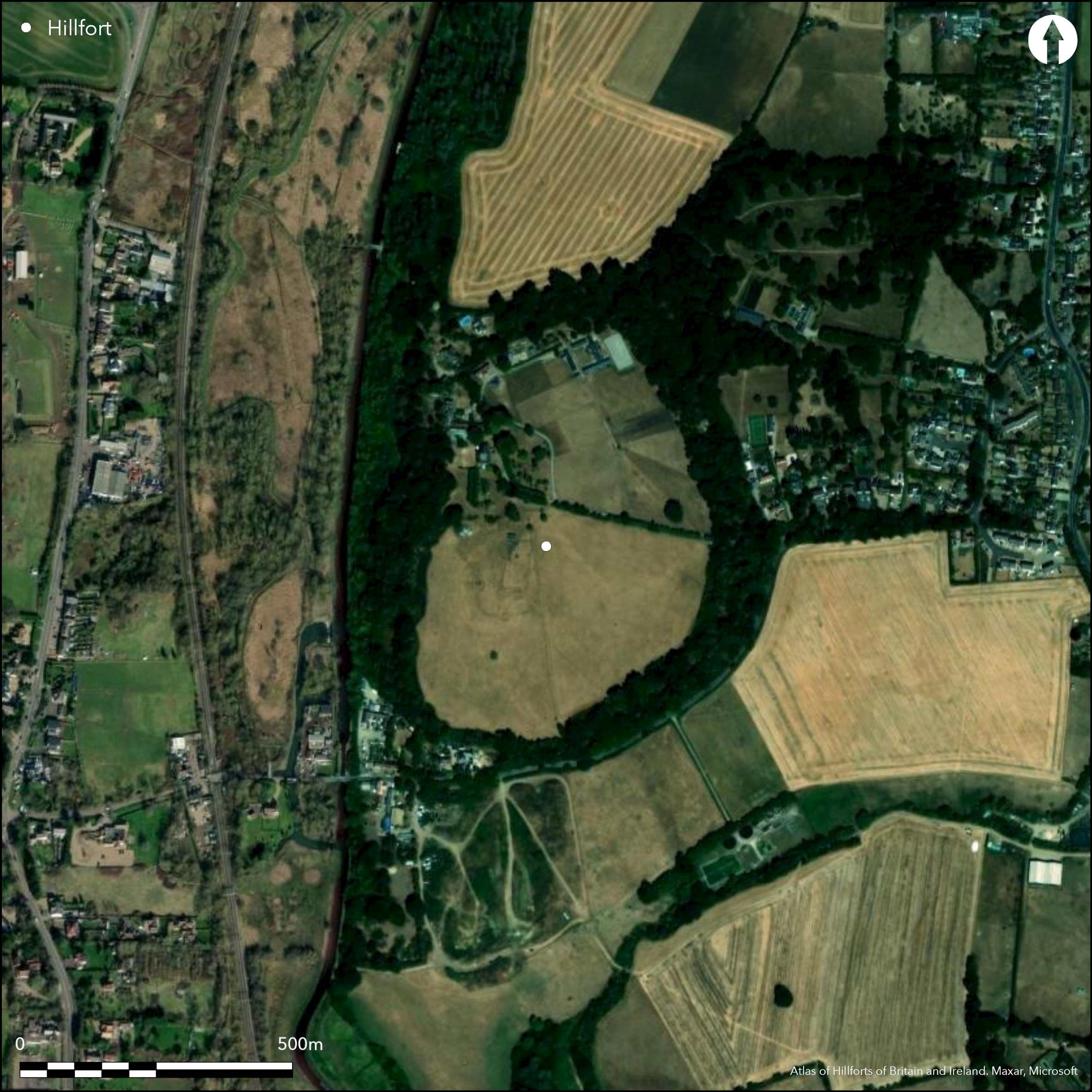
Satellite Imagery
LiDAR 1m DTM Hillshade
Satellite Imagery
Scroll left/right to view further images.
HER: Essex MEX181 (None)
NMR: TL 41 NE 14 (369962)
SM: 1002190
NGR: TL 4925 1784
X: 549250 Y: 217840 (OSGB36)
Lying to the W of Little Hallingbury, a bivallate hillfort of 16ha with an enclosed area of 12.5ha. It occupies the end of a spur at 69m OD, overlooking the Stort Valley to the W. Dense vegetation covers the ramparts. It forms an irregular oval comprising two banks and a medial ditch, the bank now discontinuous in the W. Traces of a second outer ditch have been recorded in the NE and SE. Five breaks occur around the circuit. Marshland once lay to the N and S and steep scarps to the W and only the break in the E is considered original. Excavations in 1959-1960 showed the inner rampart had been rebuilt in the early Iron Age with evidence for timber lacing. Iron Age pottery was recovered from the ditch fills (Assinder 1976). No internal features are known and today buildings and pasture lie within the interior and Dell Lane runs SE-NNW through the enclosure. A spring lies outside the ramparts in the SW. Early Iron Age pottery, late Iron Age cordoned urns and Romano-British pottery and glass were recovered from the ditch fills. Described by Morant (1768) as 'double ditched, very little defaced'. A suggested oppidum in the late period due to occupation material and the proximity of an Aylesford-Swarling type cemetery to the S (Cunliffe and Rowley 1976, 330). Recorded on 1874 1:2,500 OS mapping. Scheduled
Citizen Science: ✗
Reliability of Data: Confirmed
Reliability of Interpretation: Confirmed
X: 18366 Y: 6771099 (EPSG: 3857)
Longitude: 0.16498281090869044 Latitude: 51.83917809795937 (EPSG:4326)
Country: England; None
Current County or Unitary Authority: Essex
Historic County: Essex
Current Parish/Community/Council/Townland: Little Hallingbury
None
| Extant | ✓ |
| Cropmark | ✗ |
| Likely Destroyed | ✗ |
None
| Woodland | ✓ |
| Commercial Forestry Plantation | ✗ |
| Parkland | ✗ |
| Pasture (Grazing) | ✓ |
| Arable | ✗ |
| Scrub/Bracken | ✗ |
| Bare Outcrop | ✗ |
| Heather/Moorland | ✗ |
| Heath | ✗ |
| Built-up | ✓ |
| Coastal Grassland | ✗ |
| Other | ✗ |
A contour fort lying on a level spur at 69m OD
| Contour Fort | ✓ |
| Partial Contour Fort | ✗ |
| Promontory Fort | ✗ |
| Hillslope Fort | ✗ |
| Level Terrain Fort | ✗ |
| Marsh Fort | ✗ |
| Multiple Enclosure Fort | ✗ |
| Hilltop | ✓ |
| Coastal Promontory | ✗ |
| Inland Promontory | ✗ |
| Valley Bottom | ✗ |
| Knoll/Hillock/Outcrop | ✗ |
| Ridge | ✗ |
| Cliff/Plateau-edge/Scarp | ✗ |
| Hillslope | ✗ |
| Lowland | ✓ |
| Spur | ✓ |
Dominant Topographic Feature: Spur
| North | ✗ |
| Northeast | ✗ |
| East | ✗ |
| Southeast | ✗ |
| South | ✗ |
| Southwest | ✗ |
| West | ✗ |
| Northwest | ✗ |
| Level | ✓ |
Altitude: 69.0m
The county boundary between Essex and Hertfordshire lies 30m to the W
Boundary Type: County
Early and late Iron Age and Roman pottery recovered.
Reliability: B - Medium
| Pre 1200BC | ✗ |
| 1200BC - 800BC | ✗ |
| 800BC - 400BC | ✓ |
| 400BC - AD50 | ✓ |
| AD50 - AD400 | ✗ |
| AD400 - AD 800 | ✗ |
| Post AD800 | ✗ |
| Unknown | ✗ |
| Pre Hillfort: | None |
| Post Hillfort: | None |
| Artefactual: | None |
Described in Morant (1768) Recorded on 1874 1:2,500 OS mapping. Field investigations in 1950, 1973 and 1976. Excavated in 1959 and 1960. Scheduled
| 1st Identified Written Reference (1768): | Morant (1768) |
| 1st Identified Map Depiction (1874): | None |
| Other (1950): | Field investigation |
| Other (1973): | Field investigation |
| Other (1976): | Field investigation |
| Excavation (None): | None |
| Other (None): | Scheduled |
No contemporary internal features are recorded. Pottery and glass.
A spring lies outside the defences in the SW
| None | ✓ |
| Spring | ✗ |
| Stream | ✗ |
| Pool | ✗ |
| Flush | ✗ |
| Well | ✗ |
| Other | ✗ |
None
| No Known Features | ✓ |
| Round Stone Structures | ✗ |
| Rectangular Stone Structures | ✗ |
| Curvilinear Platforms | ✗ |
| Other Roundhouse Evidence | ✗ |
| Pits | ✗ |
| Quarry Hollows | ✗ |
| Other | ✗ |
Rampart excavated
| No Known Excavation | ✓ |
| Pits | ✗ |
| Postholes | ✗ |
| Roundhouses | ✗ |
| Rectangular Structures | ✗ |
| Roads/Tracks | ✗ |
| Quarry Hollows | ✗ |
| Other | ✗ |
| Nothing Found | ✗ |
None
| No Known Geophysics | ✓ |
| Pits | ✗ |
| Roundhouses | ✗ |
| Rectangular Structures | ✗ |
| Roads/Tracks | ✗ |
| Quarry Hollows | ✗ |
| Other | ✗ |
| Nothing Found | ✗ |
Glass
| No Known Finds | ✗ |
| Pottery | ✓ |
| Metal | ✗ |
| Metalworking | ✗ |
| Human Bones | ✗ |
| Animal Bones | ✗ |
| Lithics | ✗ |
| Environmental | ✗ |
| Other | ✓ |
None
| APs Not Checked | ✓ |
| None | ✗ |
| Roundhouses | ✗ |
| Rectangular Structures | ✗ |
| Pits | ✗ |
| Postholes | ✗ |
| Roads/Tracks | ✗ |
| Other | ✗ |
Five breaks occur around the defences. Only the break in the E is considered original
| 5: | None |
| 2: | None |
Guard Chambers: ✗
Chevaux de Frise: ✗
| 1. Simple Gap (East): | None |
Bivallate hillfort of 16ha. An irregular oval in form, it comprises two banks and a medial ditch, the bank in the W now discontinuous. Traces of a second outer ditch have been recorded in the NE and SE.
| Area 1: | 12.5ha. |
| Total: | 12.5ha. |
Total Footprint Area: 16.0ha.
None
| ✗ | None |
| ✓ | None |
| NE Quadrant: | 2 |
| SE Quadrant: | 2 |
| SW Quadrant: | 2 |
| NW Quadrant: | 2 |
| Total: | 2 |
| Partial Univallate | ✗ |
| Univallate | ✗ |
| Partial Bivallate | ✗ |
| Bivallate | ✓ |
| Partial Multivallate | ✗ |
| Multivallate | ✗ |
| Unknown | ✗ |
| Partial Univallate | ✗ |
| Univallate | ✗ |
| Partial Bivallate | ✗ |
| Bivallate | ✗ |
| Partial Multivallate | ✗ |
| Multivallate | ✗ |
None
| None | ✗ |
| Earthen Bank | ✓ |
| Stone Wall | ✗ |
| Rubble | ✗ |
| Wall-walk | ✗ |
| Evidence of Timber | ✗ |
| Vitrification | ✗ |
| Other Burning | ✗ |
| Palisade | ✗ |
| Counter Scarp Bank | ✗ |
| Berm | ✗ |
| Unfinished | ✗ |
| Other | ✗ |
None
| None | ✗ |
| Earthen Bank | ✓ |
| Stone Wall | ✗ |
| Murus Duplex | ✗ |
| Timber-framed | ✗ |
| Timber-laced | ✓ |
| Vitrification | ✗ |
| Other Burning | ✗ |
| Palisade | ✗ |
| Counter Scarp Bank | ✗ |
| Berm | ✗ |
| Unfinished | ✗ |
| No Known Excavation | ✗ |
| Other | ✗ |
| ✗ | None |
| ✓ | None |
Number of Ditches: 2
| ✗ | None |
Assinder, G, 1976, Wallbury Dell, June. Essex HER Source ID SEX185.
Black, E. W. 1990 Caesar's second invasion of Britain, Cassivellaunus and the Trinobantes. Essex Archaeol Hist 21, 1990 6-10
Cunliffe, B. and Rowley, T. (eds) 1976. Oppida: the beginnings of urbanisation in Barbarian Europe, BAR Int Ser 11.
Doubleday, H.A. 1903. Victoria County History, Essex, Vol I, 282
Morant, P. 1768. The History and Antiquities of Essex.
RCHME. 1921. Essex, II, 93-5.
Atlas of Hillforts:
Wikidata:
This work is licensed under CC BY-SA 4.0

 and should be cited as:
Lock, Gary and Ralston, Ian. 2024. Atlas of Hillforts of Britain and Ireland. Available at: https://hillforts.arch.ox.ac.uk
Document Version 1.1